SA2s are from the Australian Bureau of Statistics Australian Statistical Geography Standard (ASGS) 2016.
Qld Aged Care Planning Regions 2018 determination
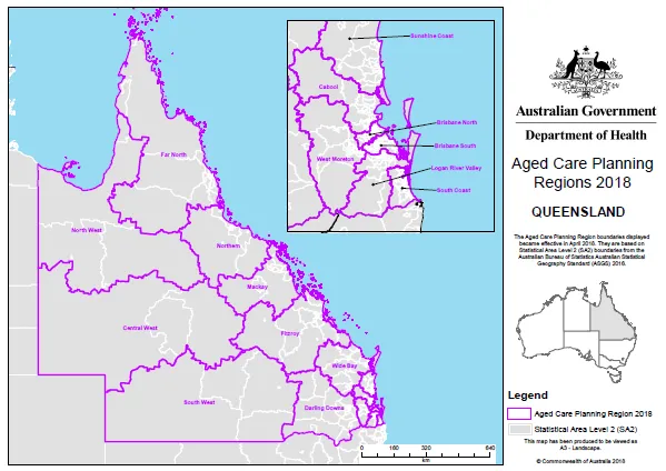
Qld overview map
Brisbane North map
Brisbane South map 1
Brisbane South map 2
Cabool map 1
Cabool map 2
Central West map
Darling Downs map 1
Darling Downs map 2
Far North map 1
Far North map 2
Fitzroy map 1
Fitzroy map 2
Logan River Valley map 1
Logan River Valley map 2
Mackay map
North West map
Northern map 1
Northern map 2
South Coast map
South West map
Sunshine Coast map 1
Sunshine Coast map 2
West Moreton map 1
West Moreton map 2
Wide Bay map 1
Wide Bay map 2
About this resource
Publication date:
Publication type:
Dataset
Language:
English
Part of a collection: