SA2s are from the Australian Bureau of Statistics Australian Statistical Geography Standard (ASGS) 2016.
NSW Aged Care Planning Regions 2018 determination
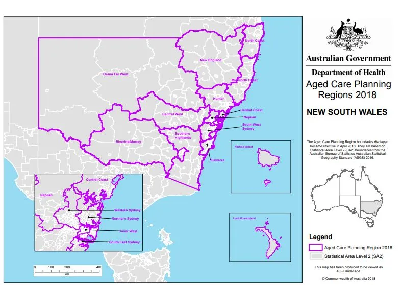
NSW overview map
Central Coast map
Central West map
Far North Coast map
Hunter map 1
Hunter map 2
Illawarra map
Inner West map
Mid North Coast map
Nepean map
New England map
Northern Sydney map 1
Northern Sydney map 2
Orana Far West map
Riverina/Murray map
South East Sydney map 1
South East Sydney map 2
South West Sydney map 1
South West Sydney map 2
Southern Highlands map
Western Sydney map 1
Western Sydney map 2
About this resource
Publication date:
Publication type:
Dataset
Language:
English
Part of a collection: