Filter results
You can narrow down the results using the filters
Audience
Topics
Our work
Diseases
11744 results
-
2018 Aged Care Planning Region maps
This collection contains the 2018 planning region maps for each state and territory, the correspondence of planning regions to Statistical Areas Level 2 (SA2s), and the planning region shapefile. -
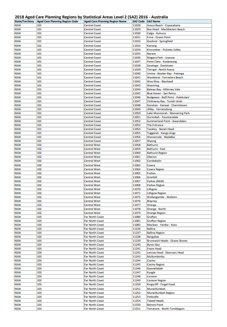
Correspondence of 2018 Aged Care Planning Regions and 2016 SA2s
This dataset lists the 2016 Statistical Areas Level 2 (SA2s) for each 2018 Aged Care Planning Region. -
2018 and 2015 Aged Care Planning Region Shapefiles
You can upload shapefiles of the 2018 and 2015 Aged Care Planning Regions into your mapping software. -
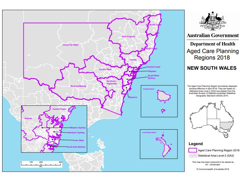
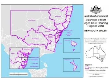
2018 NSW Aged Care Planning Regions
The current New South Wales Aged Care Planning Regions became effective in April 2018. Aged Care Planning Regions are based on Statistical Area Level 2 (SA2) boundaries. -
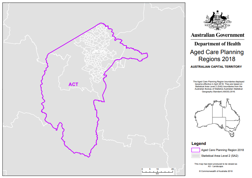
2018 ACT Aged Care Planning Region
The current Australian Capital Territory Aged Care Planning Region became effective in April 2018. Aged Care Planning Regions are based on Statistical Area Level 2 (SA2) boundaries. -
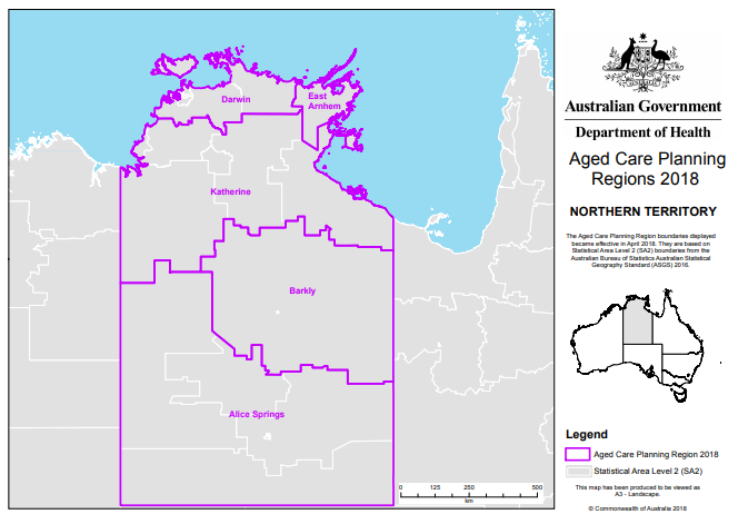
2018 NT Aged Care Planning Regions
The current Northern Territory Aged Care Planning Regions became effective in April 2018. Aged Care Planning Regions are based on Statistical Area Level 2 (SA2) boundaries. -
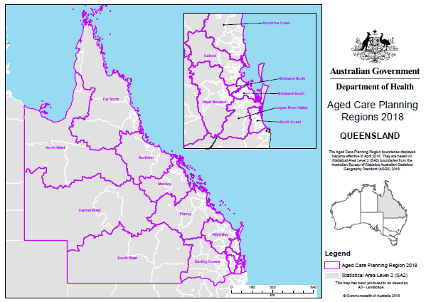
2018 Qld Aged Care Planning Regions
The current Queensland Aged Care Planning Regions became effective in April 2018. Aged Care Planning Regions are based on Statistical Area Level 2 (SA2) boundaries. -
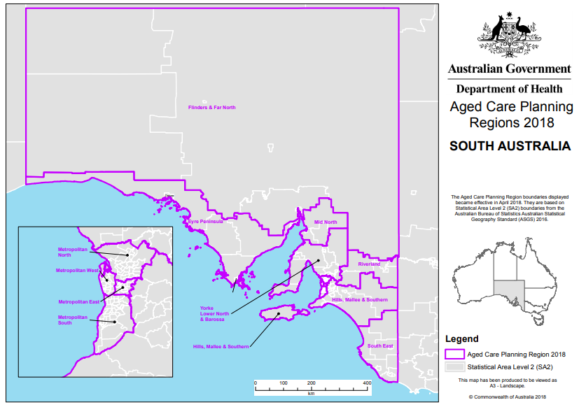
2018 SA Aged Care Planning Regions
The current South Australia Aged Care Planning Regions became effective in April 2018. Aged Care Planning Regions are based on Statistical Area Level 2 (SA2) boundaries. -
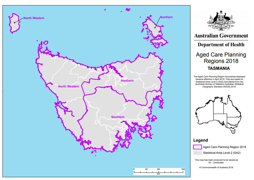
2018 Tas Aged Care Planning Regions
The current Tasmania Aged Care Planning Regions became effective in April 2018. Aged Care Planning Regions are based on Statistical Area Level 2 (SA2) boundaries. -
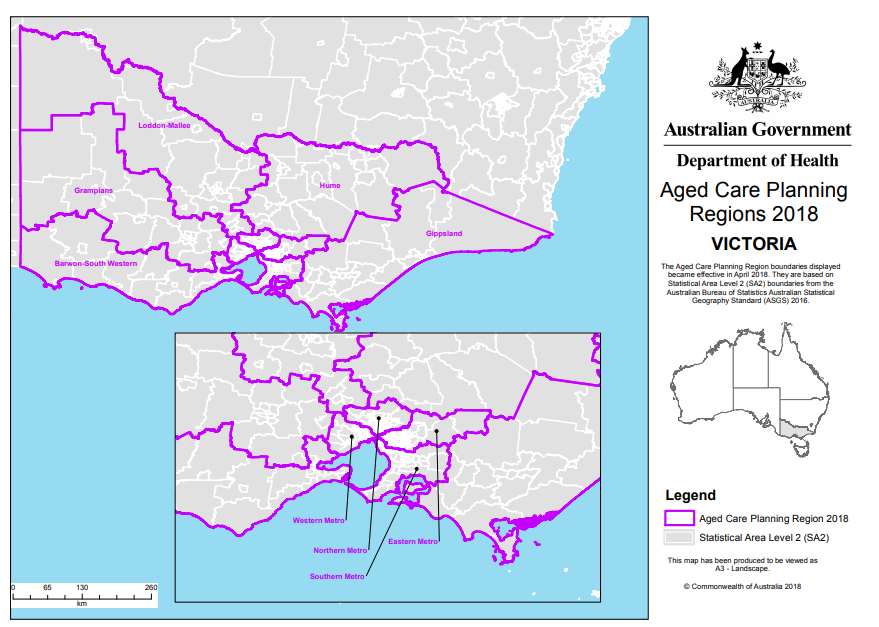
2018 Vic Aged Care Planning Regions
The current Victoria Aged Care Planning Regions became effective in April 2018. Aged Care Planning Regions are based on Statistical Area Level 2 (SA2) boundaries. -
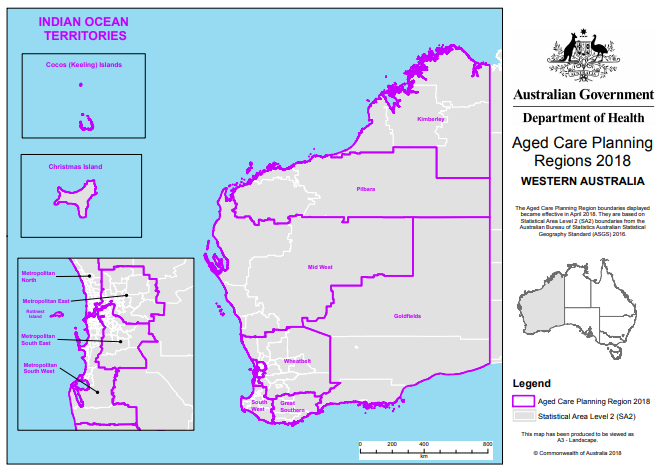
2018 WA Aged Care Planning Regions
The current Western Australia Aged Care Planning Regions became effective in April 2018. Aged Care Planning Regions are based on Statistical Area Level 2 (SA2) boundaries. -

National Drug Strategy
The National Drug Strategy aims to reduce and prevent harm caused by drugs. Six sub-strategies focus on specific issues such as alcohol, ice, tobacco, and workforce development. -
Shared Actions to Support all Diverse Older People: a Guide for Aged Care Providers
This plan sets out the actions that aged care providers can take to support the Aged Care Diversity Framework. -
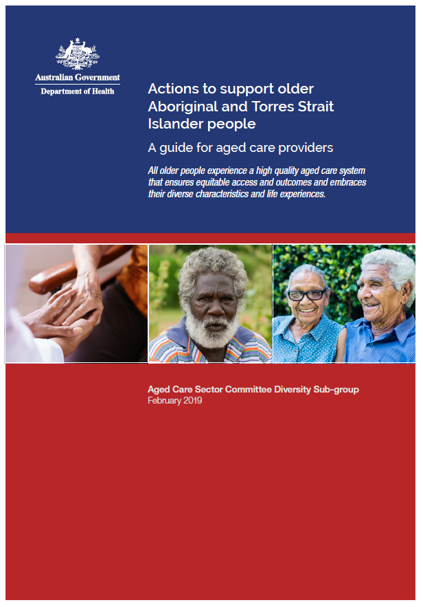
Actions to Support Older Aboriginal and Torres Strait Islander People: a Guide for Aged Care Providers
This action plan sets out what aged care providers can do to deliver more inclusive services to older Aboriginal and Torres Strait Islander peoples. -
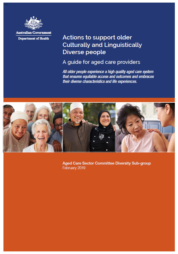
Actions to Support Older CALD People: a Guide for Aged Care Providers
This action plan sets out what aged care providers can do to deliver more inclusive services to older culturally and linguistically diverse (CALD) people. -
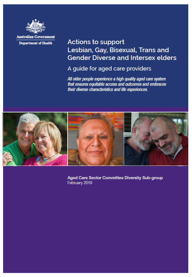
Actions to Support LGBTI Elders: a Guide for Aged Care Providers
This action plan sets out what aged care providers can do to deliver more inclusive services to lesbian, gay, bisexual, trans and gender diverse, and intersex (LGBTI) elders. -
National Strategic Action Plan for Lung Conditions
The National Strategic Action Plan for Lung Conditions outlines an evidence-based approach to reducing the burden of lung conditions in Australia. -

National Strategic Action Plan for Childhood Heart Disease
The National Strategic Action Plan for Childhood Heart Disease (CHD) aims to reduce the impact of this condition in Australia. It outlines priority areas and actions to help people with CHD live longer, healthier and more productive lives. -
Resource Utilisation and Classification Study (RUCS) Reports
RUCS was a national study that looked into the needs, costs and classification of residential aged care. The RUCS reports describe the key parts of the study including a proposed new assessment and funding model called Australian National Aged Care Classification (AN-ACC). -
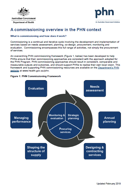
Primary Health Networks (PHNs) – commissioning information sheet – overview
This information sheet provides an overview of the commissioning process for Primary Health Networks (PHNs). -
Primary Health Networks (PHNs) – commissioning information sheet – co-design
This information sheet explains what co-design means and how it works for Primary Health Networks (PHNs). -
Primary Health Networks (PHNs) – commissioning information sheet – procurement approaches
This information sheet explains what procurement is and why it’s important in a commissioning context for Primary Health Networks (PHNs). -
Primary Health Networks (PHNs) – commissioning information sheet – markets
This information sheet helps Primary Health Networks (PHNs) understand, influence, support, develop and work collaboratively with markets. -
Primary Health Networks (PHNs) – commissioning information sheet – monitoring and evaluation
This information sheet outlines the monitoring and evaluation process for Primary Health Networks (PHNs). -

Healthy ageing: developmental research report
We commissioned a market research study into healthy ageing, identifying how we can help encourage Australians to make the most of their later years.