Filter results
You can narrow down the results using the filters
Audience
Topics
Our work
Diseases
11321 results
-
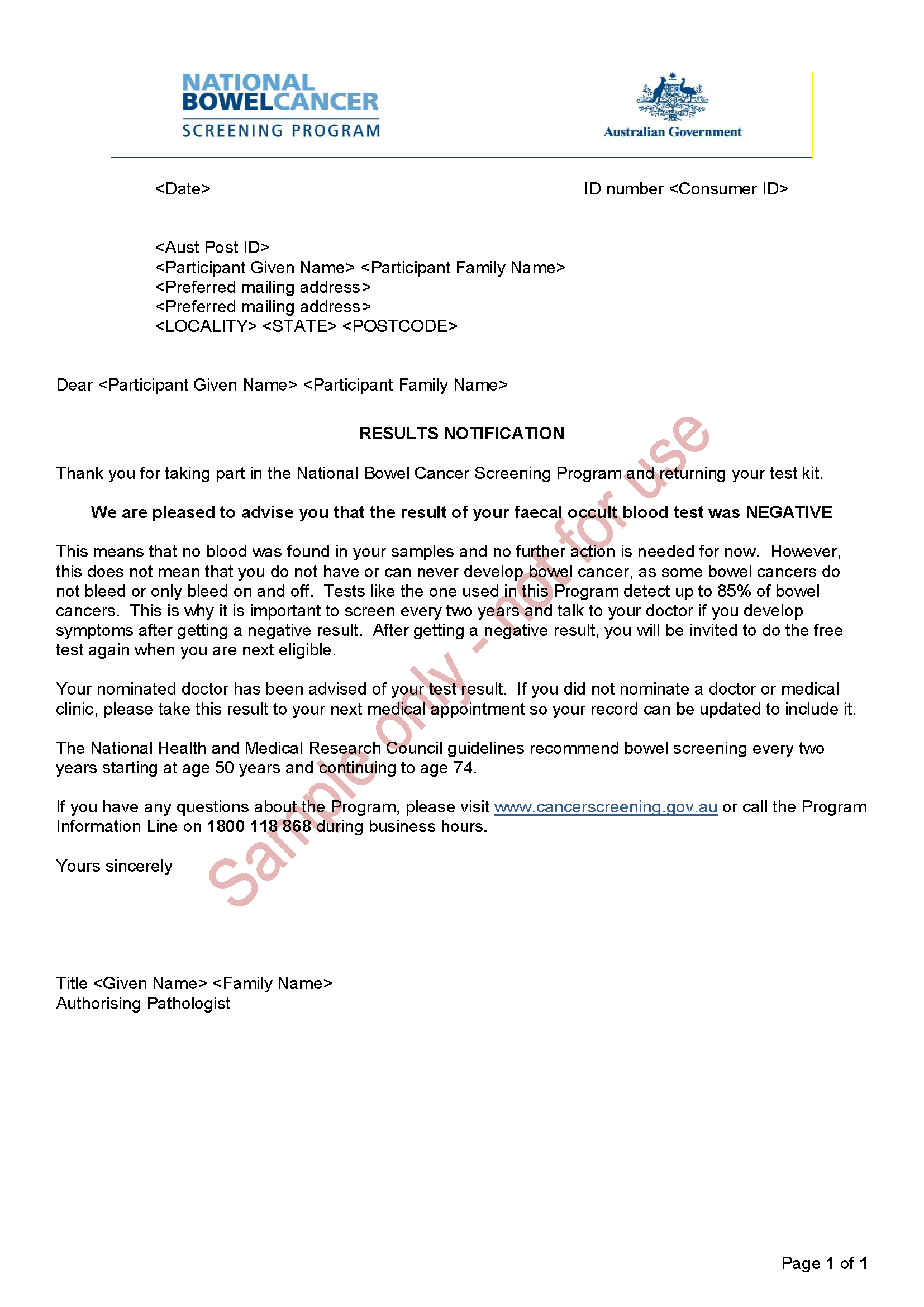
National Bowel Cancer Screening Program – Results notification letter – Negative
This is an example of the letter sent to people who have done the National Bowel Cancer Screening Program test to tell them their test was negative. -
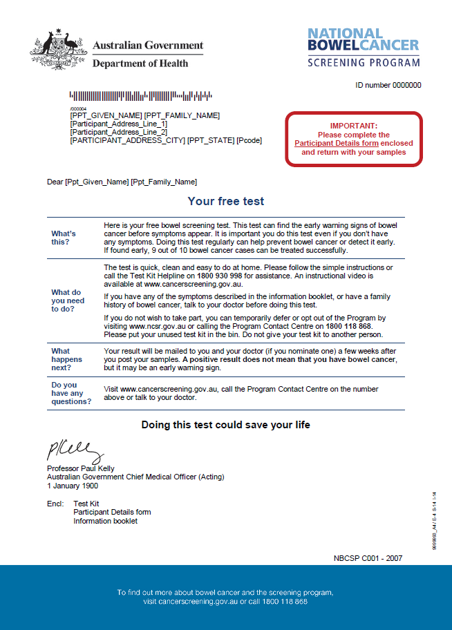
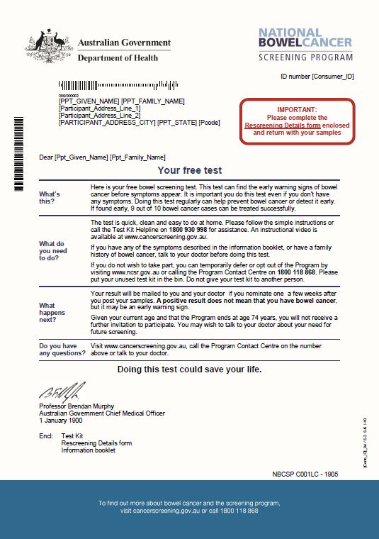
National Bowel Cancer Screening Program – Invitation letter
People aged 50 to 74 will receive this letter in the mail, along with a bowel cancer screening test kit. This is part of the National Bowel Cancer Screening Program. -
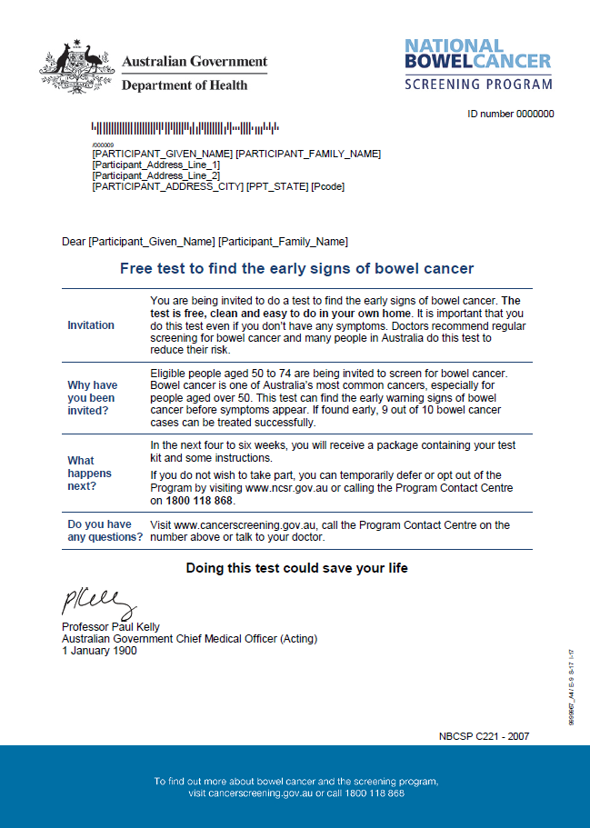
National Bowel Cancer Screening Program – Pre-invite letter
This letter tells people about the National Bowel Cancer Screening Program and encourages them to participate. -
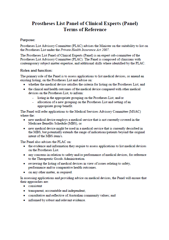
Panel of Clinical Experts Terms of Reference
This document sets out the purpose, roles, function and membership of the Panel of Clinical Experts. -
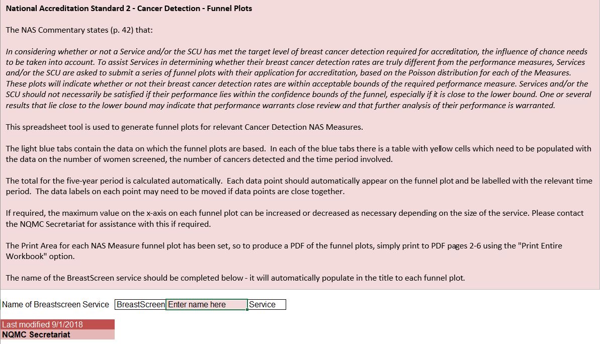
Funnel plot templates
These spreadsheet tools are used to generate funnel plots for relevant cancer detection NAS measures. They are part of the accreditation process for BreastScreen Australia Program services. -
National Bowel Cancer Screening Program – Invitation letter for 73 to 74 year olds
People aged 73 to 74 will receive this letter in the mail, along with their final bowel cancer screening test kit. This is part of the National Bowel Cancer Screening Program. -
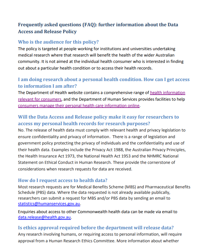
Data access and release policy
The information on this page provides researchers with an awareness and understanding of the Department of Health’s data access and release policy. -

My Aged Care research and evaluation
We regularly review and evaluate My Aged Care to make sure it’s being effective. Independent researchers consult a wide range of stakeholders to cover all aspects of My Aged Care. These reports outline the results of the research that has been done so far. -
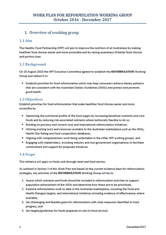
Partnership Reformulation Program – Reformulation Working Group work plan
This document outlines the Reformulation Working Group activities. -
My Life My Lead – Report on the national consultations
This report summarises the learnings from the My Life My Lead consultations held in 2017. It will guide future policy and programs, and support Closing the Gap initiatives. -
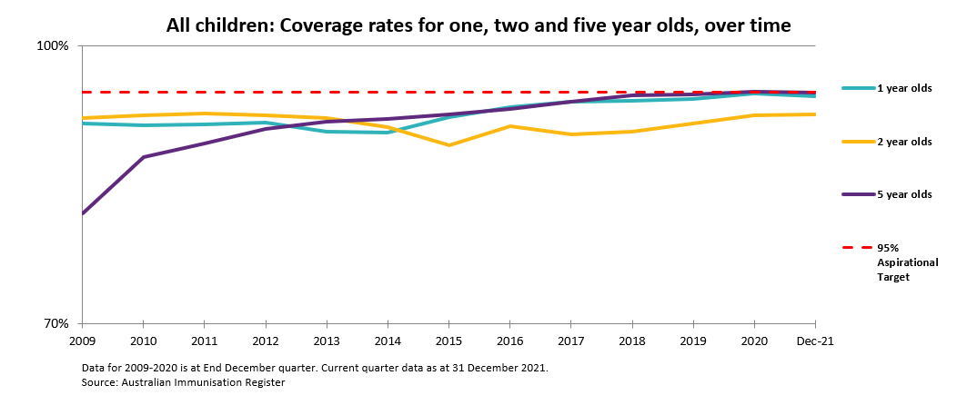
National coverage rates for all children
Immunisation coverage for 1, 2 and 5 year olds has increased since 2008. -
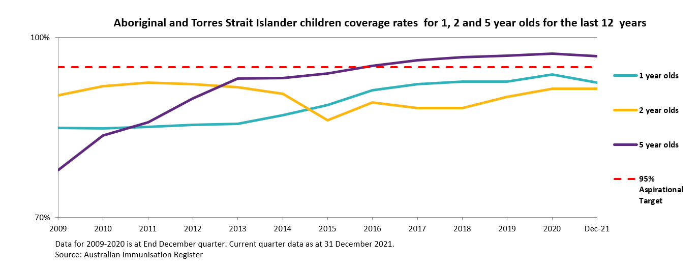
National coverage rates for Aboriginal and Torres Strait Islander children
Immunisation coverage for 1 and 5 year olds has increased since 2009. We have reached the target of 95% for Aboriginal and Torres Strait Islander 5 year olds. -
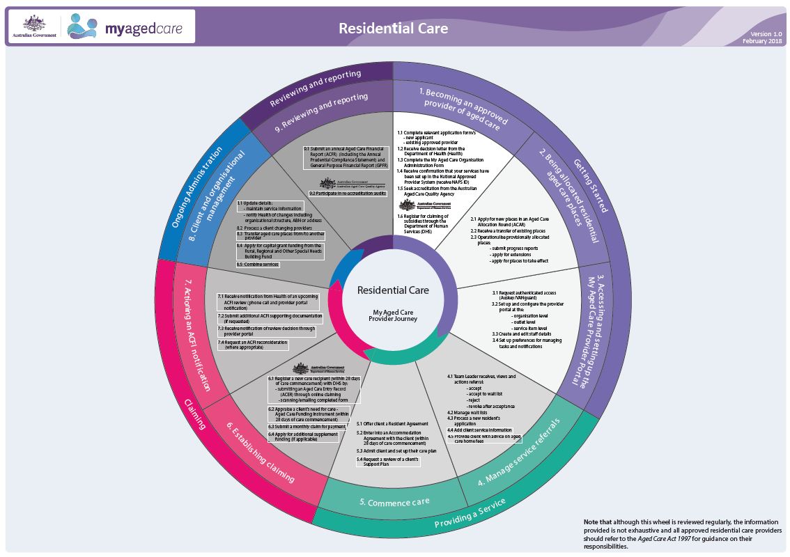
My Aged Care Process Overview – Residential Care
This diagram shows the key steps that providers should follow when providing residential care. It provides links, where available, to further guidance information. -
Third report from the Pathology Clinical Committee on Chemical Pathology
This report contains the third set of recommendations the Pathology Clinical Committee made to the MBS Review Taskforce about chemical pathology, after public consultation. -
Final clinical committee report for Pathology – Immunology
This report contains the recommendations the Pathology Clinical Committee made to the MBS Review Taskforce about immunology, after public consultation. -

National Asthma Strategy 2018
This National Asthma Strategy 2018 outlines a national response to asthma. It identifies the most effective and appropriate interventions to reduce the impact of asthma in the community. -
The Red Book
This guide aims to clarify how the laws relating to pathology and diagnostic imaging affect both requesters and providers of pathology and diagnostic imaging services. -
Literature review of international biosimilar medicines update – September to November 2017
This reports updates a literature review that looked at international and Australian clinical, academic and policy journals, as well as media articles or sources in relation to biosimilar medicines, to help inform policy development and communication activities. It covers September to November 2017. -
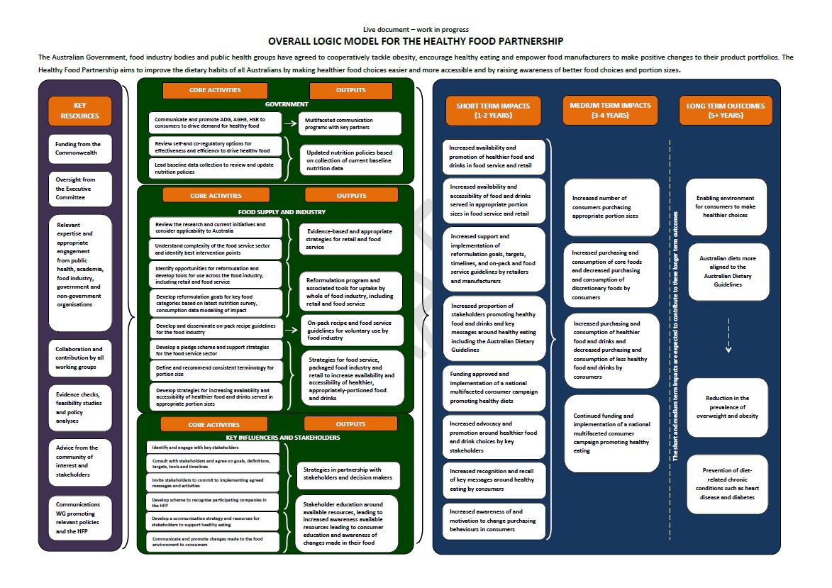
Healthy Food Partnership – Program logic
This diagram outlines the work of the Healthy Food Partnership, including resources, activities, outputs and impacts. -
Development of a framework for secondary use of My Health Record data – Community consultation summary report
This document summarises the key themes that emerged during public consultation about future possible secondary uses of My Health Record system data. -
ATAGI terms of reference
The terms of reference for the Australian Technical Advisory Group on Immunisation (ATAGI). -
Policy and regulatory approach to electronic cigarettes (e-cigarettes) in Australia
All Australian governments are taking a precautionary approach to electronic cigarettes (e-cigarettes). This document explains the principles that underpin the current policy and regulatory approach to e-cigarettes in Australia and outlines the evidence informing this approach. -
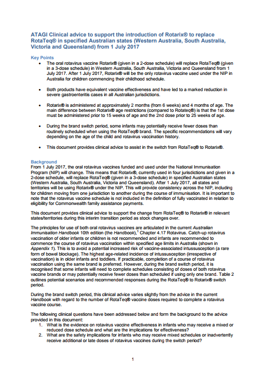
ATAGI advice on Rotarix® to replace RotaTeq®
Australian Technical Advisory Group on Immunisation (ATAGI) advice on Rotarix® to replace RotaTeq®. -
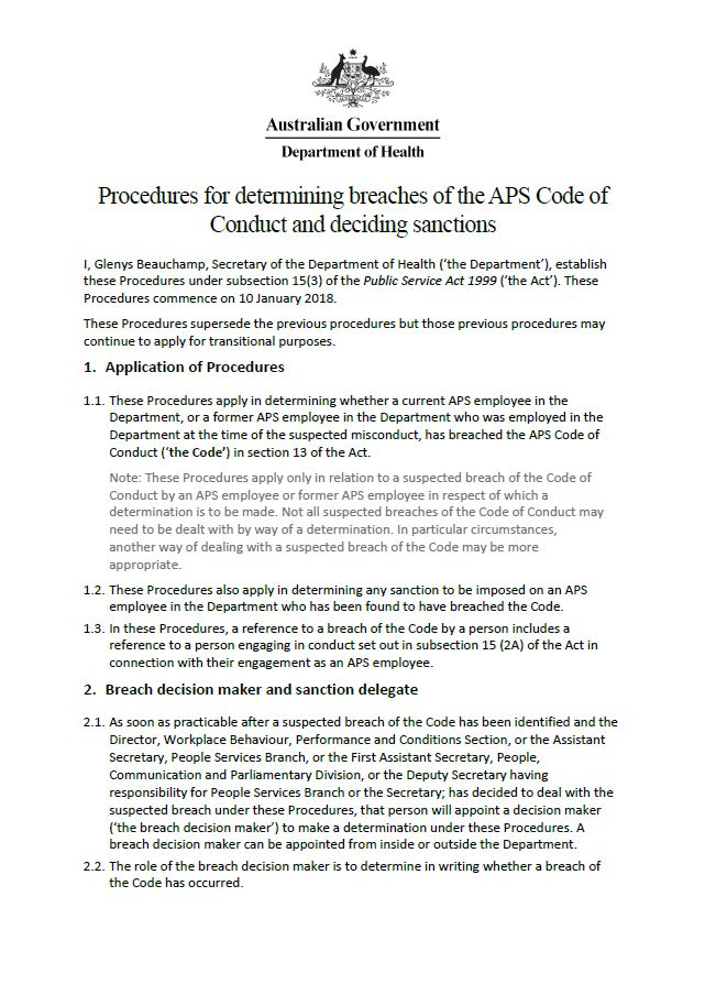
Procedures for determining breaches of the APS Code of Conduct and deciding sanctions
These procedures outline how we determine whether a current or former employee has breached the Australian Public Service (APS) Code of Conduct. It also outlines any sanctions that may be imposed. -
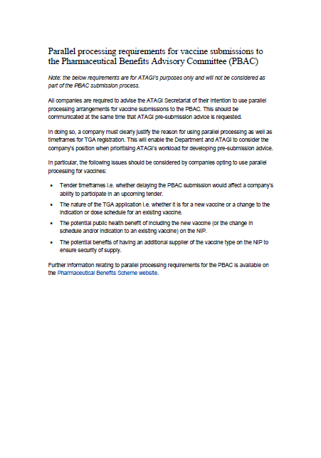
ATAGI parallel processing requirements for PBAC vaccine submissions
All companies are required to advise the Australian Technical Advisory Group on Immunisation (ATAGI) Secretariat of their intention to use parallel processing arrangements for vaccine submissions to the Pharmaceutical Benefits Advisory Committee (PBAC).