Filter results
You can narrow down the results using the filters
Audience
Publication type
Topics
Our work
Diseases
9182 results
-
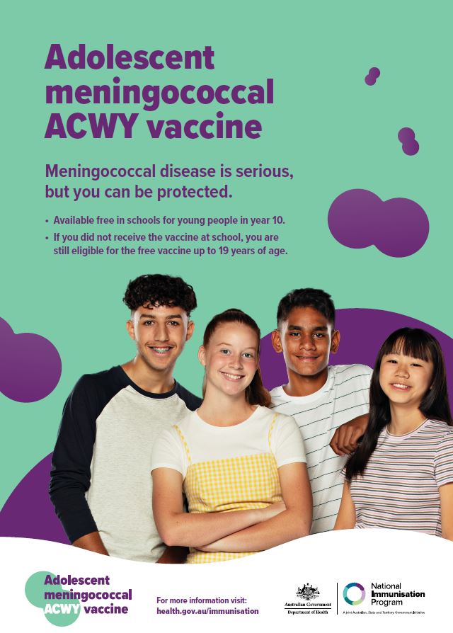
Adolescent meningococcal ACWY vaccine – poster
This poster provides information about the meningococcal ACWY vaccine, available free for adolescents. -
Prostheses List Advisory Committee (PLAC) Operational Guidelines
These guidelines set out how PLAC will operate to deliver on its Terms of Reference. -
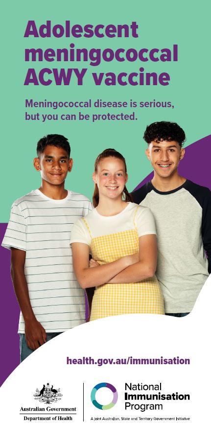
Adolescent meningococcal ACWY vaccine – brochure
This brochure provides information about the meningococcal ACWY vaccine, available free for adolescents.
-
Previous Memorandum of Understanding with the Aged Care Quality and Safety Commission
The previous Memorandum of Understanding (MoU) described how the Department of Health and the Aged Care Quality and Safety Commission would work together. -
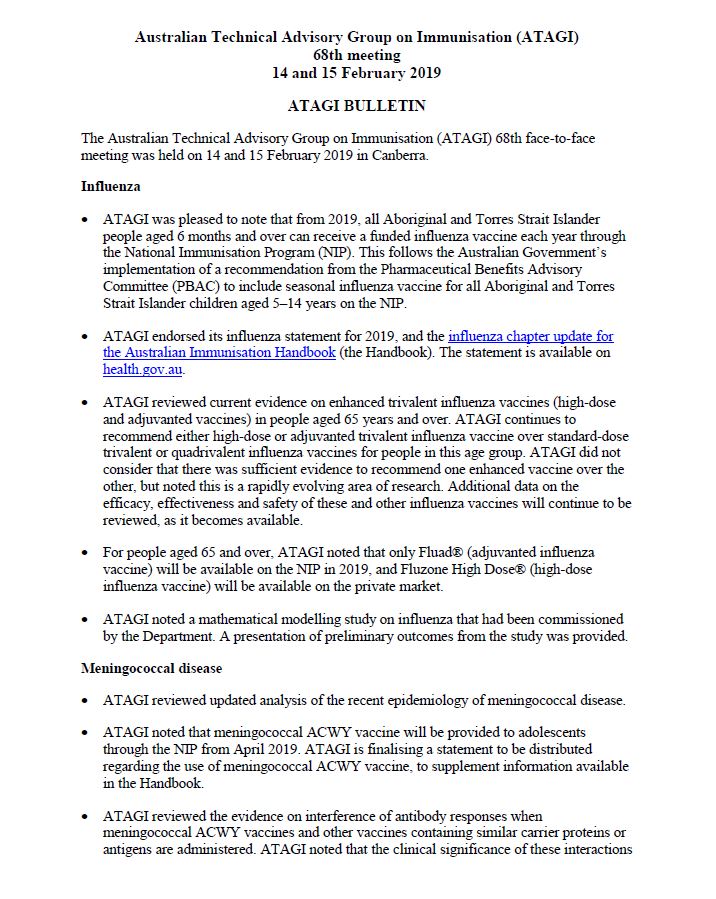
ATAGI Bulletin for the 68th Meeting, 14-15 February 2019
Australian Technical Advisory Group on Immunisation (ATAGI) Bulletin for the 68th Meeting held on 14 and 15 February 2019.
-
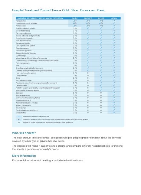
Private health insurance reforms – Gold, Silver, Bronze, Basic product tiers – fact sheet
This fact sheet describes the Gold, Silver, Bronze and Basic private hospital insurance tiers, and what they mean to you. -
Revised Benefit Setting and Review Framework Industry Working Group Terms of Reference
This document sets out the roles, function, membership and operating guidelines of the Revised Benefit Setting and Review Framework Industry Working Group. -
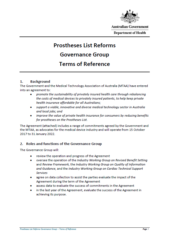
Prostheses List Reform Governance Group Terms of Reference
This document sets out the roles, function, membership, meetings and secretariat of the Governance Group. -
National Women's Health Strategy 2020–2030
This strategy outlines Australia’s national approach to improving the health of women and girls – particularly those at greatest risk of poor health – and to reducing inequities between different groups. -
Royal Commission into Violence, Abuse, Neglect and Exploitation of People with Disability Letters Patent – Terms of Reference
On 5 April 2019, the Prime Minister, the Hon Scott Morrison MP, and Minister for Families and Social Services, the Hon Paul Fletcher MP, announced the establishment of the Royal Commission into Violence, Abuse, Neglect and Exploitation of People with Disability. -
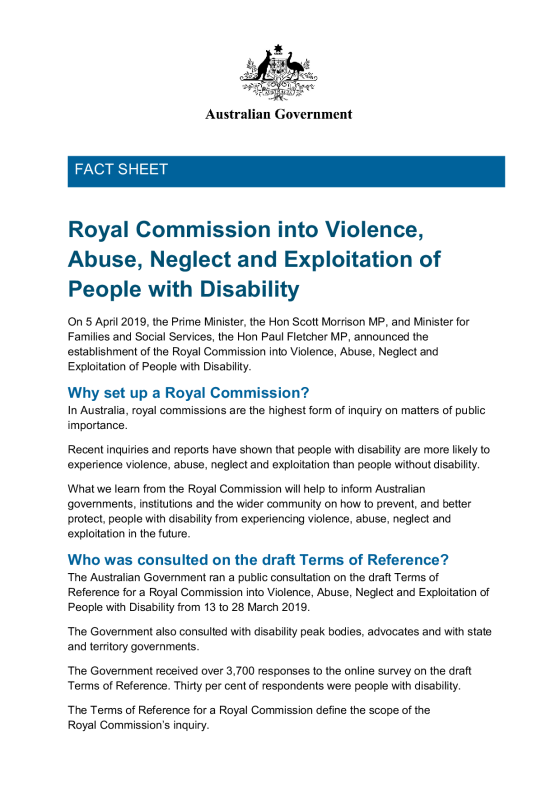
Royal Commission into Violence, Abuse, Neglect and Exploitation of People with Disability fact sheet
On 5 April 2019, the Prime Minister and Minister for Families and Social Services, announced the establishment of the Royal Commission into Violence, Abuse, Neglect and Exploitation of People with Disability. -
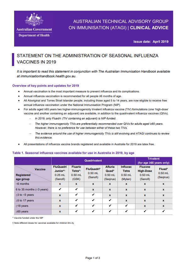
ATAGI advice on seasonal influenza vaccines in 2019
This resource provides advice for immunisation providers regarding the administration of 2019 seasonal influenza vaccines. -
ATAGI statement on meningococcal ACWY vaccine (Nimenrix®) for adolescents
This resource provides advice on the introduction of meningococcal ACWY vaccine (Nimenrix®) for adolescents through the National Immunisation Program (NIP). -
National Action Plan for the Health of Children and Young People 2020–2030
This plan outlines our approach to improving health outcomes for all children and young people. It aims to ensure that children and young people, from all backgrounds and all walks of life, have the same opportunities to fulfil their potential, and are healthy safe and thriving. -
An Action Plan for Medical Devices – Improving Australia’s medical device regulatory framework
The action plan is a 3-part strategy to strengthen Australia’s regulatory system whilst continuing to be patient focused and have greater transparency. It outlines actions that continue to improve the safety, performance and quality of medical devices in and improve health outcomes for patients. -
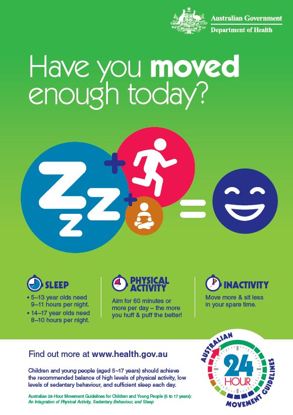
24-hour movement guidelines – children and young people (5 to 17 years) – poster for educators
This poster summarises the 24-hour movement guidelines for children and young people. It includes a quick reference to how much sleep, activity, and inactivity children and young people should do. -
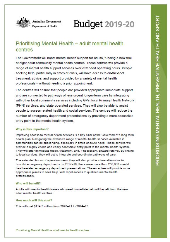
Budget 2019–20: Prioritising Mental Health – adult mental health centres
This Budget fact sheet outlines how the Government will boost mental health support for adults, funding a new trial of eight adult community mental health centres. -
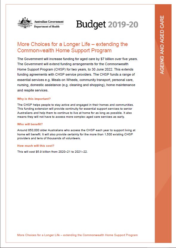
Budget 2019–20: More Choices for a Longer Life – extending the Commonwealth Home Support Program
This Budget fact sheet outlines how the Government will extend funding arrangements for the Commonwealth Home Support Program (CHSP) for two years, to 30 June 2022. -
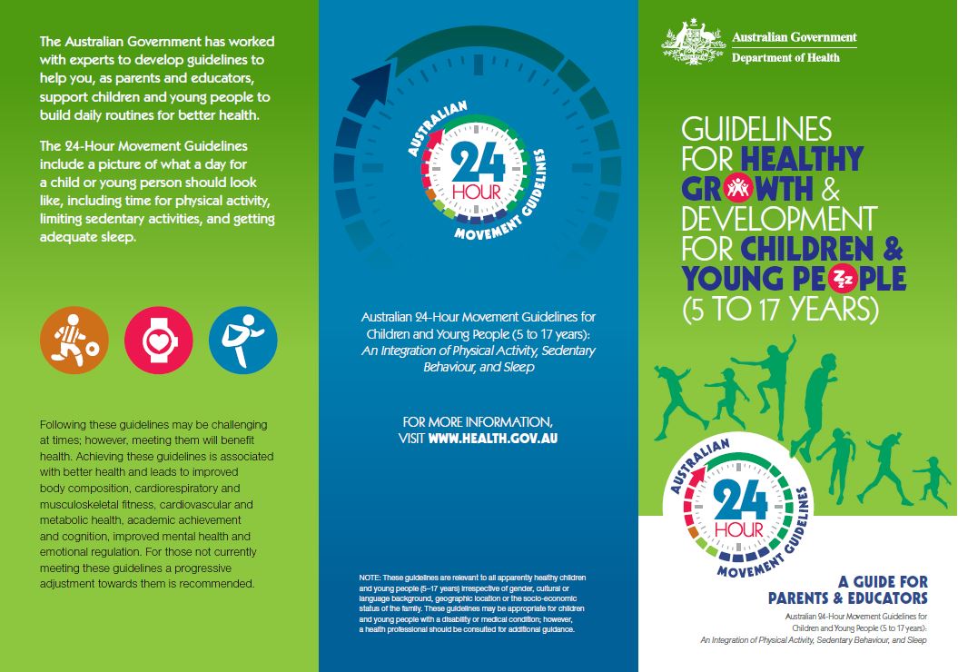
24-hour movement guidelines – children and young people (5 to 17 years) – brochure
Being active is important for children and young people to be healthy, and set good habits for life. This brochure outlines how much activity children and young people should do each day, how sitting time and screen time should be limited, and how much sleep they should get. -
Australian 24-hour movement guidelines for children (5 to 12 years) and young people (13 to 17 years): an integration of physical activity, sedentary behaviour, and sleep
This report outlines a review of the scientific evidence and recommends new guidelines for children and young people. It formed the basis of Australia’s 24-hour movement guidelines for children aged 5 to 17 years. -
Accessibility and quality of mental health services in rural and remote Australia
Australian Government response to the Senate Community Affairs References Committee Inquiry: Accessibility and quality of mental health services in rural and remote Australia – April 2019 -
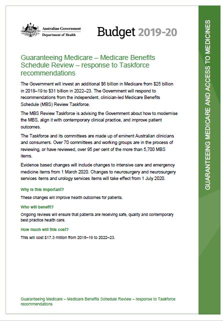
Budget 2019–20: Guaranteeing Medicare – Medicare Benefits Schedule Review – response to Taskforce recommendations
This Budget fact sheet outlines the Government's additional investments in Medicare and it's response to recommendations from the Medicare Benefits Schedule (MBS) Review Taskforce. -
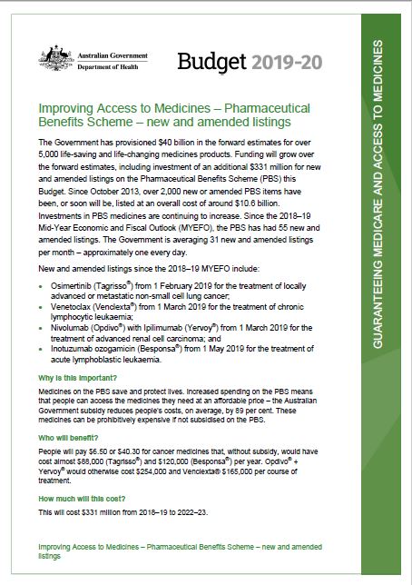
Budget 2019–20: Improving Access to Medicines – Pharmaceutical Benefits Scheme – new and amended listings
This Budget fact sheet outlines the Government's provision for funding of life-saving and life-changing medicines products. -
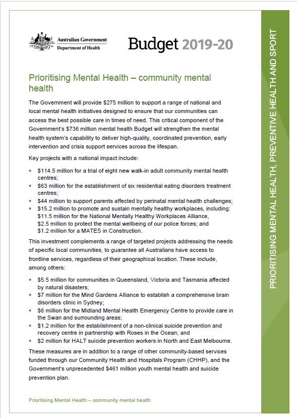
Budget 2019–20: Prioritising Mental Health – community mental health
This Budget fact sheet outlines how the Government will provide $275 million to support a range of national and local mental health initiatives designed to ensure that our communities can access the best possible care in times of need. -
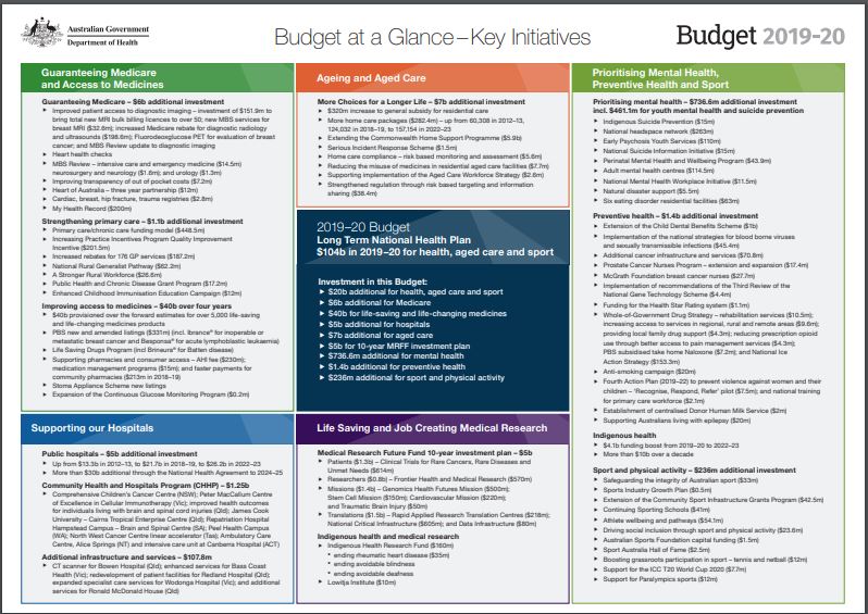
Budget at a glance
This summary sheet outlines the key initiatives from the 2019–20 Budget.