Filter results
You can narrow down the results using the filters
Audience
Publication type
Topics
Our work
Diseases
9608 results
-
National Obesity Summit presentation – Professor Louise Baur – Obesity and the first 2,000 days
This is the presentation by Professor Louise Baur at the National Obesity Summit, which brought together experts to look at the causes of obesity and what we can do about it. The summit was part of the process to develop a National Obesity Strategy. -
National Obesity Summit presentation – Dr Peter Molloy – Genetics, epigenetics and obesity
This is the presentation by Dr Peter Molloy at the National Obesity Summit, which brought together experts to look at the causes of obesity and what we can do about it. The summit was part of the process to develop a National Obesity Strategy. -

National Obesity Summit presentation – Professor Susan Jebb – Policy initiatives to tackle obesity in England
This is the presentation by Professor Susan Jebb at the National Obesity Summit, which brought together experts to look at the causes of obesity and what we can do about it. The summit was part of the process to develop a National Obesity Strategy. -
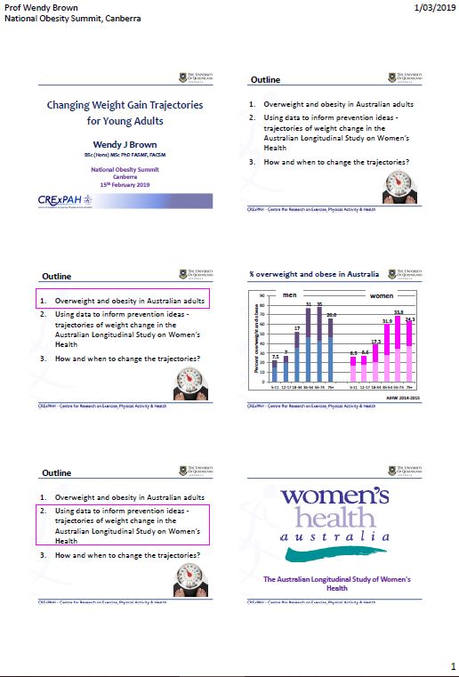
National Obesity Summit presentation – Professor Wendy Brown – Changing weight gain trajectories for young adults
This is the presentation by Professor Wendy Brown at the National Obesity Summit, which brought together experts to look at the causes of obesity and what we can do about it. The summit was part of the process to develop a National Obesity Strategy. -
Australian Government Diversity Action Plan
This 2019 plan sets out the actions the Government will take to support the Aged Care Diversity Framework. -

National guidelines for managing HIV transmission risk behaviours
These guidelines help Chief Health Officers ensure consistency in the way all Australian states and territories manage HIV transmission risk behaviours. -
Specialist Disability Accommodation Pricing and Payments Framework Review: Final Report
Specialist Disability Accommodation Pricing and Payments Framework Review: Final Report -
Actions to Support LGBTI Elders: a Guide for Consumers
This guide helps lesbian, gay, bisexual, trans and gender diverse, and intersex (LGBTI) elders to express their needs when speaking with aged care providers. It can also help people working in aged care to better understand LGBTI needs. -
Actions to Support Older Aboriginal and Torres Strait Islander People: a Guide for Consumers
This guide helps older Aboriginal and Torres Strait Islander peoples to express their needs when speaking with aged care providers. It can also help people working in aged care to better understand the needs of Aboriginal and Torres Strait Islander peoples. -
Aged Care Sector Committee 2018 Communiques
Communiques for the 2018 meetings of the Aged Care Sector Committee. -
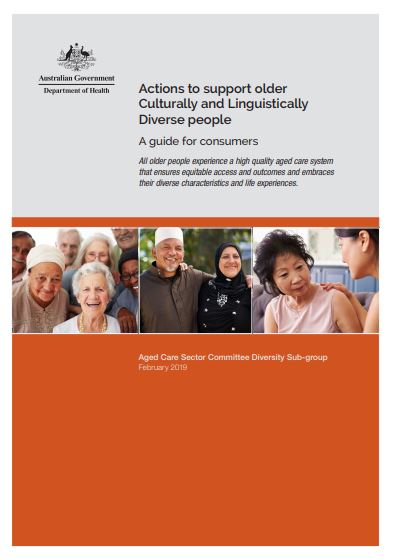
Actions to Support Older CALD People: a Guide for Consumers
This guide helps older people from culturally and linguistically diverse (CALD) backgrounds to express their needs when speaking with aged care providers. It can also help people working in aged care to better understand CALD needs. -
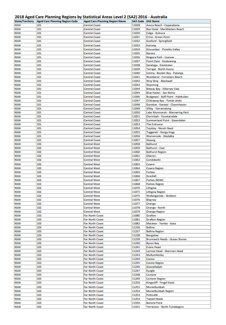
Correspondence of 2018 Aged Care Planning Regions and 2016 SA2s
This dataset lists the 2016 Statistical Areas Level 2 (SA2s) for each 2018 Aged Care Planning Region. -
2018 and 2015 Aged Care Planning Region Shapefiles
You can upload shapefiles of the 2018 and 2015 Aged Care Planning Regions into your mapping software. -
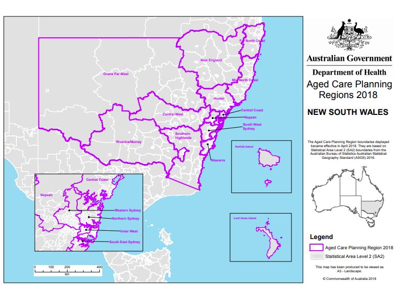
2018 NSW Aged Care Planning Regions
The current New South Wales Aged Care Planning Regions became effective in April 2018. Aged Care Planning Regions are based on Statistical Area Level 2 (SA2) boundaries. -
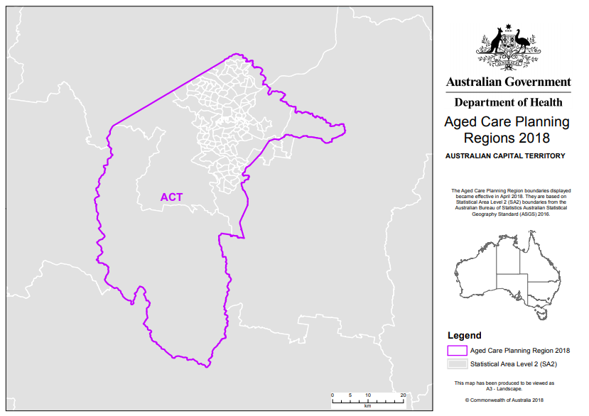
2018 ACT Aged Care Planning Region
The current Australian Capital Territory Aged Care Planning Region became effective in April 2018. Aged Care Planning Regions are based on Statistical Area Level 2 (SA2) boundaries. -
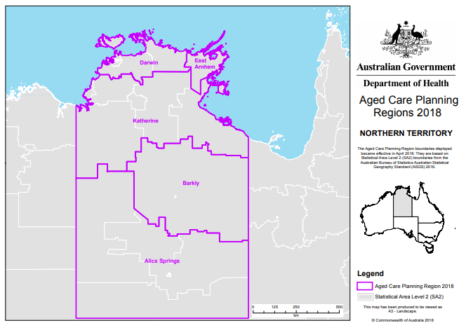
2018 NT Aged Care Planning Regions
The current Northern Territory Aged Care Planning Regions became effective in April 2018. Aged Care Planning Regions are based on Statistical Area Level 2 (SA2) boundaries. -
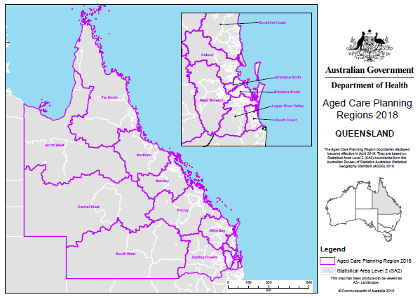
2018 Qld Aged Care Planning Regions
The current Queensland Aged Care Planning Regions became effective in April 2018. Aged Care Planning Regions are based on Statistical Area Level 2 (SA2) boundaries. -
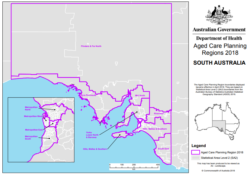
2018 SA Aged Care Planning Regions
The current South Australia Aged Care Planning Regions became effective in April 2018. Aged Care Planning Regions are based on Statistical Area Level 2 (SA2) boundaries. -
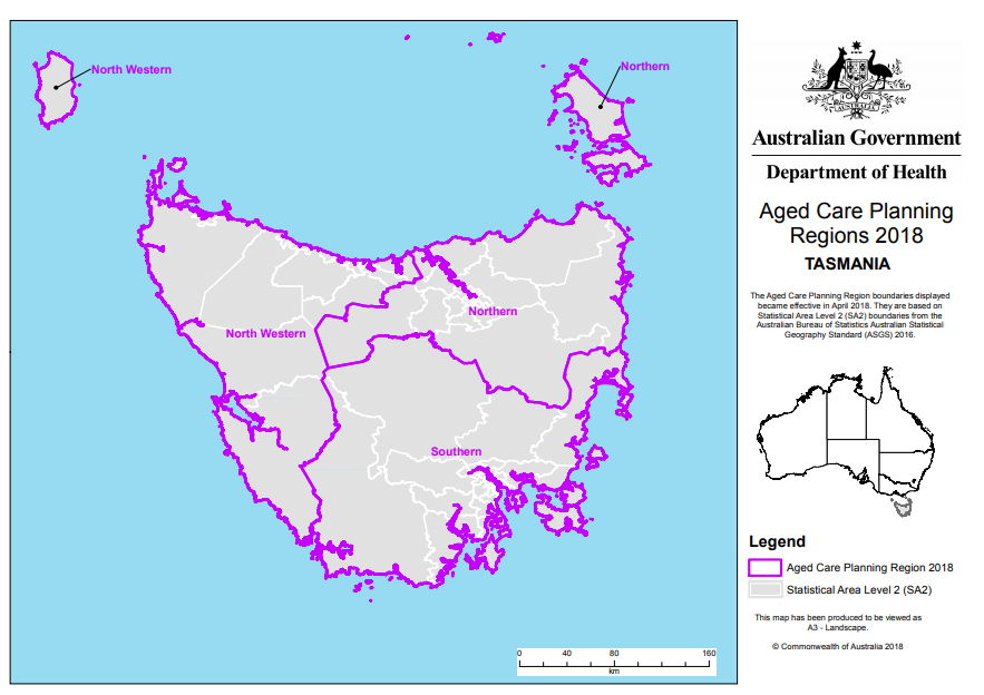
2018 Tas Aged Care Planning Regions
The current Tasmania Aged Care Planning Regions became effective in April 2018. Aged Care Planning Regions are based on Statistical Area Level 2 (SA2) boundaries. -
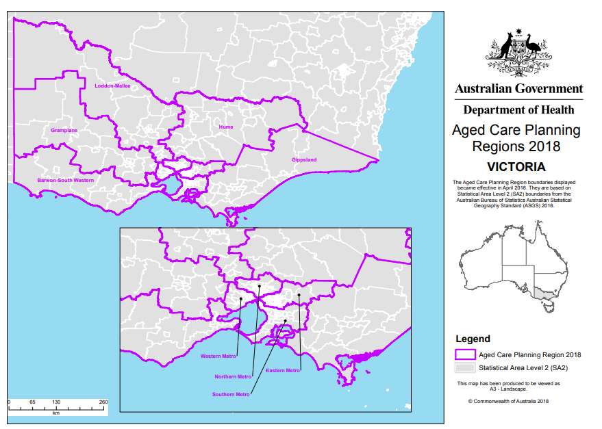
2018 Vic Aged Care Planning Regions
The current Victoria Aged Care Planning Regions became effective in April 2018. Aged Care Planning Regions are based on Statistical Area Level 2 (SA2) boundaries. -
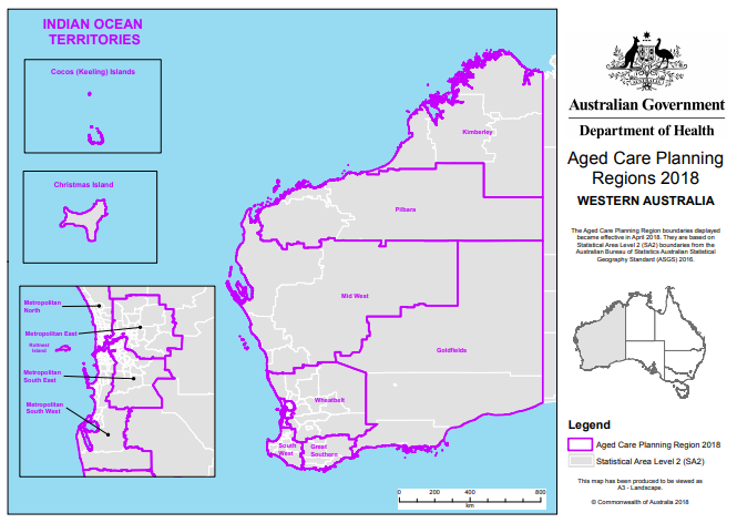
2018 WA Aged Care Planning Regions
The current Western Australia Aged Care Planning Regions became effective in April 2018. Aged Care Planning Regions are based on Statistical Area Level 2 (SA2) boundaries. -
Shared Actions to Support all Diverse Older People: a Guide for Aged Care Providers
This plan sets out the actions that aged care providers can take to support the Aged Care Diversity Framework. -
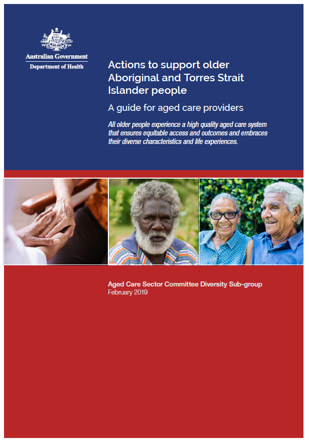
Actions to Support Older Aboriginal and Torres Strait Islander People: a Guide for Aged Care Providers
This action plan sets out what aged care providers can do to deliver more inclusive services to older Aboriginal and Torres Strait Islander peoples. -
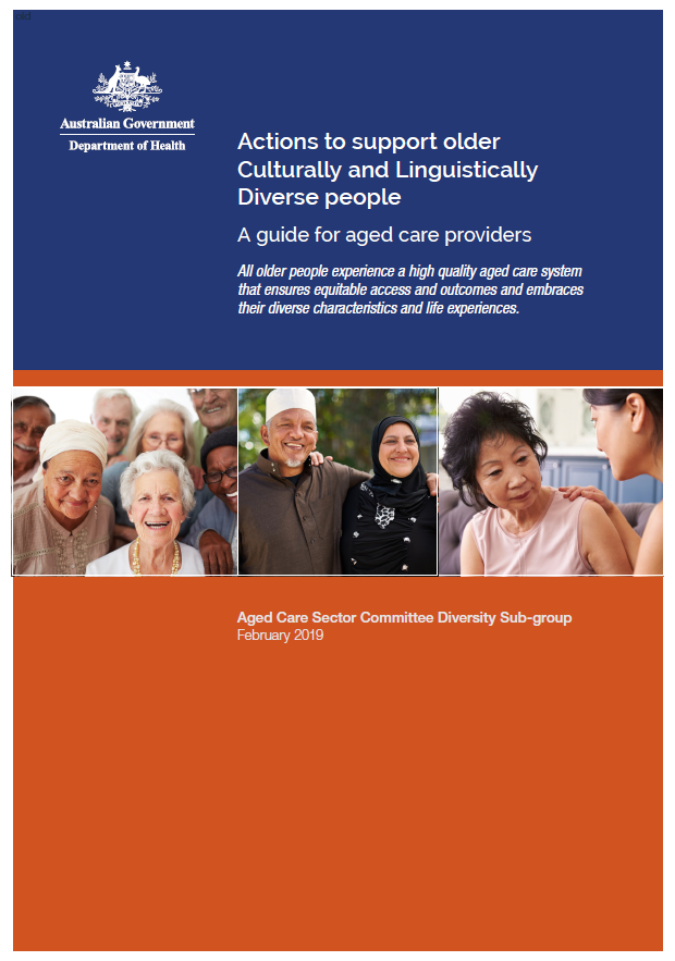
Actions to Support Older CALD People: a Guide for Aged Care Providers
This action plan sets out what aged care providers can do to deliver more inclusive services to older culturally and linguistically diverse (CALD) people. -
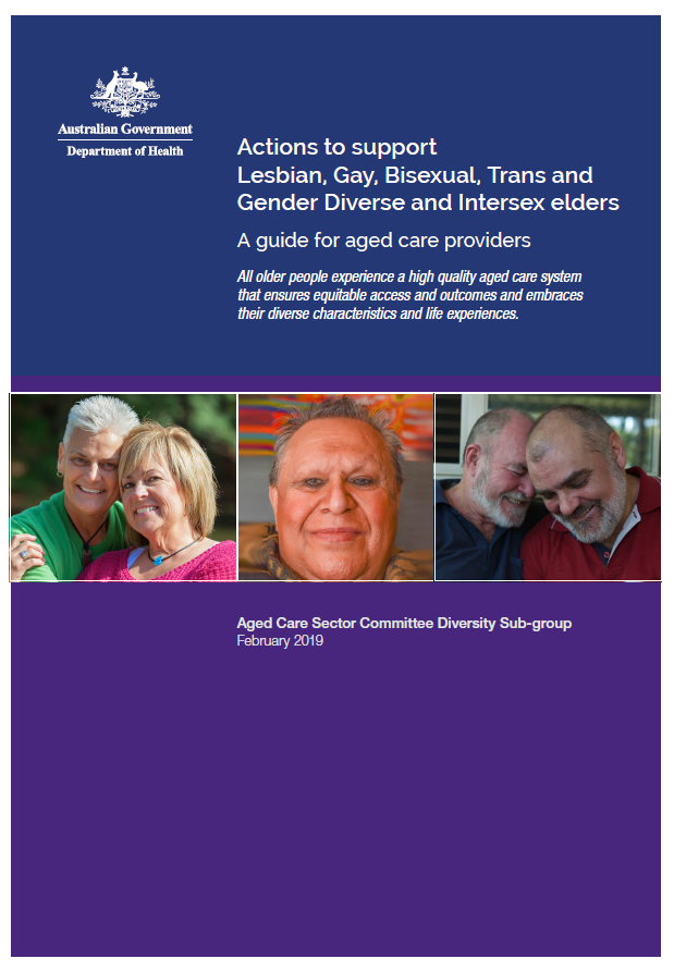
Actions to Support LGBTI Elders: a Guide for Aged Care Providers
This action plan sets out what aged care providers can do to deliver more inclusive services to lesbian, gay, bisexual, trans and gender diverse, and intersex (LGBTI) elders.