Filter results
You can narrow down the results using the filters
Audience
Topics
Our work
Diseases
405 results
-
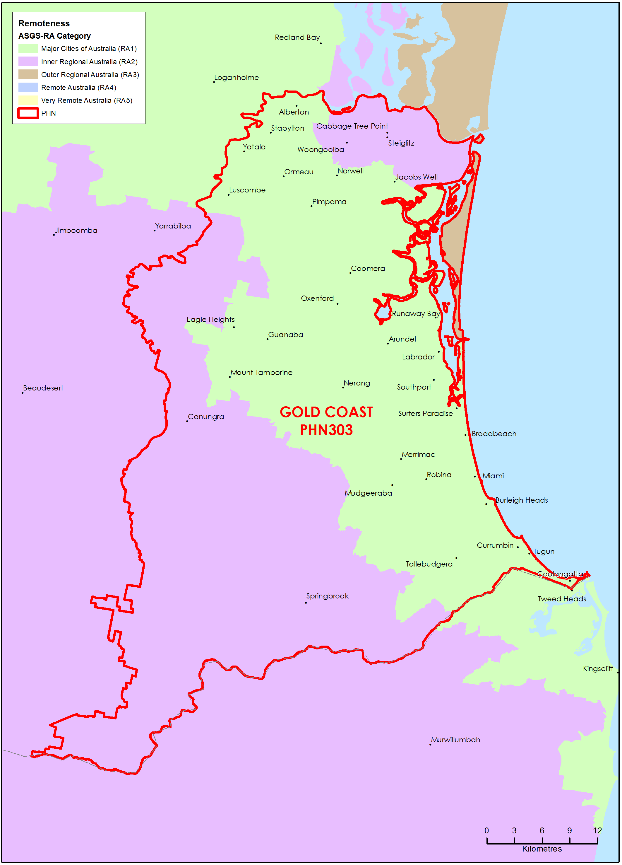
Gold Coast (Qld) Primary Health Network (PHN) map – Australian Statistical Geography Standard (ASGS) remoteness area
This map shows the Australian Statistical Geography Standard remoteness area classifications within the Gold Coast (Qld) Primary Health Network. -
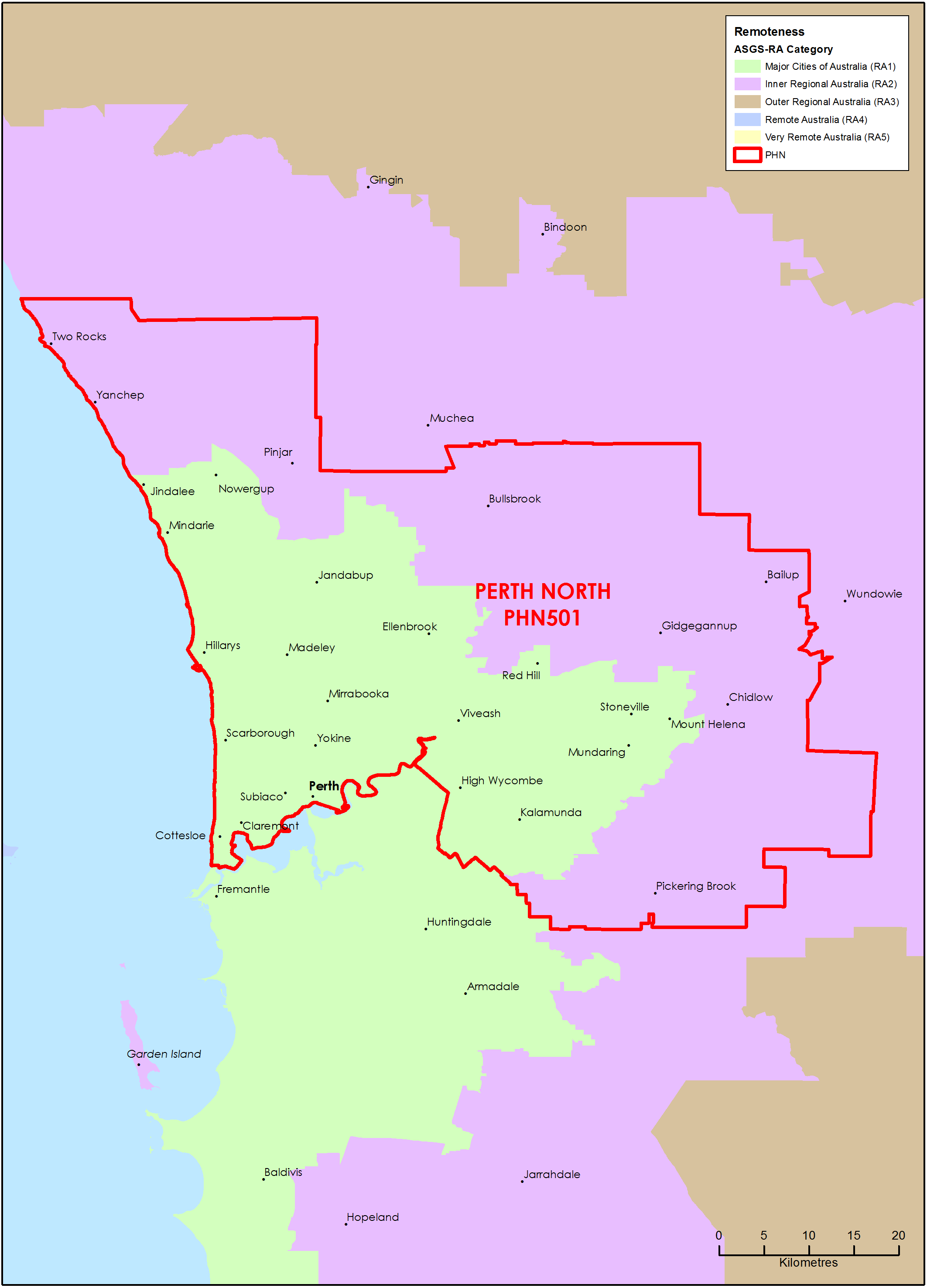
Perth North (WA) Primary Health Network (PHN) map – Australian Statistical Geography Standard (ASGS) remoteness area
This map shows the Australian Statistical Geography Standard remoteness area classifications within the Perth North (WA) Primary Health Network. -
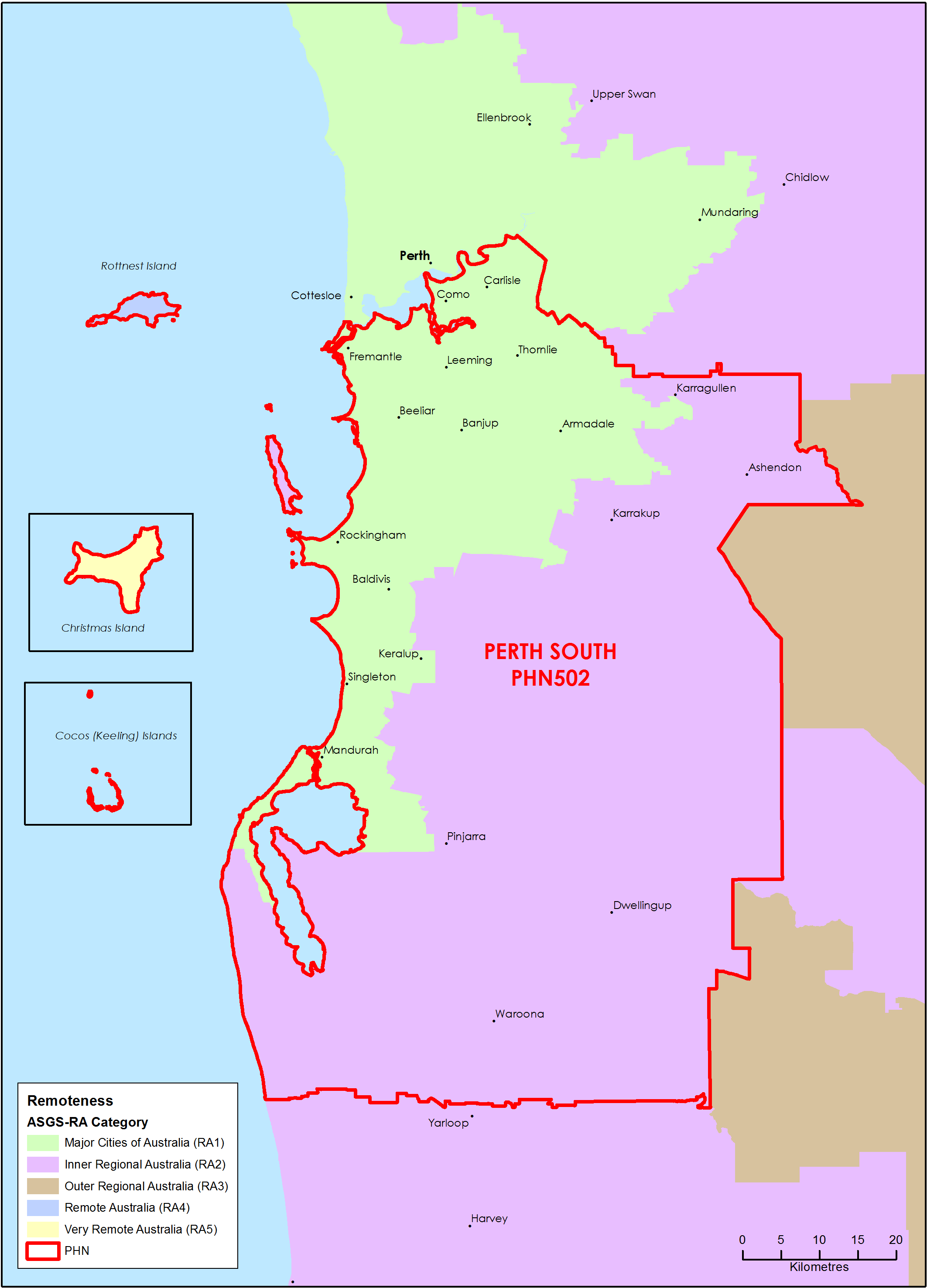
Perth South (WA) Primary Health Network (PHN) map – Australian Statistical Geography Standard (ASGS) remoteness area
This map shows the Australian Statistical Geography Standard remoteness area classifications within the Perth South (WA) Primary Health Network. -
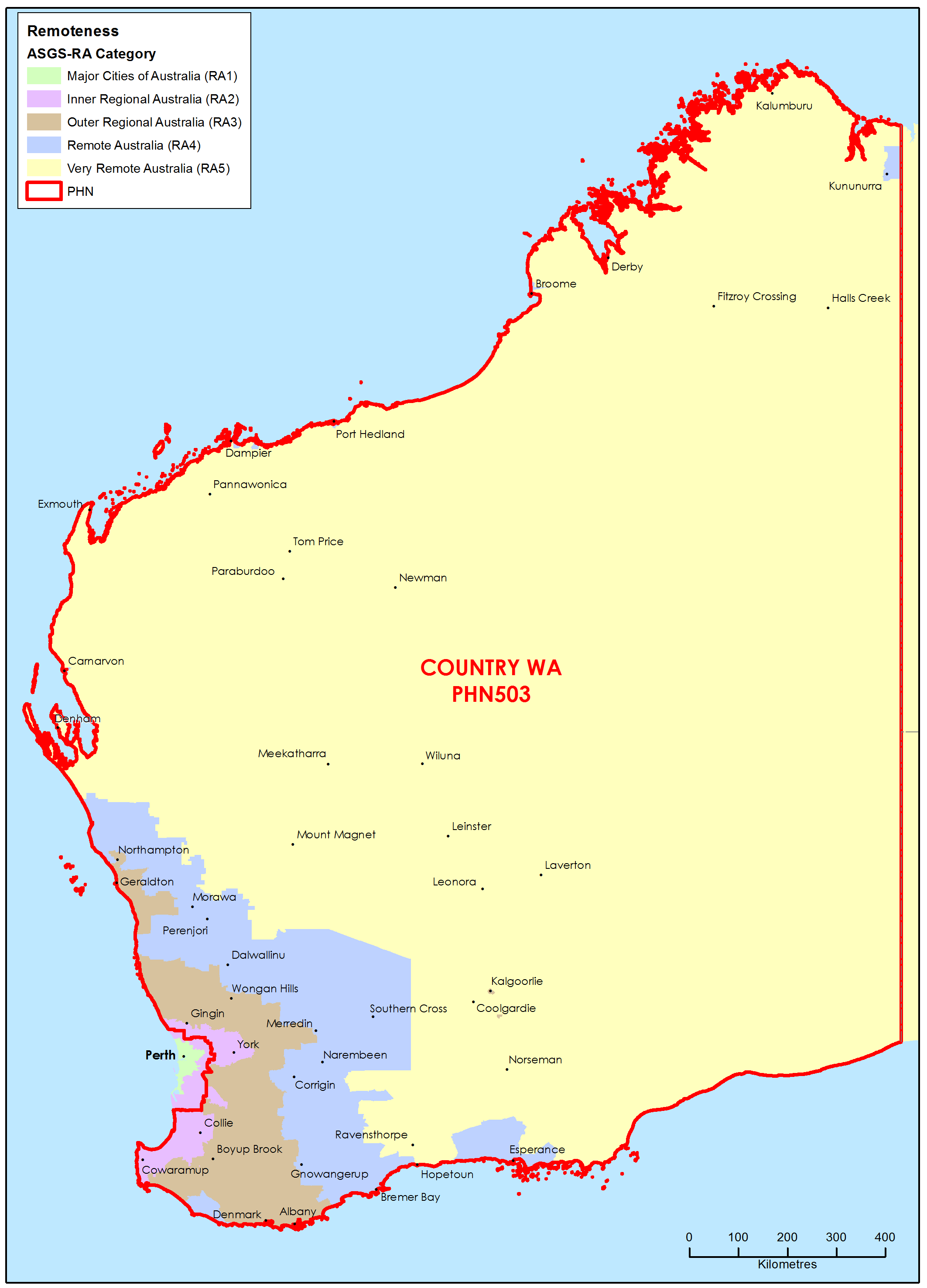
Country Western Australia Primary Health Network (PHN) map – Australian Statistical Geography Standard (ASGS) remoteness area
This map shows the Australian Statistical Geography Standard remoteness area classifications within the Country Western Australia Primary Health Network. -
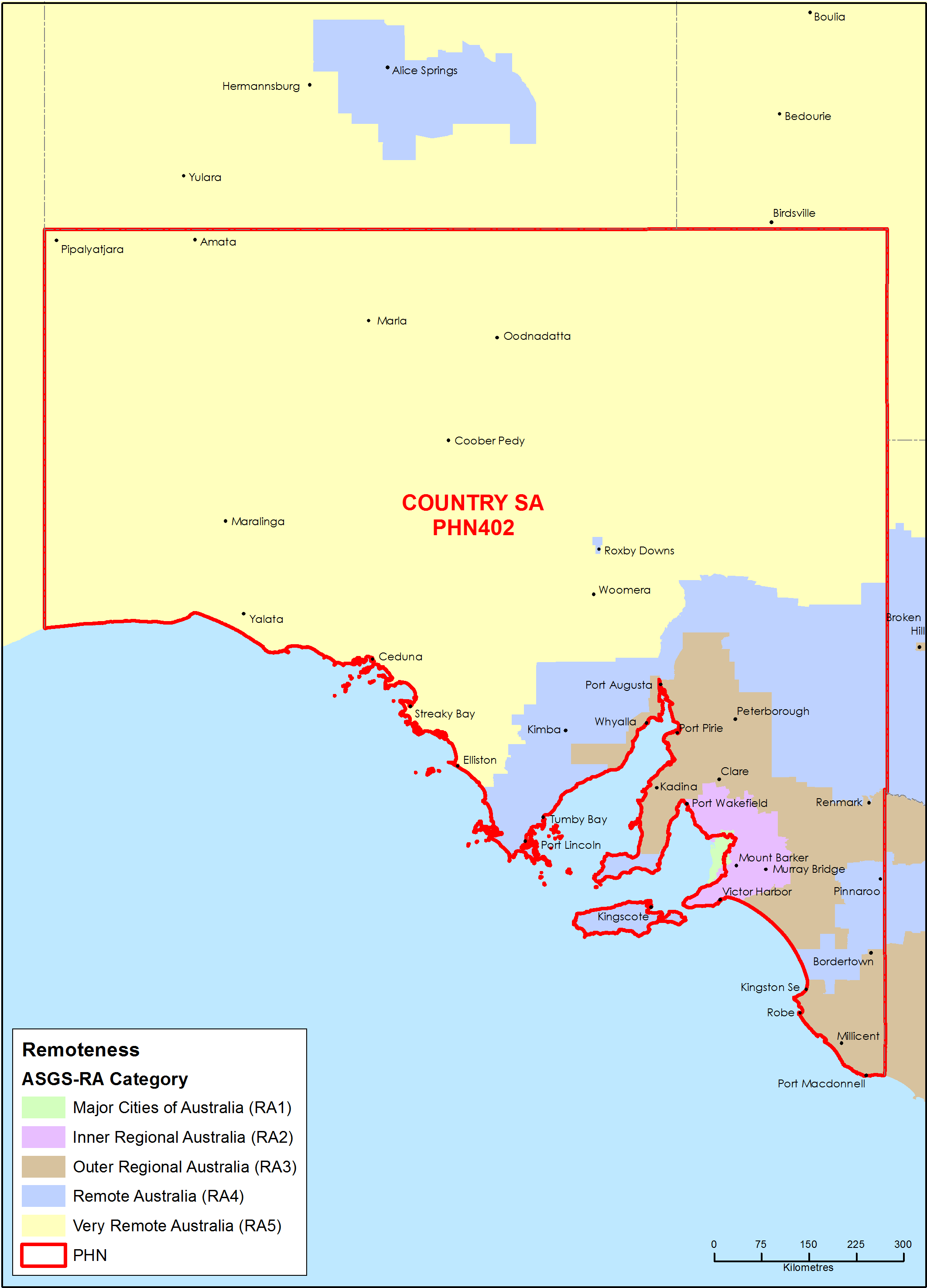
Country South Australia Primary Health Network (PHN) map – Australian Statistical Geography Standard (ASGS) remoteness area
This map shows the Australian Statistical Geography Standard remoteness area classifications within the Country South Australia Primary Health Network. -
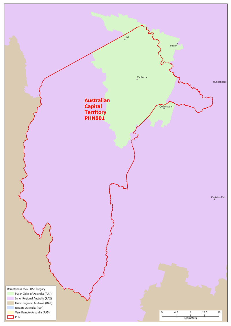
Australian Capital Territory (ACT) Primary Health Network (PHN) map – Australian Statistical Geography Standard (ASGS) remoteness area
This map shows the Australian Statistical Geography Standard remoteness area classifications within the Australian Capital Territory Primary Health Network. -
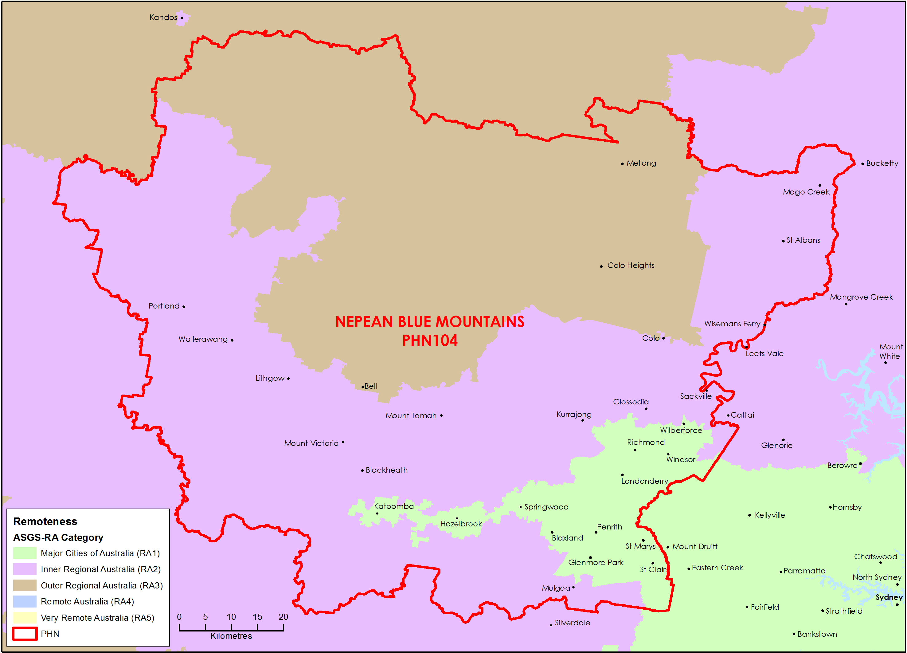
Nepean Blue Mountains (NSW) Primary Health Network (PHN) map – Australian Statistical Geography Standard (ASGS) remoteness area
This map shows the Australian Statistical Geography Standard remoteness area classifications within the Nepean Blue Mountains (NSW) Primary Health Network. -
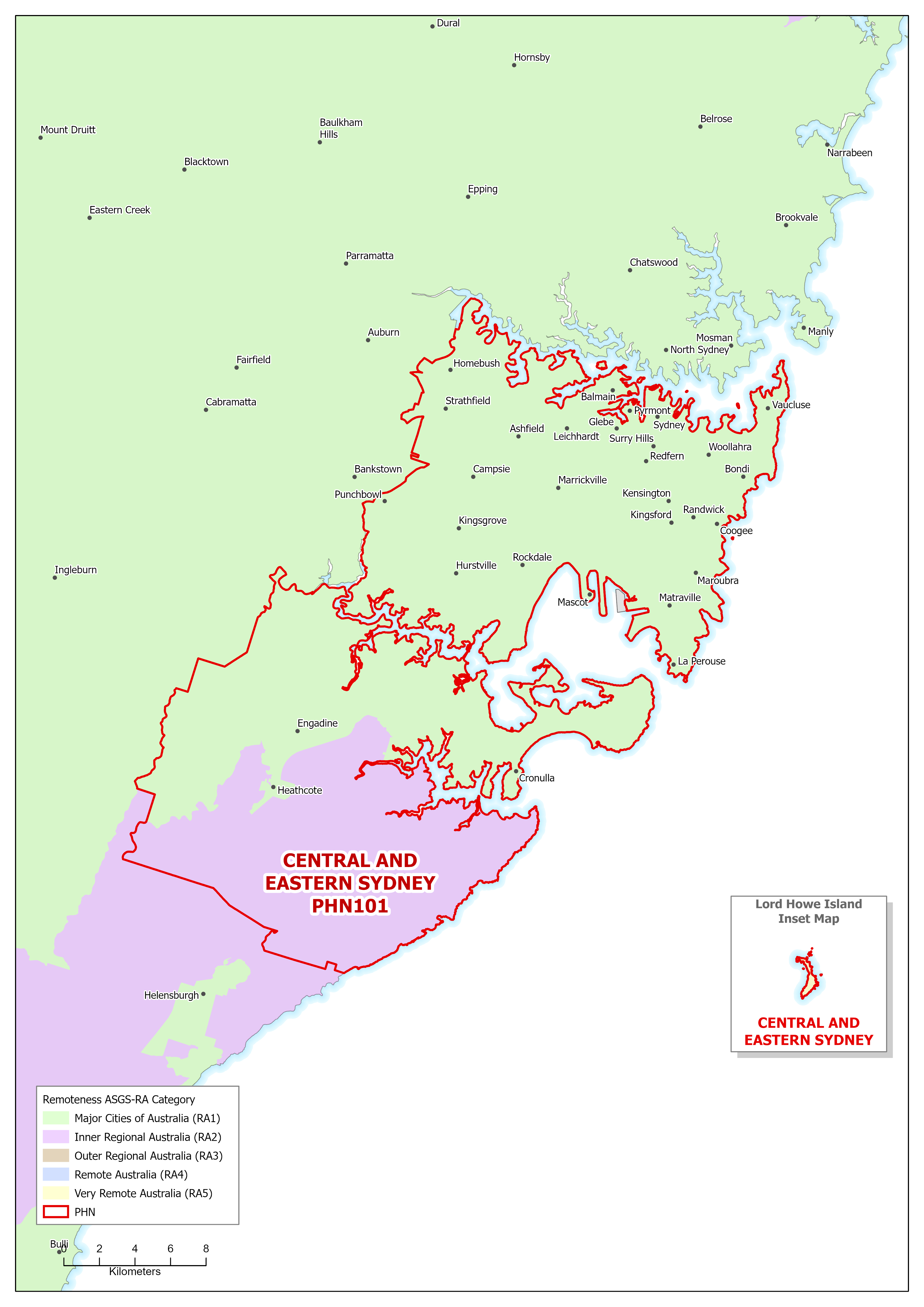
Central and Eastern Sydney (NSW) Primary Health Network (PHN) map – Australian Statistical Geography Standard (ASGS) remoteness area
This map shows the Australian Statistical Geography Standard remoteness area classifications within the Central and Eastern Sydney (NSW) Primary Health Network. -
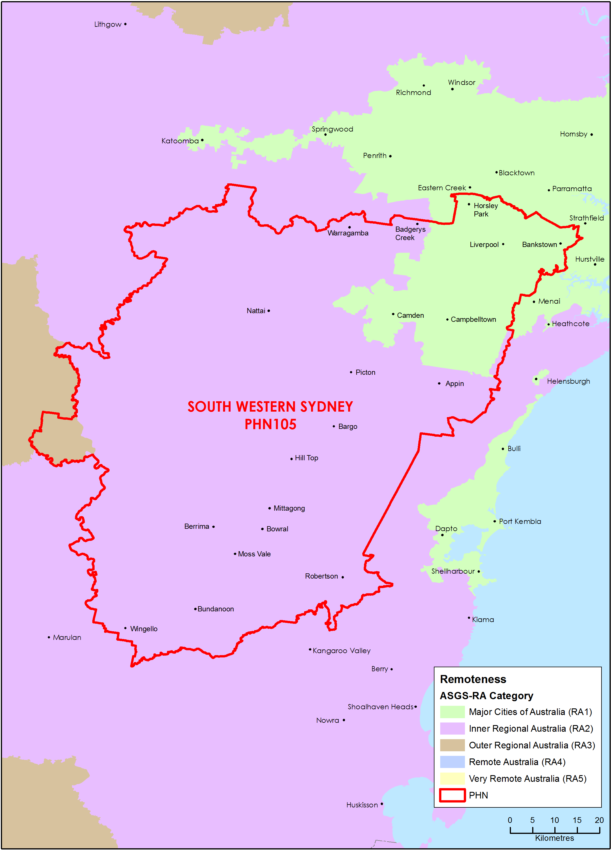
South Western Sydney (NSW) Primary Health Network (PHN) map – Australian Statistical Geography Standard (ASGS) remoteness area
This map shows the Australian Statistical Geography Standard remoteness area classifications within the South Western Sydney (NSW) Primary Health Network. -
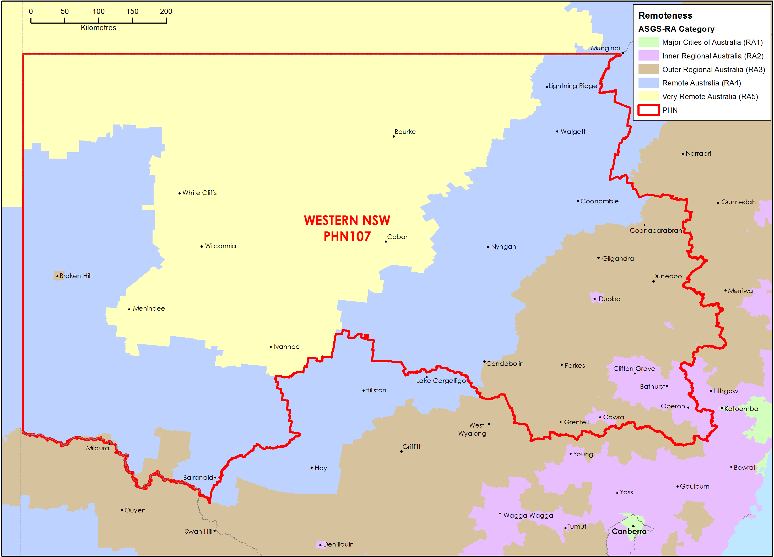
Western New South Wales Primary Health Network (PHN) map – Australian Statistical Geography Standard (ASGS) remoteness area
This map shows the Australian Statistical Geography Standard remoteness area classifications within the Western New South Wales Primary Health Network. -
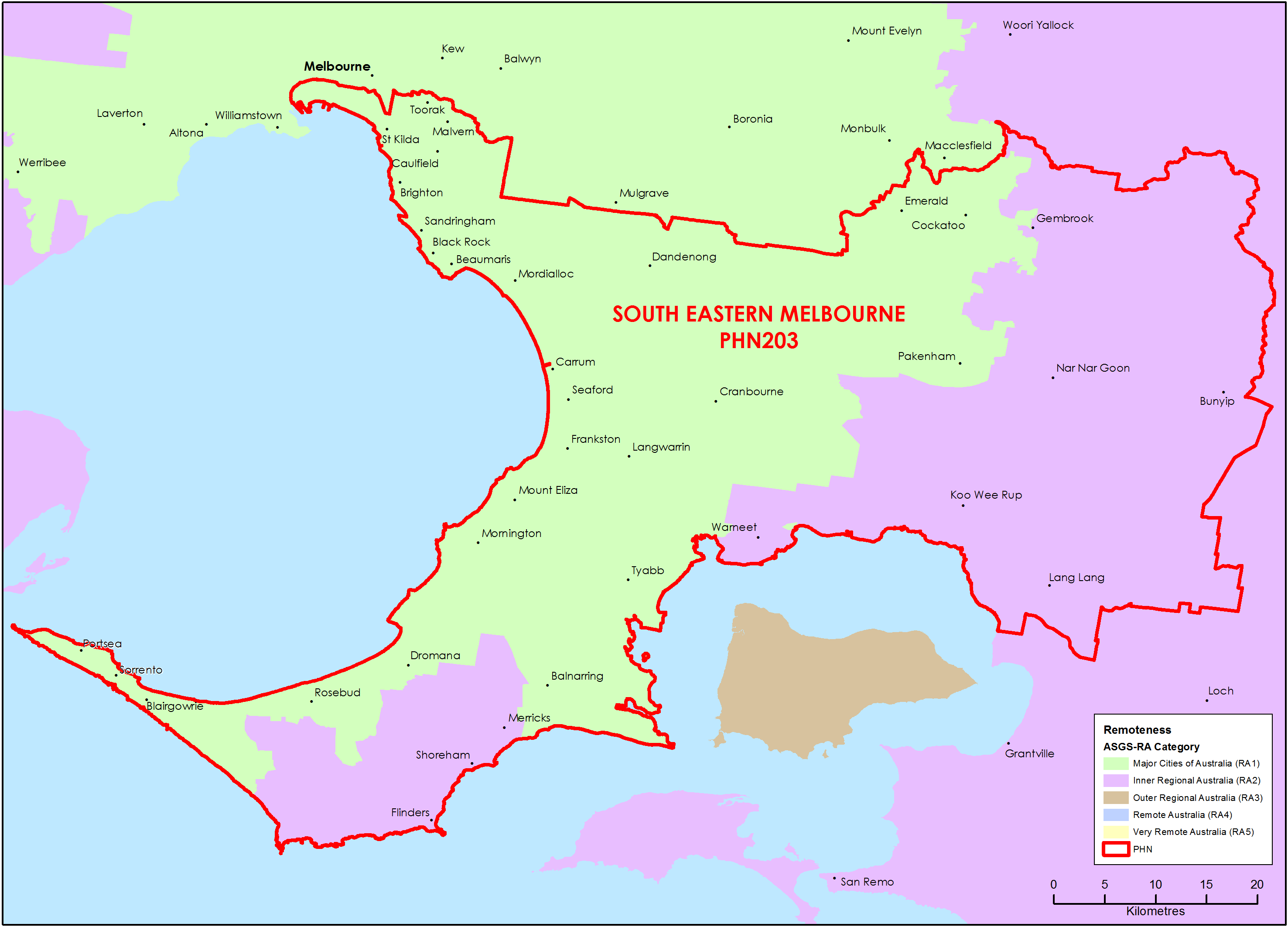
South Eastern Melbourne (Vic) Primary Health Network (PHN) map – Australian Statistical Geography Standard (ASGS) remoteness area
This map shows the Australian Statistical Geography Standard remoteness area classifications within the South Eastern Melbourne (Vic) Primary Health Network. -
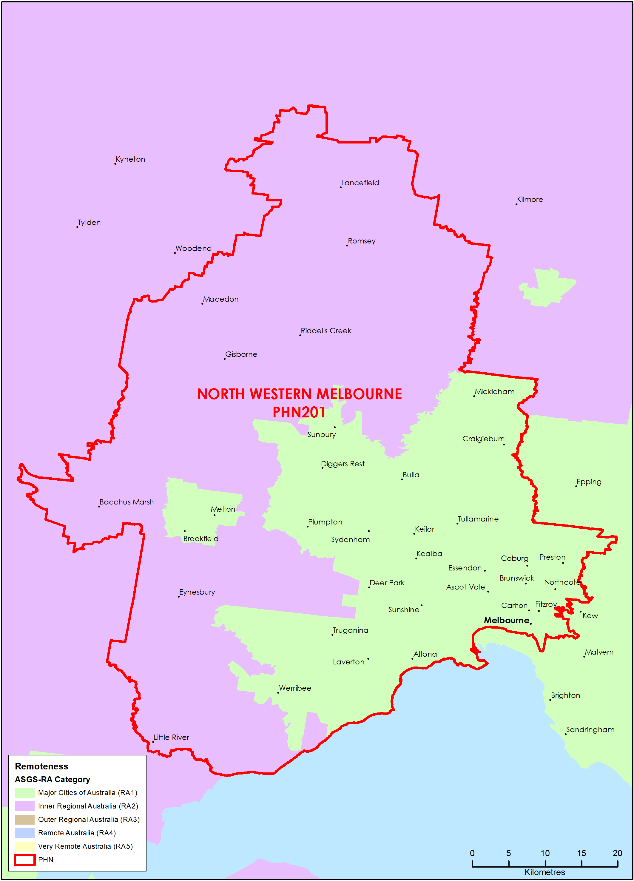
North Western Melbourne (Vic) Primary Health Network (PHN) map – Australian Statistical Geography Standard (ASGS) remoteness area
This map shows the Australian Statistical Geography Standard remoteness area classifications within the North Western Melbourne (Vic) Primary Health Network. -
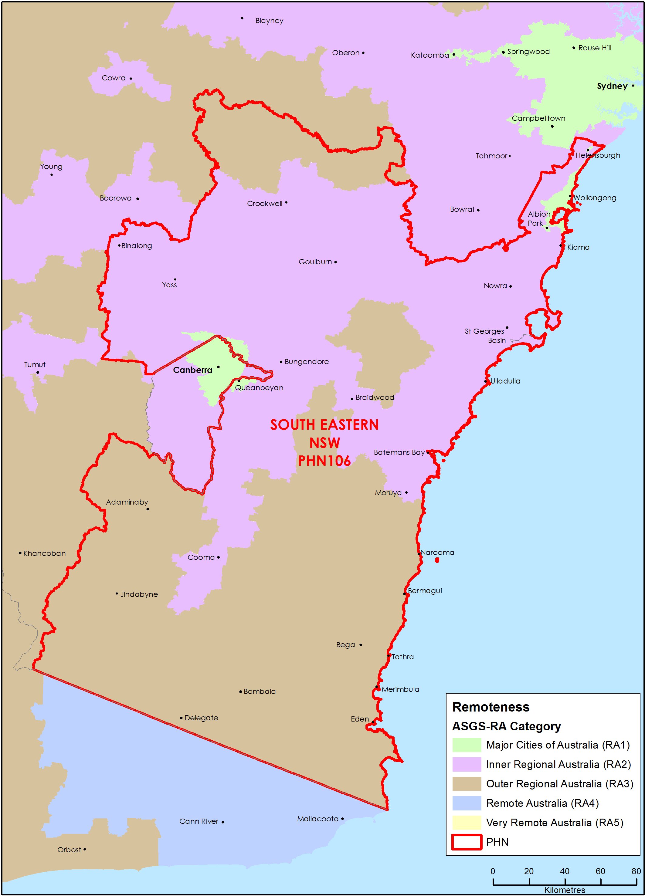
South Eastern New South Wales Primary Health Network (PHN) map – Australian Statistical Geography Standard (ASGS) remoteness area
This map shows the Australian Statistical Geography Standard remoteness area classifications within the South Eastern New South Wales Primary Health Network. -
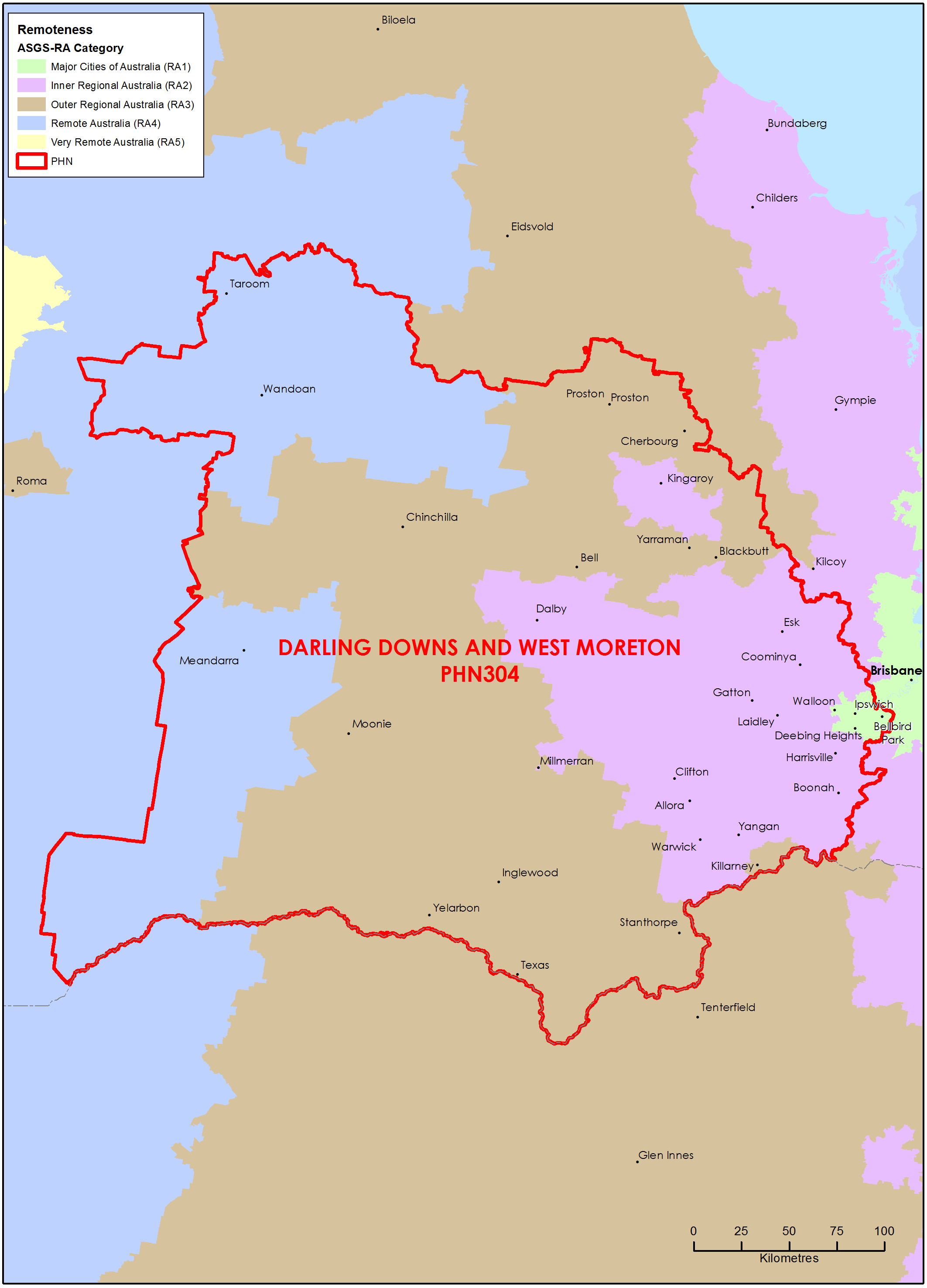
Darling Downs and West Moreton (Qld) Primary Health Network (PHN) map – Australian Statistical Geography Standard (ASGS) remoteness area
This map shows the Australian Statistical Geography Standard remoteness area classifications within the Darling Downs and West Moreton (Qld) Primary Health Network. -
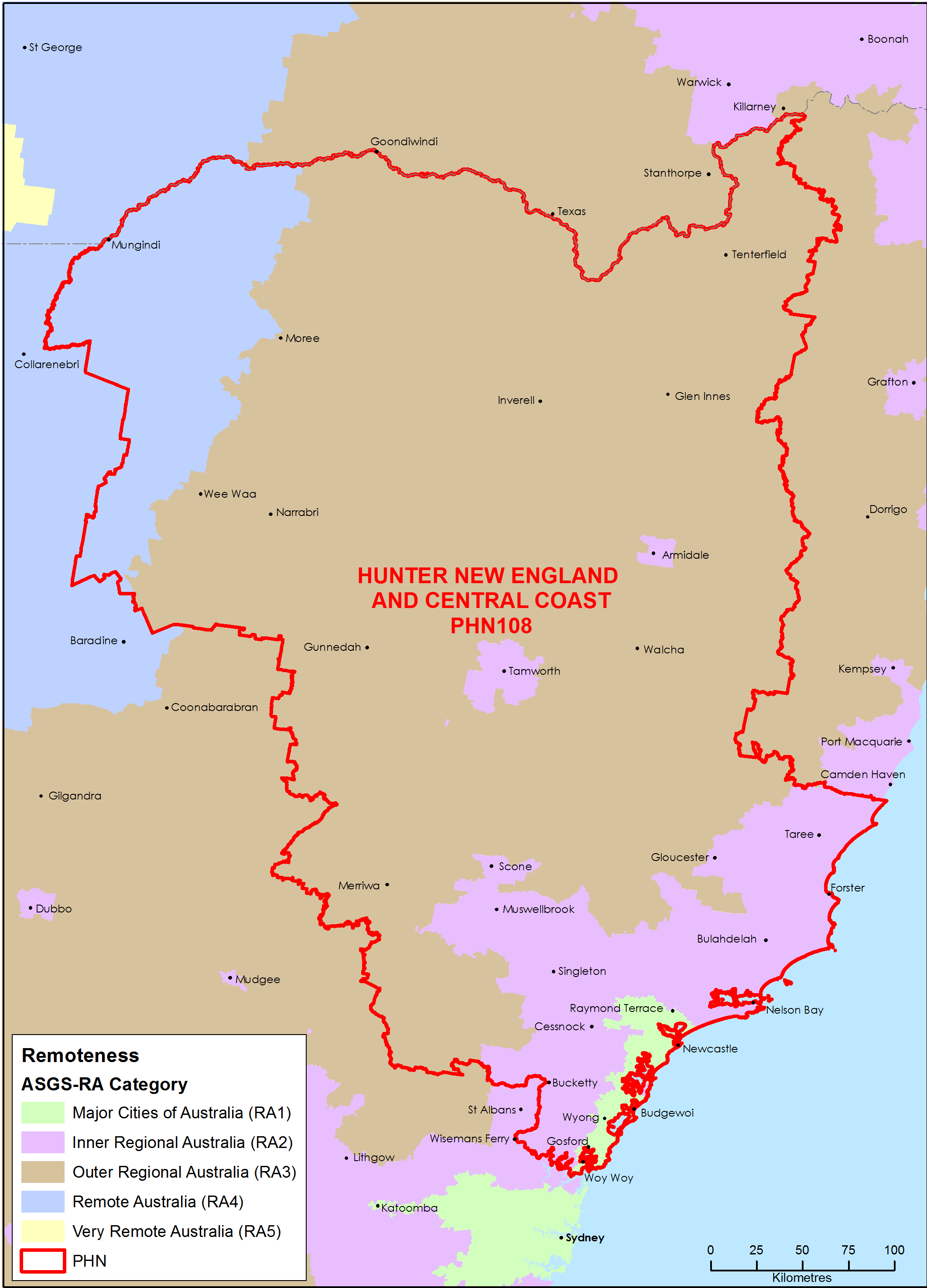
Hunter, New England and Central Coast (NSW) Primary Health Network (PHN) map – Australian Statistical Geography Standard (ASGS) remoteness area
This map shows the Australian Statistical Geography Standard remoteness area classifications within the Hunter, New England and Central Coast (NSW) Primary Health Network. -
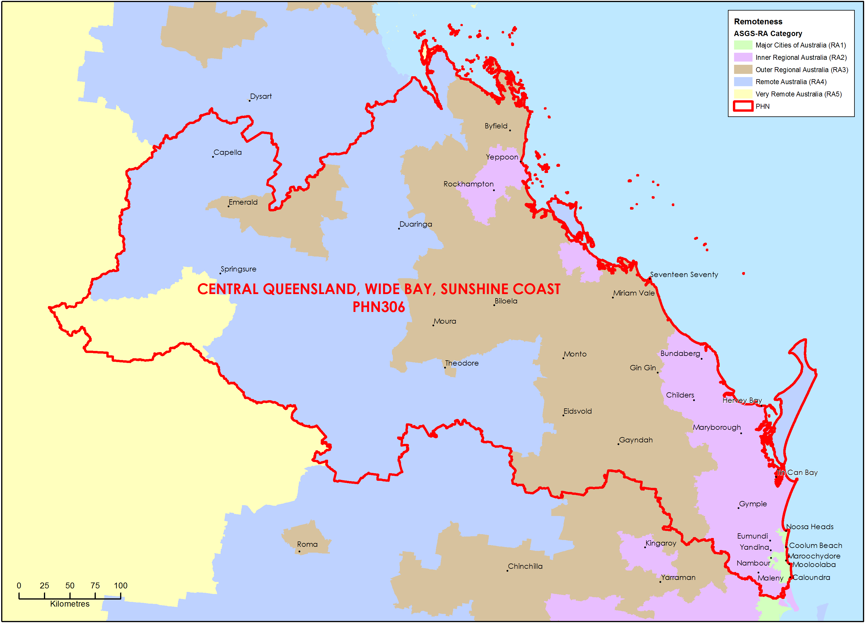
Central Queensland, Wide Bay, Sunshine Coast Primary Health Network (PHN) map – Australian Statistical Geography Standard (ASGS) remoteness area
This map shows the Australian Statistical Geography Standard remoteness area classifications within the Central Queensland, Wide Bay, Sunshine Coast Primary Health Network. -
Primary Health Networks (PHNs) collection of concordance files
Researchers undertaking geospatial and data analysis can use the concordance files in this collection based on Australian Statistical Geography Standards, Local Government Areas, Postal Areas and Commonwealth Electoral Divisions. -
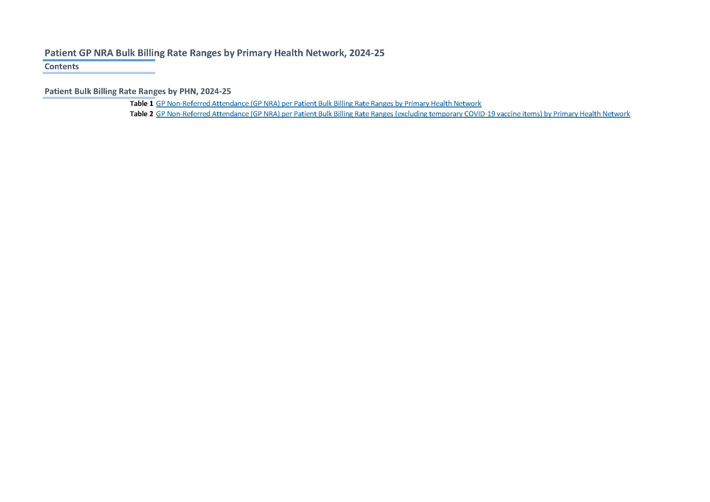
Medicare GP Non-Referred Attendances patient bulk billing ranges – Primary Health Networks (2009–10 to 2024–25)
This document contains annual statistics about the GP Non-Referred Attendances patient bulk billing ranges by Primary Health Networks, from 2009–10 to 2024–25. -

New South Wales Primary Health Networks (PHN) resource collection
This collection contains a demographics fact sheet and various maps for each Primary Health Network (PHN) in New South Wales. -
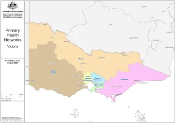
Victoria Primary Health Networks (PHN) resource collection
This collection contains a demographics fact sheet and various maps for each Primary Health Network (PHN) in Victoria. -
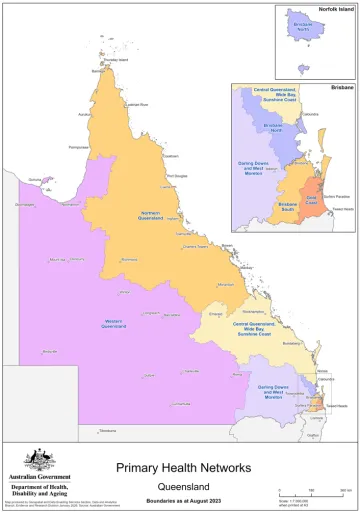
Queensland Primary Health Networks (PHN) resource collection
This collection contains a demographics fact sheet and various maps for each Primary Health Network (PHN) in Queensland. -

Health Workforce Locator
Use our workforce locator map to check the geographical classification of any location in Australia. The map can tell you if a location is classified as metropolitan, rural or remote and if it has been identified as an area of workforce shortage. -
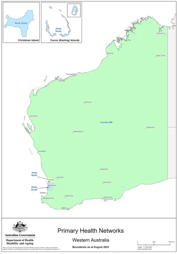
Western Australia Primary Health Networks (PHN) resource collection
This collection contains a demographics fact sheet and various maps for each Primary Health Network (PHN) in Western Australia. -
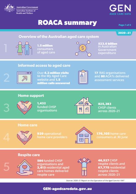
Summary of the 2020–21 Report on the Operation of the Aged Care Act 1997
This document provides key statistics from the 2020–21 report on the operation of the Aged Care Act 1997 (ROACA). It includes statistics for different types of care, the aged care workforce and quality and regulation. -
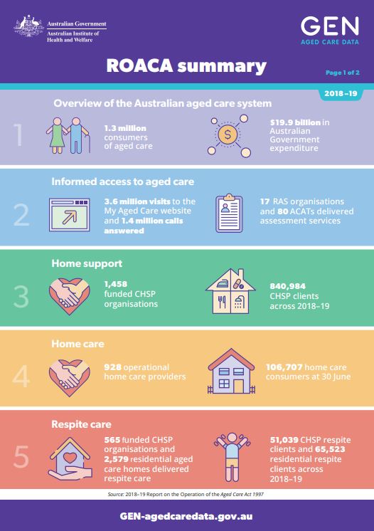
Summary of the 2018–19 Report on the Operation of the Aged Care Act 1997
This document provides key statistics from the 2018–19 report on the operation of the Aged Care Act 1997 (ROACA). It includes statistics for different types of care, the aged care workforce and quality and regulation.