Filter results
You can narrow down the results using the filters
Audience
Topics
Our work
Diseases
11744 results
-

Report card for the Implementation Plan for the National Aboriginal and Torres Strait Islander Health Plan 2013–2023
This report card outlines the progress made towards achieving the goals in the implementation plan. It shows improvements across various health and social outcomes for Aboriginal and Torres Strait Islander Peoples. -
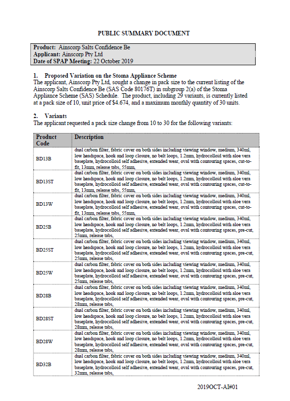
SPAP public summary documents – October 2019 – Ainscorp Confidence Be
This public summary document outlines a Stoma Product Assessment Panel (SPAP) recommendation to change pack sizes for the current listing of Ainscorp Confidence Be in subgroup 2(a) of the Stoma Appliance Scheme Schedule. -
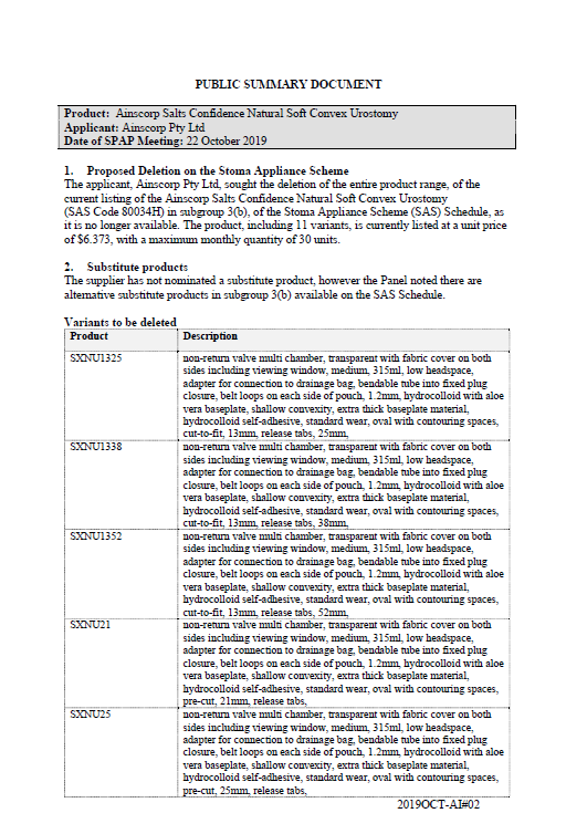
SPAP public summary documents – October 2019 – Ainscorp Confidence Natural Soft Convex Urostomy
This public summary document outlines a Stoma Product Assessment Panel (SPAP) recommendation to delete the entire range of Ainscorp Confidence Natural Soft Convex Urostomy products from subgroup 3(b) of the Stoma Appliance Scheme Schedule. -
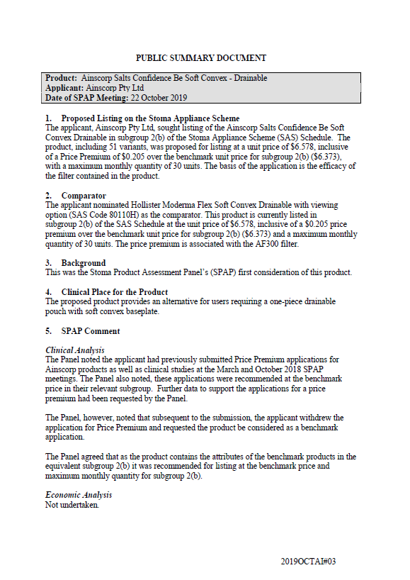
SPAP public summary documents – October 2019 – Ainscorp Confidence Be Soft Convex Drainable
This public summary document outlines a Stoma Product Assessment Panel (SPAP) recommendation to list the Ainscorp Salts Confidence Be Soft Convex Drainable in subgroup 2(b) of the Stoma Appliance Scheme Schedule. -
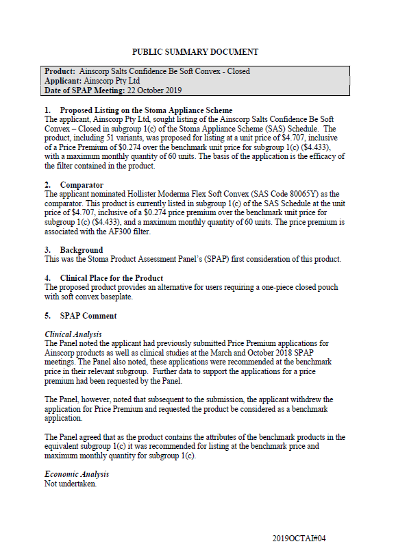
SPAP public summary documents – October 2019 – Ainscorp Confidence Be Soft Convex Closed
This public summary document outlines a Stoma Product Assessment Panel (SPAP) recommendation to list the Ainscorp Confidence Be Soft Convex Closed in subgroup 1(c) of the Stoma Appliance Scheme Schedule. -
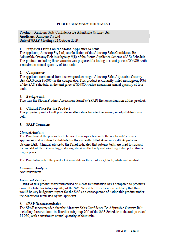
SPAP public summary documents – October 2019 – Ainscorp Confidence Be Adjustable Ostomy Belt
This public summary document outlines a Stoma Product Assessment Panel (SPAP) recommendation to list the Ainscorp Confidence Be Adjustable Ostomy Belt in subgroup 9(b) of the Stoma Appliance Scheme Schedule. -
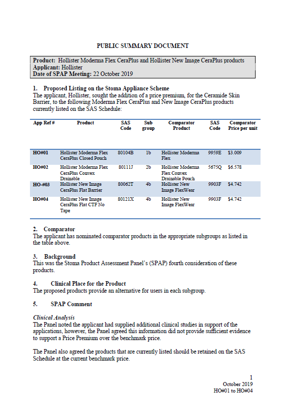
SPAP public summary documents – October 2019 – Hollister Moderma Flex CeraPlus and Hollister New Image CeraPlus products
This public summary document outlines a Stoma Product Assessment Panel (SPAP) recommendation to reject the application to add a price premium to Hollister Moderma Flex CeraPlus and Hollister New Image CeraPlus products listed on the Stoma Appliance Scheme Schedule. -
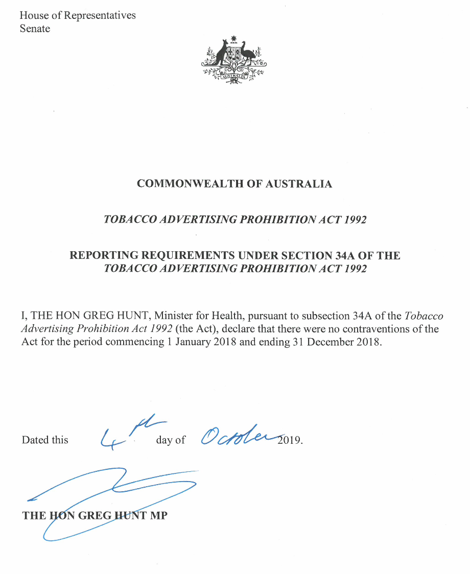
Reporting Requirements under Section 34A of the Tobacco Advertising Prohibition Act 1992 (1 January–31 December 2018)
This declaration from the Minister for Health is a reporting requirement under Section 34A of the Tobacco Advertising Prohibition Act 1992. -
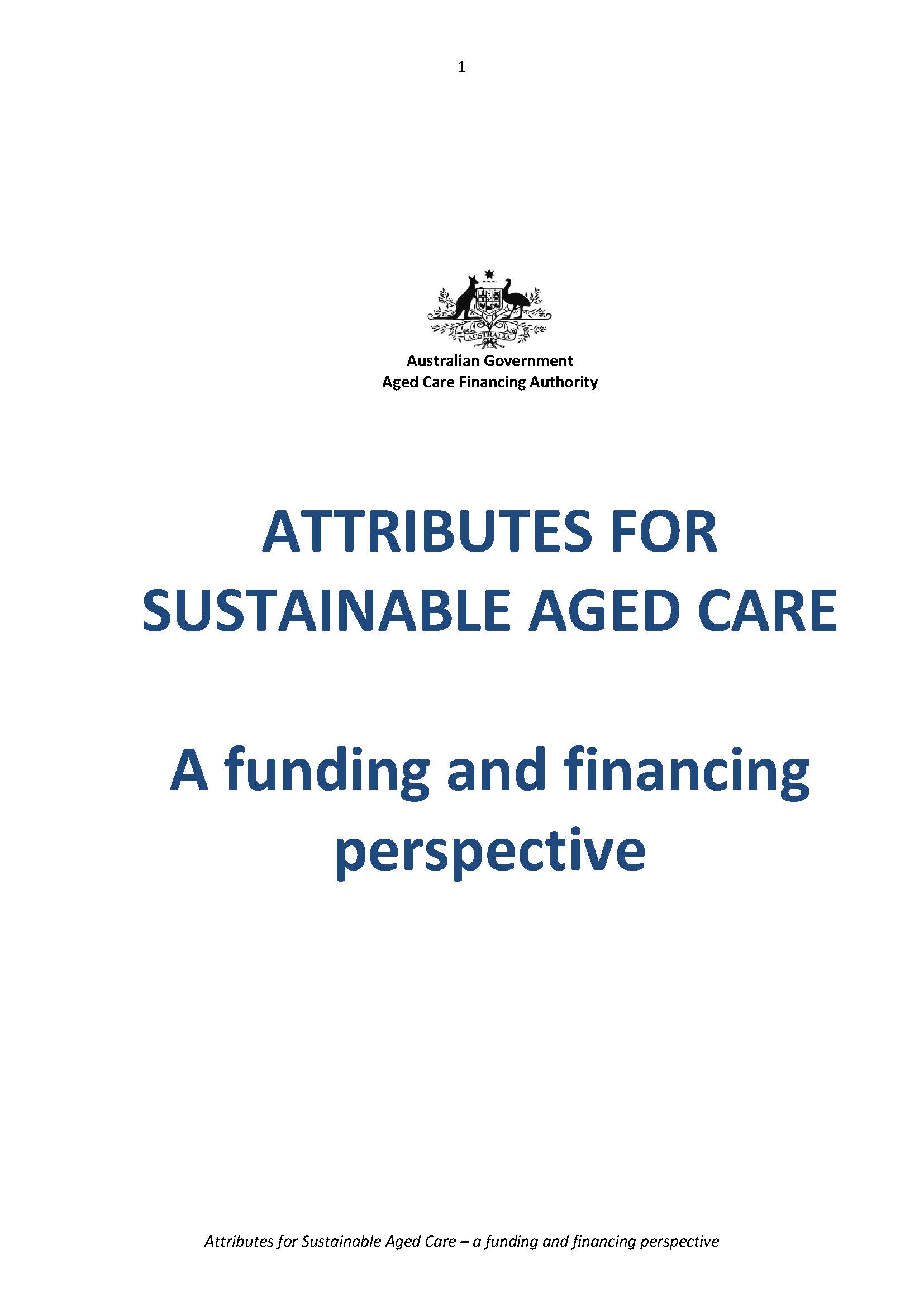
ACFA Report on Attributes for Sustainable Aged Care
This report is by the Aged Care Financing Authority (ACFA). It outlines the 11 attributes for sustainable aged care from a funding and financing viewpoint. -
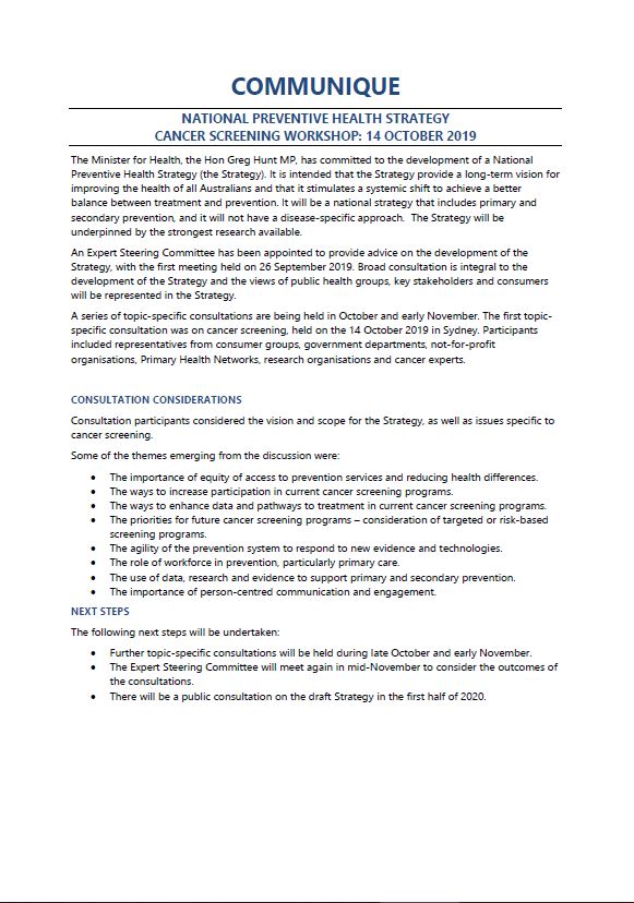
National Preventive Health Strategy consultation communique – Cancer screening workshop, October 2019
This document provides a summary of the consultation held about cancer screening to support the development of the National Preventive Health Strategy. -
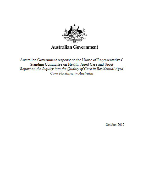
Quality of Care in Residential Aged Care Facilities
Australian Government response to the House of Representatives’ Standing Committee on Health, Aged Care and Sport's Inquiry into the Quality of Care in Residential Aged Care Facilities in Australia. -
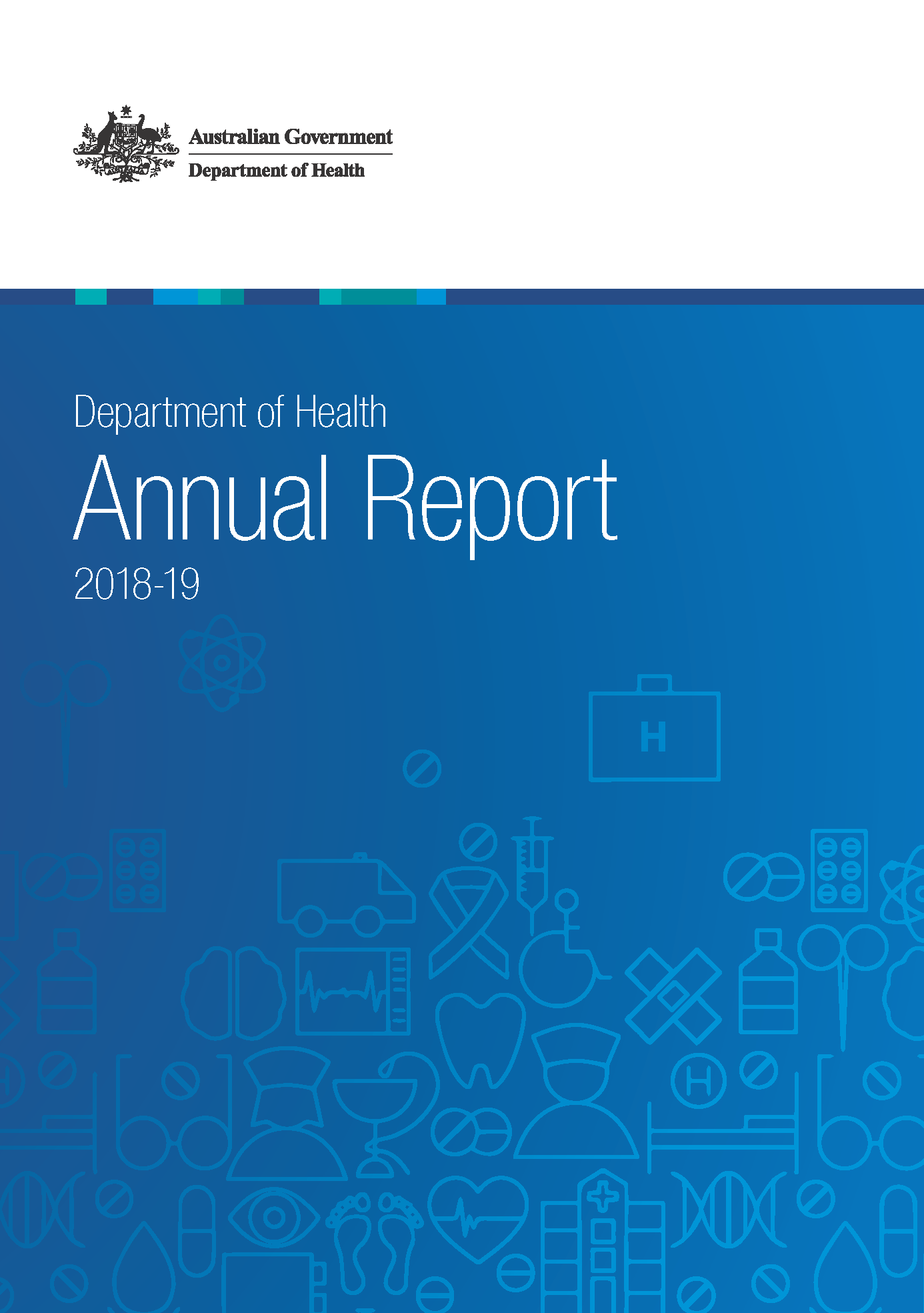
Department of Health Annual Report 2018–19
This report describes our work to deliver the Government's long term national health plan in the financial year ending 30 June 2019. It includes information about our reforms, operations, budget, governance and performance. -
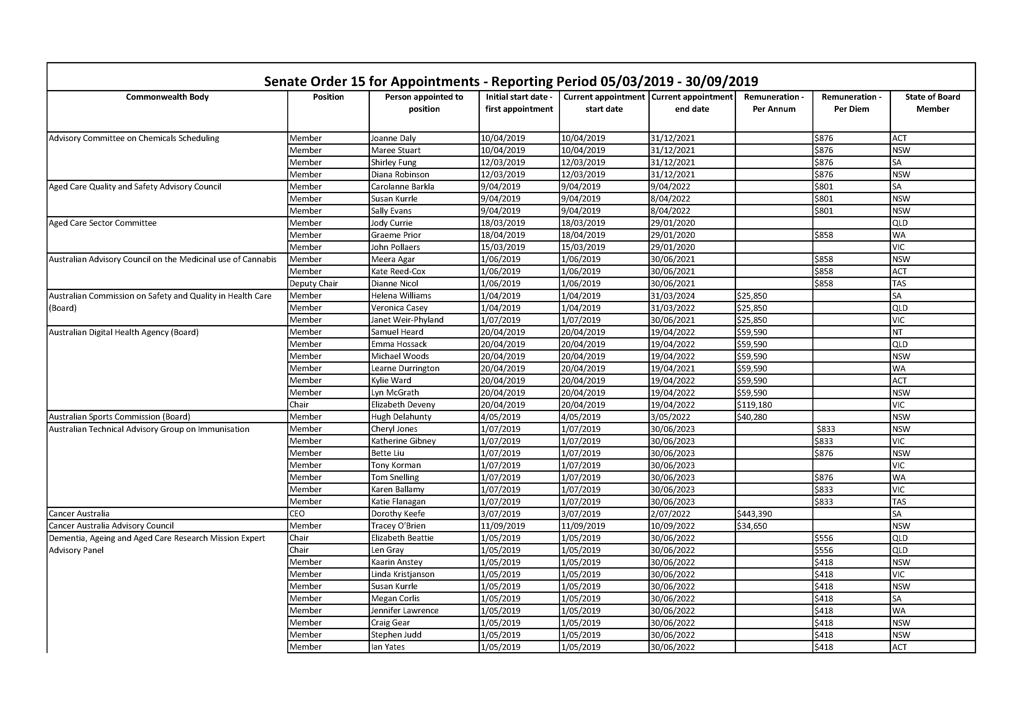
Departmental and agency appointments and vacancies (Senate Order 15 Listing)
Our appointments and vacancies listings as required by Senate Order 15 – Departmental and agency appointments and vacancies. -
Aged care in MPS: Response to the Australian Government Terms of Reference
This review examines whether delivering aged care services in regional and remote areas through Multi-Purpose Services (MPS) is an effective model. It contains a number of recommendations for the program. -
National Strategic Action Plan for Osteoporosis 2019
The National Strategic Action Plan for Osteoporosis 2019 aims to reduce the impact of this condition in Australia. It outlines priority areas and actions to improve the quality of life of Australians living with osteoporosis. -
Midwives – Australia’s Future Health Workforce report
This report presents long-term, national workforce projections for midwives to 2030. It is part of our series on Australia’s Future Health Workforce. -
National Bowel Cancer Screening Program – GP assessment form
General practitioners (GPs) use this form to provide information about your patient who has received a positive iFOBT test result with the program, their symptoms, and whether they have been referred for colonoscopy or other examination. -
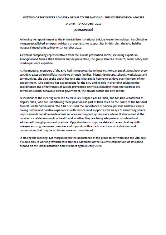
Communique from the expert advisory group to the National Suicide Prevention Adviser
This communique outlines what the National Suicide Prevention Adviser's expert advisory group discussed at its first meeting. -
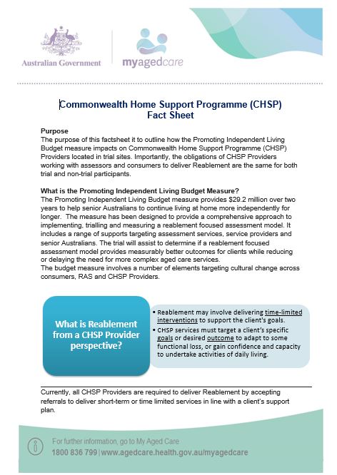
Reablement Commonwealth Home Support Programme (CHSP) fact sheet
This fact sheet shows how the Promoting Independent Living Budget measure affects Commonwealth Home Support Programme (CHSP) providers in trial sites. -
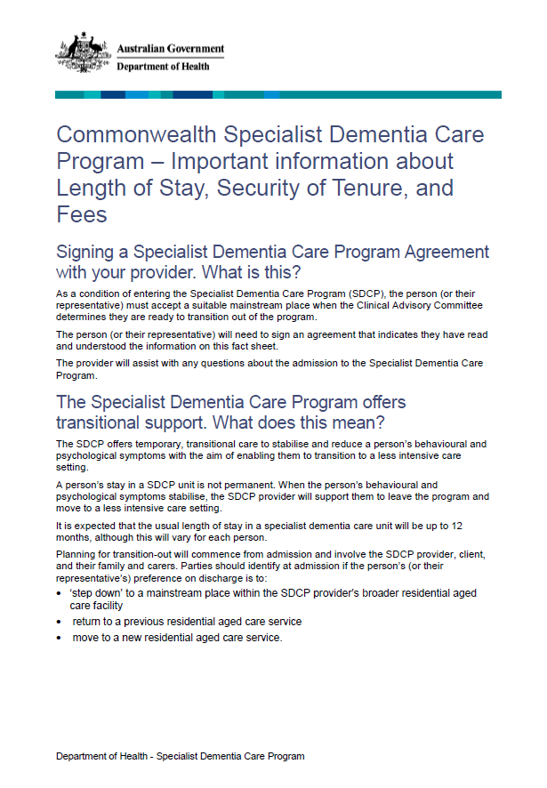
Specialist Dementia Care Program – Length of Stay, Fees and Security of Tenure
This fact sheet sets out what must happen when a person enters a Specialist Dementia Care Program unit. It includes how long a stay can be and the fees and charges that apply. It also outlines what happens when they are ready to leave the unit. -
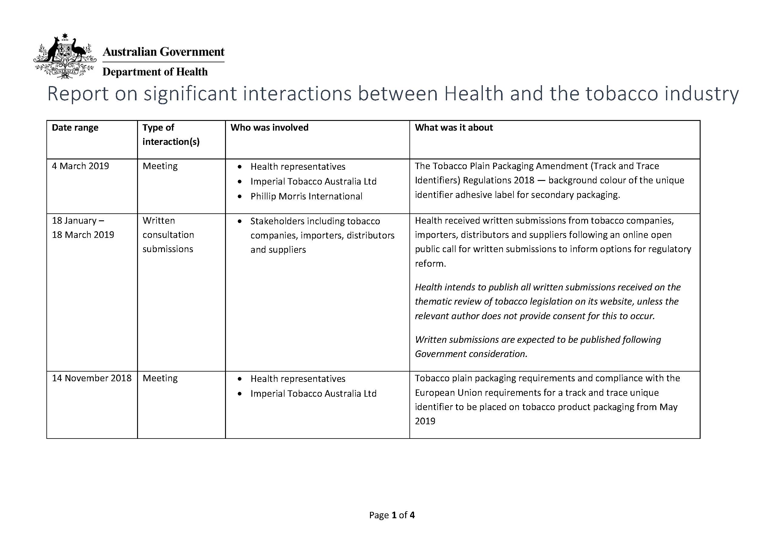
Report on interactions between Health and the tobacco industry
We have obligations under the World Health Organization Framework Convention on Tobacco Control. Part of these is to report on our interactions with the tobacco industry. -
Supporting new clients and Commonwealth community mental health clients to access psychosocial support – NDIS, CoS and NPS
This fact sheet outlines what Australian Government-funded psychosocial supports are available from 1 July 2019. -
National Preventive Health Strategy Expert Steering Committee communique – September 2019
This document summarises what the National Preventive Health Strategy Expert Steering Committee discussed at its September 2019 roundtable. -
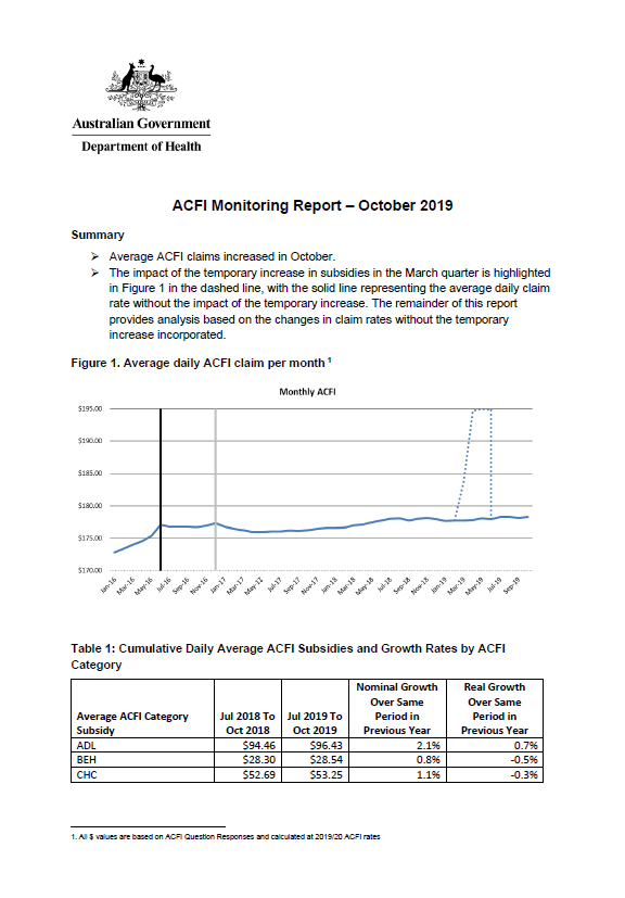
Aged care funding instrument (ACFI) monitoring report – October 2019
This report shows the monthly growth in ACFI subsidies compared to estimates for October 2019. -
Carer Gateway service areas
A key element in implementing the new Integrated Carer Support Service (ICSS) is defining the service areas that the new Carer Gateway service providers will operate in from April 2020.