Filter results
You can narrow down the results using the filters
Audience
Topics
Our work
Diseases
11516 results
-
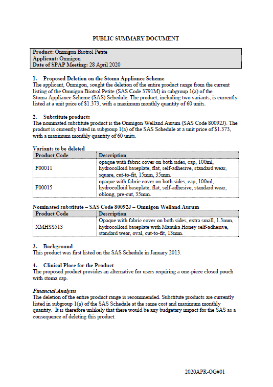
SPAP public summary documents – April 2020 – Omnigon Biotrol Petite
This public summary document outlines a Stoma Product Assessment Panel (SPAP) recommendation to delete the entire Omnigon Biotrol Petite product range from subgroup 1(a) of the Stoma Appliance Scheme Schedule. -
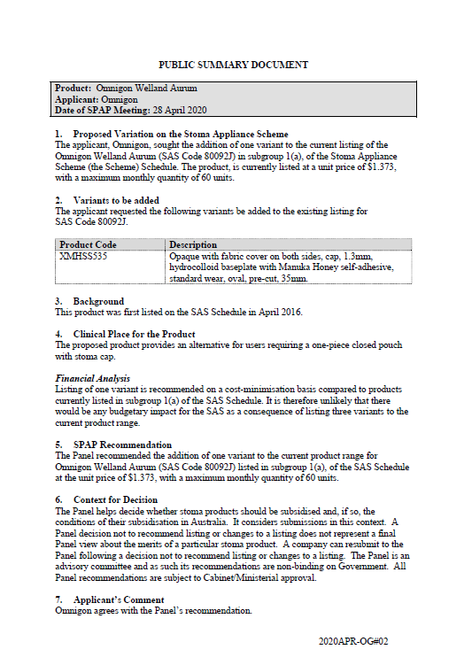
SPAP public summary documents – April 2020 – Omnigon Welland Aurum
This public summary document outlines a Stoma Product Assessment Panel (SPAP) recommendation to add one variant of the Omnigon Welland Aurum in subgroup 1(a) of the Stoma Appliance Scheme Schedule. -

Advisory Committee for the COVID-19 Response for People with Disability – Meeting key outcomes 2 June 2020
This communique is for the meetings of the Advisory Committee on Health Emergency Response to Coronavirus (COVID-19) for People with Disability on 2 June 2020. -

Coronavirus (COVID-19) at a glance – 1 June 2020
This infographic provides a quick view of the coronavirus (COVID-19) situation in Australia on 1 June 2020. -
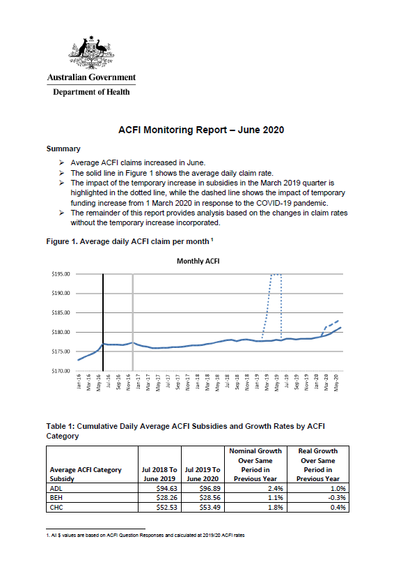
Aged care funding instrument (ACFI) monitoring report – June 2020
This report shows the monthly growth in ACFI subsidies compared to estimates for June 2020. -
Final report from the Telehealth Working Group
This report contains the recommendations the Telehealth Working Group made to the MBS Review Taskforce, after public consultation. -

Coronavirus (COVID-19) at a glance – 31 May 2020
This infographic provides a quick view of the coronavirus (COVID-19) situation in Australia on 31 May 2020. -
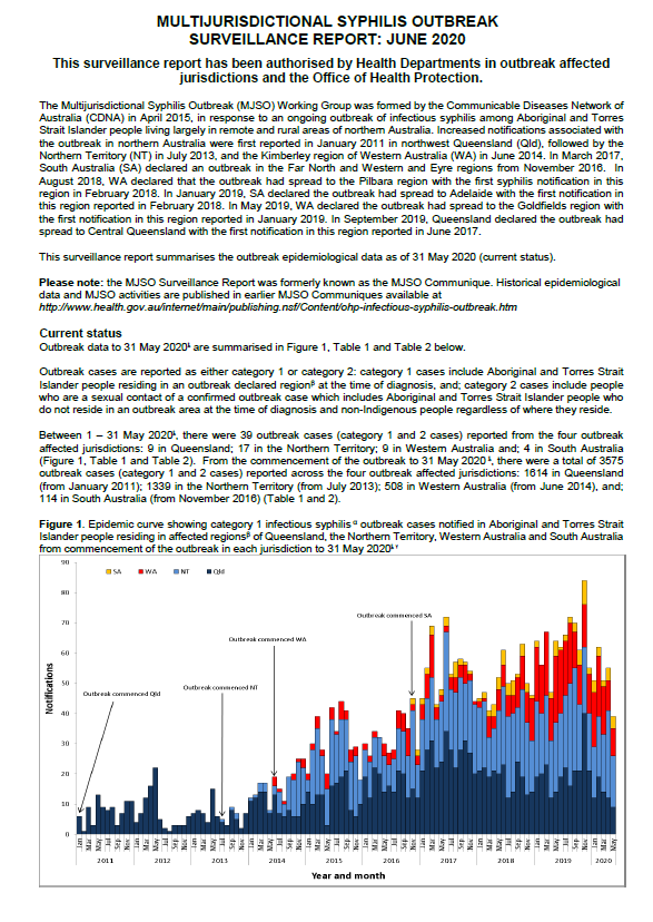
Multijurisdictional Syphilis Outbreak (MJSO) Surveillance Report – June 2020
This report summarises the status of an ongoing outbreak of infectious syphilis among Aboriginal and Torres Strait Islander people in remote and rural areas of northern Australia, as of 31 May 2020. -

Coronavirus (COVID-19) at a glance – 30 May 2020
This infographic provides a quick view of the coronavirus (COVID-19) situation in Australia on 30 May 2020. -
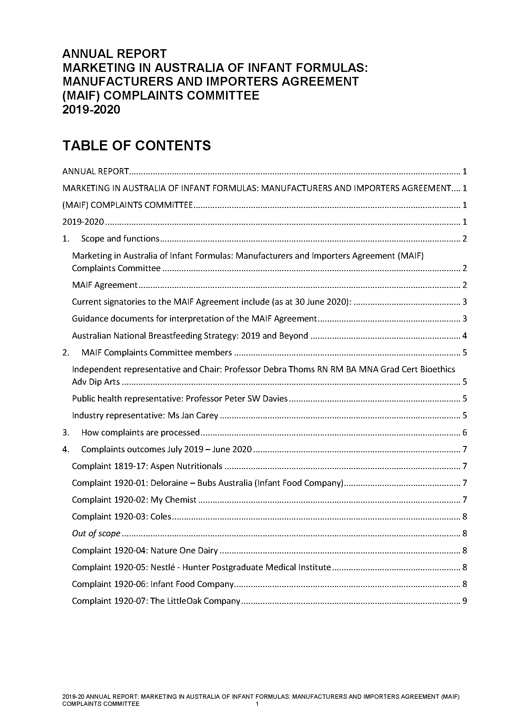
Annual report of the MAIF Agreement Complaints Committee 2019–20
This 2019–20 annual report of the Marketing in Australia of Infant Formulas (MAIF) Agreement Complaints Committee contains information about complaints the committee received in relation to the MAIF Agreement. -
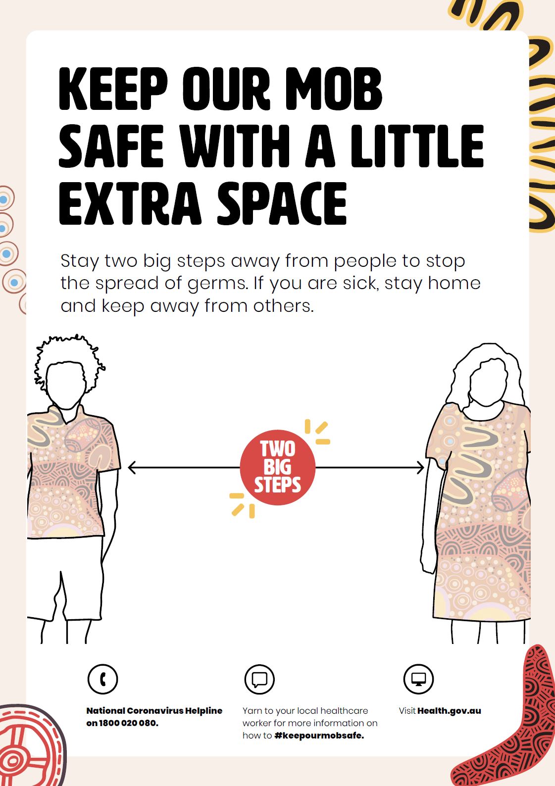
Coronavirus (COVID-19) – Keep our mob safe with extra space (Aboriginal and Torres Strait Islander people)
To keep our communities safe from COVID-19, it's important to keep a safe space away from other people. -
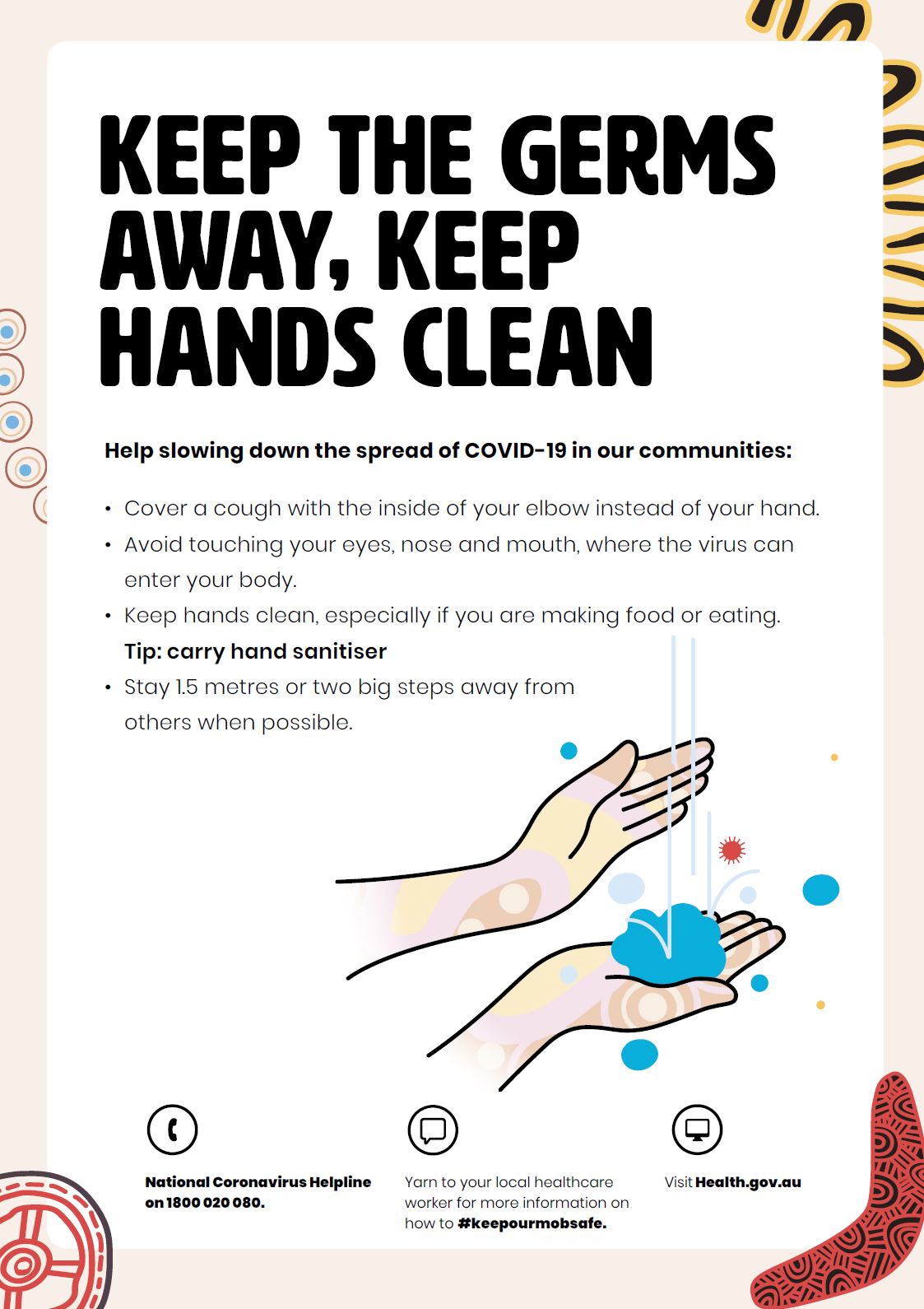
Coronavirus (COVID-19) – Keep hands clean (Aboriginal and Torres Strait Islander people)
It's important to help stop the spread of COVID-19 in our communities by keeping our hands clean. -
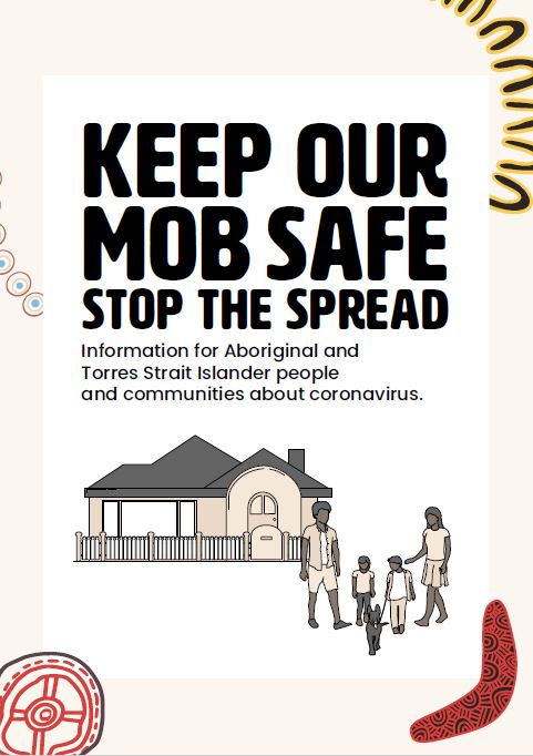
Coronavirus (COVID-19) – Booklet – Keep our mob safe (Aboriginal and Torres Strait Islander people)
This booklet offers some tips for Aboriginal and Torres Strait Islander people and communities about coronavirus. -
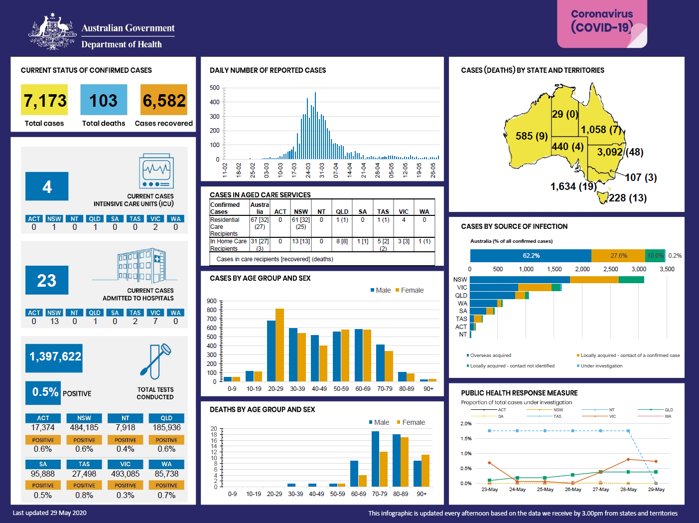
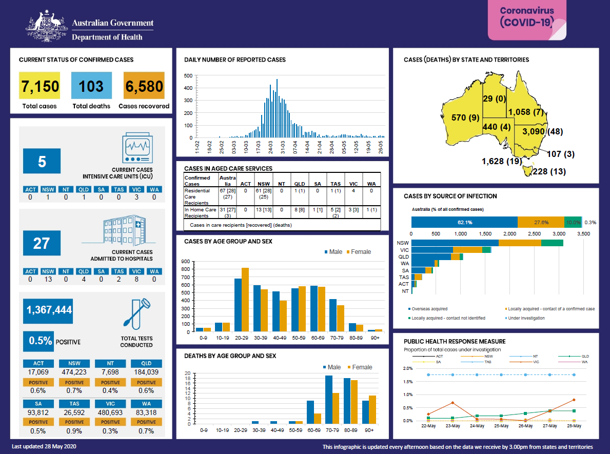
Coronavirus (COVID-19) at a glance – 29 May 2020
This infographic provides a quick view of the coronavirus (COVID-19) situation in Australia on 29 May 2020. -
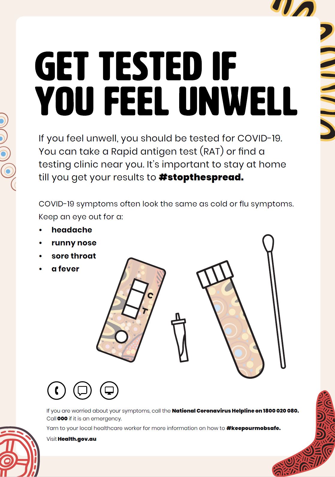
Coronavirus (COVID-19) – Get tested if you're unwell (Aboriginal and Torres Strait Islander people)
This poster explains that you need to get tested if you are unwell and symptoms to look for. -
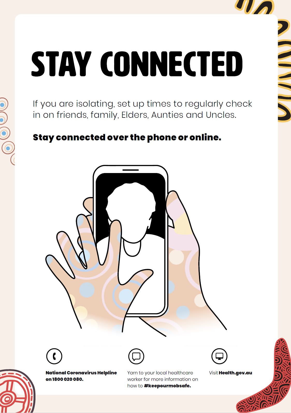
Coronavirus (COVID-19) – Stay connected (Aboriginal and Torres Strait Islander people)
During this time, it's important to stay connected. This poster offers some tips to help do this. -
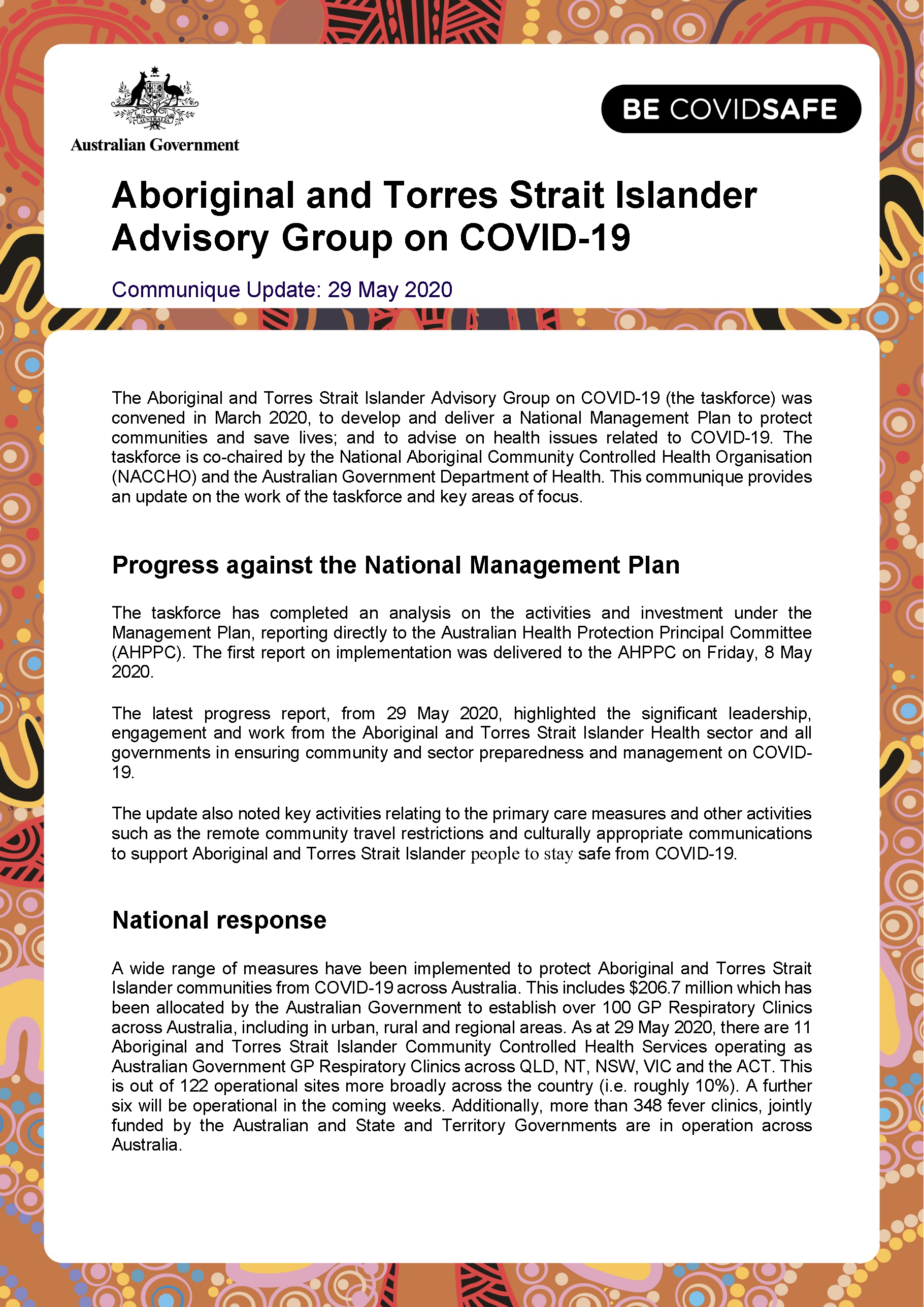
Aboriginal and Torres Strait Islander Advisory Group on COVID-19 communique – 29 May 2020
This communique summarises the meeting of the Aboriginal and Torres Strait Islander Advisory Group on COVID-19 held on 29 May 2020. -
Coronavirus (COVID-19) at a glance – 28 May 2020
This infographic provides a quick view of the coronavirus (COVID-19) situation in Australia on 28 May 2020. -
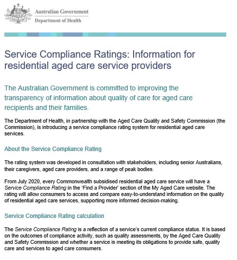
Service Compliance Ratings: Information for residential aged care service providers
This fact sheet has information for residential aged care service providers about the service compliance rating. -

Coronavirus (COVID-19) at a glance – 27 May 2020
This infographic provides a quick view of the coronavirus (COVID-19) situation in Australia on 27 May 2020. -
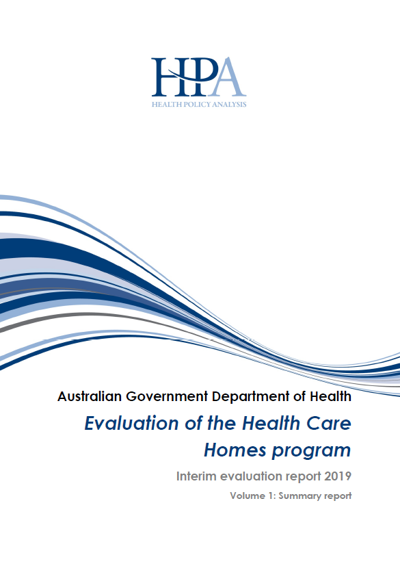
Evaluation of the Health Care Homes program – Interim evaluation report 2019
This report provides the first interim results of an evaluation of the Health Care Homes trial, which ran between 2017 and 2021. -

Coronavirus (COVID-19) at a glance – 26 May 2020
This infographic provides a quick view of the coronavirus (COVID-19) situation in Australia on 26 May 2020. -
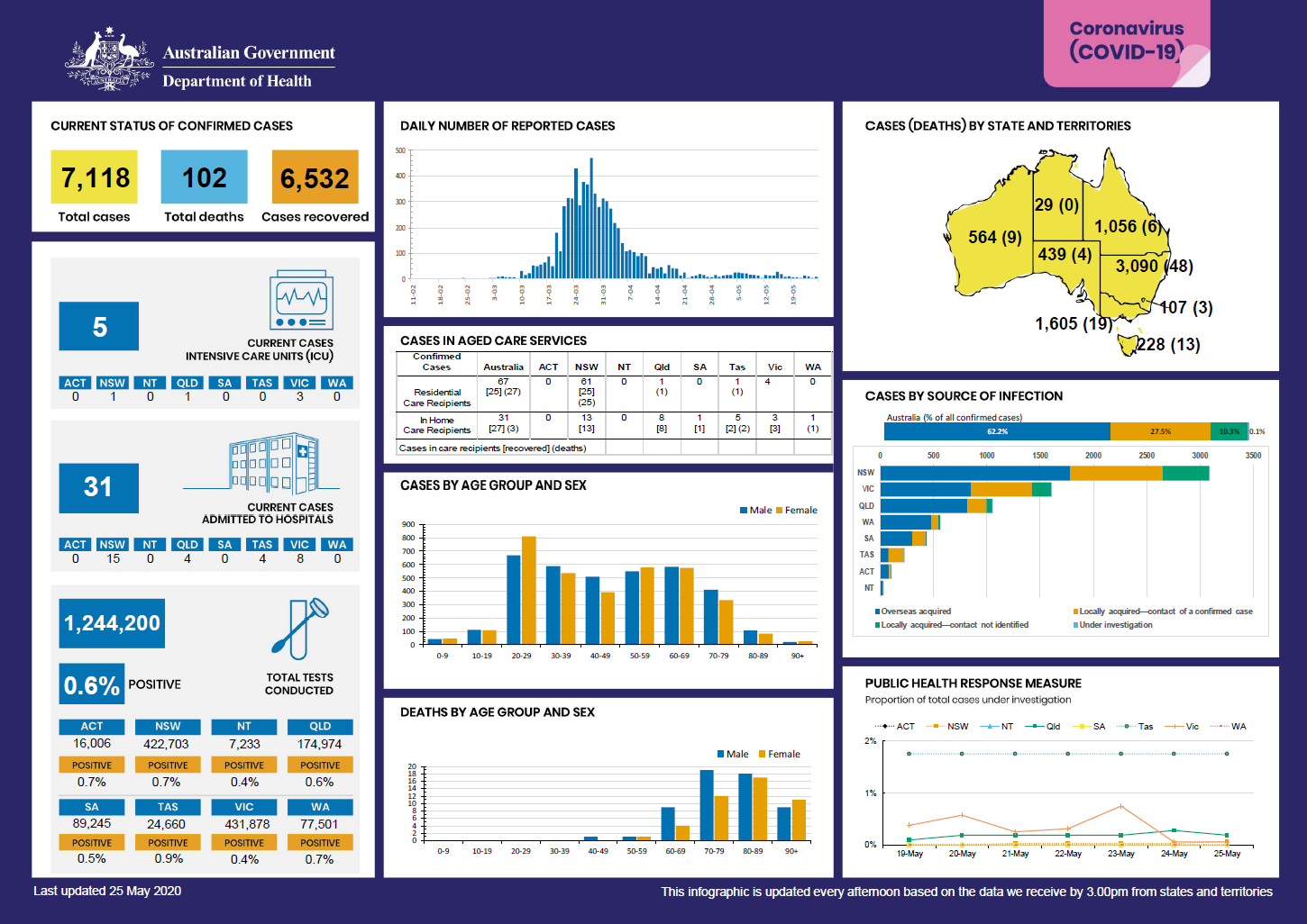
Coronavirus (COVID-19) at a glance – 25 May 2020
This infographic provides a quick view of the coronavirus (COVID-19) situation in Australia on 25 May 2020. -
Clinical and Technical Working Group for the Aboriginal and Torres Strait Islander Health Services Data Advisory Group – Terms of Reference
This document defines the purpose and structure of the Clinical and Technical Working Group for the Aboriginal and Torres Strait Islander Health Services Data Advisory Group. -
Health Services Data Advisory Group submission template
This document provides guidance and a template for making a submission to the Aboriginal and Torres Strait Islander Health Services Data Advisory Group (HS DAG).