Filter results
You can narrow down the results using the filters
Audience
Topics
Our work
Diseases
11423 results
-
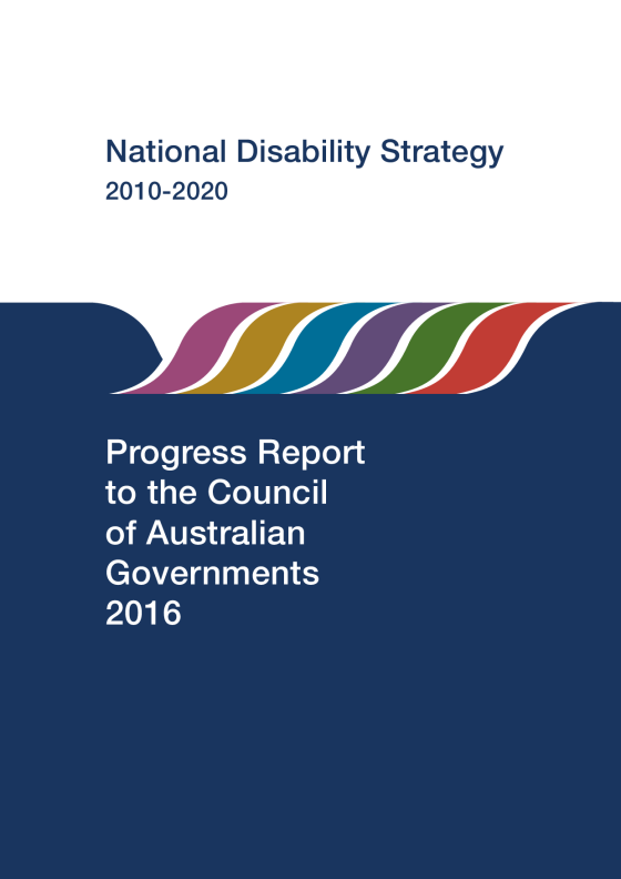
NDS 2010–2020 Second Progress Report to the Council of Australian Governments 2016
The 2016 Progress Report was the second progress report under the National Disability Strategy 2010–2020. -
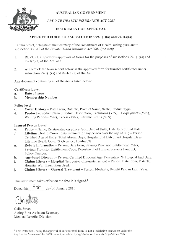
PHI 03/19 attachment – Instrument of approval for the new approved form for transfer certificate
This attachment to PHI circular 03/19 is the signed instrument of approval for the new approved form for transfer certificate. -
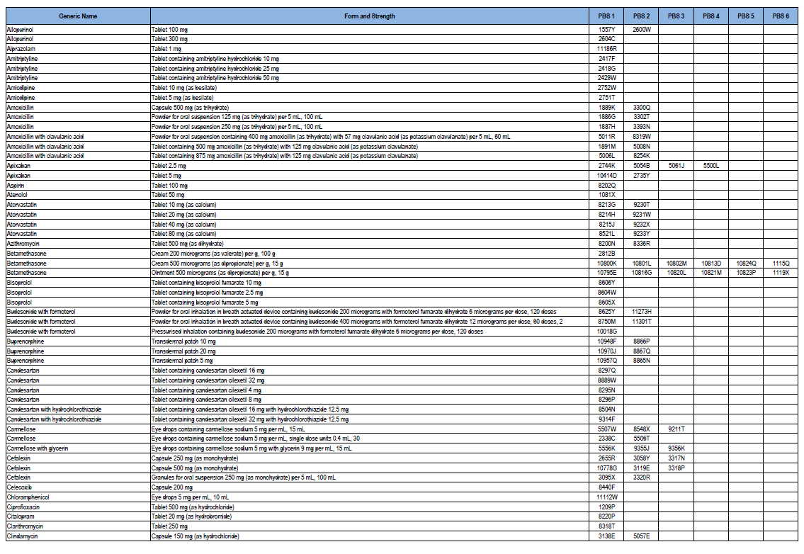
High-volume Pharmaceutical Benefits Scheme (PBS) medicine list 2018–19
This document provides a list of PBS medicines often prescribed, including form and strength, as well as PBS codes, for Community Service Obligation (CSO) for Pharmaceutical Wholesalers funding pool stakeholders for 2018–19. -
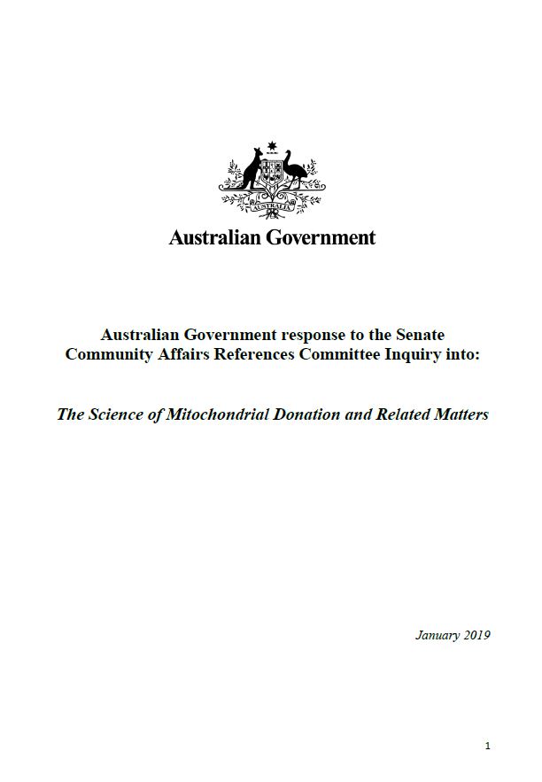
The science of mitochondrial donation and related matters
Australian Government response to the Senate Community Affairs References Committee Inquiry into the science of mitochondrial donation and related matters -
Final clinical committee report for Colorectal Surgery
This report contains the recommendations the Colorectal Surgery Clinical Committee made to the MBS Review Taskforce, after public consultation. -
Final clinical committee report for Pain Management
This report contains the recommendations the Pain Management Clinical Committee made to the MBS Review Taskforce, after public consultation. -
Final report from the Aboriginal and Torres Strait Islander Health Reference Group
This report contains the recommendations the Aboriginal and Torres Strait Islander Health Reference Group made to the MBS Review Taskforce, after public consultation. -
Final report from the Allied Health Reference Group
This report contains the recommendations the Allied Health Reference Group made to the MBS Review Taskforce, after public consultation. -
Final report from the Cleft Dental Services Working Group
This report contains the recommendations the Cleft Dental Services Working Group made to the MBS Review Taskforce, after public consultation. -
Final report from the Nurse Practitioner Reference Group
This report contains the recommendations the Nurse Practitioner Reference Group made to the MBS Review Taskforce, after public consultation. -
Final report from the Participating Midwives Reference Group
This report contains the recommendations the Participating Midwives Reference Group made to the MBS Review Taskforce, after public consultation. -
Final report from the Mental Health Reference Group
This report contains the recommendations the Mental Health Reference Group made to the MBS Review Taskforce, after public consultation. -
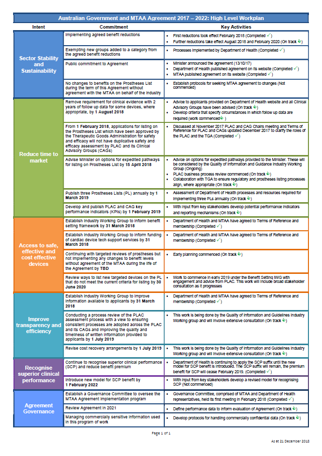
Australian Government and the Medical Technology Association of Australia (MTAA) Agreement: High Level Workplan
This workplan describes the work the Government intends to do under the Australian Government and MTAA Agreement (2017 to 2022). -
After Hours Other Medical Practitioners (AHOMPs) program guidelines
These guidelines provide information about the responsibilities of After Hours Other Medical Practitioners (AHOMPs) participants. -
Advice to the National Rural Health Commissioner on the development of the National Rural Generalist Pathway
This document presents the National Rural Generalist Taskforce's advice on the development of national training pathway for rural generalist doctors. It guided discussions with governments, professional bodies and health services. -
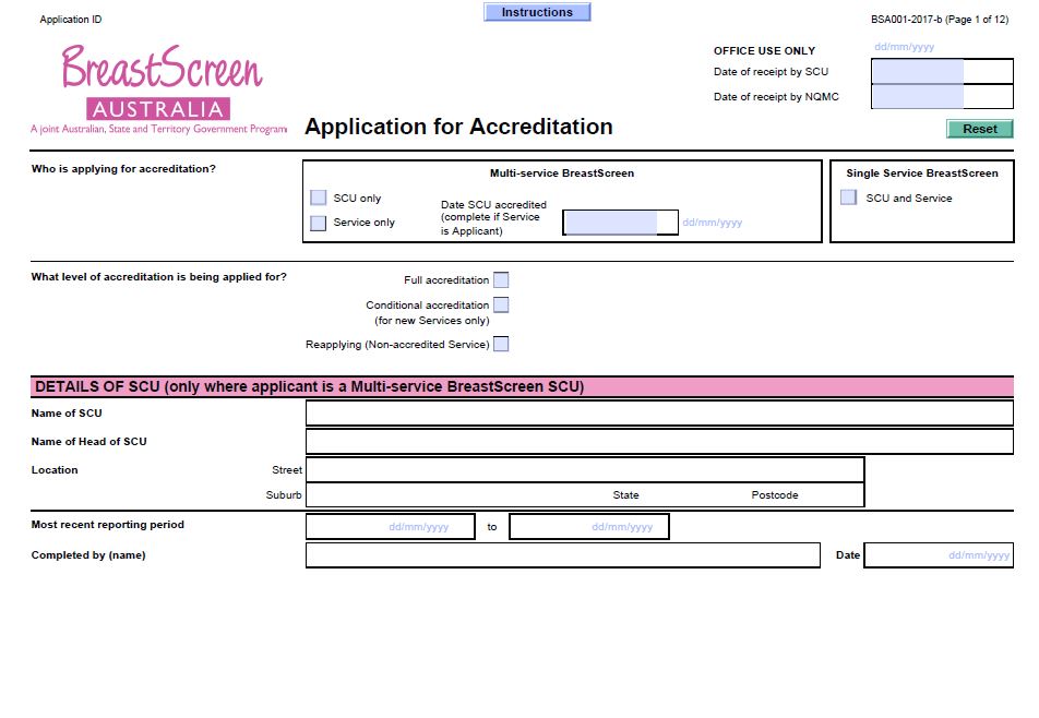
BreastScreen Australia – Application for accreditation (BSA001)
BreastScreen Australia services and State Coordination Units (SCUs) use this form to re-apply for accreditation every 4 years. -
PHN mental health care guidance – psychological treatment services for people with mental illness in residential aged care facilities
This guidance document provides advice to Primary Health Networks (PHNs) on expectations and strategies for commissioning psychological services targeting the mental health needs of people living in residential aged care facilities. -
Review of the organ donation, retrieval and transplantation system – Final report
This report and statement complete phase 1 of a 2-phase approach to review Australia’s organ donation, retrieval and transplantation system. The 57 recommendations in the report will be considered during phase 2 — the development of the future national strategy. -
ICSS Service Blueprint
The Integrated Carer Support Service (ICSS) Service Blueprint describes the service components (and their relationship) that the Government will put in place to operationalise the ICSS. The blueprint is designed to provide guidance to those organisations who will support the delivery of the ICSS. -
Advice to the NRHC on a national rural generalist pathway
This report from the National Rural Generalist Taskforce provides a guide to discussions with Governments, professional bodies and health services when considering the implementation of a national rural generalist pathway. -
Vaccine safety in Australia AusVaxSafety 2016-17
This collection contains the Vaccine safety in Australia AusVaxSafety summary report 2016-17 and related infographics. -
Bonded Medical Places Scheme – Information booklet 2019
This booklet provides information about the Bonded Medical Places Scheme for participants from 2016 to 2019, including eligibility and obligations, frequently asked questions, and contact details. -
Vaccine safety in Australia AusVaxSafety summary report 2016-17
AusVaxSafety is a national system for monitoring vaccine safety in Australia. The report shows how parents and carers responded to the SMS about their child's health a few days after their vaccination at each schedule point in the National Immunisation Program (NIP) in Australia in 2016-17. -
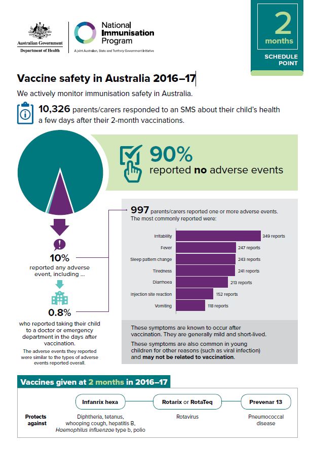
2 months schedule point - Vaccine safety in Australia 2016–17
The AusVaxSafety system actively monitors vaccine safety throughout Australia. This infographic provides a visual representation of the number of parents and carers who responded to an SMS about their child's health a few days after their 2 month vaccinations. -
4 months schedule point - Vaccine safety in Australia 2016–17
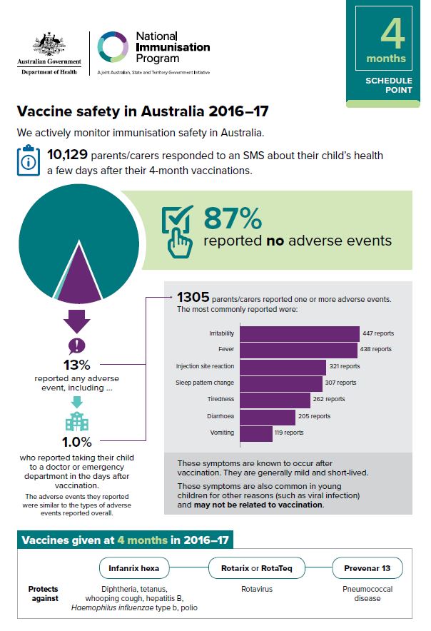
The AusVaxSafety system actively monitors vaccine safety throughout Australia. This infographic provides a visual representation of the number of parents and carers who responded to an SMS about their child's health a few days after their 4 month vaccinations.