Filter results
You can narrow down the results using the filters
Audience
Topics
Our work
Diseases
11567 results
-

COVID-19 National Health Plan – Health Protection – COVID-19 National Communication Campaign
A fact sheet about the Australian Government's response to the COVID-19 outbreak. This fact sheet is about a national communication plan to ensure timely, factual and consistent information is provided. -

COVID-19 National Health Plan – Aged Care – Aged Care Preparedness
A fact sheet about the Australian Government's response to the COVID-19 outbreak. This fact sheet is about funding for a range of measures to support senior Australians in aged care and home care. -

COVID-19 National Health Plan – Primary Care – Boosting Workforce and Infection Control Training
A fact sheet about the Australian Government's response to the COVID-19 outbreak. This fact sheet is about boosting the health workforce and infection control training. -

COVID-19 National Health Plan – Modelling and Surveillance to Support the Response to COVID-19
A fact sheet about the Australian Government's response to the COVID-19 outbreak. This fact sheet is about the additional modelling and surveillance activities that will help improve our understanding of and response to COVID-19. -

COVID-19 National Health Plan – Primary Care – COVID-19 Remote Community Preparedness and Retrieval
A fact sheet about the Australian Government's response to the COVID-19 outbreak. This fact sheet is about measures to increase the capacity of remote communities to evacuate early cases, and enable an effective response if an outbreak occurs. -

COVID-19 National Health Plan – Primary Care – Central Patient COVID-19 Triage Hotline
A fact sheet about the Australian Government's response to the COVID-19 outbreak. This fact sheet is about the 24/7 hotline to be expanded to help triage people with respiratory symptoms and those who are concerned about contact with a possible COVID-19 case. -
COVID-19 National Health Plan – Coronavirus Research Response
A fact sheet about the Australian Government's response to the COVID-19 outbreak. This fact sheet is about investing in Australian researchers to contribute to global efforts to control the outbreak. -

COVID-19 National Health Plan – Aged Care – Pathology Testing in Aged Care
A fact sheet about the Australian Government's response to the COVID-19 outbreak. This fact sheet is about funding for specialist inreach pathology testing for COVID-19 and influenza in residential aged care facilities. -

COVID-19 National Health Plan – Primary Health – MBS Pathology (Microbiology) Test for COVID-19 and Influenza
A fact sheet about the Australian Government's response to the COVID-19 outbreak. This fact sheet is about adding a new temporary item to the Medicare Benefits Schedule to provide accessible and rapid lab testing of severe acute respiratory syndrome coronavirus 2. -

COVID-19 National Health Plan – National Medical Stockpile – Purchase of Masks, Other Personal Protective Equipment and Pharmaceuticals
A fact sheet about the Australian Government's response to the COVID-19 outbreak. This fact sheet is about increasing Australia’s supply of personal protective equipment and pharmaceuticals held in the National Medical Stockpile. -

COVID-19 National Health Plan – Primary Health – Respiratory Clinics
A fact sheet about the Australian Government's response to the COVID-19 outbreak. This fact sheet is about the establishment of up to 100 private practice respiratory clinics for people with mild to moderate symptoms. -

COVID-19 National Health Plan – Primary Care – Fast Track Electronic Prescribing
A fact sheet about the Australian Government's response to the COVID-19 outbreak. This fact sheet is about electronic prescribing (ePrescribing) to help protect people most at-risk in our community from exposure to COVID-19. -

Coronavirus (COVID-19): National Health Plan resources
A collection of resources for the general public, health professionals and industry outlining a range of funding measures the Australian Government is taking to combat coronavirus (COVID-19). -
Inquiry into Biotoxin-related Illnesses in Australia
Australian Government Response to the House of Representatives Standing Committee on Health, Aged Care and Sport’s report on the Inquiry into Biotoxin-related Illnesses in Australia. -
Available funding sources and resources for the Aboriginal Community Controlled Health Services (ACCHS) sector
This report identifies the range of support and revenue sources available to the ACCHS sector. -
Evaluation of the National Palliative Care Projects Final Report
This report describes the assessment and evaluation of the National Palliative Care Projects which are funded under the Public Health and Chronic Disease Grant Program. The Report outlines key findings and recommendations. -
Regulations restricting the use of restraints in residential aged care services
Australian Government response to the Parliamentary Joint Committee on Human Rights inquiry into the Quality of Care Amendment (Minimising the Use of Restraints) Principles 2019. -
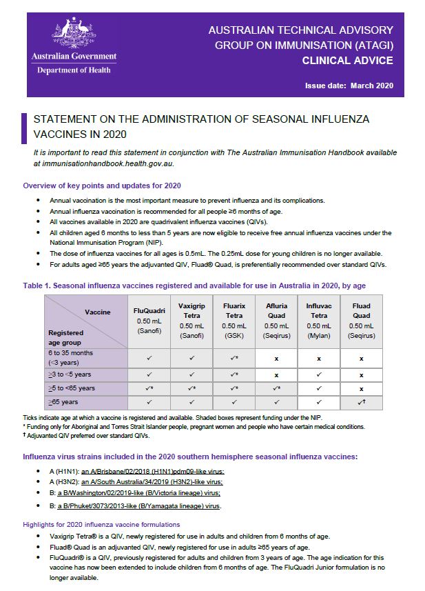
ATAGI advice on seasonal influenza vaccines in 2020
This resource provides advice for immunisation providers regarding the administration of 2020 seasonal influenza vaccines. -
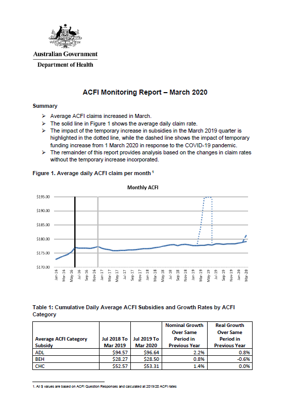
Aged care funding instrument (ACFI) monitoring report – March 2020
This report shows the monthly growth in ACFI subsidies compared to estimates for March 2020. -
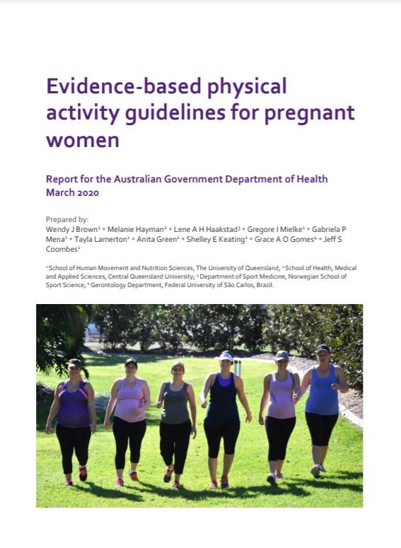
Evidence-based physical activity guidelines for pregnant women
This document provides a summary of evidence used to inform Australia’s physical activity and sedentary behaviour guidelines for pregnant women in Australia. -
Business case template – Business Improvement Fund
Residential aged care providers use this business case template to apply for grants under the Business Improvement Fund. -
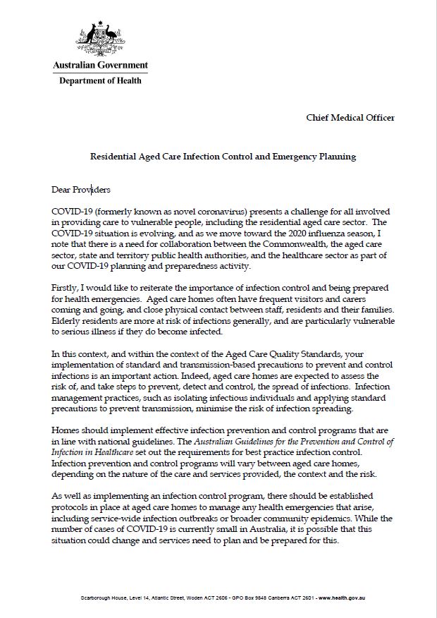
Residential aged care infection control and emergency planning
This letter is from the Chief Medical Officer to aged care providers. It's on the importance of infection control and health emergency planning in residential care. -
National Strategic Action Plan for Rare Diseases
The National Strategic Action Plan for Rare Diseases outlines principles and actions to bring about the best possible health and wellbeing outcomes for Australians living with a rare disease. -
Australian Government response to the Joint Standing Committee – General issues around the implementation and performance of the NDIS
The Australian Government welcomes the Joint Standing Committee on the National Disability Insurance Scheme second progress report on the inquiry into general issues around the implementation and performance of the National Disability Insurance Scheme (NDIS). -
Australian Government response to the Joint Standing Committee – Inquiry into market readiness for provision of services under the NDIS
The Australian Government welcomes the Joint Standing Committee on the National Disability Insurance Scheme’s report to the Inquiry into Market Readiness for provision of services under the NDIS (the Report).