Filter results
You can narrow down the results using the filters
Audience
Topics
Our work
Diseases
11577 results
-
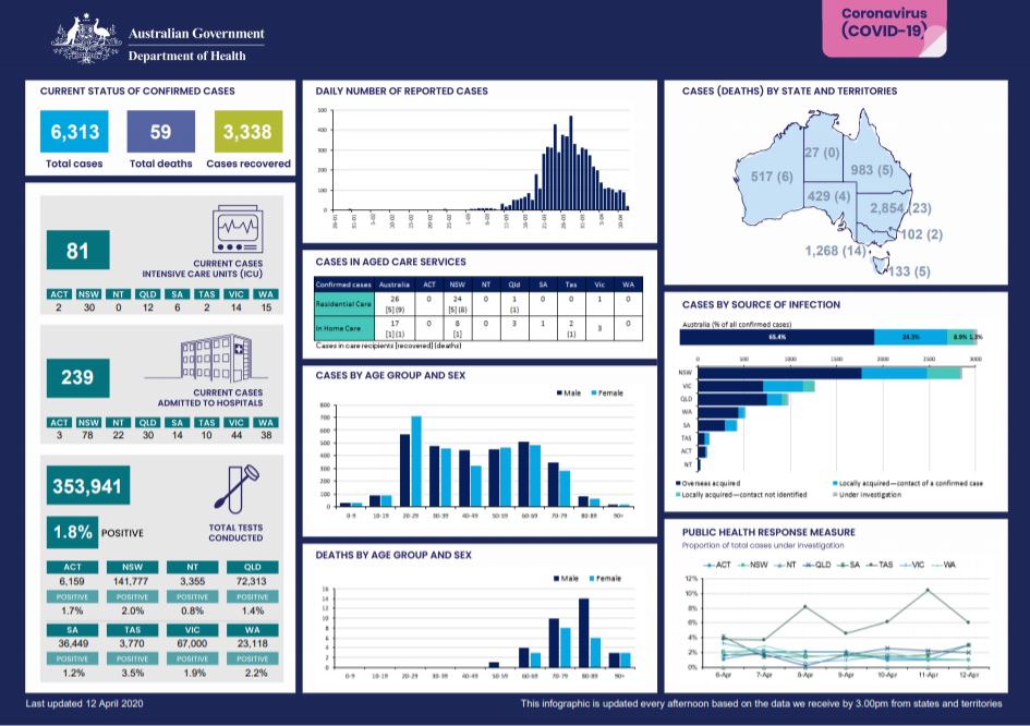
Coronavirus (COVID-19) at a glance – 12 April 2020
This infographic provides a quick view of the coronavirus (COVID-19) situation in Australia on 12 April 2020. -
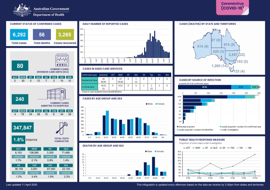
Coronavirus (COVID-19) at a glance – 11 April 2020
This infographic provides a quick view of the coronavirus (COVID-19) situation in Australia on 11 April 2020. -
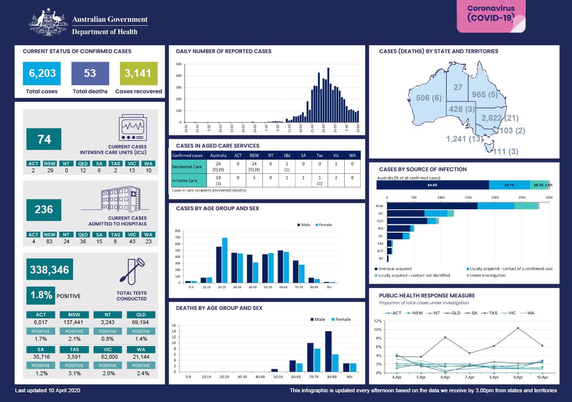
Coronavirus (COVID-19) at a glance – 10 April 2020
This infographic provides a quick view of the coronavirus (COVID-19) situation in Australia on 10 April 2020. -
Overseas Student Health Cover (OSHC) – Explanatory guidelines for consumers
These guidelines provide information about OSHC including waiting periods, how to buy OSHC, benefit payments, and access to public and private hospitals. This is an accompanying document to the 1 July 2016 to 30 June 2022 deed. -
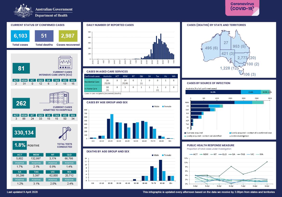
Coronavirus (COVID-19) at a glance – 9 April 2020
This infographic provides a quick view of the coronavirus (COVID-19) situation in Australia on 9 April 2020. -
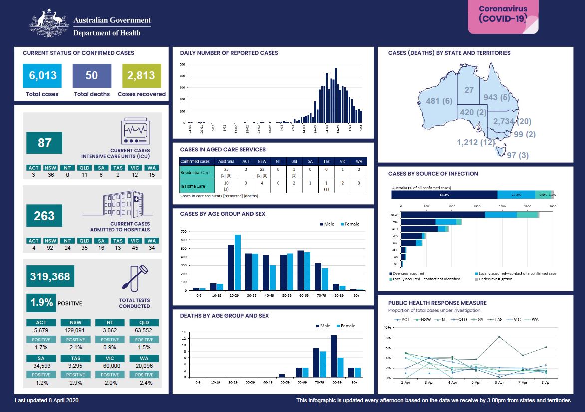
Coronavirus (COVID-19) at a glance – 8 April 2020
This infographic provides a quick view of the coronavirus (COVID-19) situation in Australia on 8 April 2020. -
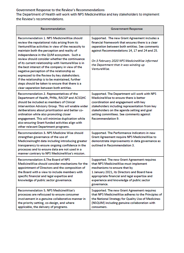
Response to the Review of the Quality Use of Medicines Program’s delivery by NPS MedicineWise
This document outlines the Australian Government’s response to a departmental review, which looked at the effectiveness of the National Prescribing Service, NPS MedicineWise, in delivering the Quality Use of Medicines Program. -
AGPT Program National Report on the 2019 Registrar Satisfaction Survey
Each year, we give medical registrars training under the Australian General Practitioner Training (AGPT) Program the chance to have their say. This report gives the national results of the 2019 Registrar Satisfaction Survey. -
Impact of COVID-19 in Australia – ensuring the health system can respond
These documents outline scenario modelling undertaken to inform how Australia prepares our health system, including our intensive care units, for COVID-19. -
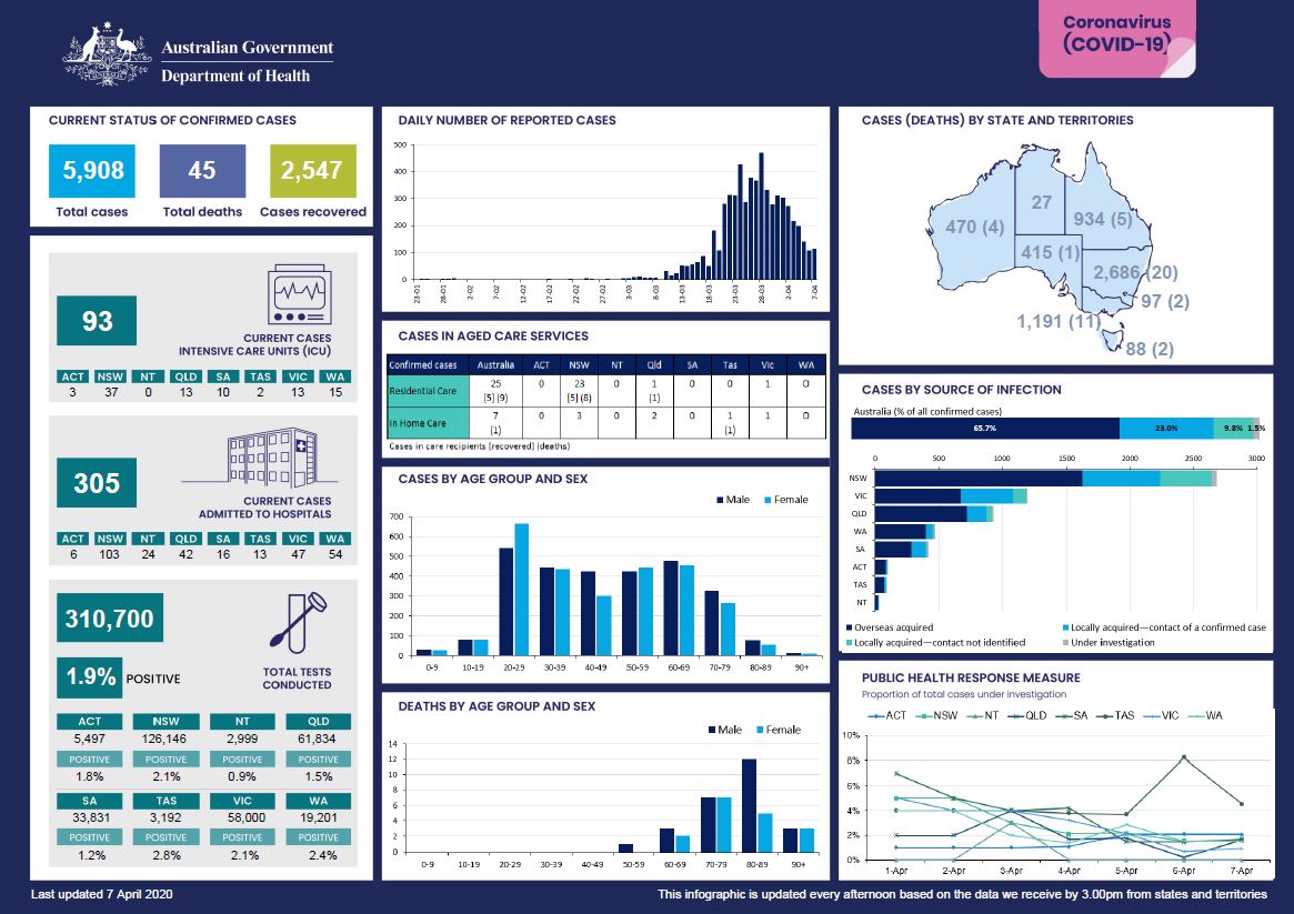
Coronavirus (COVID-19) at a glance – 7 April 2020
This infographic provides a quick view of the coronavirus (COVID-19) situation in Australia on 7 April 2020. -
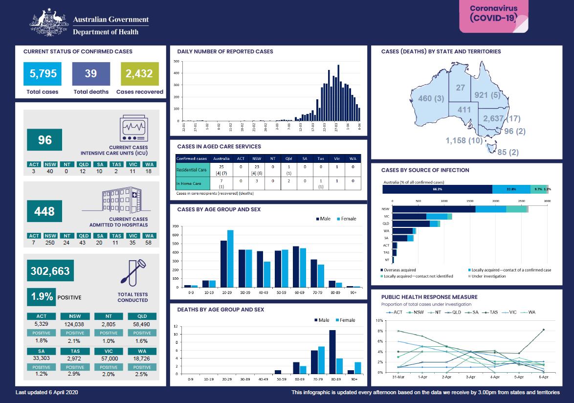
Coronavirus (COVID-19) at a glance – 6 April 2020
This infographic provides a quick view of the coronavirus (COVID-19) situation in Australia on 6 April 2020. -
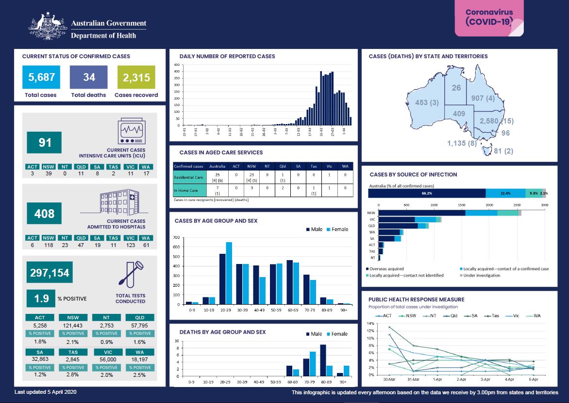
Coronavirus (COVID-19) at a glance – 5 April 2020
This infographic provides a quick view of the coronavirus (COVID-19) situation in Australia on 5 April 2020. -
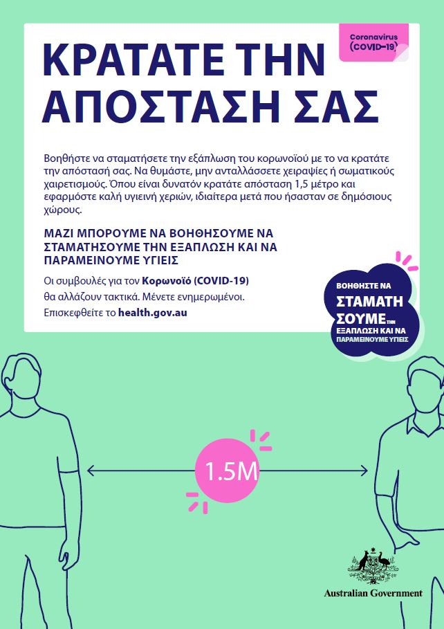
Coronavirus (COVID-19) – Κρατατε την αποσταση σασ – (Keeping your distance)
Βοηθήστε να σταματήσετε την εξάπλωση του κορωνοϊού με το να κρατάτε την απόστασή σας. -
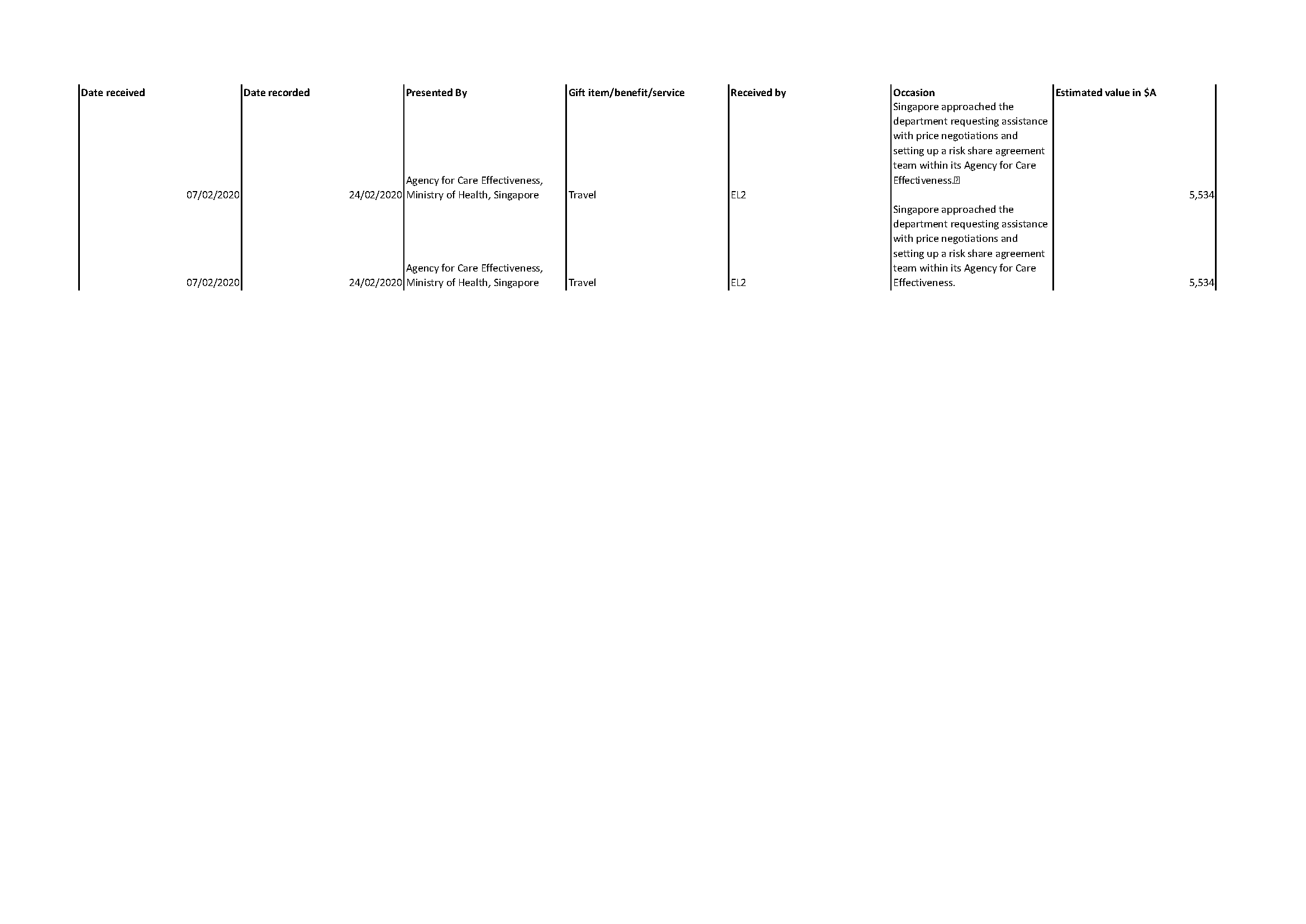
Reportable gifts received – March 2020
This report is of gifts given to officers of the Department of Health that are valued over $100, as at 4 March, 2020. -

Restrictive practices: understanding and managing behaviours in a time of pandemic
This Dementia Support Australia fact sheet is for aged care services. It provides tips to support a person living with dementia where behaviour may be affecting their care during the COVID-19 pandemic. -
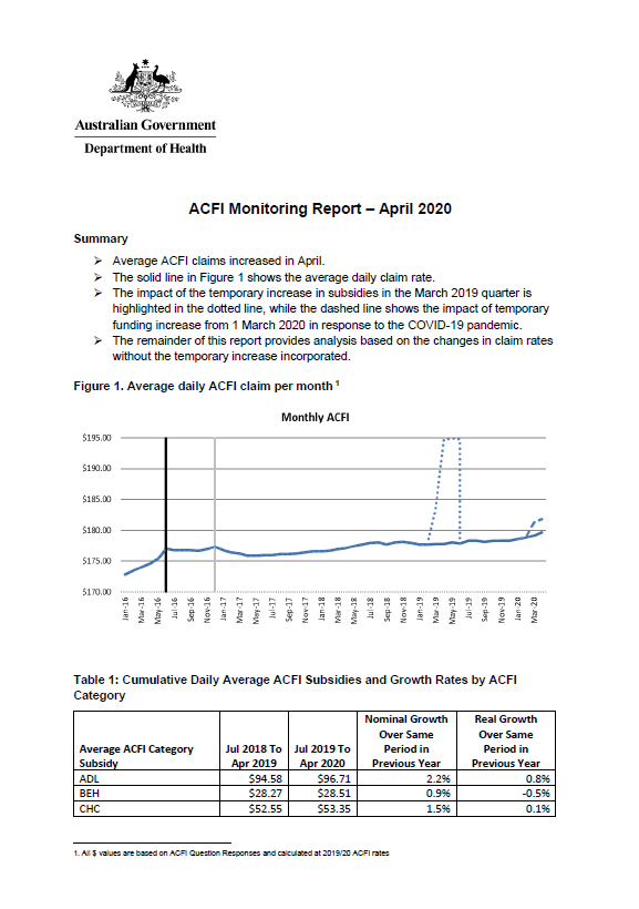
Aged care funding instrument (ACFI) monitoring report – April 2020
This report shows the monthly growth in ACFI subsidies compared to estimates for April 2020. -
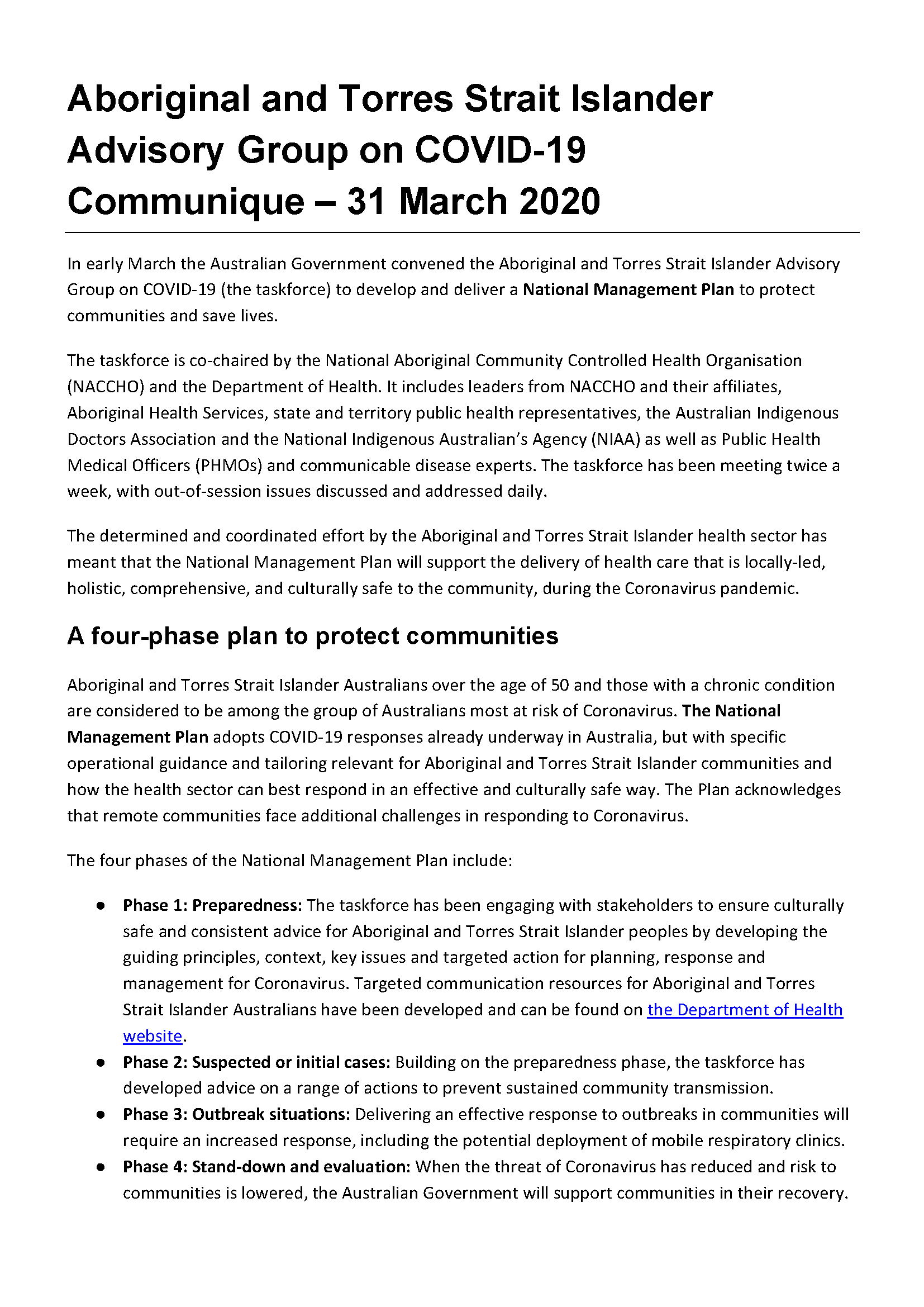
Aboriginal and Torres Strait Islander Advisory Group on COVID-19 communique – 31 March 2020
This communique summarises the meeting of the Aboriginal and Torres Strait Islander Advisory Group on COVID-19 held on 31 March 2020. -

Annual report 2019 – National Rural Health Commissioner
This annual report covers the commissioner’s activities from 1 January 2019 to 31 December 2019. -
National Rural Health Commissioner Annual Report 2019
This report covers the Commissioner’s activities from 1 January 2019 to 31 December 2019. -
COVID-19 National Health Plan – Supporting the mental health of Australians through the Coronavirus pandemic
A fact sheet about a package of measures to support the mental health and wellbeing of Australians as we face the challenges of the Coronavirus pandemic. -
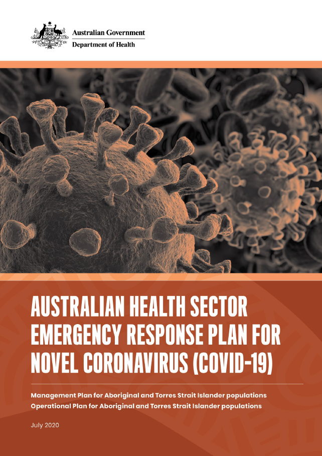
Management Plan for Aboriginal and Torres Strait Islander Populations
The Australian Health Sector Emergency Response Plan for Novel Coronavirus guides the Australian health sector response. This Management Plan focuses on culturally appropriate testing and care for Aboriginal and Torres Strait Islander peoples, and for specific locations including remote communities. -
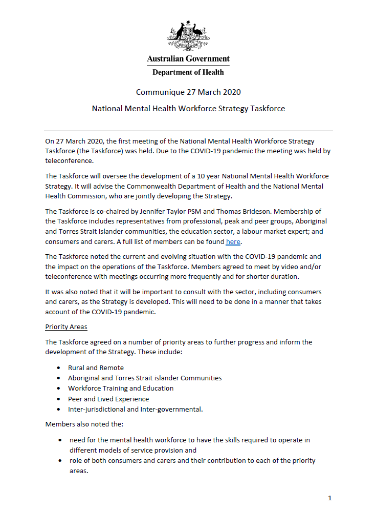
NMHWS taskforce meeting communique – 27 March 2020
This communique summarises the first meeting of the National Mental Health Workforce Strategy taskforce (NMHWS) held by teleconference on 27 March 2020. -
National Bowel Cancer Screening Program – stickers
These stickers are designed for use by hospitals and health providers to help identify referrals and results sheets for program participants. -

COVID-19 National Health Plan – Primary Care – MBS telehealth items staged rollout
This fact sheet provides information about the 4-stage rollout of the COVID-19 Medicare Benefits Schedule (MBS) telehealth items. -
Review of the My Health Records legislation
A review of the My Health Records legislation has been completed by Professor John McMillan AO. Read the key findings and recommendations in the final report.
These will inform future revisions of the legislation to make sure that the system works as well as it can for all Australians.