Filter results
You can narrow down the results using the filters
Audience
Topics
Our work
Diseases
11382 results
-
Smallpox Emergency Management Plan
This emergency management plan outlines how we will coordinate a national health response to a deliberate release of smallpox in Australia. -
Adolescent ‘booster’ dose of diphtheria-tetanus-pertussis (dTpa) vaccine - brochure
This brochure provides information about the diphtheria-tetanus-pertussis (dTpa) vaccine for adolescents. -

Vaccination videos for high school students
These videos provide information for students on how vaccination protects you, why it’s important, and what to expect when you receive your vaccinations at school. -
Practice Incentives Program Quality Improvement Incentive – Consumer fact sheet
This fact sheet for consumers covers how the Practice Incentives Program (PIP) Quality Improvement (QI) Incentive affects the care GPs provide. -
Topic 4 — Future directions in health care delivery
This is the fourth literature review to inform the national Independent Review of Nursing Education – Educating the Nurse of the Future. It looks at the future directions in healthcare delivery. -
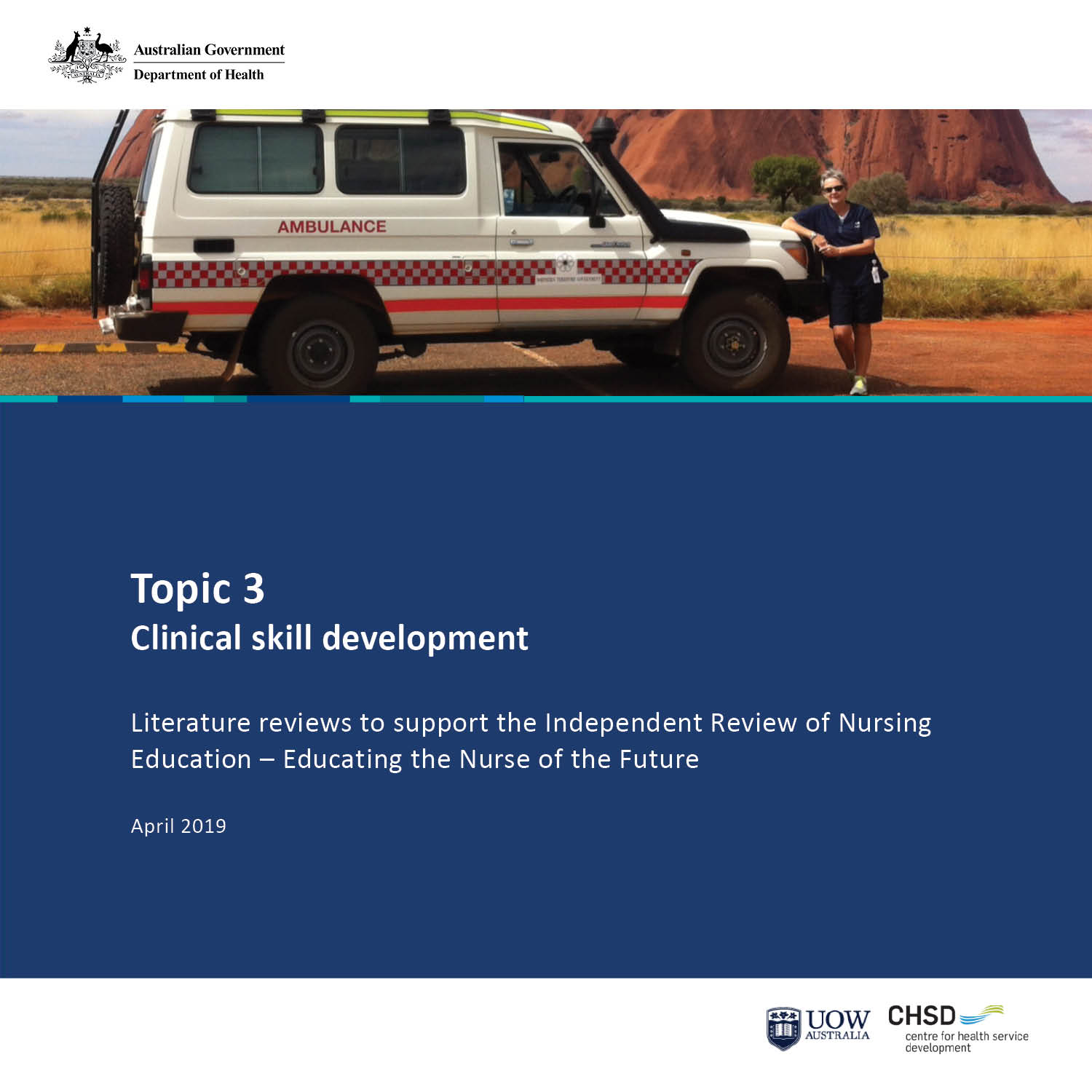
Topic 3 — Clinical skill development
This is the third literature review to inform the national Independent Review of Nursing Education – Educating the Nurse of the Future. It looks at clinical skill development. -
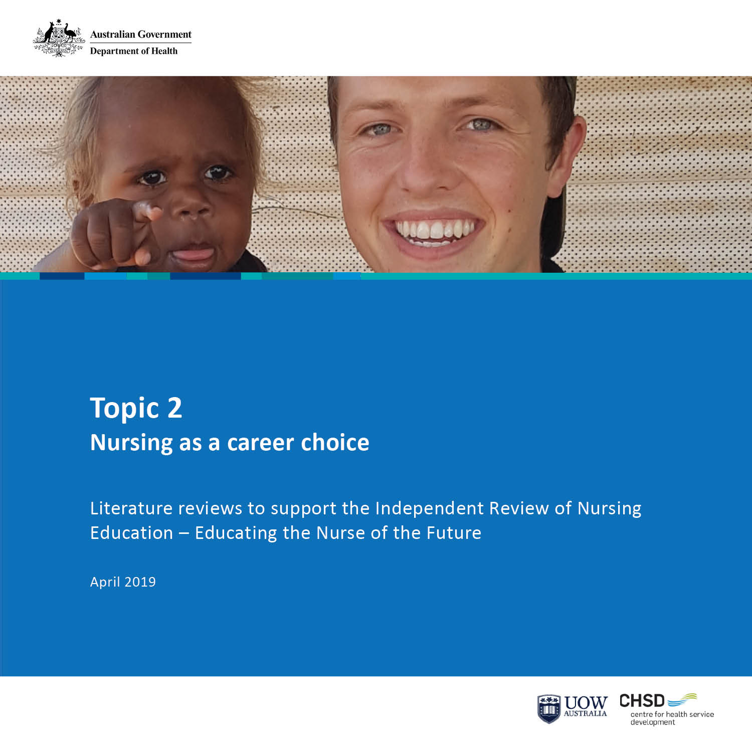
Topic 2 — Nursing as a career choice
This is the second literature review to inform the national Independent Review of Nursing Education – Educating the Nurse of the Future. It looks at nursing as a career choice. -
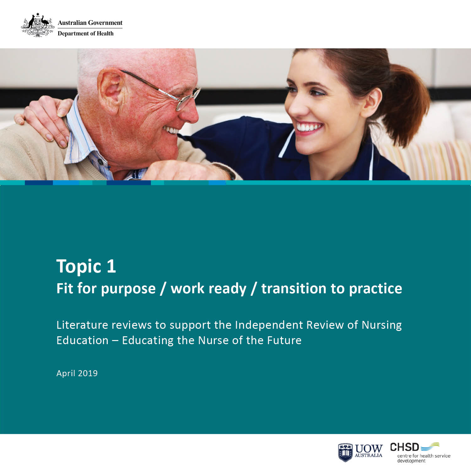
Topic 1 — Fit for purpose / work ready / transition to practice
This is the first literature review to inform the national Independent Review of Nursing Education – Educating the Nurse of the Future. It looks at work readiness and transition to practice. -
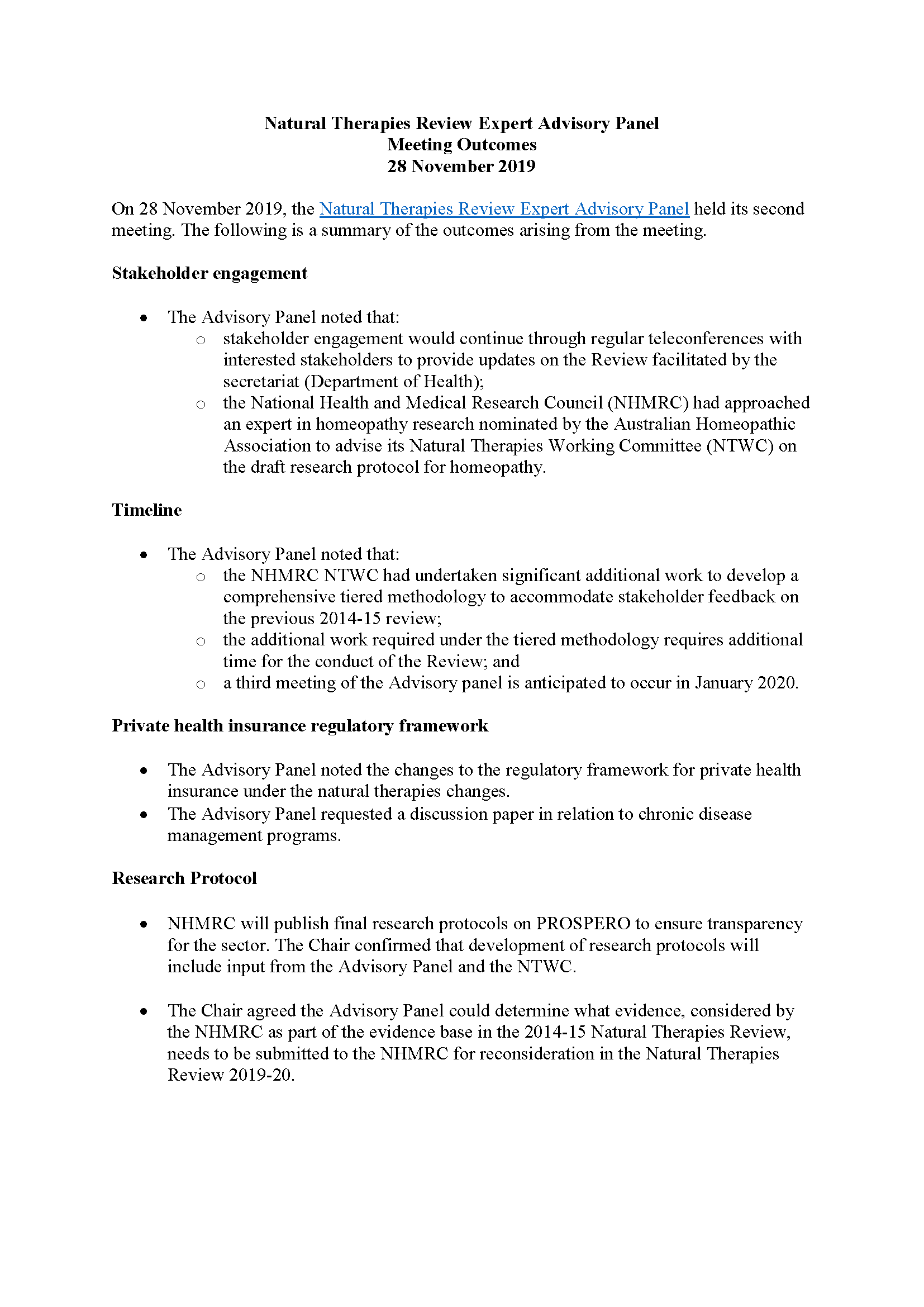
NTREAP meeting outcomes – 28 November 2019
Natural Therapies Review Expert Advisory Panel (NTREAP) meeting outcomes for 28 November 2019 meeting. -
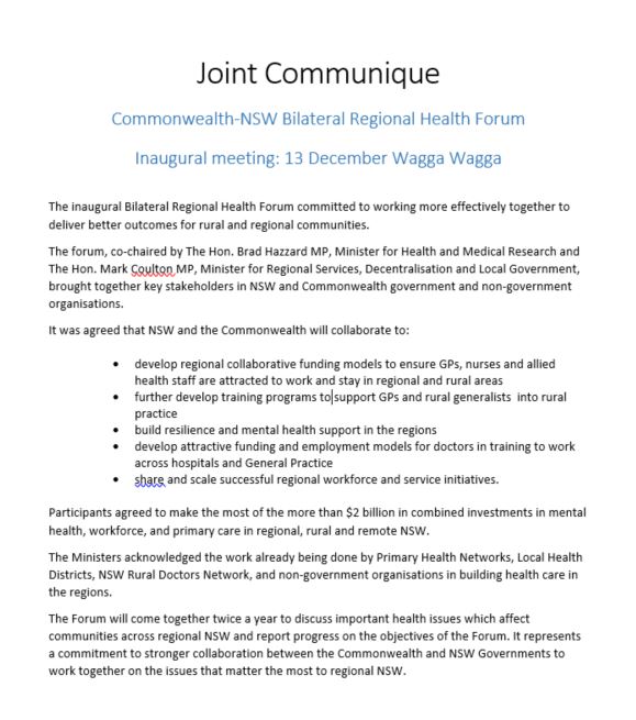
Bilateral Regional Health Forum – Joint communique – 13 December 2019
A joint communiqué from the Commonwealth-New South Wales Bilateral Regional Health Forum. -
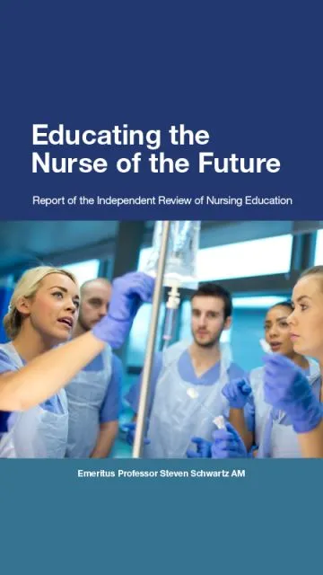
Educating the Nurse of the Future reports and literature reviews
These reports and literature reviews support the national independent review of nursing education in Australia, called Educating the Nurse of the Future. -
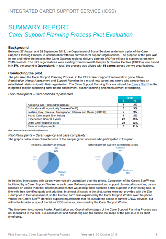
Summary Report Carer Support Planning Process Pilot Evaluation
A summary report on the pilot to test and refine the process that Carer Gateway regional delivery partners will use to support carers from 2019 onwards. -

MRFF initiatives – implementation plan snapshots
This collection contains publications related to the implementation of Medical Research Future Fund (MRFF) initiatives and missions. -
Carer Support Planning Framework
The Carer Support Planning Framework outlines how Carer Gateway regional delivery partners provide support to carers. -
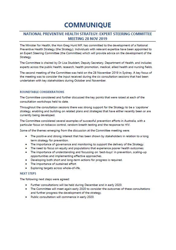
National Preventive Health Strategy Expert Steering Committee communique – November 2019
This document summarises what the National Preventive Health Strategy Expert Steering Committee discussed at its November 2019 meeting. -
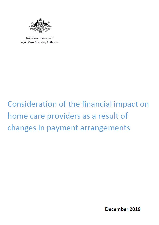
Consideration of the Financial Impact on Home Care Providers as a Result of Changes in Payment Arrangements
The Aged Care Financing Authority (ACFA) looked at the financial impact of improving payment arrangements in home care. They provided this report to Government on 11 December 2019. -
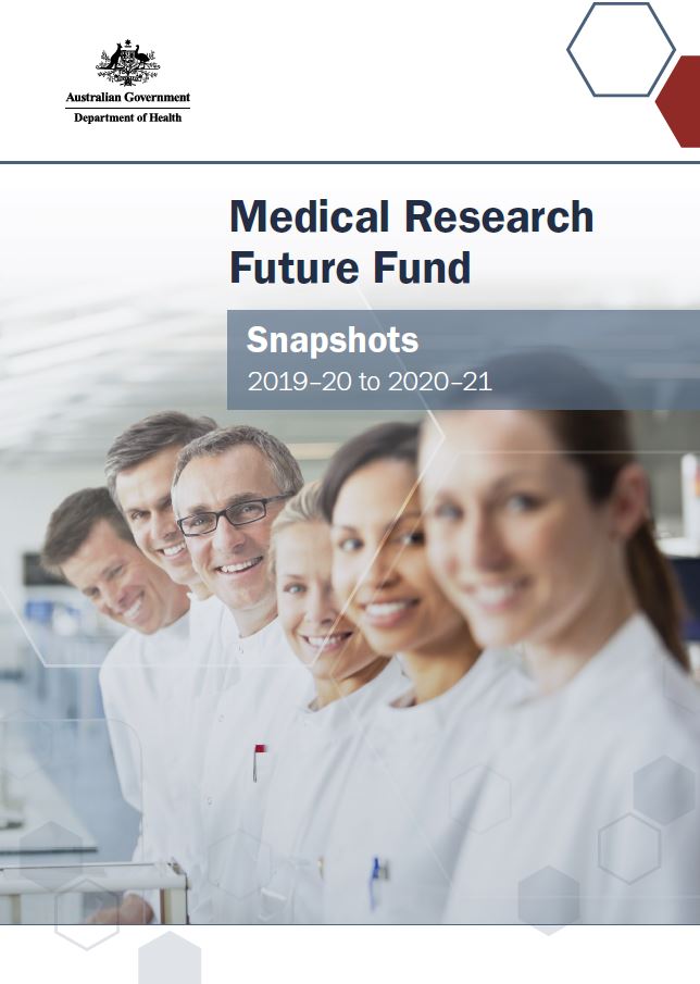
Medical Research Future Fund initiative implementation snapshots report
This compilation report presents a snapshot for each of the 20 Medical Research Future Fund (MRFF) initiatives under the Government's 10-year plan. -
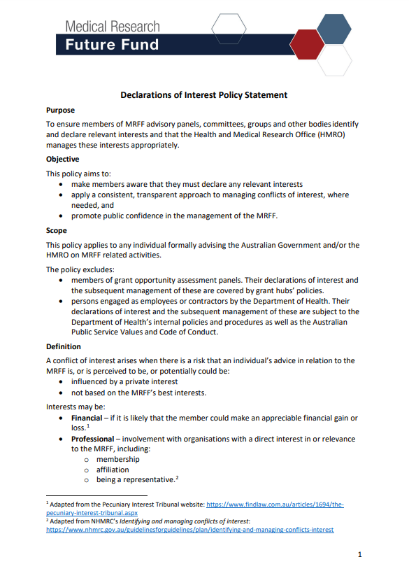
Medical Research Future Fund Declaration of Interest Policy Statement
This policy ensures members of MRFF advisory panels, committees, groups and other bodies identify and declare relevant interests and that the Health and Medical Research Office (HMRO) manages these interests appropriately. -
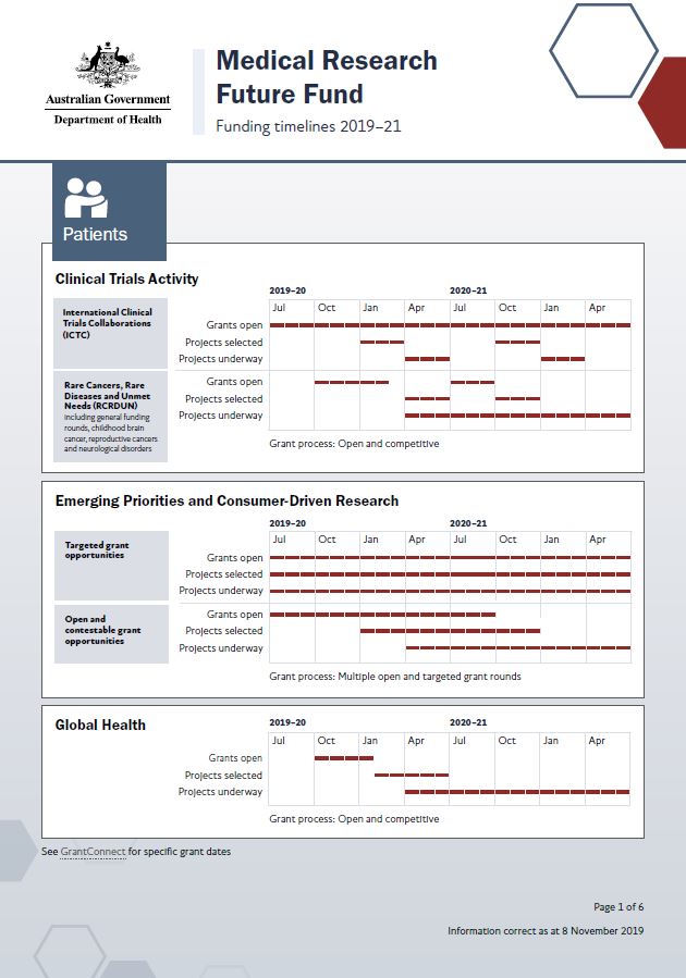
Medical Research Future Fund funding timelines 2019–21
This document shows the projected timelines for grant activity in 2019–21 under the 20 initiatives that comprise the Medical Research Future Fund (MRFF) 10-year plan. -
Right to opportunity: Consultation report to help shape the next national disability strategy – Summary report
This is the summary report on the 2019 stage 1 consultations that were held for the development of Australia’s Disability Strategy 2021–2031. -
Right to opportunity: Consultation report to help shape the next national disability strategy
This is the full report and appendices on the 2019 stage 1 consultations that were held for the development of Australia’s Disability Strategy 2021–2031. -
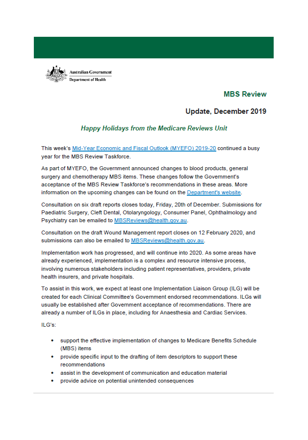
December 2019 update – MBS Review
This newsletter outlines recent changes to the Medicare Benefits Schedule (MBS) as a result of the MBS Review. -
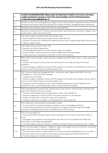
nKPI and OSR Roadmap Recommendations
This document contains the endorsed list of recommendations from the nKPI and OSR Implementation Roadmap. -
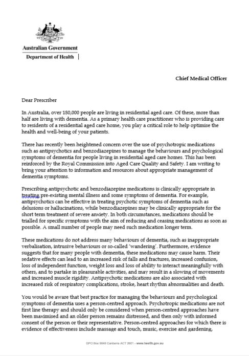
Letter from the Chief Medical Officer to Prescribers
The Chief Medical Officer has written to approximately 28,000 practitioners about new resources for prescribers to support care of people with dementia who live in residential aged care. -
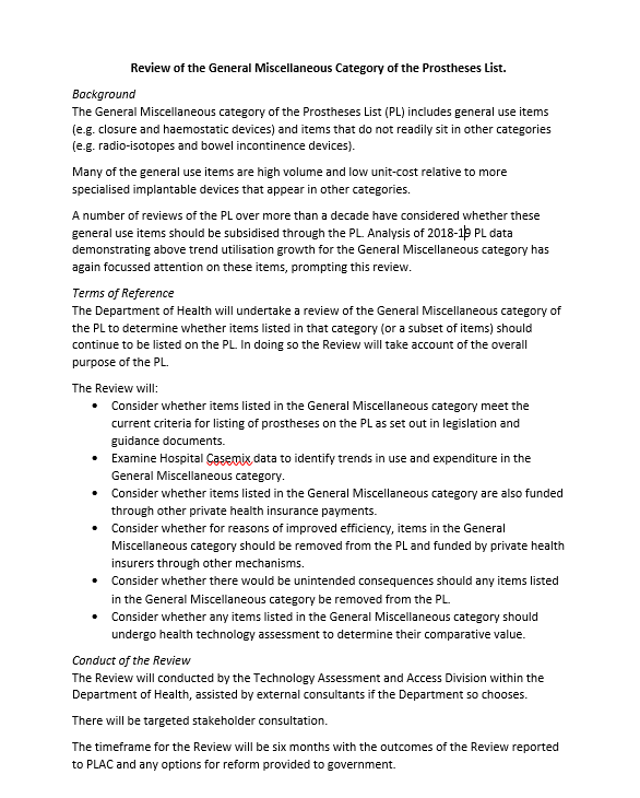
Review of the General Miscellaneous Category of the Prostheses List terms of reference
This document is the terms of reference for the review of the General Miscellaneous Category of the Prostheses List.