Filter results
You can narrow down the results using the filters
Audience
Topics
Our work
Diseases
11321 results
-
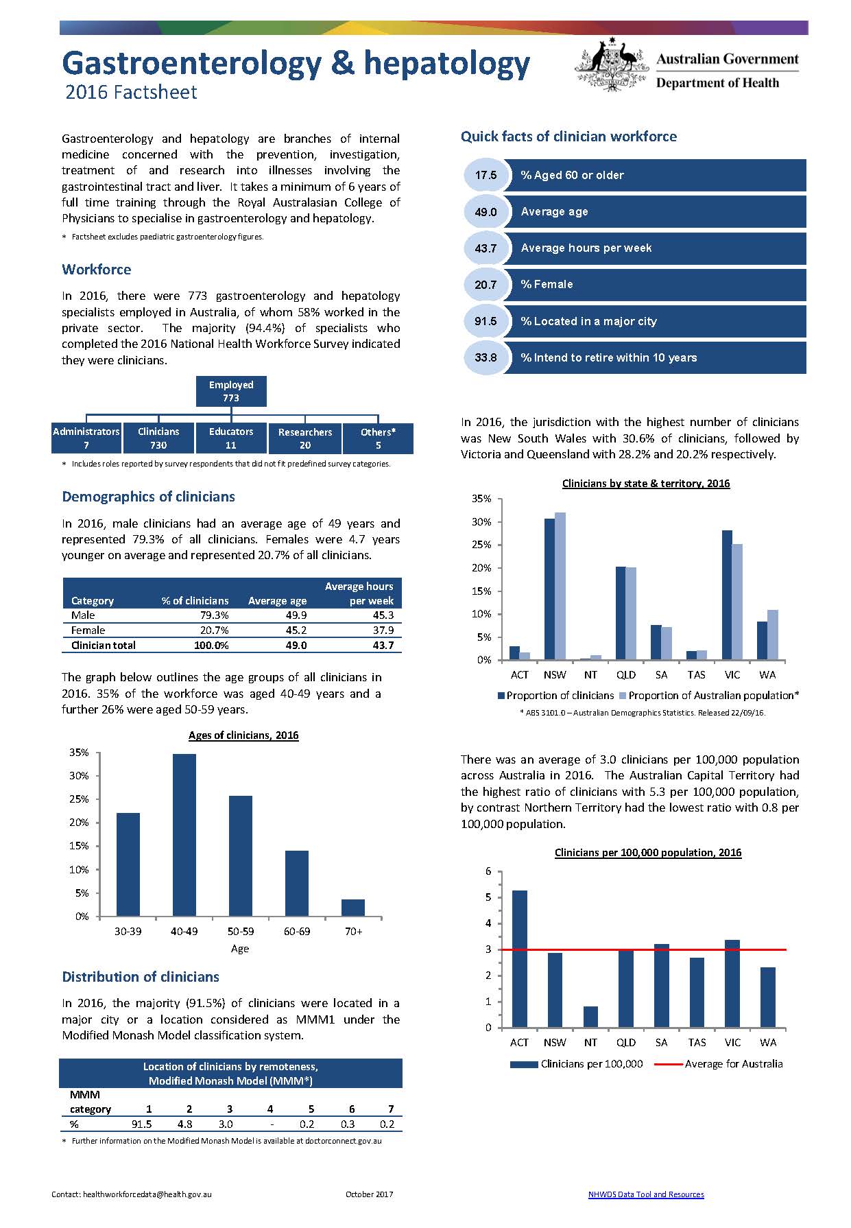
Gastroenterology and hepatology workforce – MWRAC fact sheet
This Medical Workforce Reform Advisory Committee (MWRAC) fact sheet provides information on the demographics and distribution of the gastroenterology and hepatology workforce. -
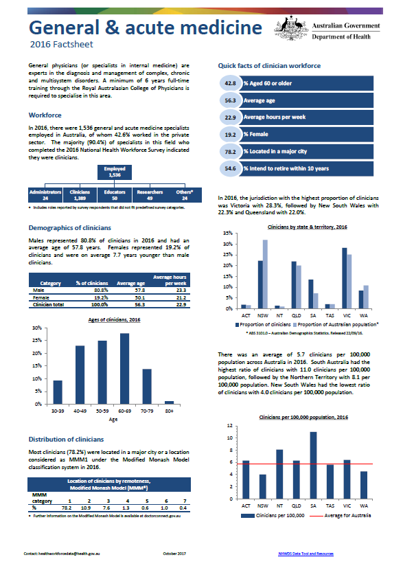
General and acute medicine workforce – MWRAC fact sheet
This Medical Workforce Reform Advisory Committee (MWRAC) fact sheet provides information on the demographics and distribution of the general and acute medicine workforce. -
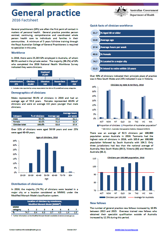
General practice workforce – MWRAC fact sheet
This Medical Workforce Reform Advisory Committee (MWRAC) fact sheet provides information on the demographics and distribution of the general practice workforce. -
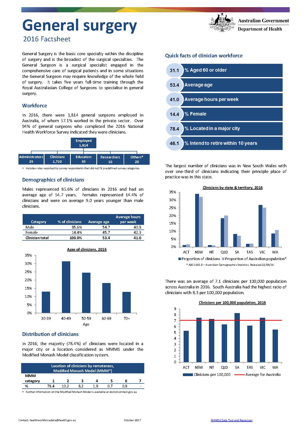
General surgery workforce – MWRAC fact sheet
This Medical Workforce Reform Advisory Committee (MWRAC) fact sheet provides information on the demographics and distribution of the general surgery workforce. -
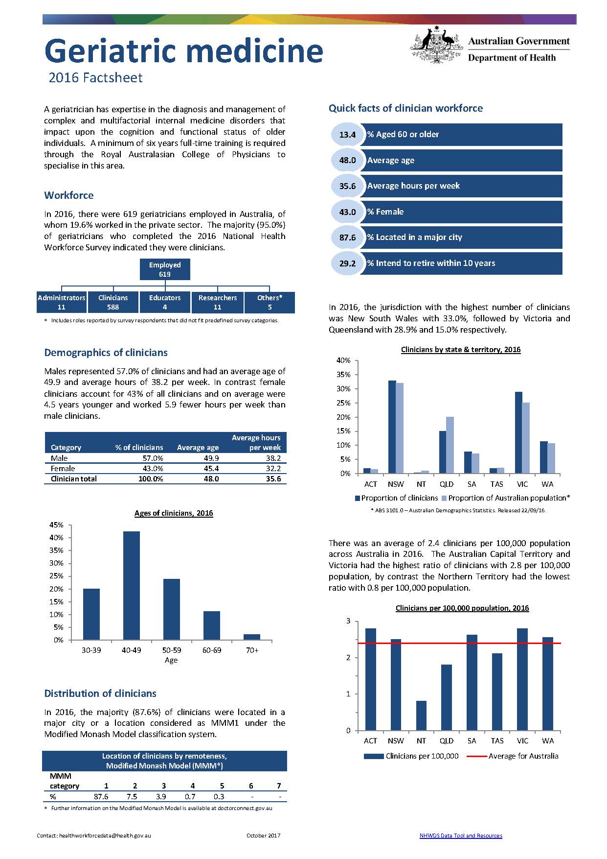
Geriatric medicine workforce – MWRAC fact sheet
This Medical Workforce Reform Advisory Committee (MWRAC) fact sheet provides information on the demographics and distribution of the geriatric medicine workforce. -
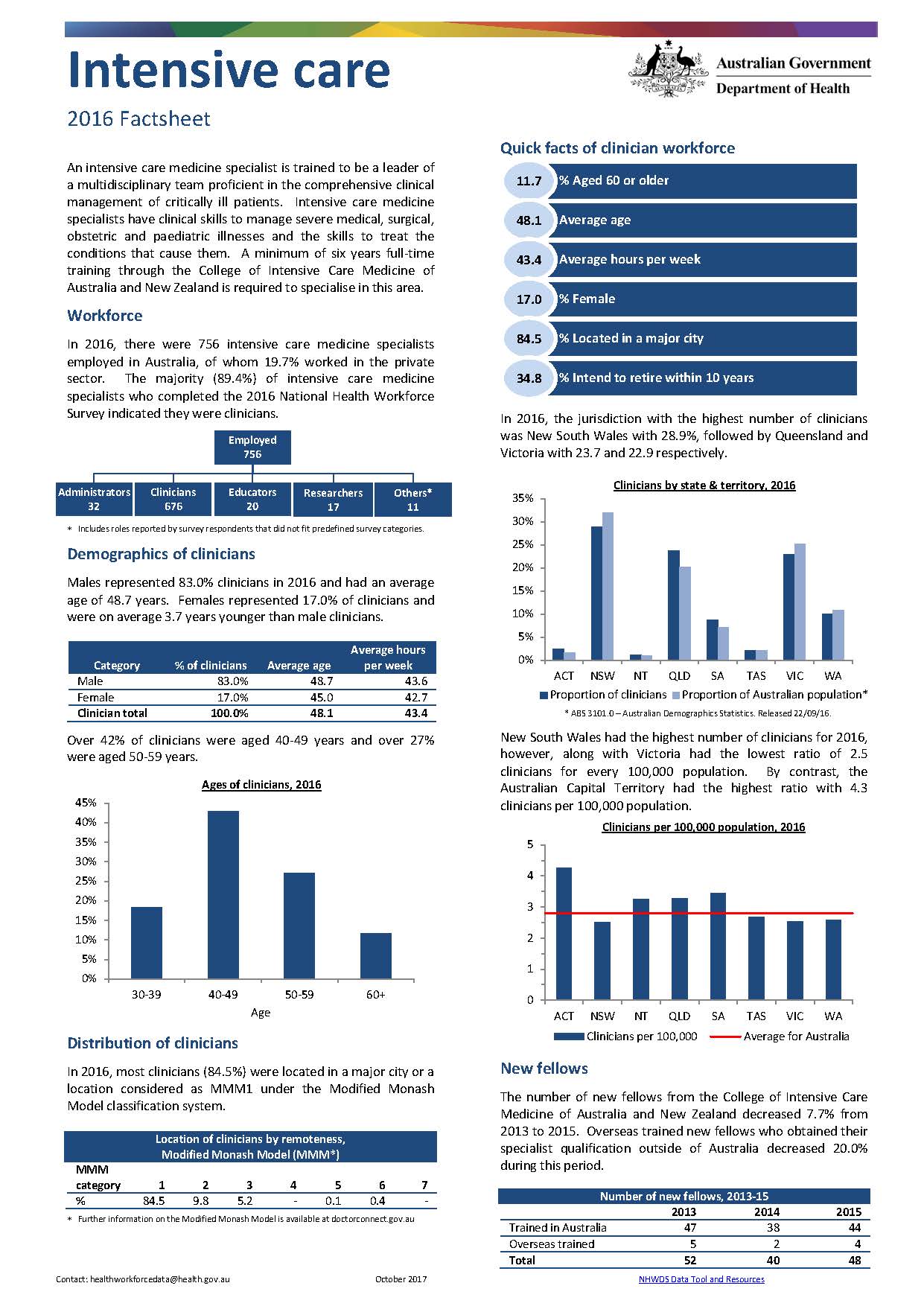
Intensive care medicine workforce – MWRAC fact sheet
This Medical Workforce Reform Advisory Committee (MWRAC) fact sheet provides information on the demographics and distribution of the intensive care medicine workforce. -
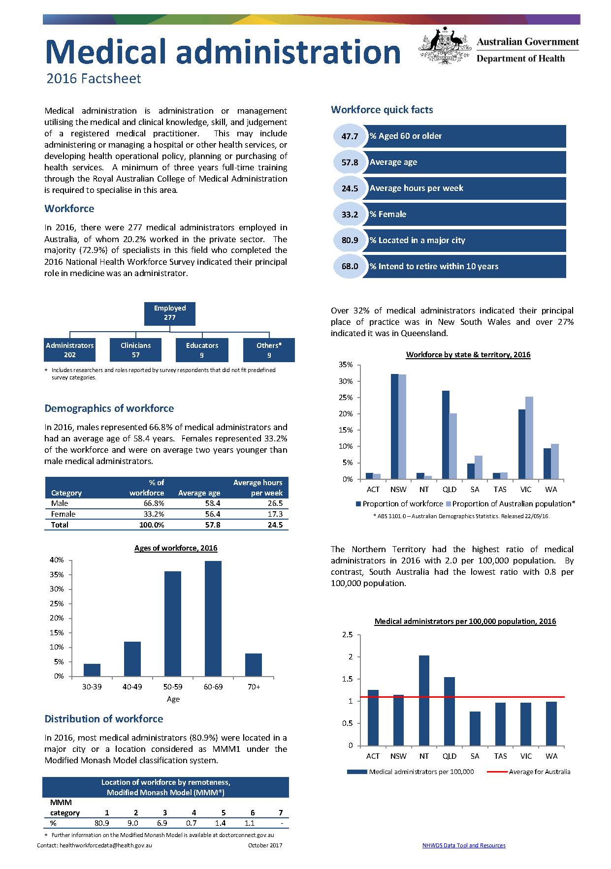
Medical administration workforce – MWRAC fact sheet
This Medical Workforce Reform Advisory Committee (MWRAC) fact sheet provides information on the demographics and distribution of the medical administration workforce. -
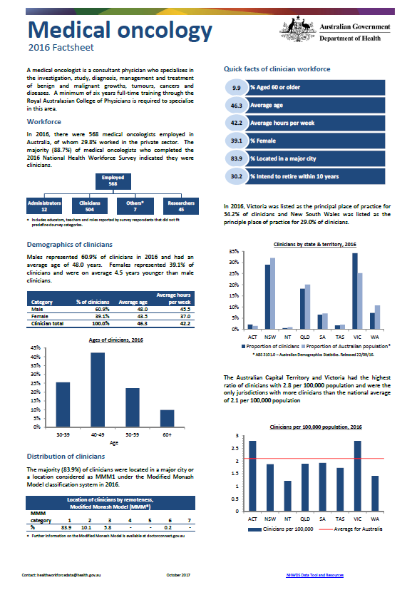
Medical oncology workforce – MWRAC fact sheet
This Medical Workforce Reform Advisory Committee (MWRAC) fact sheet provides information on the demographics and distribution of the medical oncology workforce. -
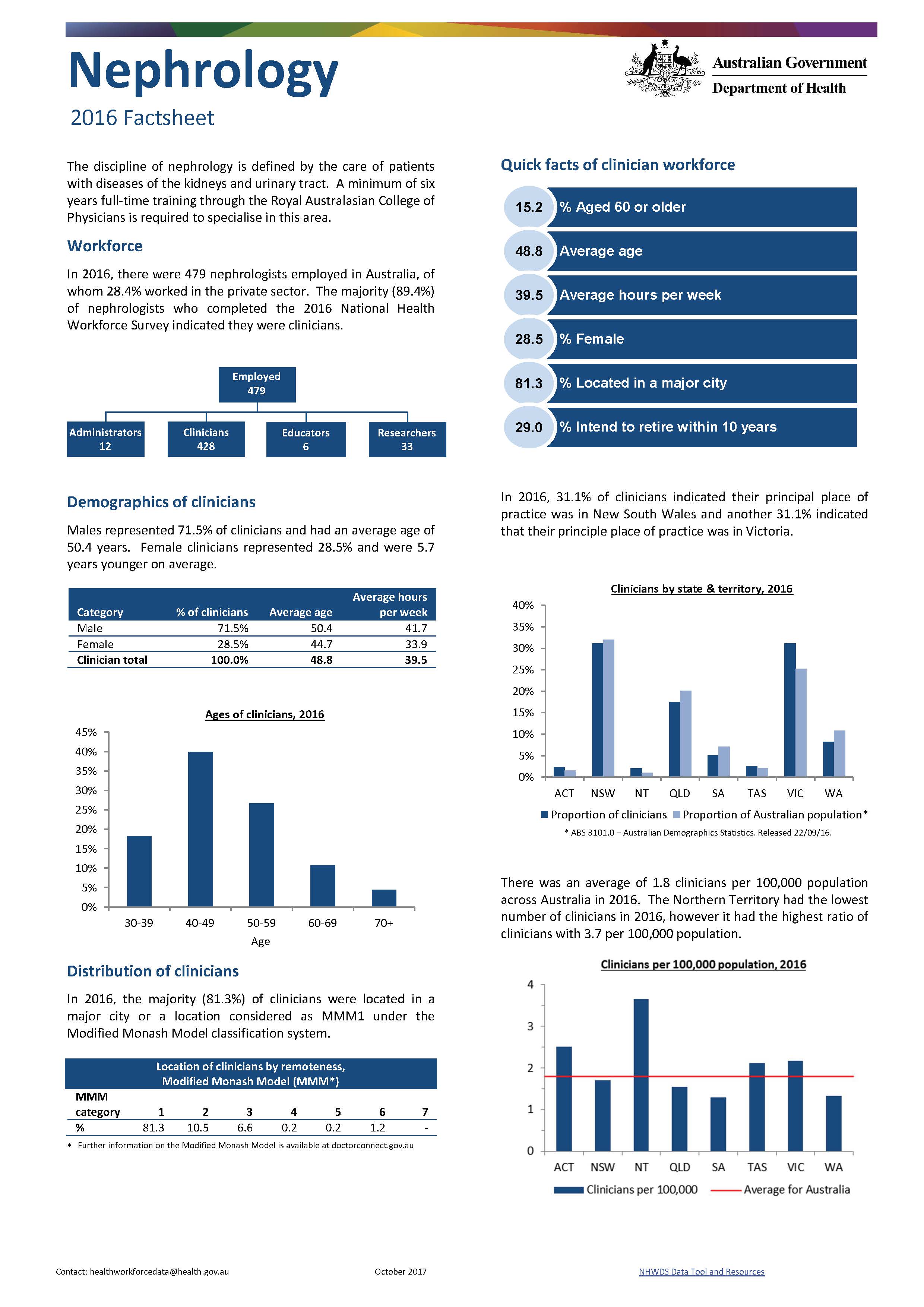
Nephrology workforce – MWRAC fact sheet
This Medical Workforce Reform Advisory Committee (MWRAC) fact sheet provides information on the demographics and distribution of the nephrology workforce. -
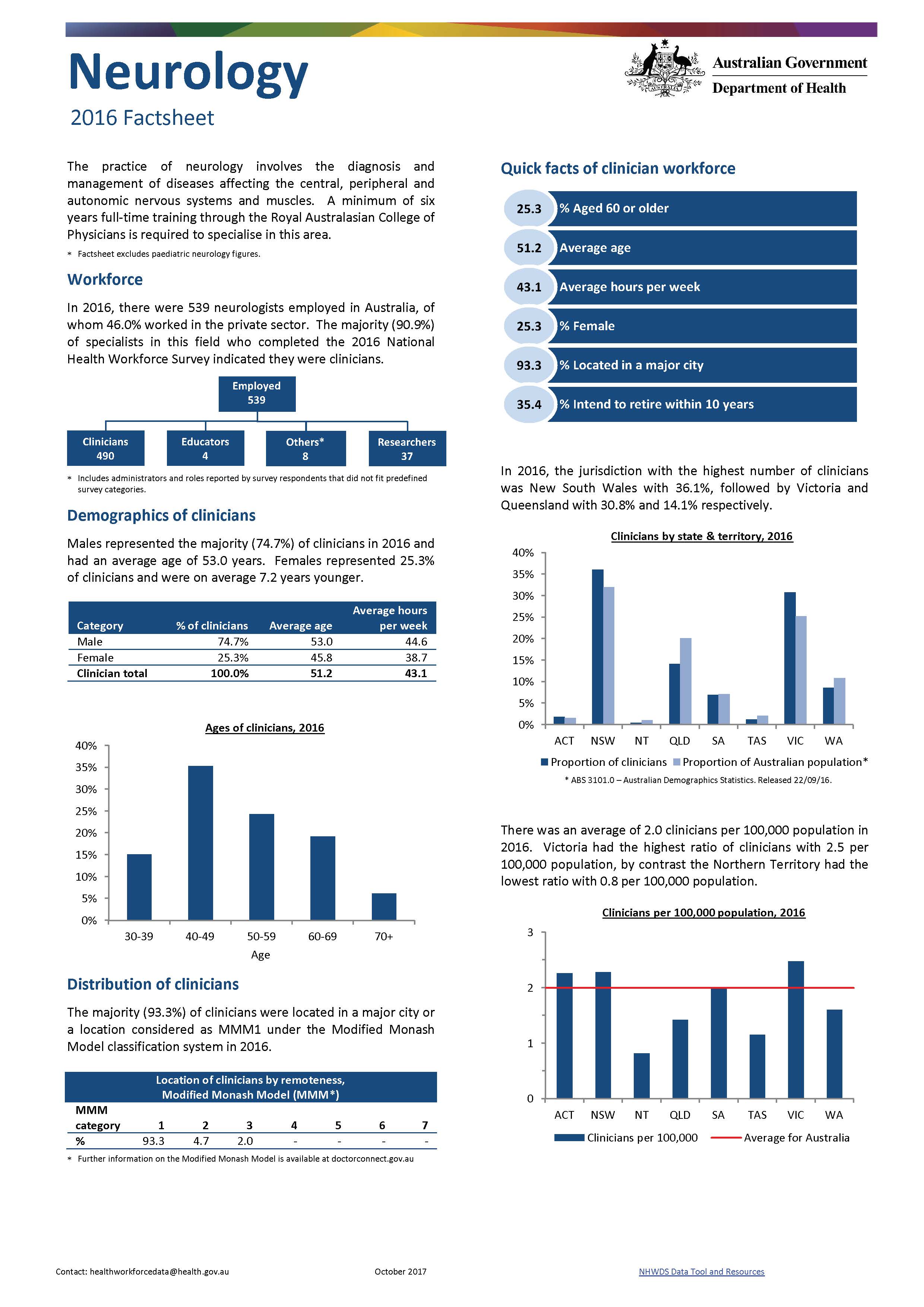
Neurology workforce – MWRAC fact sheet
This Medical Workforce Reform Advisory Committee (MWRAC) fact sheet provides information on the demographics and distribution of the neurology workforce. -
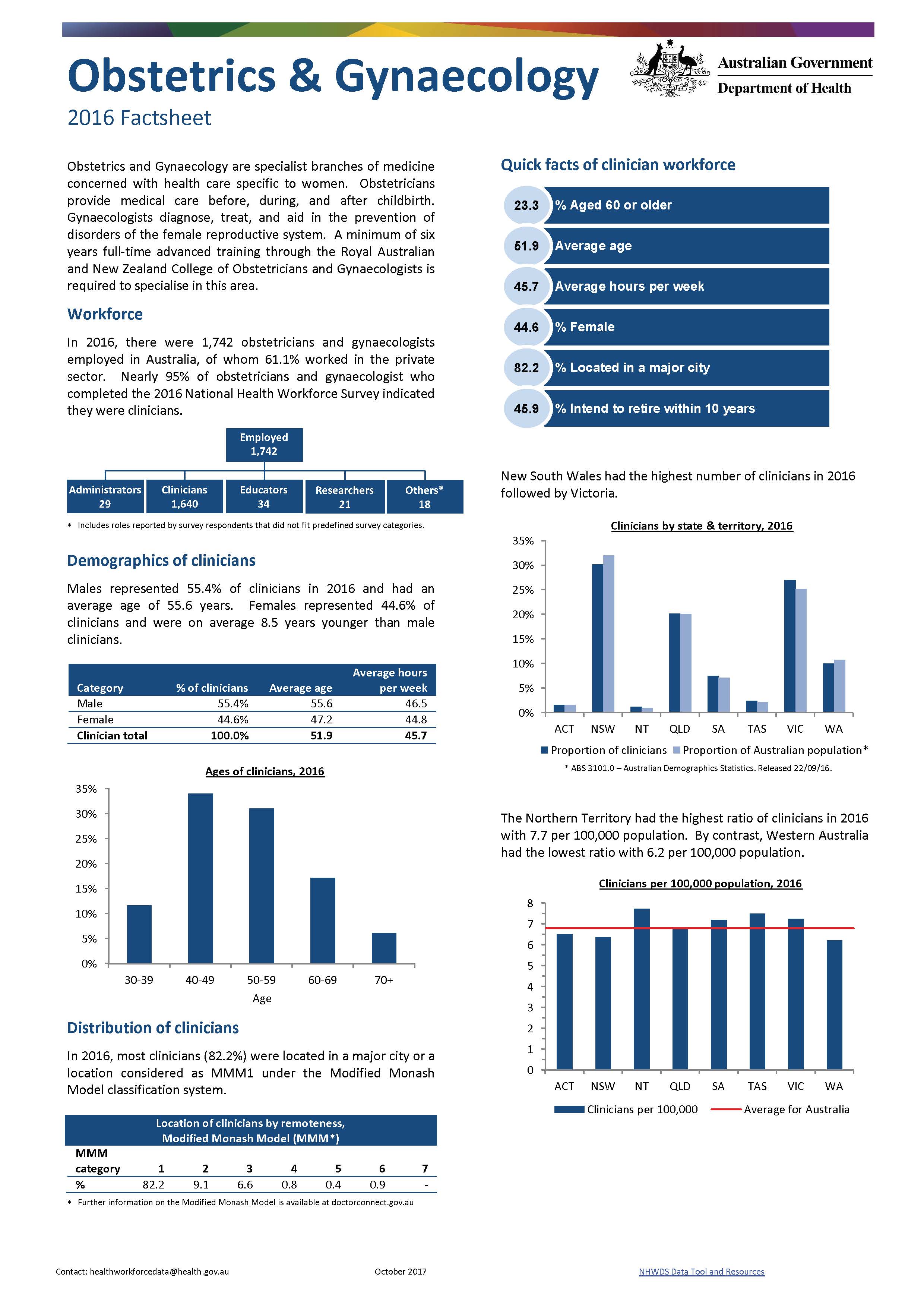
Obstetrics and gynaecology workforce – MWRAC fact sheet
This Medical Workforce Reform Advisory Committee (MWRAC) fact sheet provides information on the demographics and distribution of the obstetrics and gynaecology workforce. -
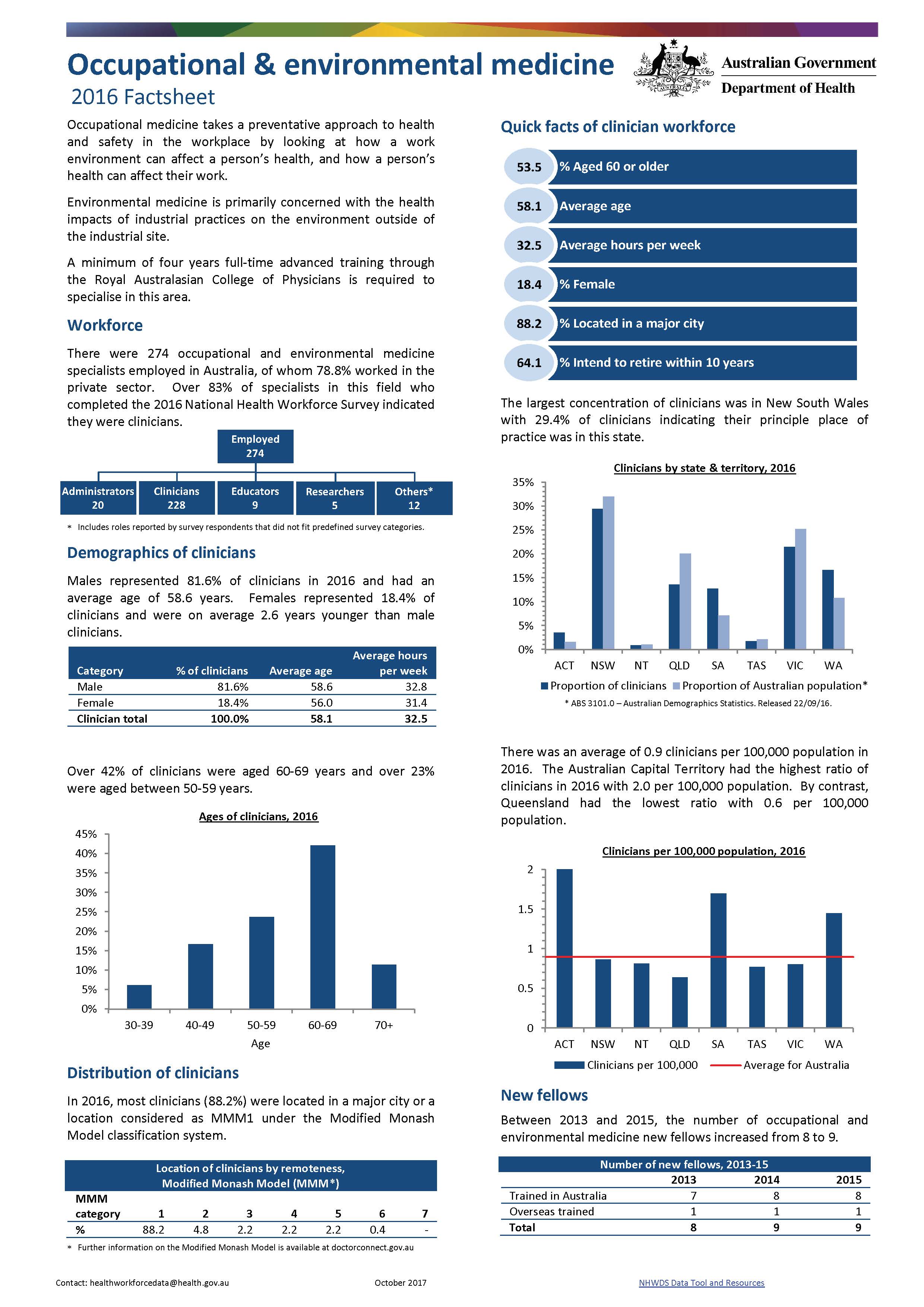
Occupational and environmental medicine workforce – MWRAC fact sheet
This Medical Workforce Reform Advisory Committee (MWRAC) fact sheet provides information on the demographics and distribution of the occupational and environmental medicine workforce. -
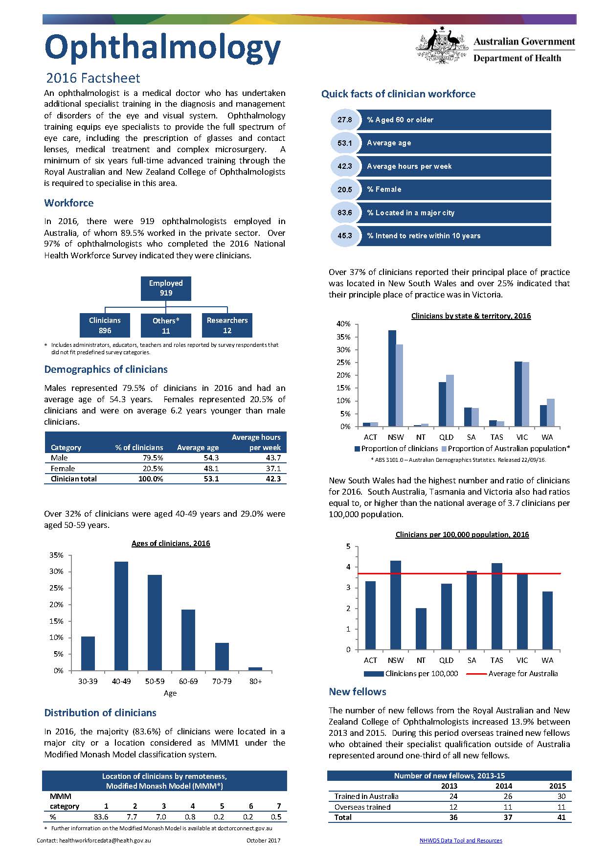
Ophthalmology workforce – MWRAC fact sheet
This Medical Workforce Reform Advisory Committee (MWRAC) fact sheet provides information on the demographics and distribution of the ophthalmology workforce. -
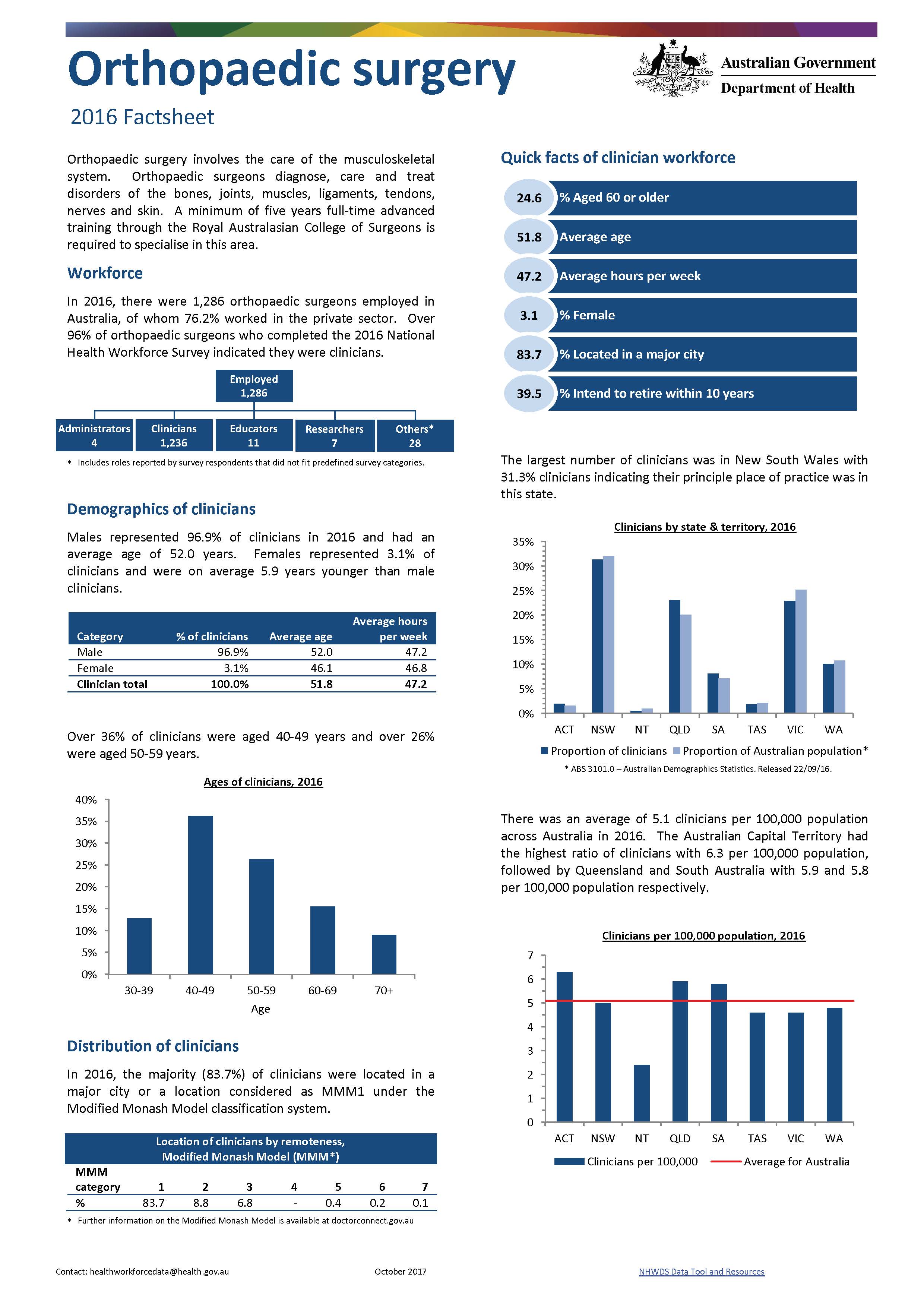
Orthopaedic surgery workforce – MWRAC fact sheet
This Medical Workforce Reform Advisory Committee (MWRAC) fact sheet provides information on the demographics and distribution of the orthopaedic surgery workforce. -
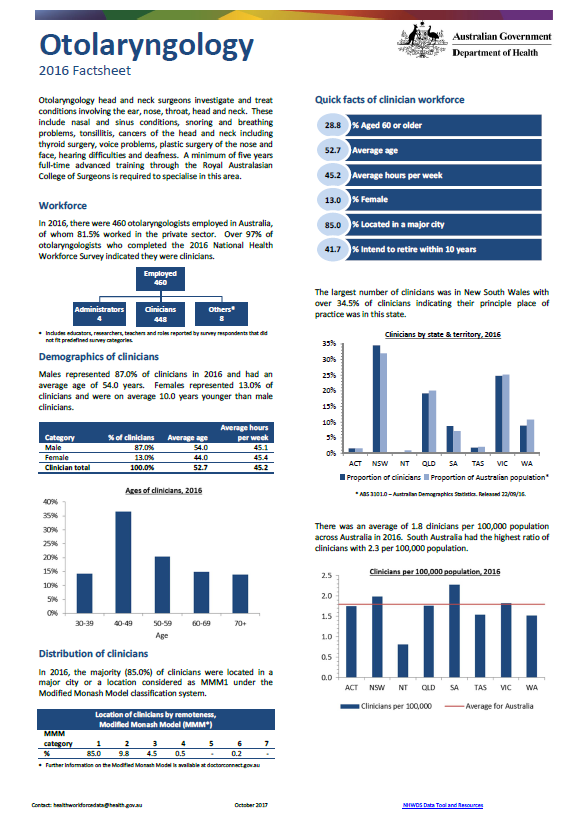
Otolaryngology workforce – MWRAC fact sheet
This Medical Workforce Reform Advisory Committee (MWRAC) fact sheet provides information on the demographics and distribution of the otolaryngology workforce. -
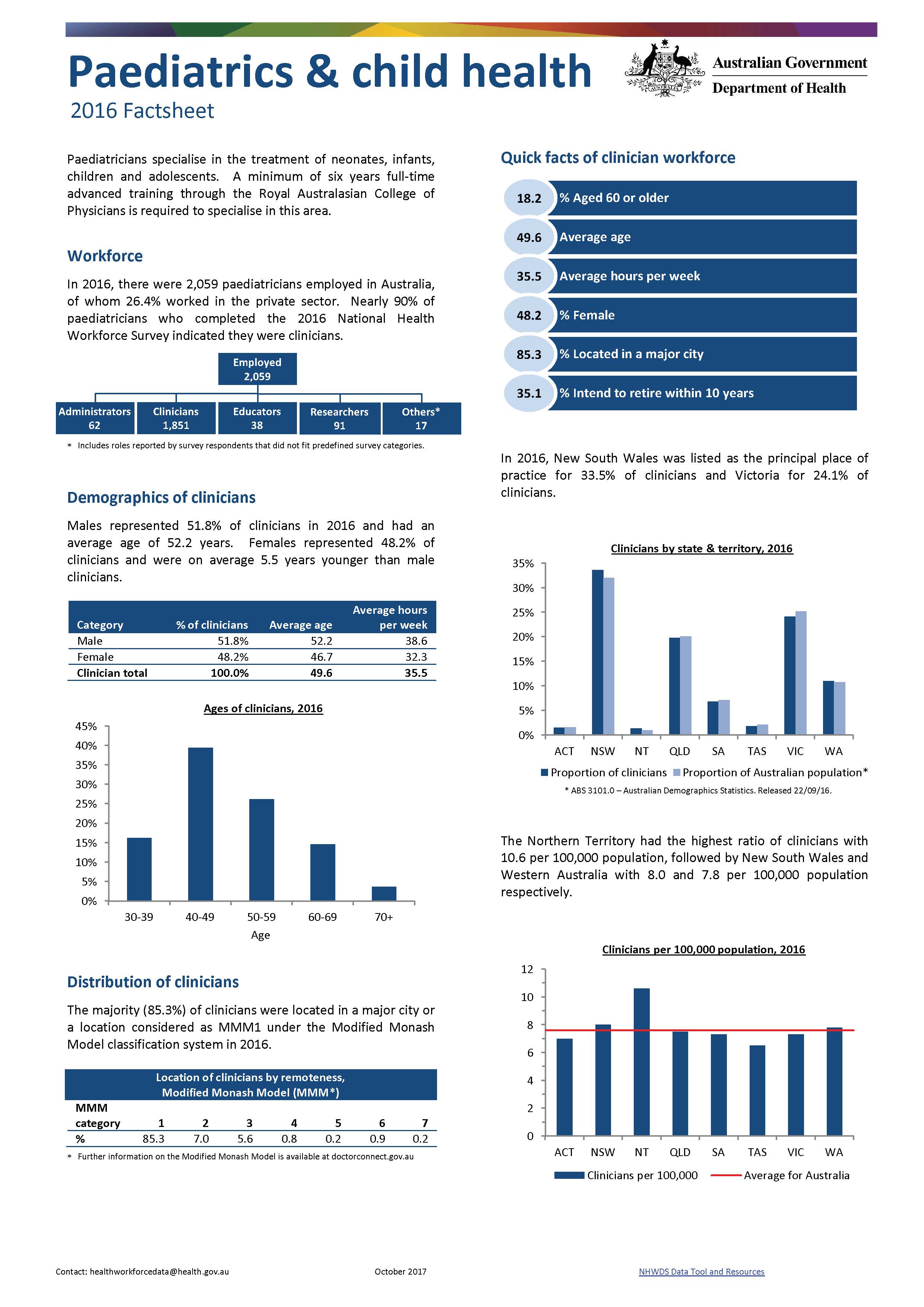
Paediatrics and child health workforce – MWRAC fact sheet
This Medical Workforce Reform Advisory Committee (MWRAC) fact sheet provides information on the demographics and distribution of the paediatrics and child health workforce. -
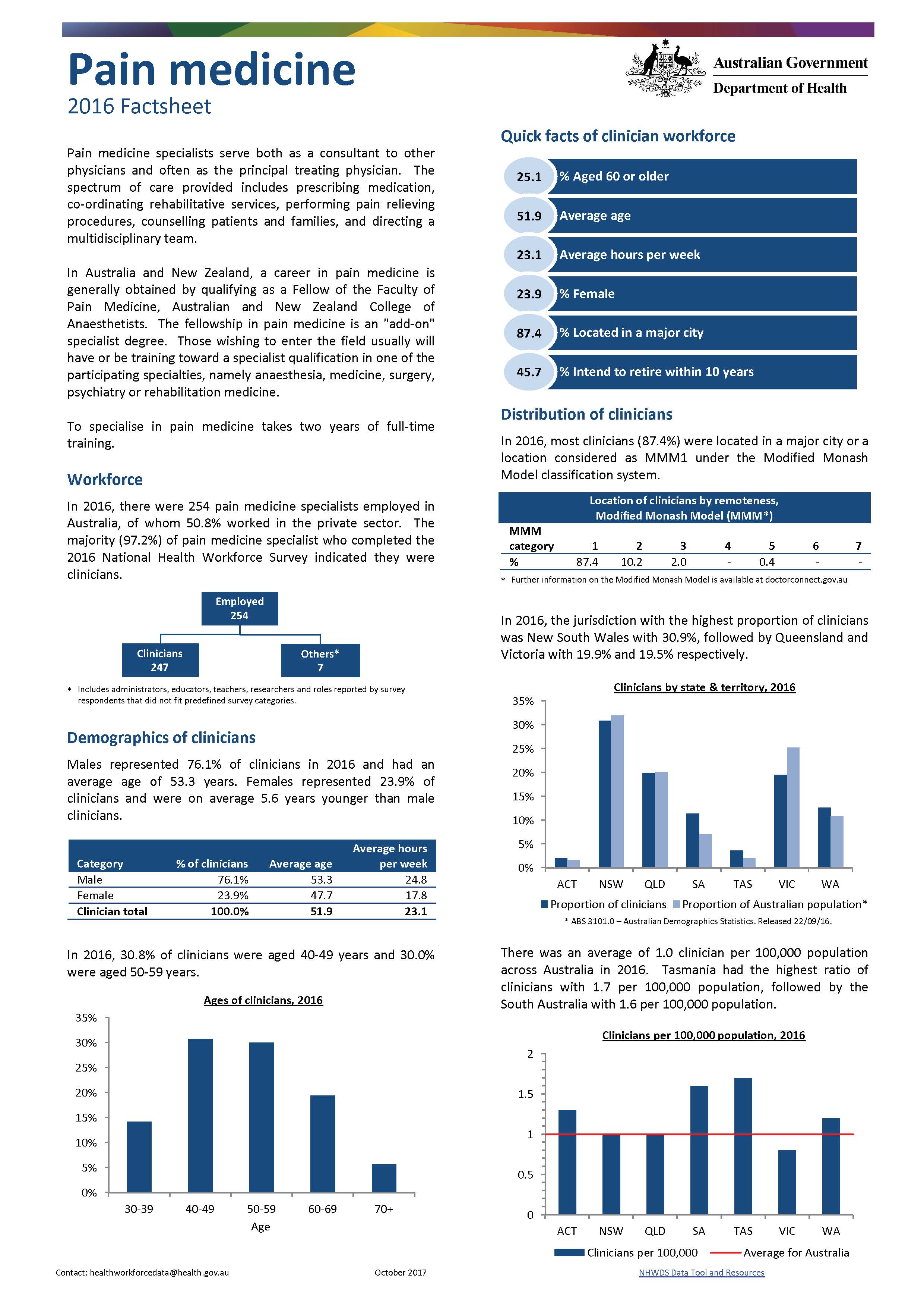
Pain medicine workforce – MWRAC fact sheet
This Medical Workforce Reform Advisory Committee (MWRAC) fact sheet provides information on the demographics and distribution of the pain medicine workforce. -
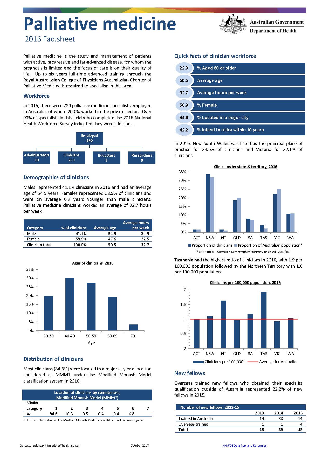
Palliative medicine workforce – MWRAC fact sheet
This Medical Workforce Reform Advisory Committee (MWRAC) fact sheet provides information on the demographics and distribution of the palliative medicine workforce. -
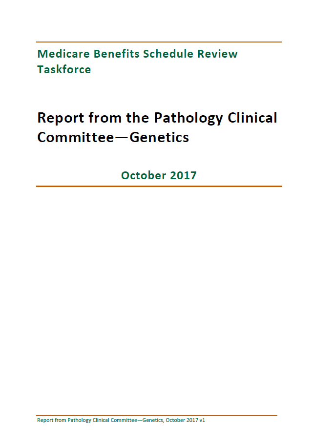
Final clinical committee report for Pathology – Genetics
This report contains the recommendations the Pathology Clinical Committee made to the MBS Review Taskforce about genetics, after public consultation. -
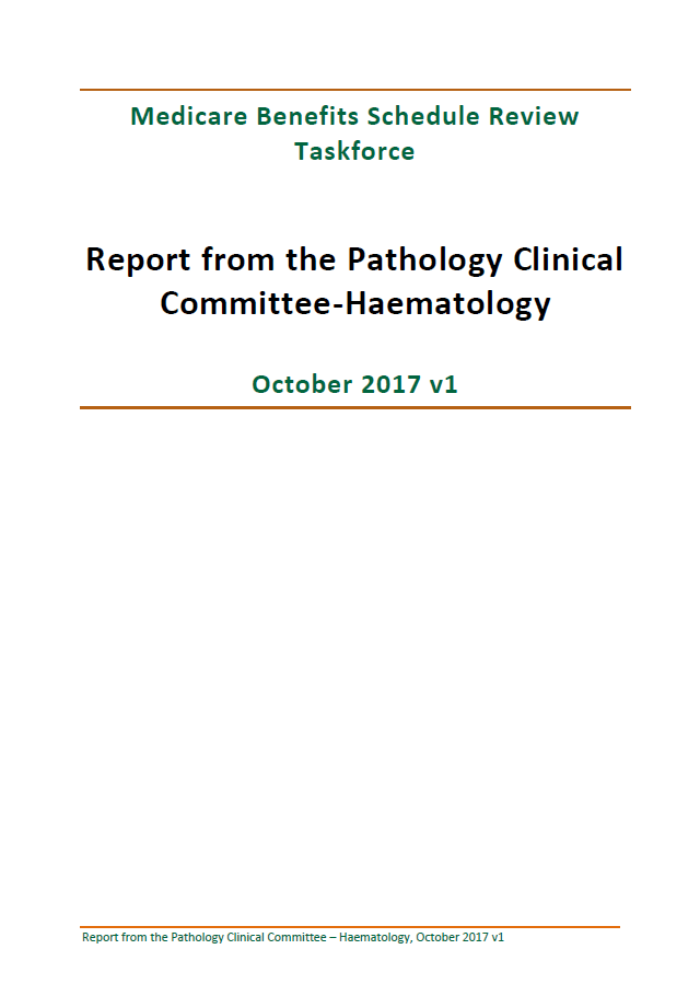
Final clinical committee report for Pathology – Haematology
This report contains the recommendations the Pathology Clinical Committee made to the MBS Review Taskforce about haematology, after public consultation. -
Final clinical committee report for Pathology – Microbiology
This report contains the recommendations the Pathology Clinical Committee made to the MBS Review Taskforce about microbiology, after public consultation. -

Community Service Obligation (CSO) for Pharmaceutical Wholesalers funding pool complaints procedures and form
This procedures outline the process to receive, consider and resolve a complaint for the Community Service Obligation (CSO) for Pharmaceutical Wholesalers funding pool. Use the form to lodge a complaint. -

Literature review of international biosimilar medicines update – June to August 2017
This reports updates a literature review that looked at international and Australian clinical, academic and policy journals, as well as media articles or sources in relation to biosimilar medicines, to help inform policy development and communication activities. It covers June to August 2017. -

National Drug Strategy 2017–2026
A 10-year framework that aims to reduce and prevent the harmful effects of alcohol, tobacco and other drugs. -
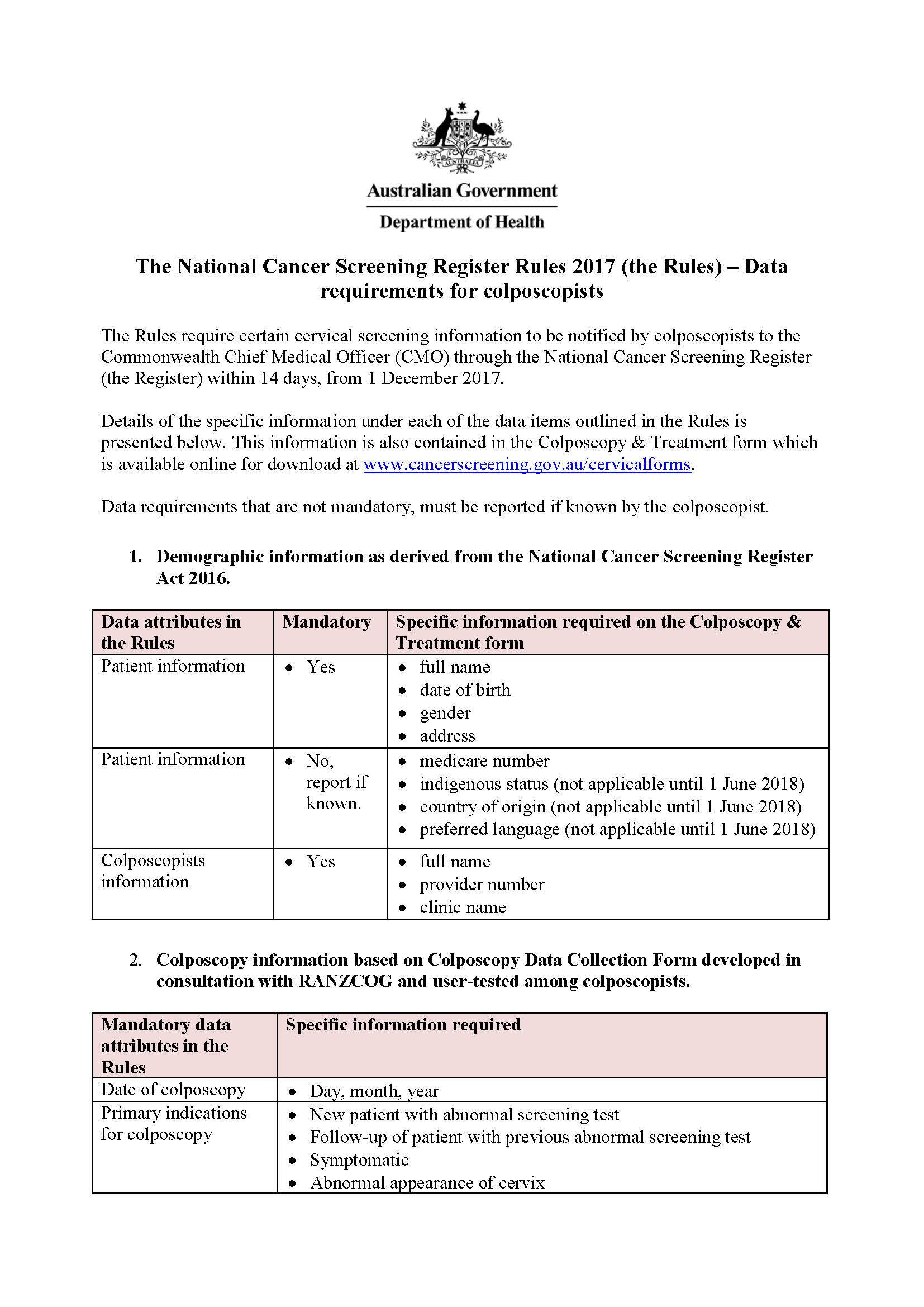
National Cervical Screening Program – data requirements for colposcopists
Find out what information colposcopists need to notify to the National Cancer Screening Register about cervical screening tests.