Filter results
You can narrow down the results using the filters
Audience
Topics
Our work
Diseases
11383 results
-
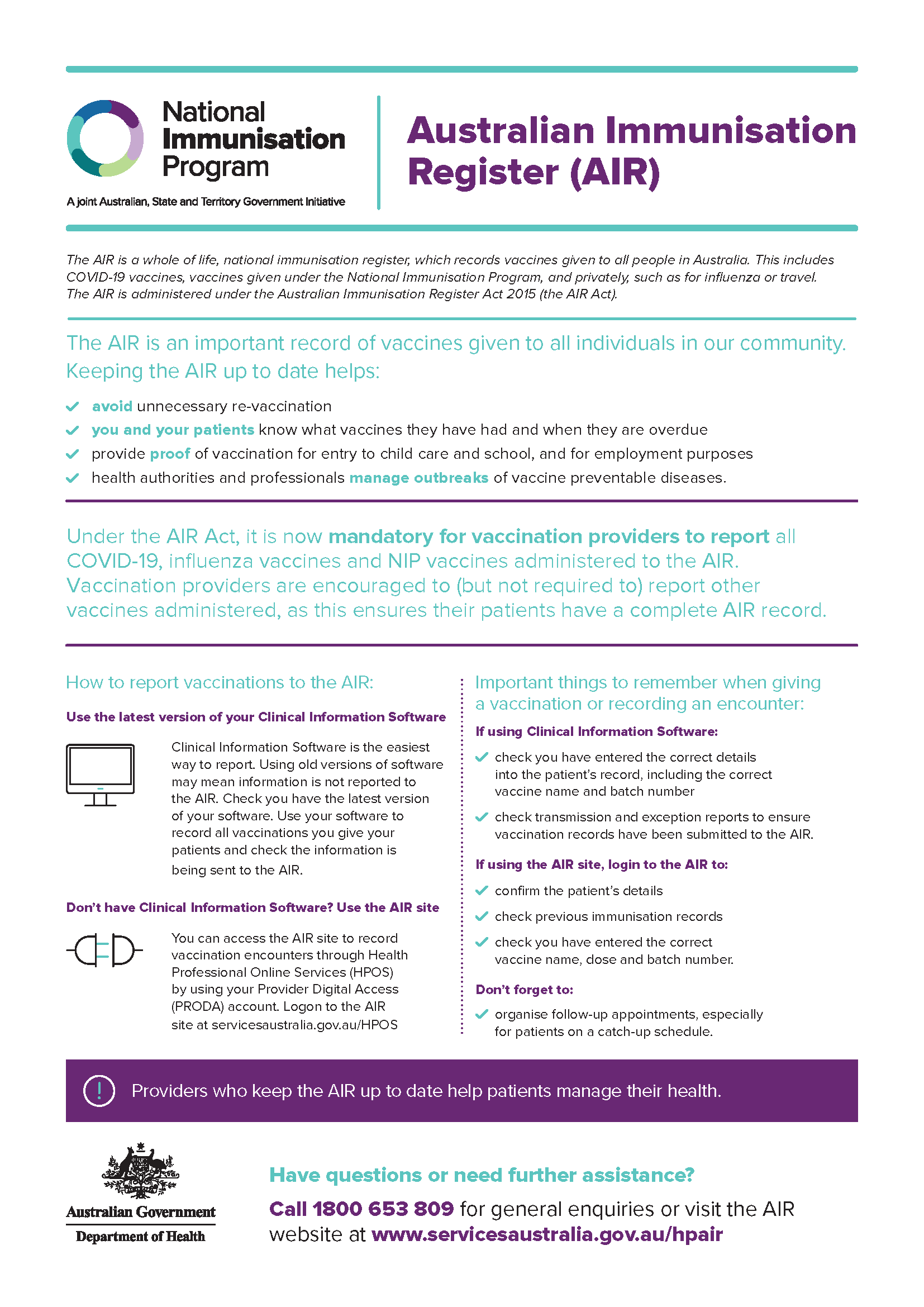
Australian Immunisation Register fact sheet
This fact sheet provides information about reporting vaccinations to the Australian Immunisation Register. -

Caring for your mob at the end of their life
This brochure is to help Aboriginal and Torres Strait Islander people plan end-of-life care for their loved ones. -
Annual report 2017 – National Rural Health Commissioner
This annual report covers the commissioner’s activities from 11 November 2017 to 31 December 2017. -
Revised use of human papillomavirus (HPV) vaccines – January 2018
This document outlines changes to the recommended use of human papillomavirus (HPV) vaccines in The Australian Immunisation Handbook 10th Edition proposed in 2017. It includes the outcome of public consultations and the final recommendation made to the National Health and Medical Research Council. -
Proposed changes to the infant pneumococcal vaccination schedule – November 2017
This document outlines changes to the infant pneumococcal vaccination schedule that were proposed in 2017. It includes the outcome of public consultations and the final recommendation made to the National Health and Medical Research Council. -
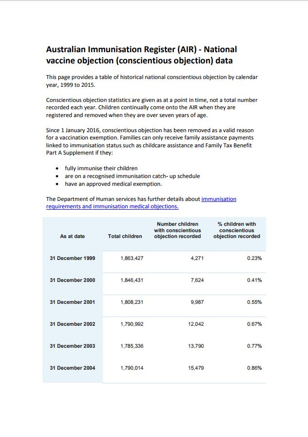
National vaccine objection (conscientious objection) data 1999 to 2015
This document provides national conscientious objection yearly, from 1999 to 2015. Conscientious objection statistics are given as at a point in time, not a total number recorded each year. Only historical conscientious objection data is published on this page. -
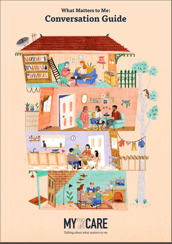
What matters to me: conversation guide
This brochure provides you with ideas on how to start the conversation about your end-of-life care. -
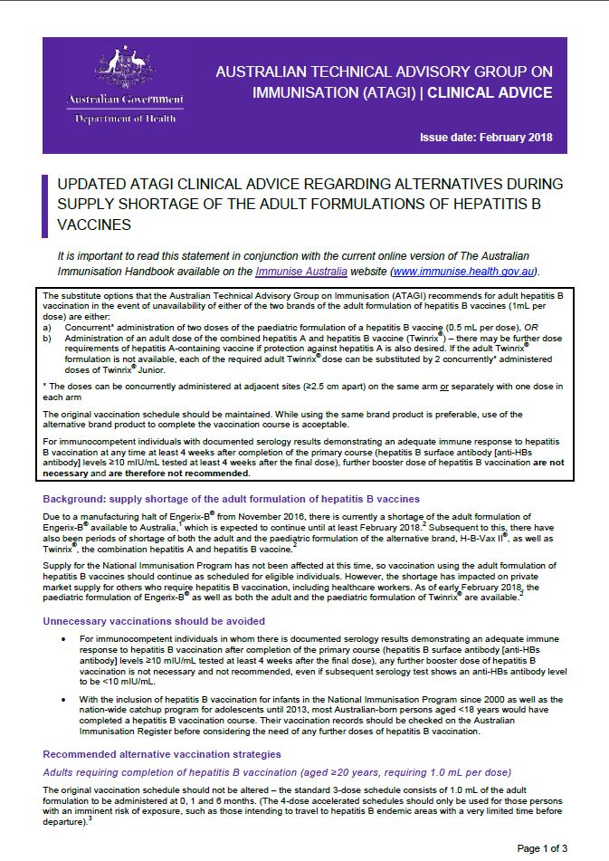
ATAGI advice (updated): alternatives during supply shortage of adult hepatitis B vaccines
This resource provides Australian Technical Advisory Group on Immunisation (ATAGI) clinical advice regarding the use of alternative vaccines during periods when adult formulations of hepatitis B vaccines are not available.
-
Australian Government response to the Senate inquiry into the supply of Pharmaceutical Benefits Scheme (PBS) Medicines to Remote Area Aboriginal Health Services
This document contains the Australian Government’s response to the Senate Community Affairs References Committee Report from its inquiry into the s100 Pharmaceutical Benefits Scheme (PBS) Remote Area Aboriginal Health Services Program. -
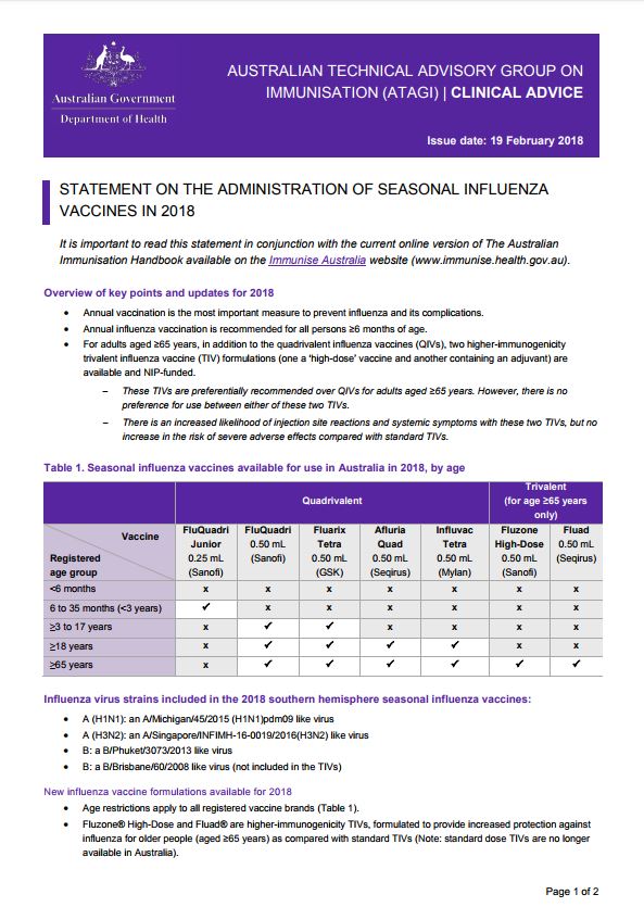
ATAGI advice on seasonal influenza vaccines in 2018
This resource provides advice for immunisation providers regarding the administration of 2018 seasonal influenza vaccines. -
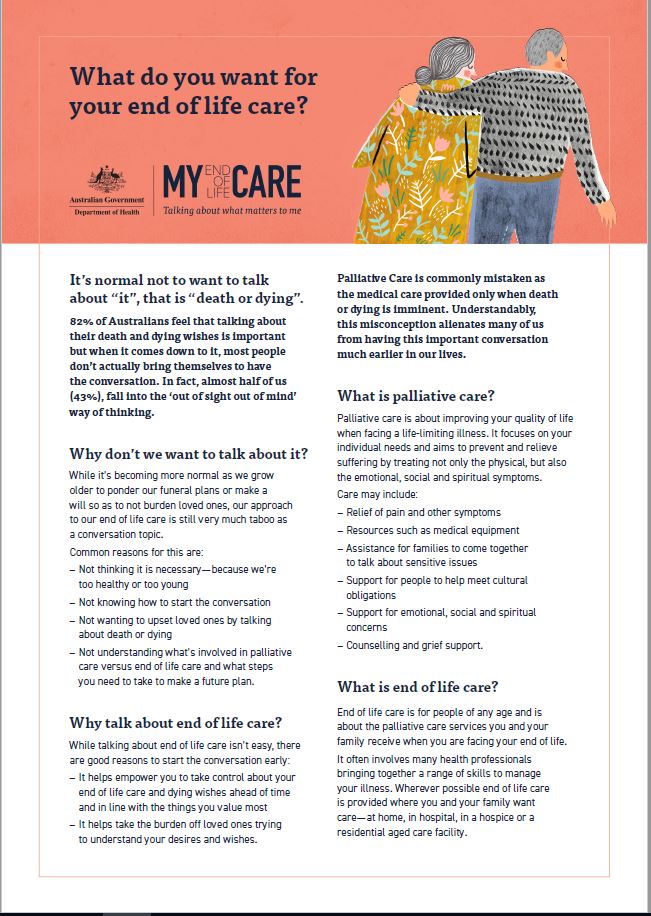
What do you want for your end of life care?
This brochure is designed to help people plan end-of-life. -
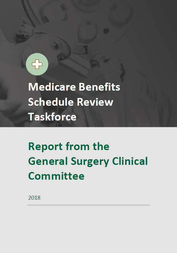
Final clinical committee report for General Surgery
This report contains the recommendations the General Surgery Clinical Committee made to the MBS Review Taskforce, after public consultation. -
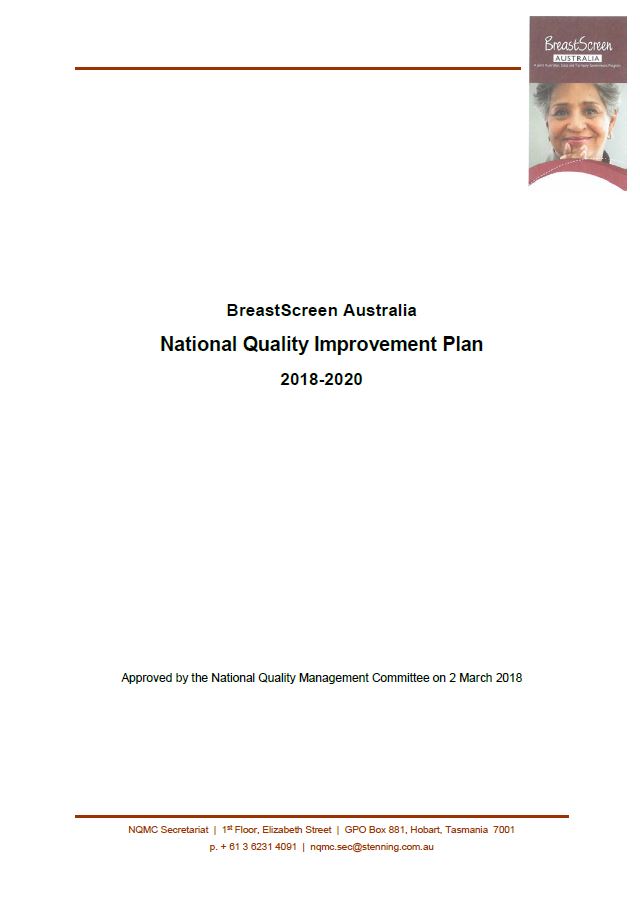
BreastScreen Australia – National Quality Improvement Plan 2018–2020
This National Quality Improvement Plan (NQIP) developed by the National Quality Management Committee helps BreastScreen Australia improve the quality of services. -
Australian Government response – Provision of services under the NDIS for people with psychosocial disabilities related to a mental health condition
The Australian Government response to the Joint Standing Committee on the NDIS Inquiry into the provision of services under the NDIS for people with psychosocial disabilities related to a mental health condition was tabled in the Senate on the 2 March 2018. -
Australian Government response to the Joint Standing Committee – Provision of hearing services under the National Disability Insurance Scheme
The Australian Government welcomes the Joint Standing Committee on the National Disability Insurance Scheme (the Committee) interim report, Provision of hearing services under the National Disability Insurance Scheme (NDIS), September 2017 (interim report) -
Australian Government response to the Senate Community Affairs References Committee Report
On 29 November 2016, the Senate referred the following matter to the Senate Community Affairs References Committee for Inquiry and report: The delivery of outcomes under the National Disability Strategy 2010–2020 to build inclusive and accessible communities. -
Management of women with atypical ductal hyperplasia (ADH) diagnosed on needle core biopsy of a screen-detected breast lesion
Women with ADH are at increased risk of invasive breast cancer. This clinical advice from the BreastScreen Australia outlines recommended best practice on this issue. -
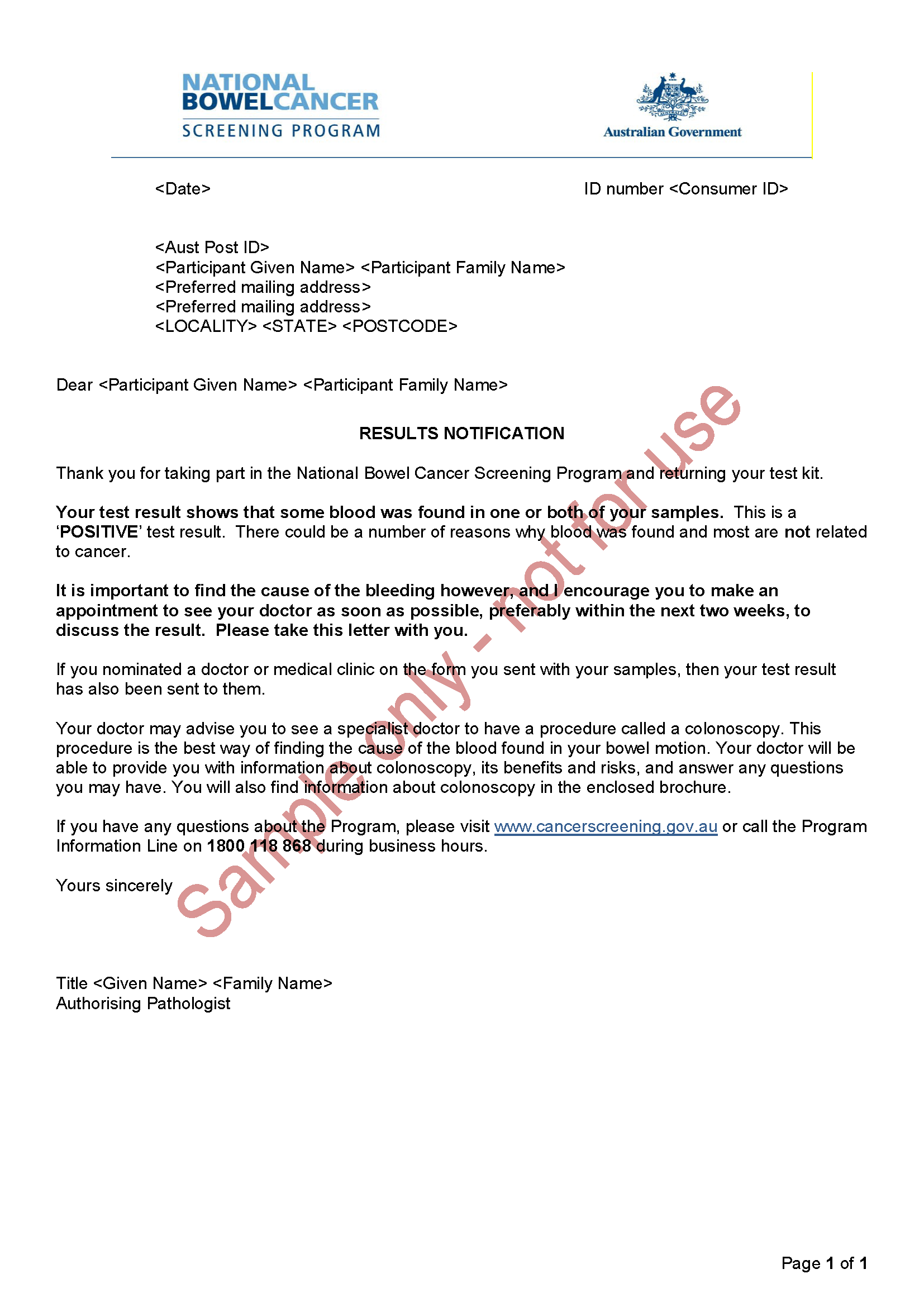
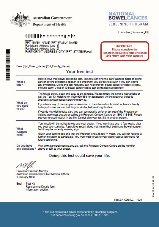
National Bowel Cancer Screening Program – Results notification letter – Positive
This is an example of the letter sent to people who have done the National Bowel Cancer Screening Program test to tell them their test was positive and what they need to do next. -
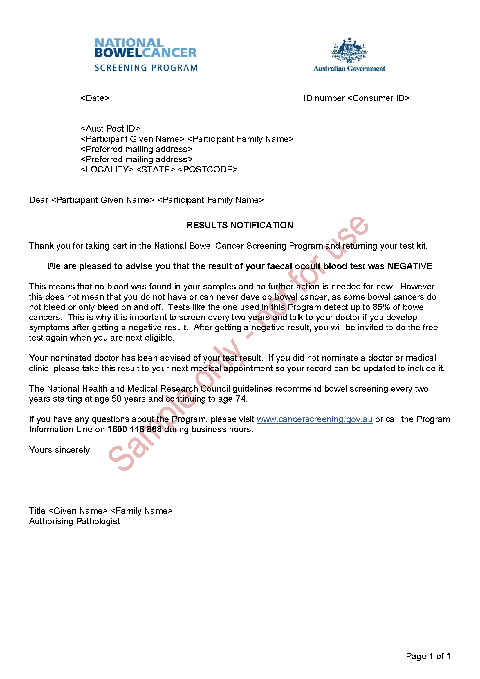
National Bowel Cancer Screening Program – Results notification letter – Negative
This is an example of the letter sent to people who have done the National Bowel Cancer Screening Program test to tell them their test was negative. -
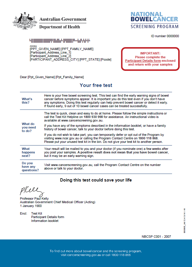
National Bowel Cancer Screening Program – Invitation letter
People aged 50 to 74 will receive this letter in the mail, along with a bowel cancer screening test kit. This is part of the National Bowel Cancer Screening Program. -
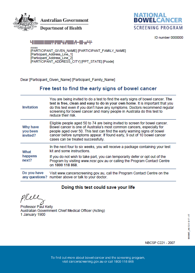
National Bowel Cancer Screening Program – Pre-invite letter
This letter tells people about the National Bowel Cancer Screening Program and encourages them to participate. -
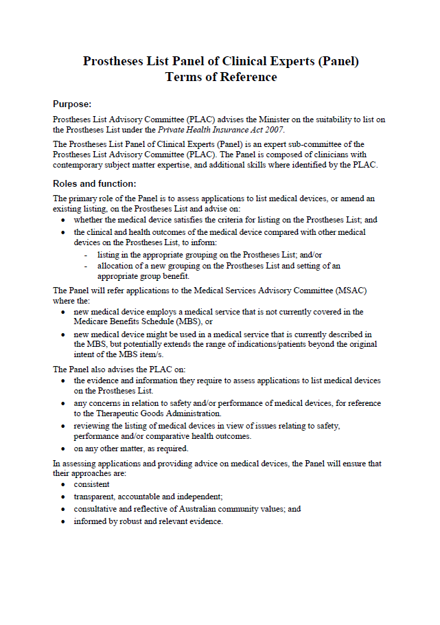
Panel of Clinical Experts Terms of Reference
This document sets out the purpose, roles, function and membership of the Panel of Clinical Experts. -
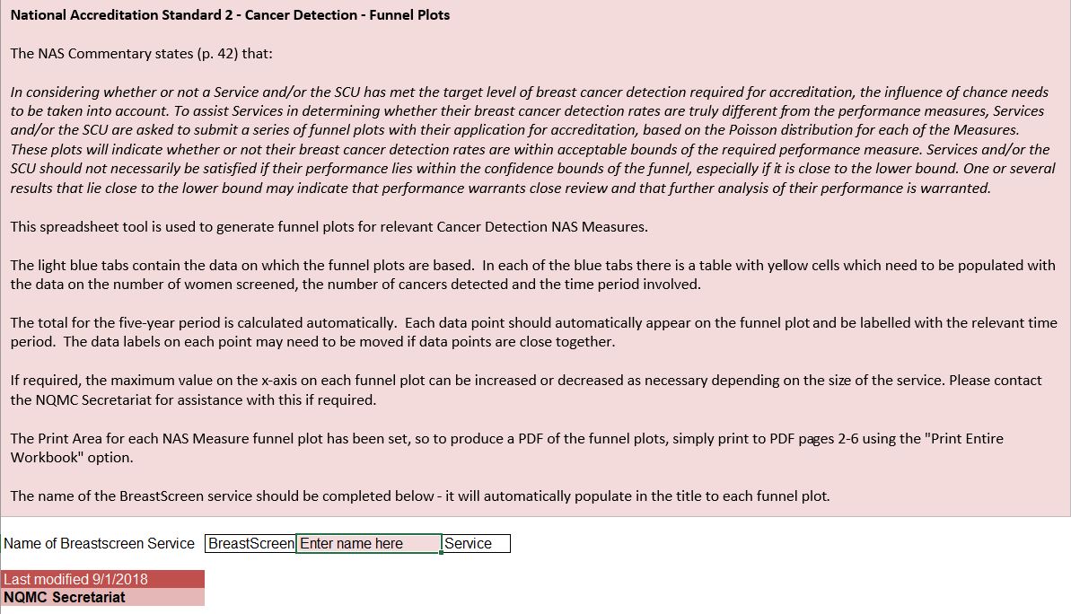
Funnel plot templates
These spreadsheet tools are used to generate funnel plots for relevant cancer detection NAS measures. They are part of the accreditation process for BreastScreen Australia Program services. -
National Bowel Cancer Screening Program – Invitation letter for 73 to 74 year olds
People aged 73 to 74 will receive this letter in the mail, along with their final bowel cancer screening test kit. This is part of the National Bowel Cancer Screening Program. -
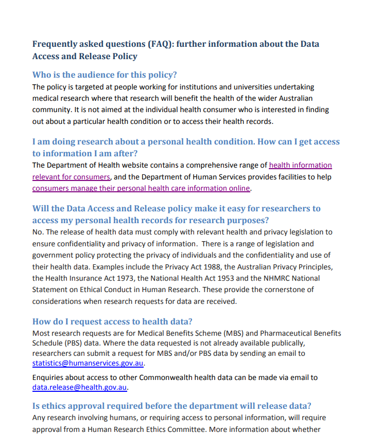
Data access and release policy
The information on this page provides researchers with an awareness and understanding of the Department of Health’s data access and release policy.