Filter results
You can narrow down the results using the filters
Audience
Publication type
Topics
Our work
Diseases
9570 results
-
National Immunisation Research — Qualitative (2016) and quantitative (2017) research reports
Research reports on qualitative and quantitative research conducted on attitudes and behaviours regarding childhood and adult immunisation. -
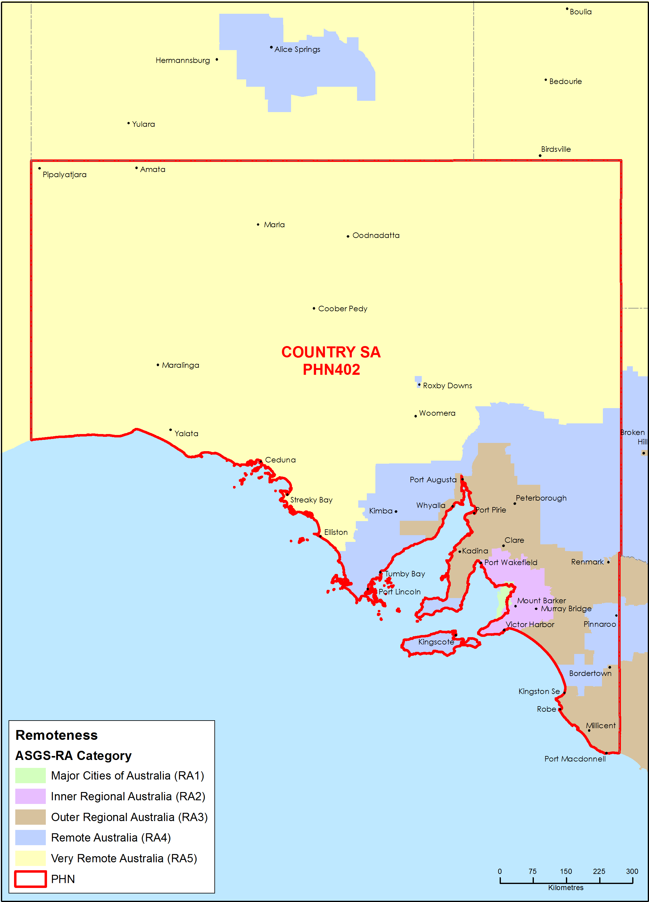
Country South Australia Primary Health Network (PHN) map – Australian Statistical Geography Standard (ASGS) remoteness area
This map shows the Australian Statistical Geography Standard remoteness area classifications within the Country South Australia Primary Health Network. -
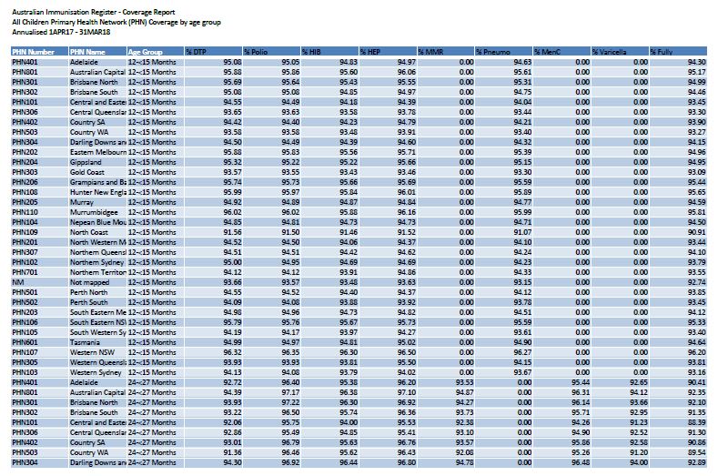
2018 PHN childhood immunisation coverage data
These spreadsheets provide 2018 childhood immunisation coverage data by Primary Health Network (PHN), for all children and Aboriginal and Torres Strait Islander children. -
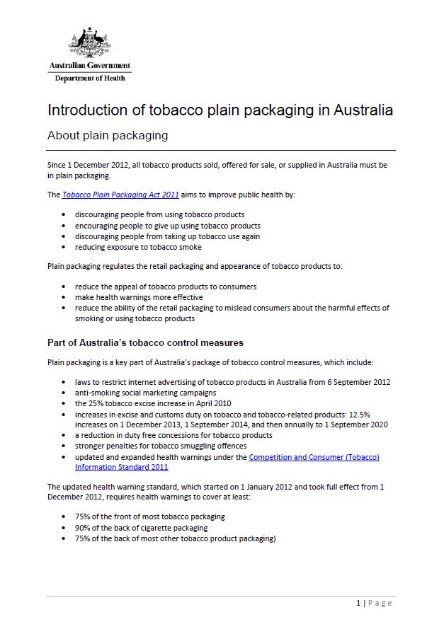
Introduction of tobacco plain packaging in Australia
Find out how plain packaging of tobacco products was introduced in Australia in 2012. -
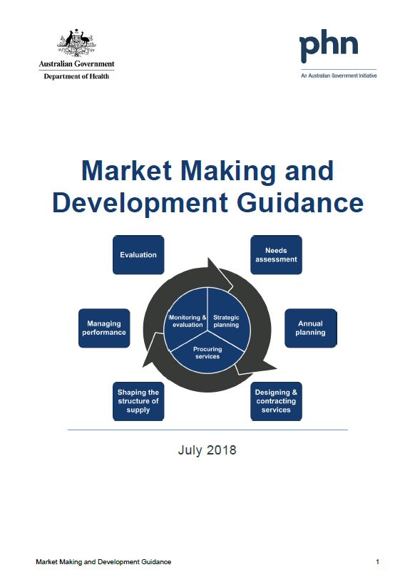
Primary Health Networks (PHNs) market making and development guidance and toolkit
This guidance and toolkit help Primary Health Networks (PHNs) understand, influence, support, develop and work collaboratively with their service provider markets. -
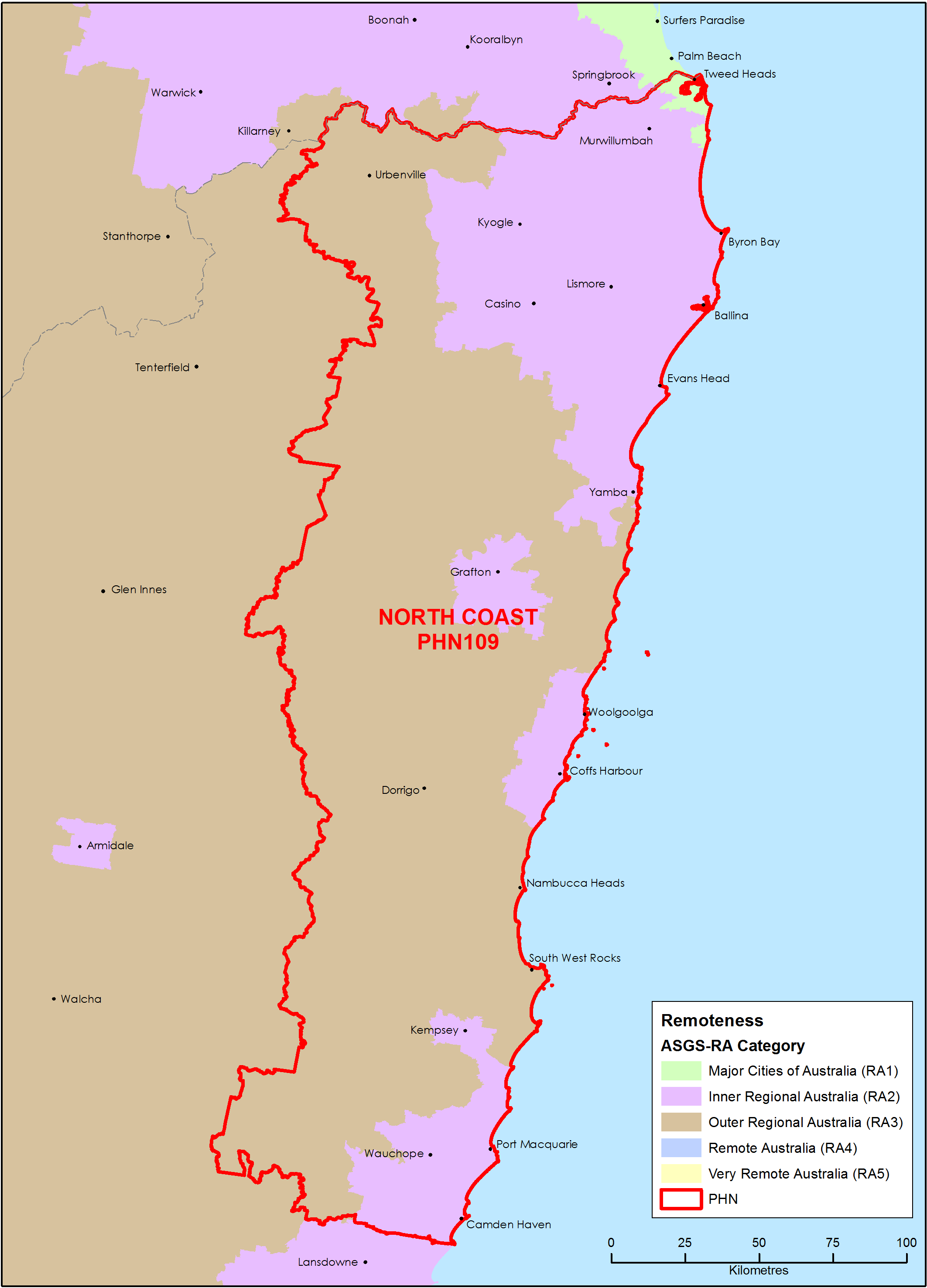
North Coast (NSW) Primary Health Network (PHN) map – Australian Statistical Geography Standard (ASGS) remoteness area
This map shows the Australian Statistical Geography Standard remoteness area classifications within the North Coast (NSW) Primary Health Network. -
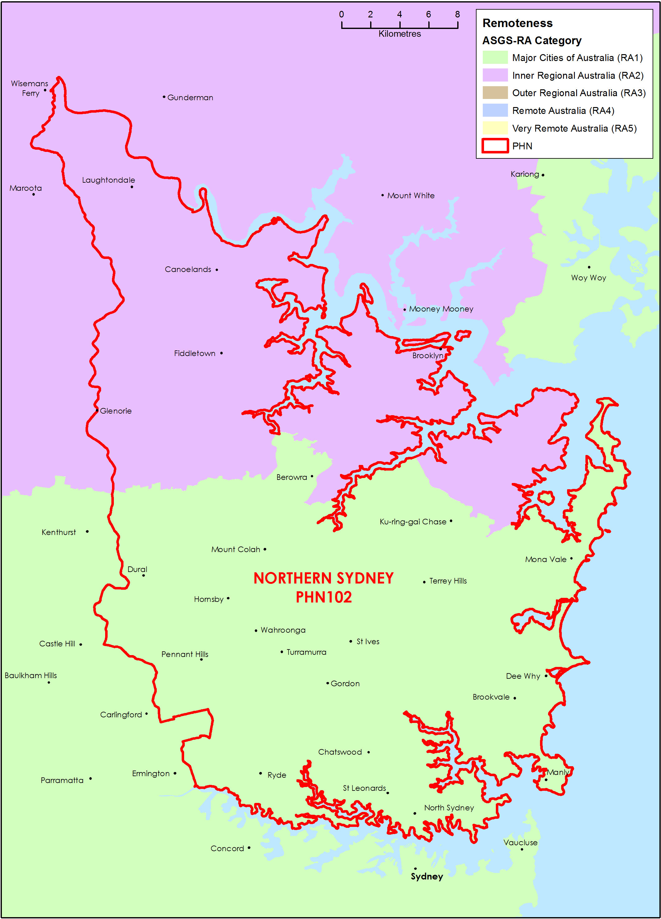
Northern Sydney (NSW) Primary Health Network (PHN) map – Australian Statistical Geography Standard (ASGS) remoteness area
This map shows the Australian Statistical Geography Standard remoteness area classifications within the Northern Sydney (NSW) Primary Health Network. -
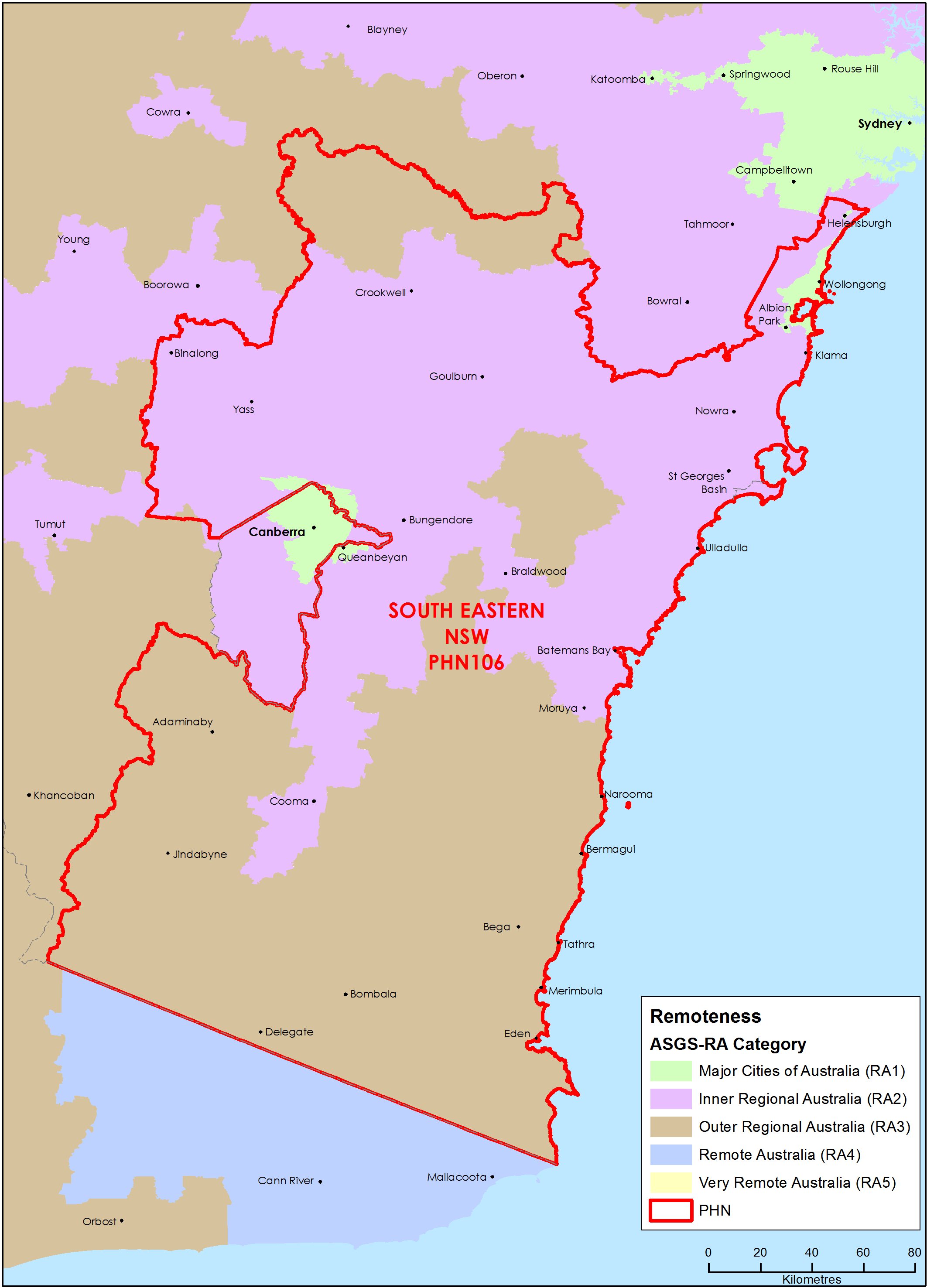
South Eastern New South Wales Primary Health Network (PHN) map – Australian Statistical Geography Standard (ASGS) remoteness area
This map shows the Australian Statistical Geography Standard remoteness area classifications within the South Eastern New South Wales Primary Health Network. -
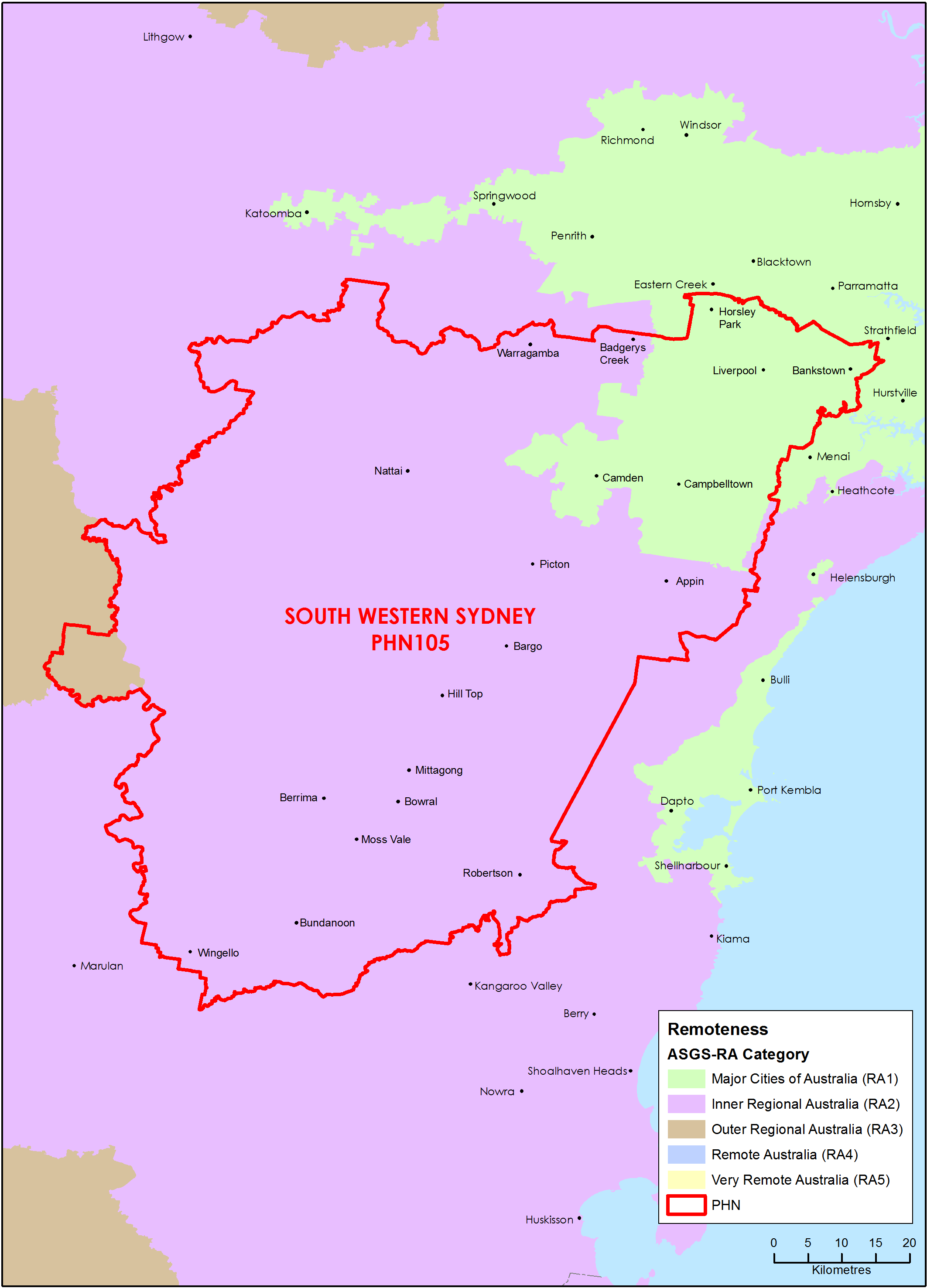
South Western Sydney (NSW) Primary Health Network (PHN) map – Australian Statistical Geography Standard (ASGS) remoteness area
This map shows the Australian Statistical Geography Standard remoteness area classifications within the South Western Sydney (NSW) Primary Health Network. -
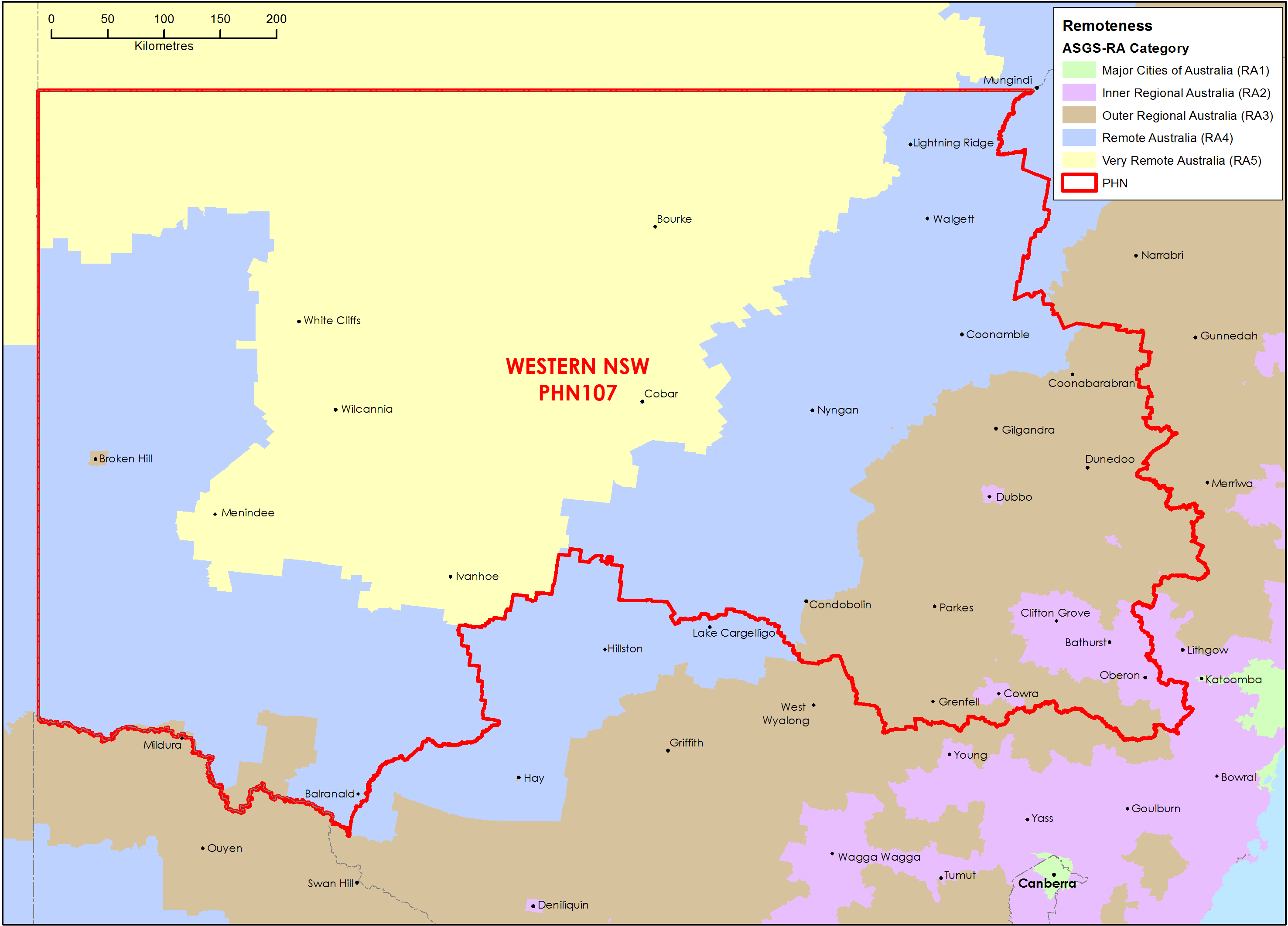
Western New South Wales Primary Health Network (PHN) map – Australian Statistical Geography Standard (ASGS) remoteness area
This map shows the Australian Statistical Geography Standard remoteness area classifications within the Western New South Wales Primary Health Network. -
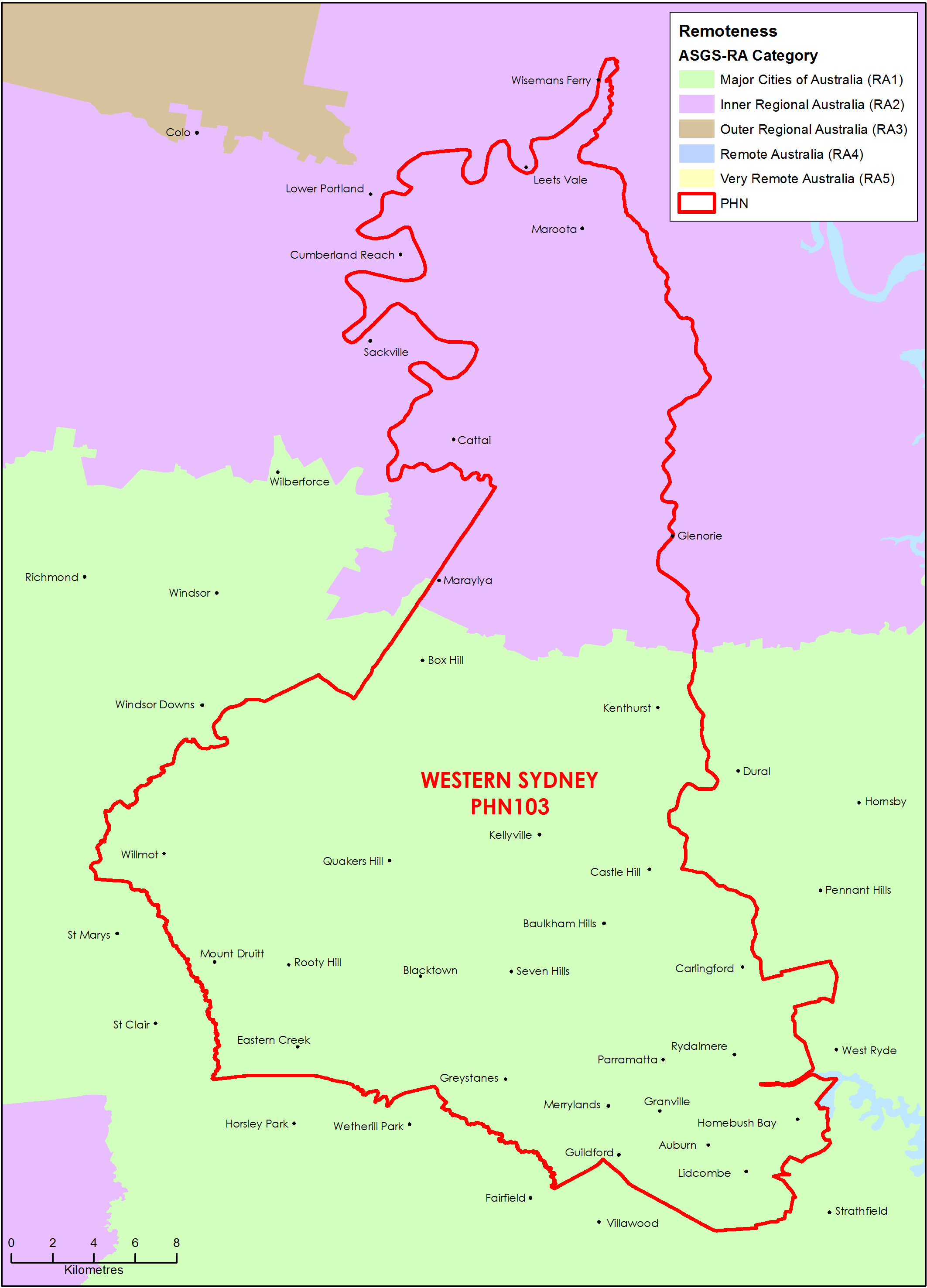
Western Sydney (NSW) Primary Health Network (PHN) map – Australian Statistical Geography Standard (ASGS) remoteness area
This map shows the Australian Statistical Geography Standard remoteness area classifications within the Western Sydney (NSW) Primary Health Network. -
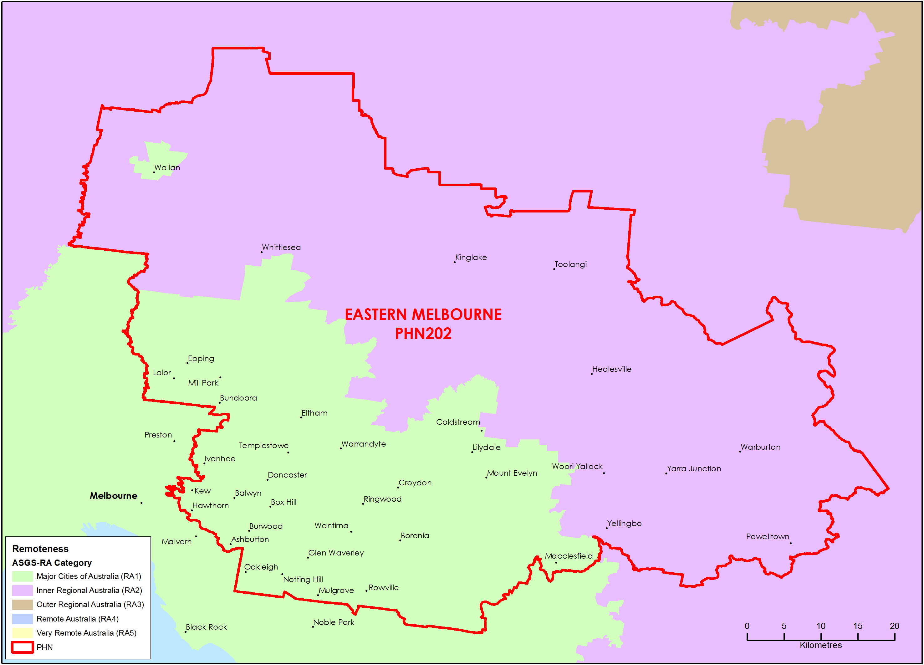
Eastern Melbourne (Vic) Primary Health Network (PHN) map – Australian Statistical Geography Standard (ASGS) remoteness area
This map shows the Australian Statistical Geography Standard remoteness area classifications within the Eastern Melbourne (Vic) Primary Health Network. -
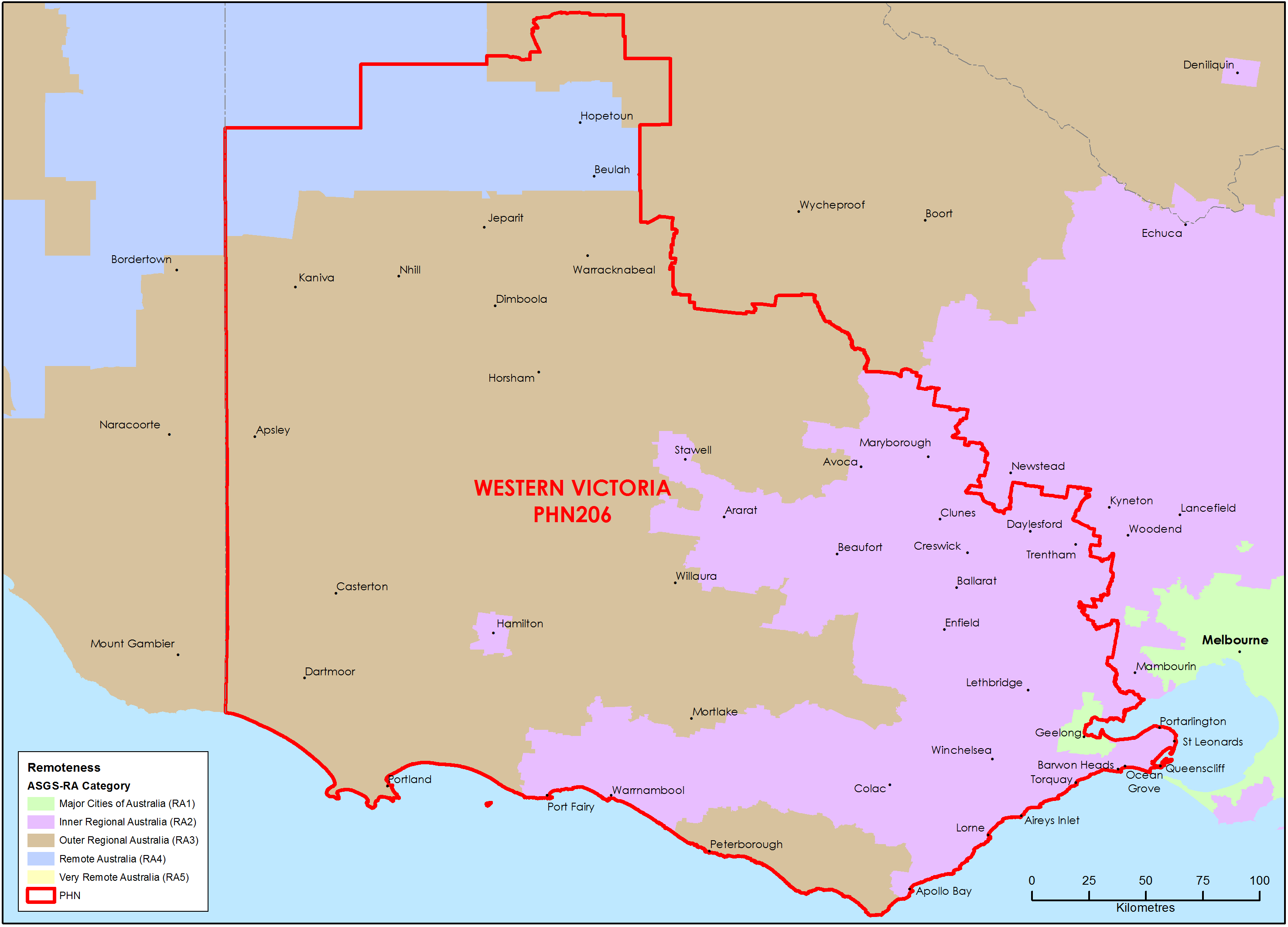
Western Victoria Primary Health Network (PHN) map – Australian Statistical Geography Standard (ASGS) remoteness area
This map shows the Australian Statistical Geography Standard remoteness area classifications within the Western Victoria Primary Health Network. -
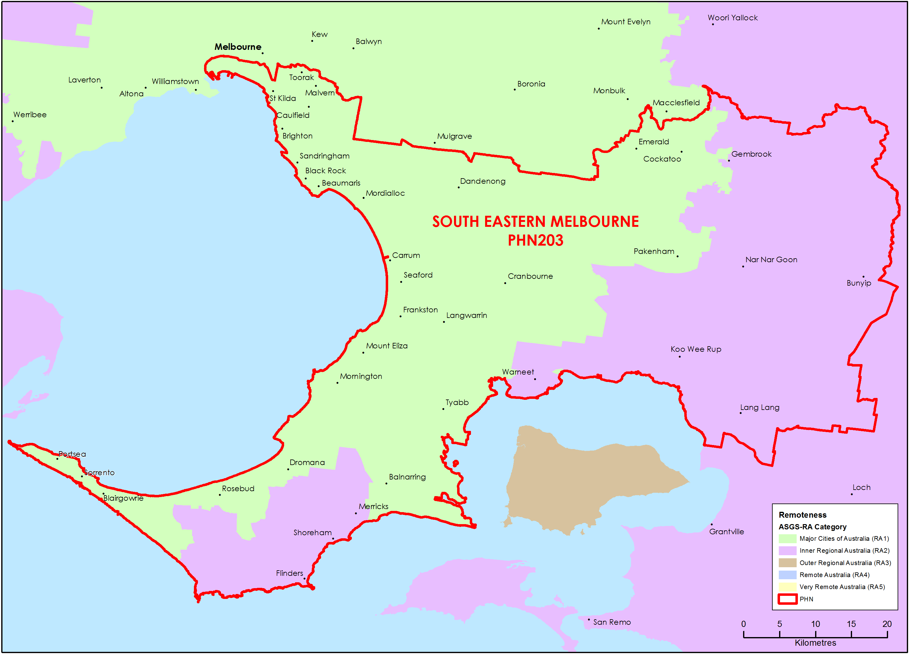
South Eastern Melbourne (Vic) Primary Health Network (PHN) map – Australian Statistical Geography Standard (ASGS) remoteness area
This map shows the Australian Statistical Geography Standard remoteness area classifications within the South Eastern Melbourne (Vic) Primary Health Network. -
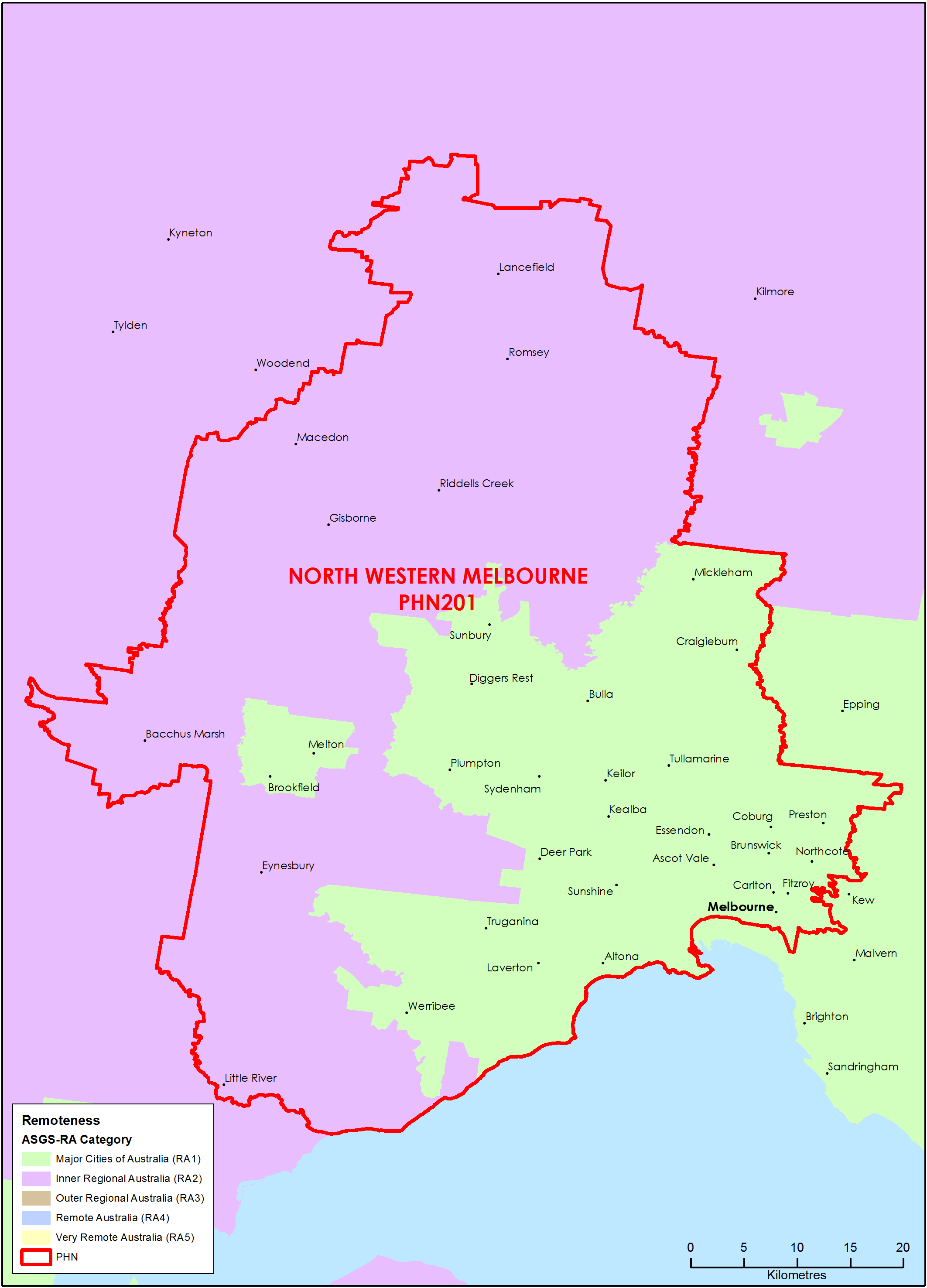
North Western Melbourne (Vic) Primary Health Network (PHN) map – Australian Statistical Geography Standard (ASGS) remoteness area
This map shows the Australian Statistical Geography Standard remoteness area classifications within the North Western Melbourne (Vic) Primary Health Network. -
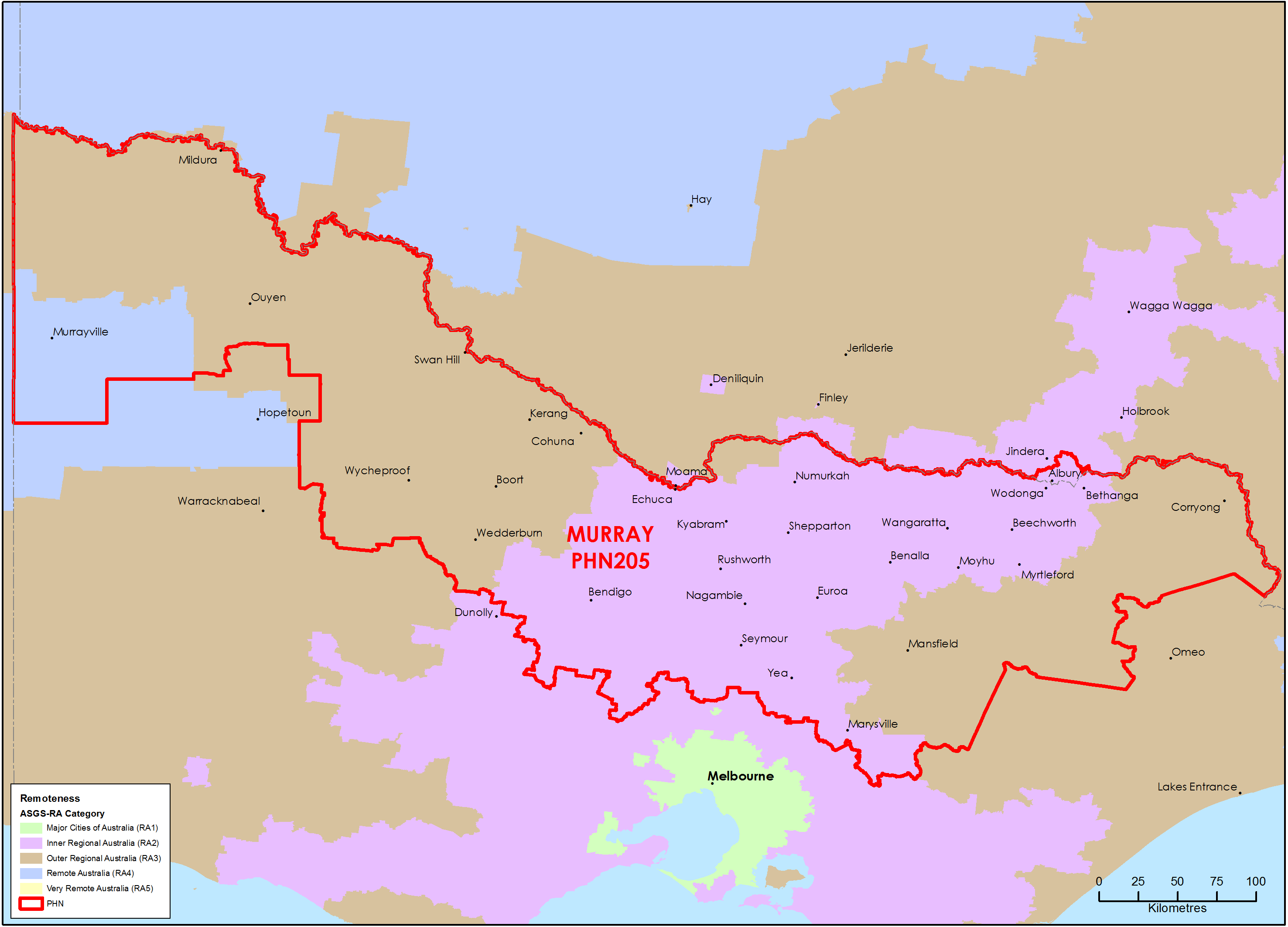
Murray (Vic) Primary Health Network (PHN) map – Australian Statistical Geography Standard (ASGS) remoteness area
This map shows the Australian Statistical Geography Standard remoteness area classifications within the Murray (Vic) Primary Health Network. -
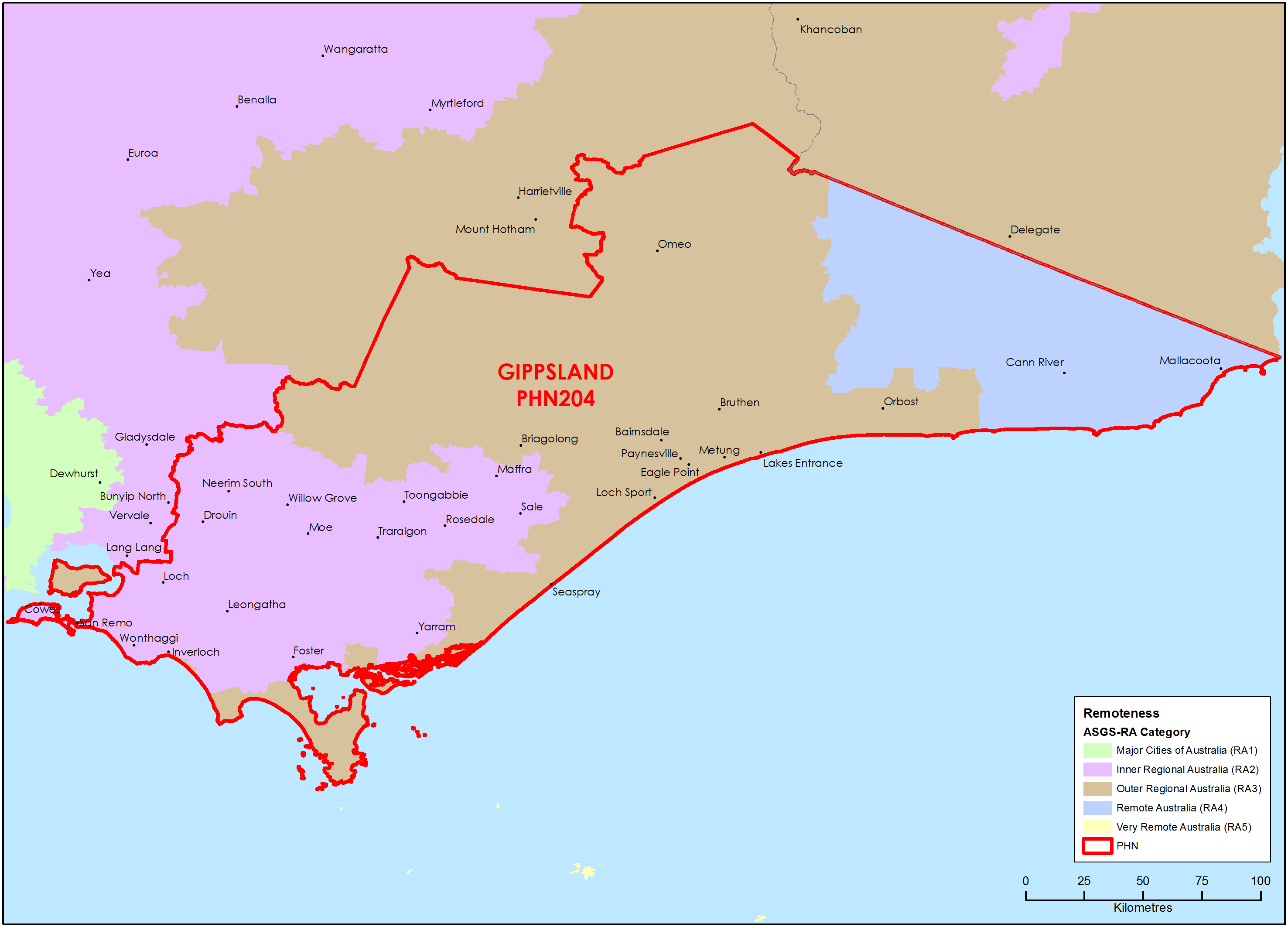
Gippsland (Vic) Primary Health Network (PHN) map – Australian Statistical Geography Standard (ASGS) remoteness area
This map shows the Australian Statistical Geography Standard remoteness area classifications within the Gippsland (Vic) Primary Health Network. -
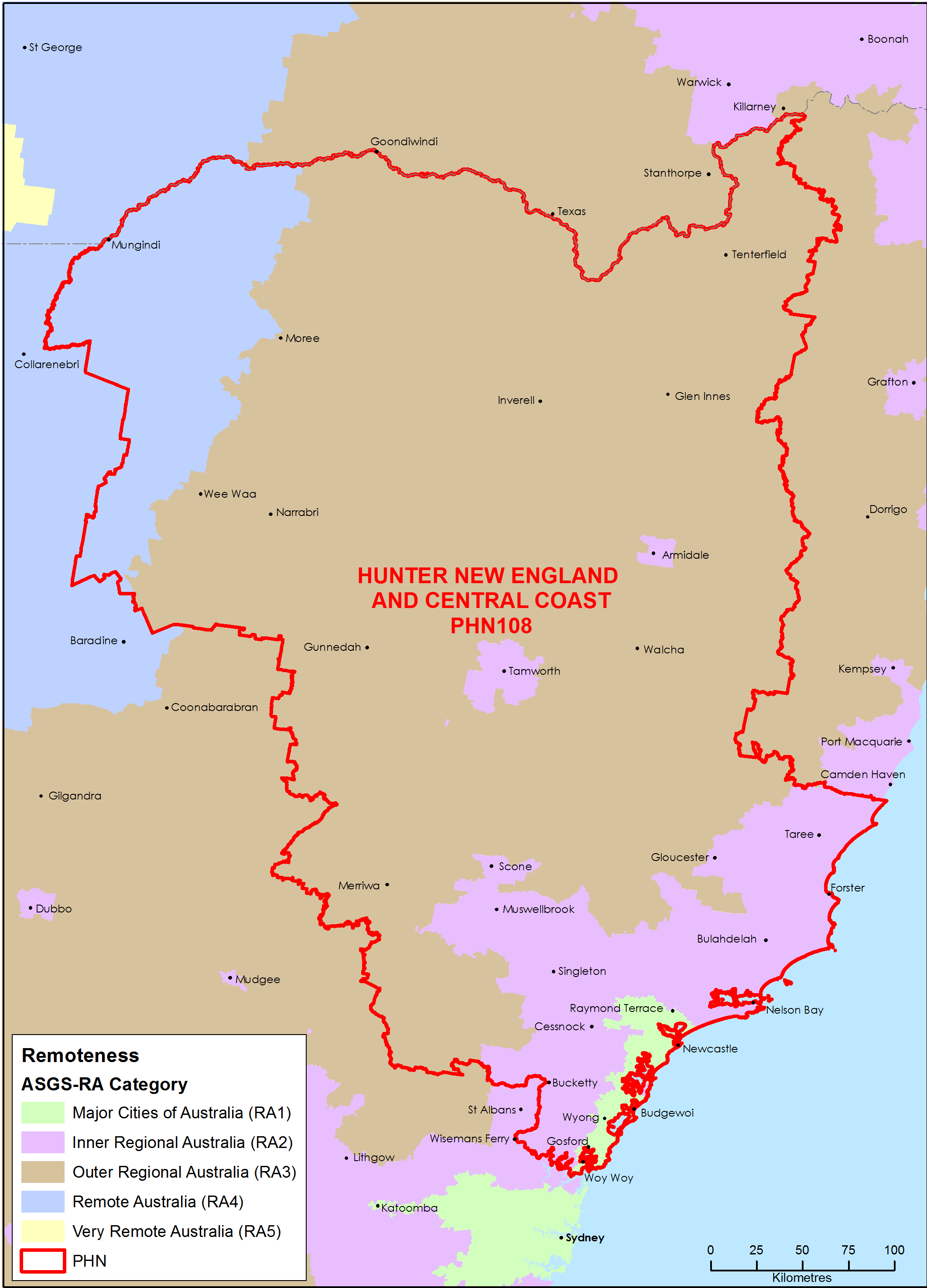
Hunter, New England and Central Coast (NSW) Primary Health Network (PHN) map – Australian Statistical Geography Standard (ASGS) remoteness area
This map shows the Australian Statistical Geography Standard remoteness area classifications within the Hunter, New England and Central Coast (NSW) Primary Health Network. -
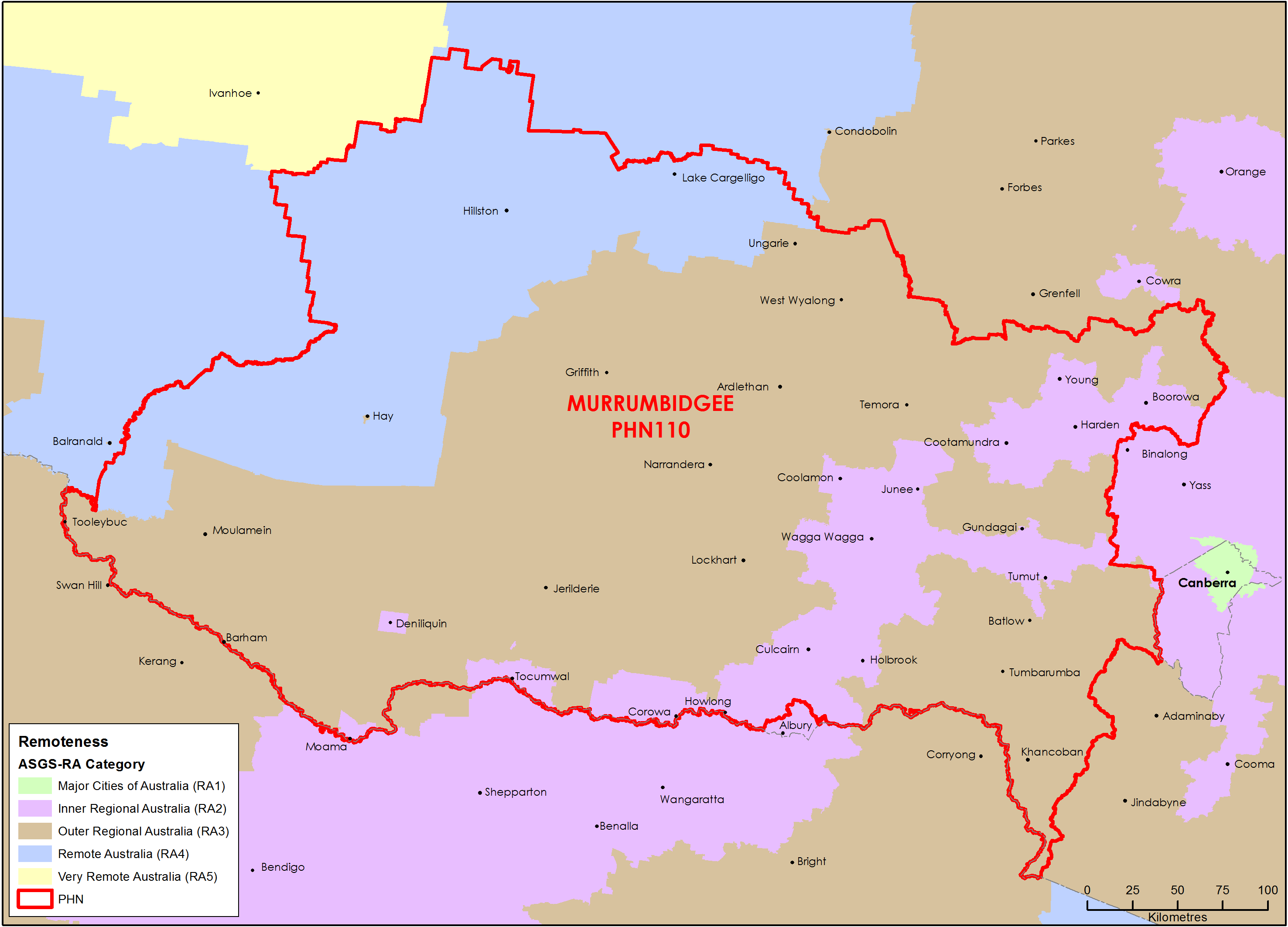
Murrumbidgee (NSW) Primary Health Network (PHN) map – Australian Statistical Geography Standard (ASGS) remoteness area
This map shows the Australian Statistical Geography Standard remoteness area classifications within the Murrumbidgee (NSW) Primary Health Network. -
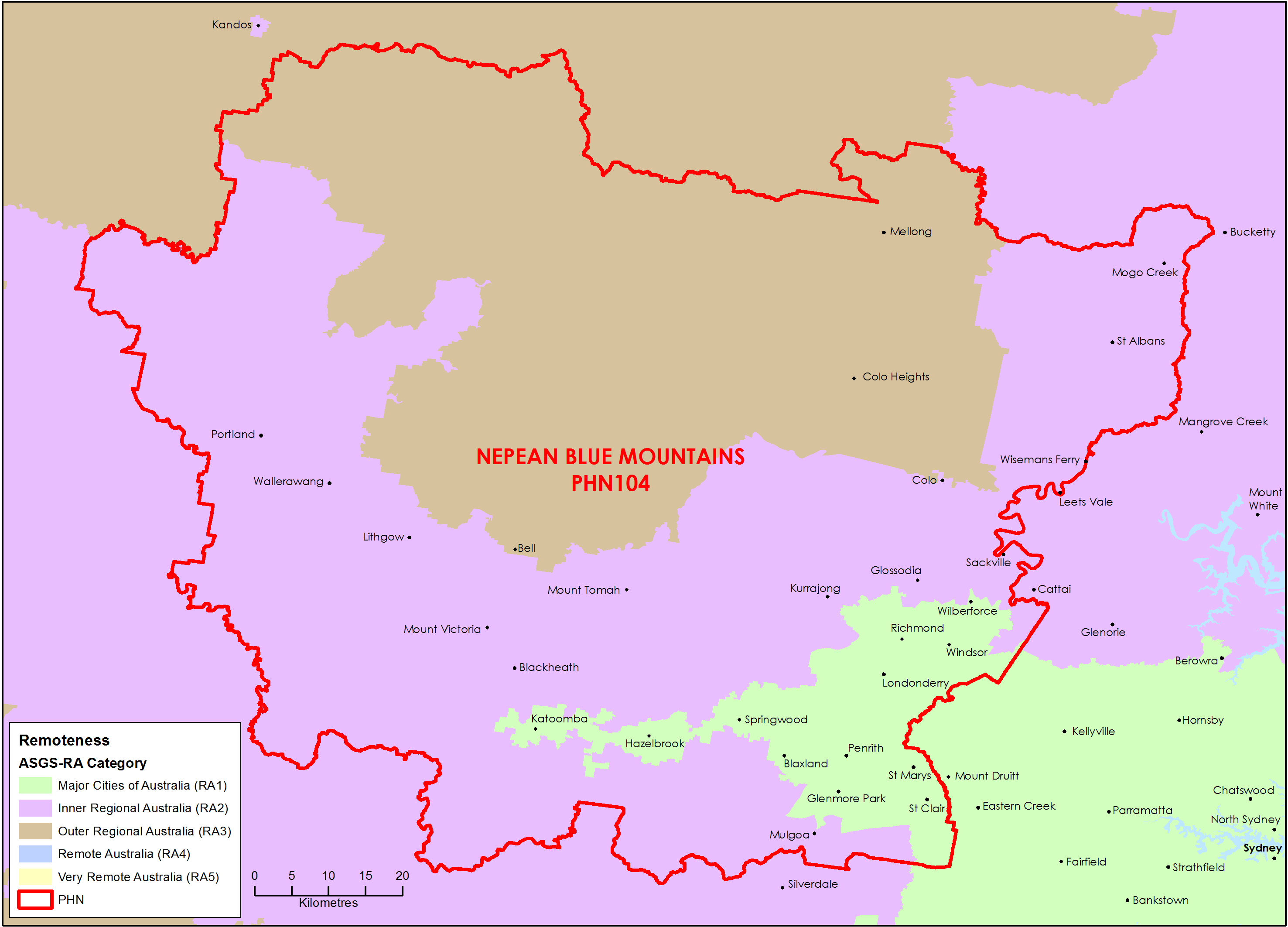
Nepean Blue Mountains (NSW) Primary Health Network (PHN) map – Australian Statistical Geography Standard (ASGS) remoteness area
This map shows the Australian Statistical Geography Standard remoteness area classifications within the Nepean Blue Mountains (NSW) Primary Health Network. -
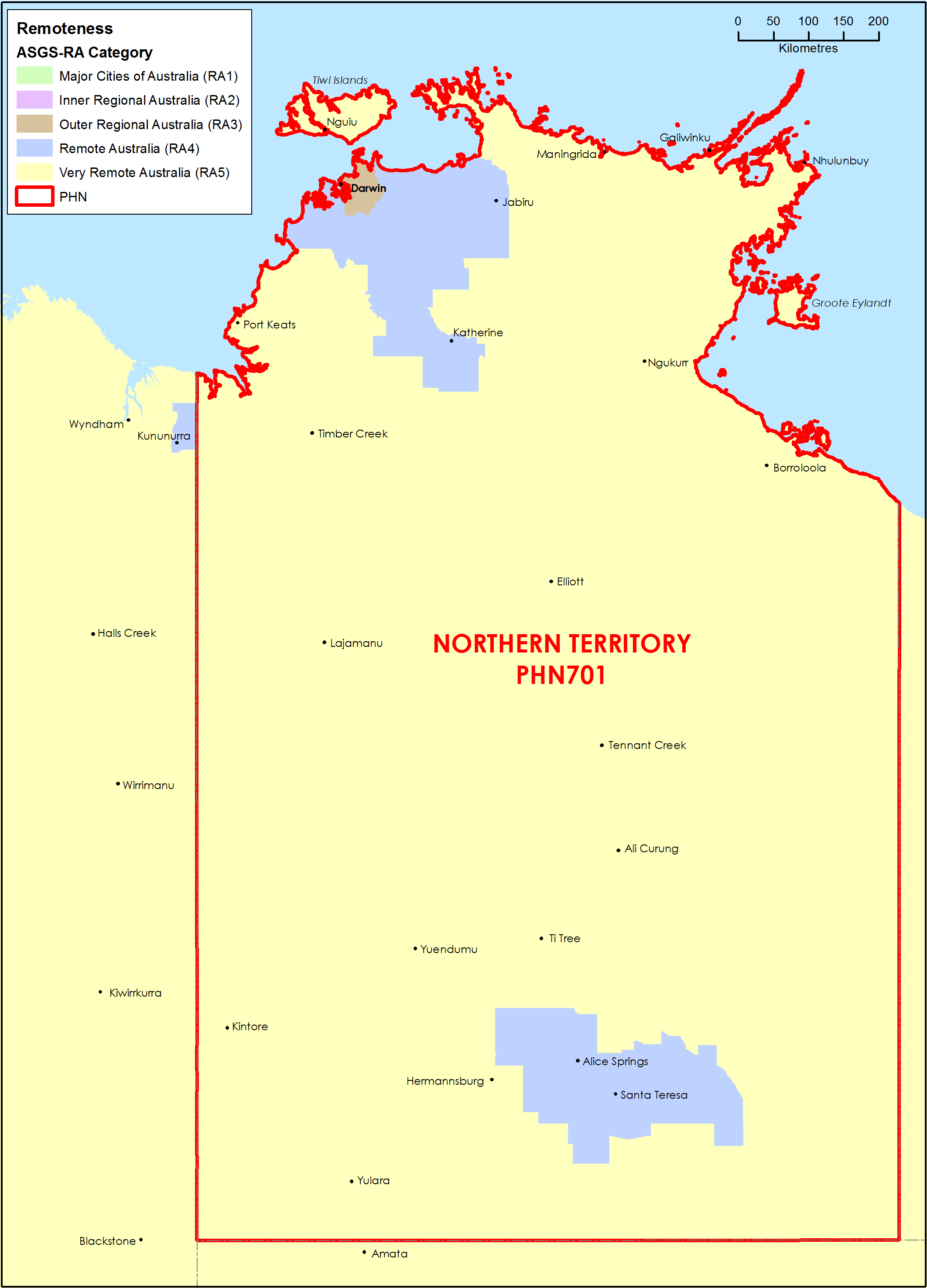
Northern Territory (NT) Primary Health Network (PHN) map – Australian Statistical Geography Standard (ASGS) remoteness area
This map shows the Australian Statistical Geography Standard remoteness area classifications within the Northern Territory Primary Health Network. -
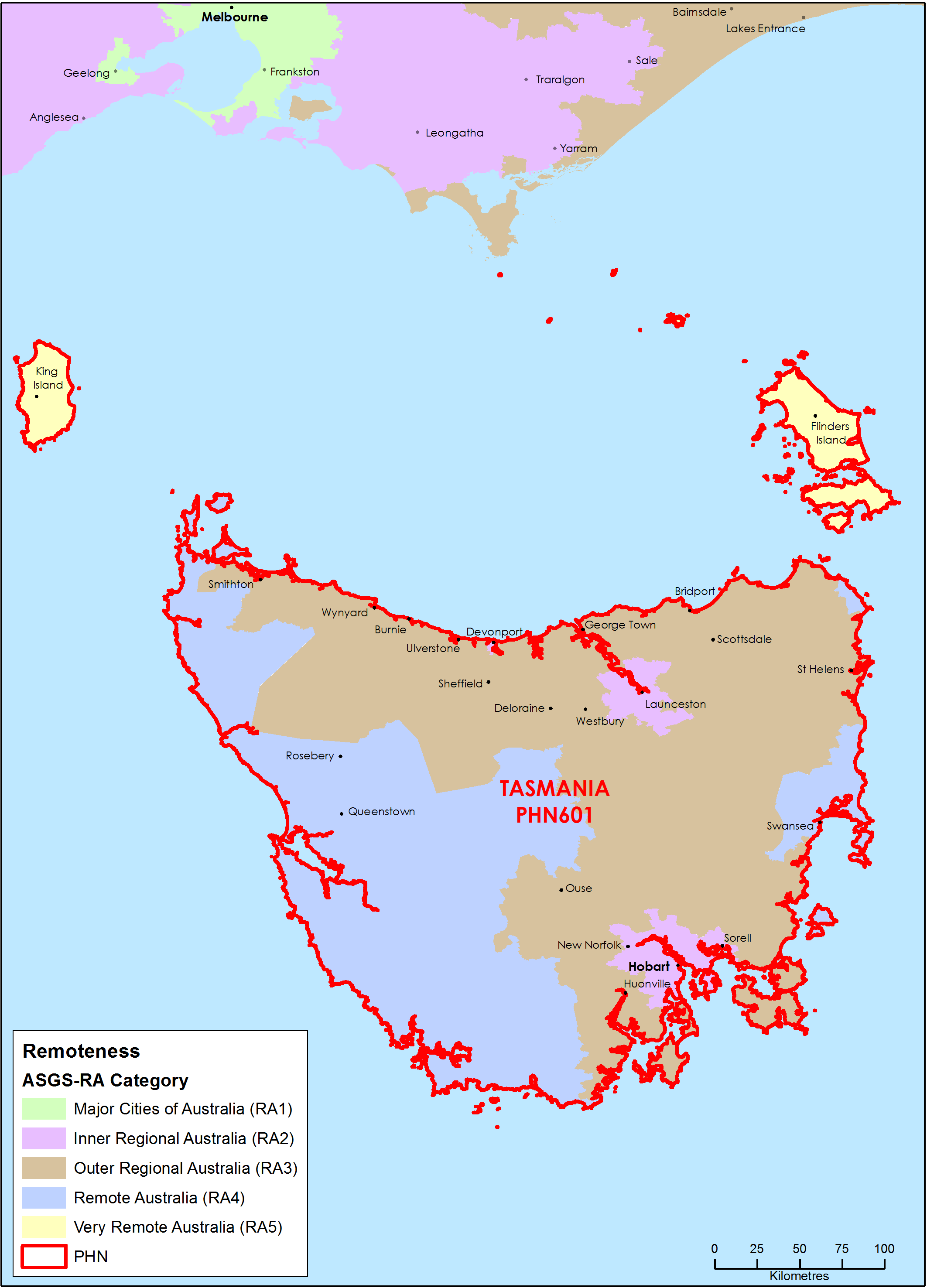
Tasmania Primary Health Network (PHN) map – Australian Statistical Geography Standard (ASGS) remoteness area
This map shows the Australian Statistical Geography Standard remoteness area classifications within the Tasmania Primary Health Network. -
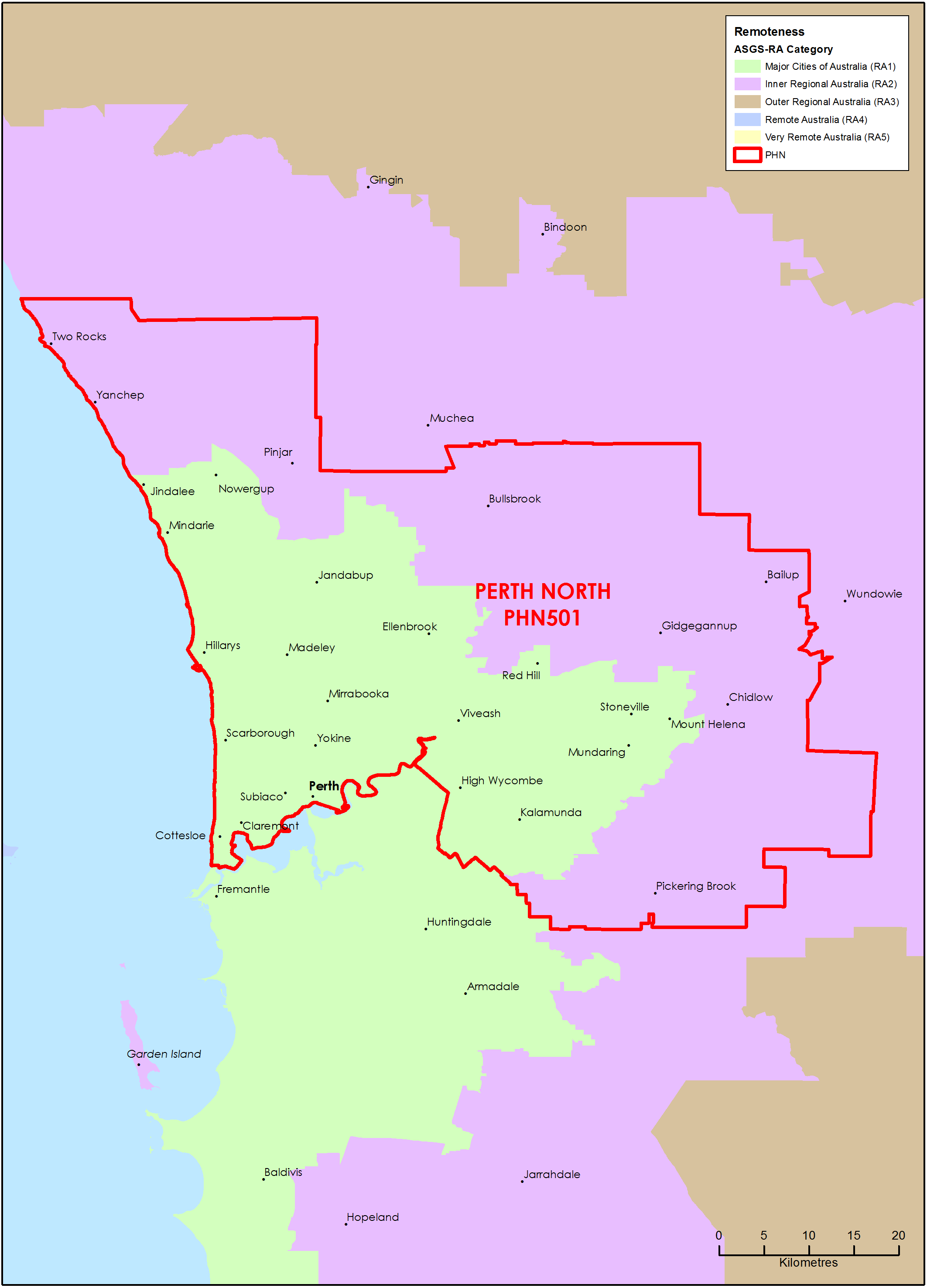
Perth North (WA) Primary Health Network (PHN) map – Australian Statistical Geography Standard (ASGS) remoteness area
This map shows the Australian Statistical Geography Standard remoteness area classifications within the Perth North (WA) Primary Health Network. -
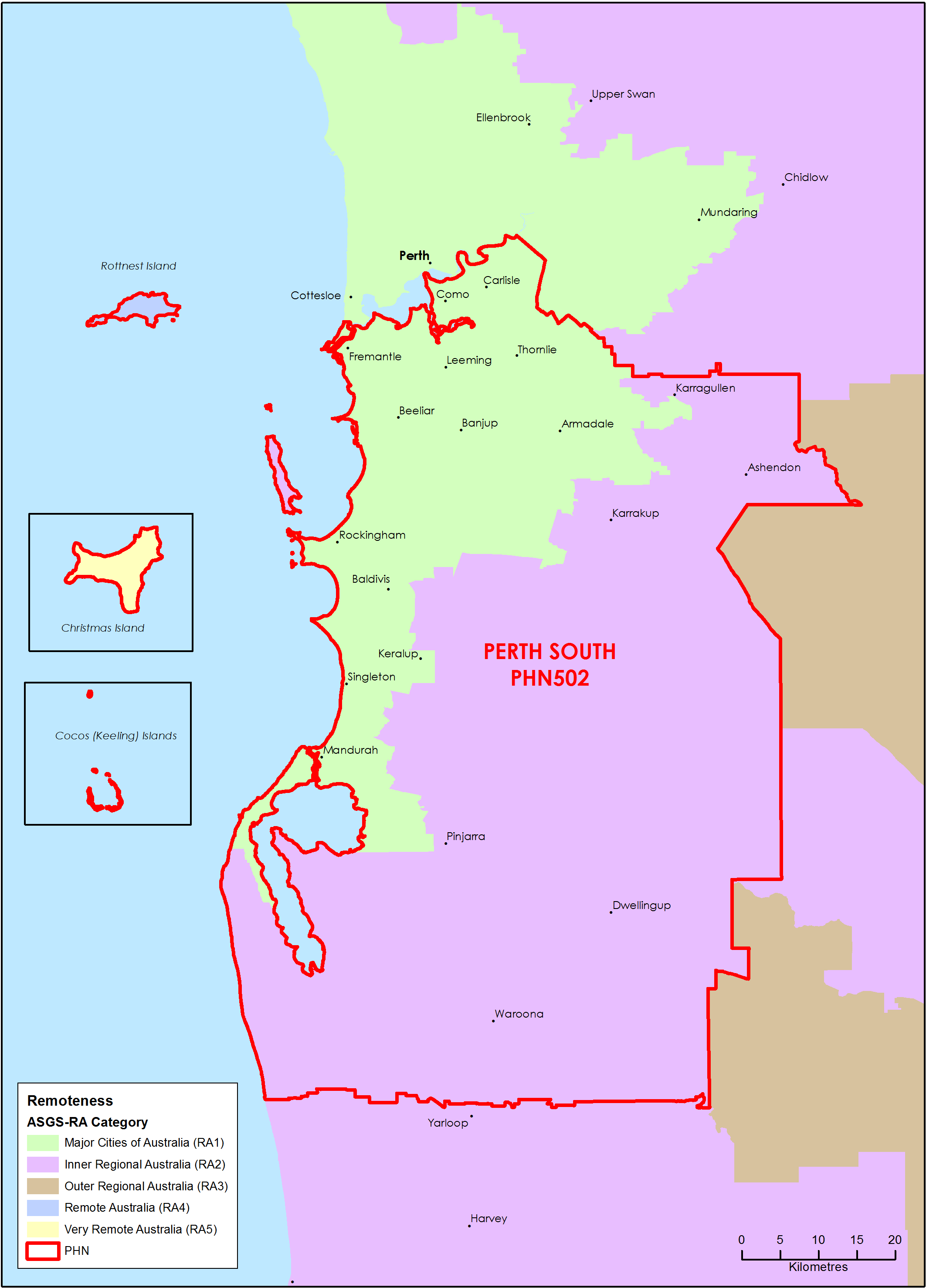
Perth South (WA) Primary Health Network (PHN) map – Australian Statistical Geography Standard (ASGS) remoteness area
This map shows the Australian Statistical Geography Standard remoteness area classifications within the Perth South (WA) Primary Health Network. -
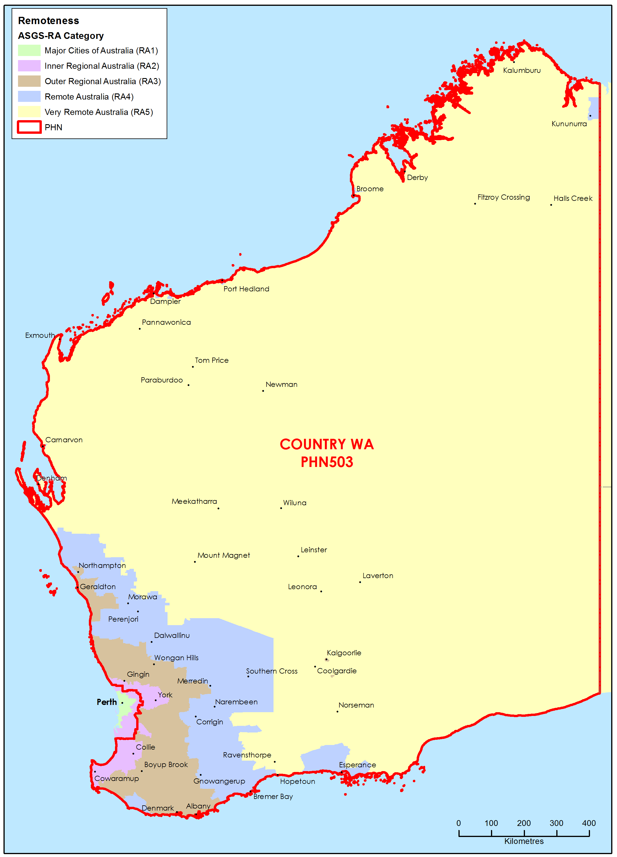
Country Western Australia Primary Health Network (PHN) map – Australian Statistical Geography Standard (ASGS) remoteness area
This map shows the Australian Statistical Geography Standard remoteness area classifications within the Country Western Australia Primary Health Network.