Filter results
You can narrow down the results using the filters
Audience
Publication type
Topics
Our work
Diseases
9568 results
-

Smoking – social media tile (version 2)
Social media tile to support quitting smoking. -

Smoking – social media tile (version 1)
Social media tile to support quitting smoking. -

Smoking – social media tile (version 3)
Social media tile to support quitting smoking. -
Certification statement – National Tobacco and E-cigarette campaign (Phase 2)
This certification statement, signed by Secretary Blair Comley on 16 December 2025, certifies that the National Tobacco and E-cigarette campaign (Phase 2) complies with relevant guidelines and policies. -

Certification statement – Youth Vaping Education Campaign (Phase 3)
This certification statement, signed by Secretary Blair Comley on 9 December 2025, certifies that the Youth Vaping Education Campaign complies with relevant guidelines and policies. -
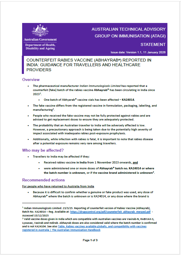
ATAGI statement: Counterfeit Rabies vaccine (Abhayrab®) reported in India: Guidance for travellers and healthcare providers
Counterfeit Abhayrab® rabies vaccines have been circulating in India since 2023. Travellers vaccinated there since Nov 2023 may be unprotected and should replace invalid doses with Australian‑registered vaccines. Healthcare providers should follow ATAGI guidance. -
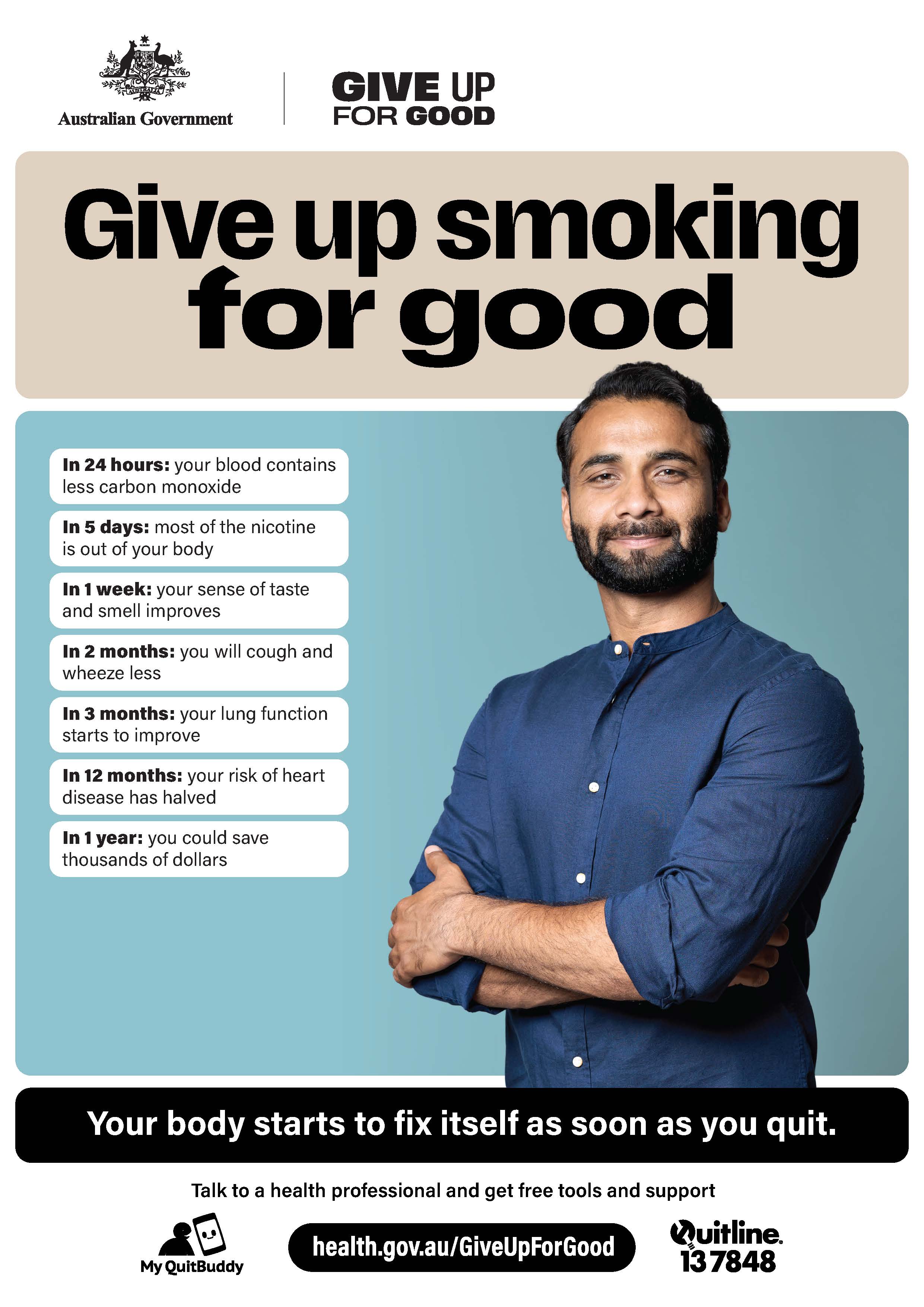
Give up smoking for good – health benefits for men
This poster shows the male health benefits when you quit smoking. -
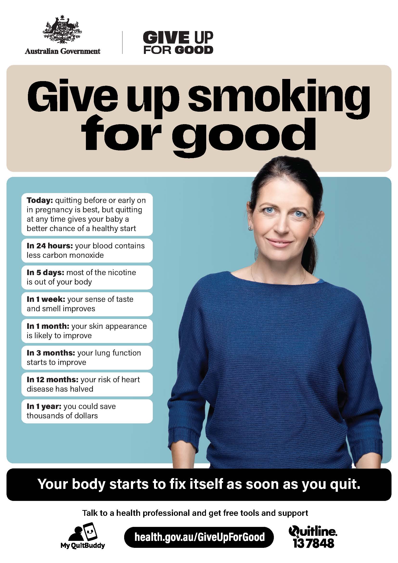
Give up smoking for good – health benefits for women
This poster shows the female health benefits when you quit smoking. -

Tips for supporting someone to quit
When someone decides to quit smoking or vaping, they’re more likely to succeed with the support of their family and friends. -
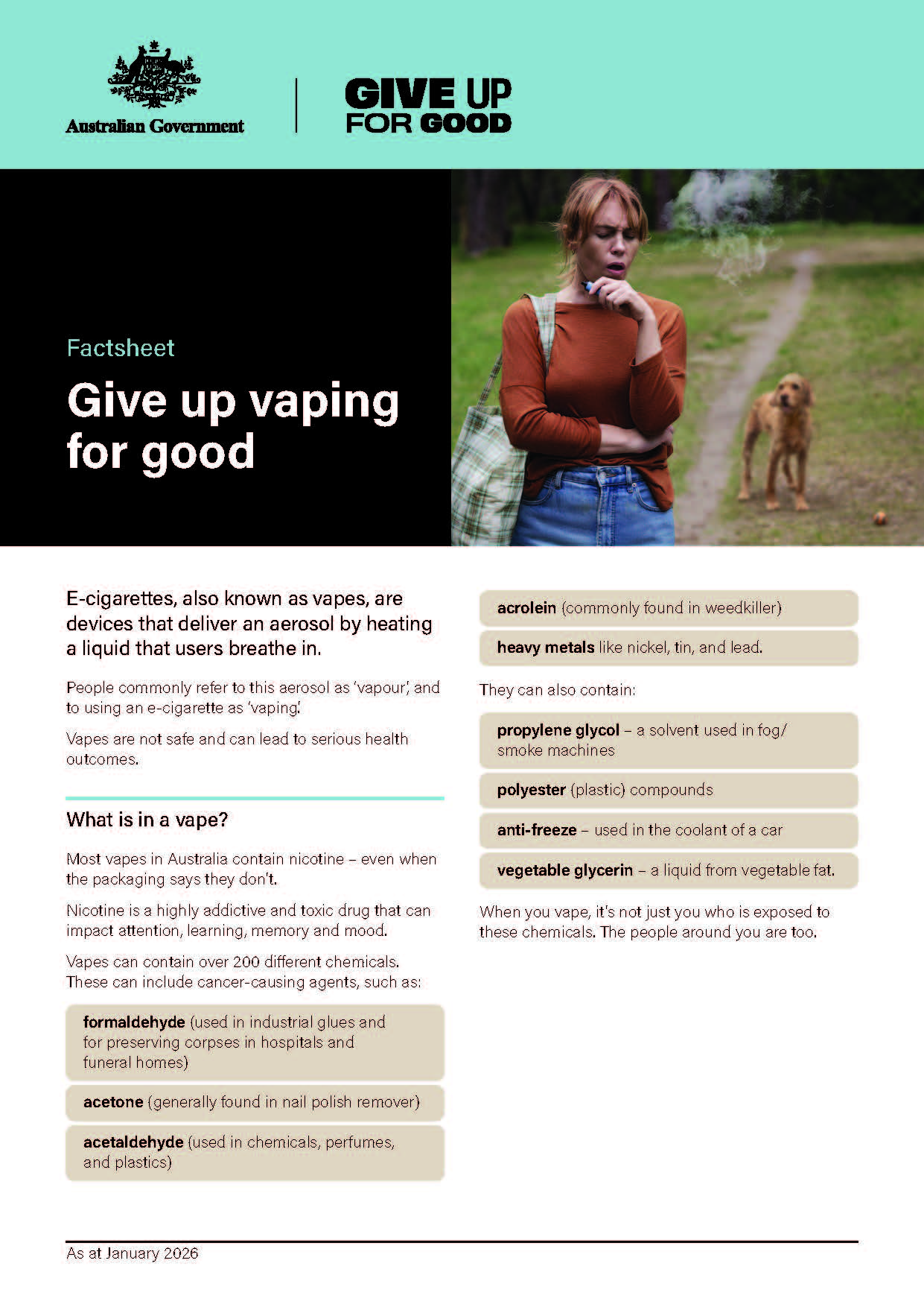
Give up vaping for good
Learn more about the harms of vaping, how to quit and support options to help you give up for good. -
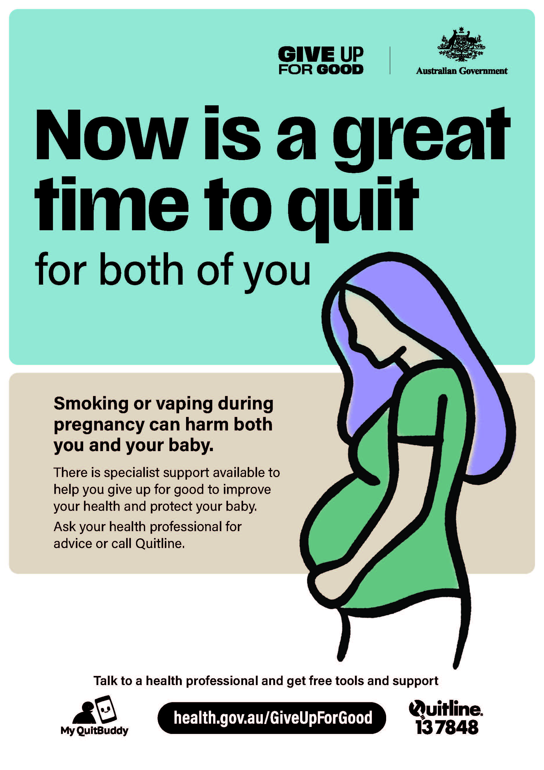
Now is a great time to quit for you and your baby
Now is a great time to quit for both of you. -
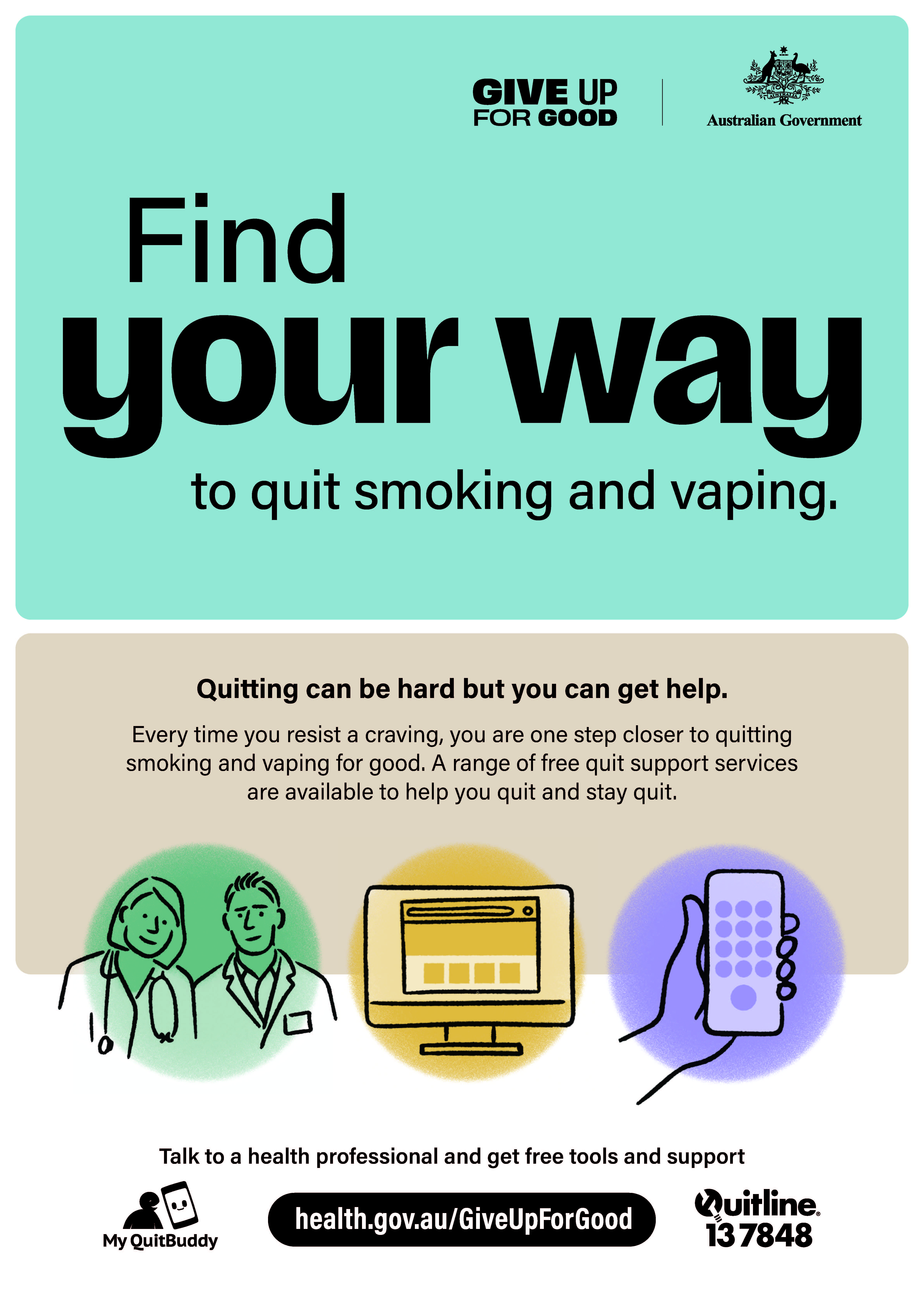
Find your way
Find your way to quit smoking and vaping. -
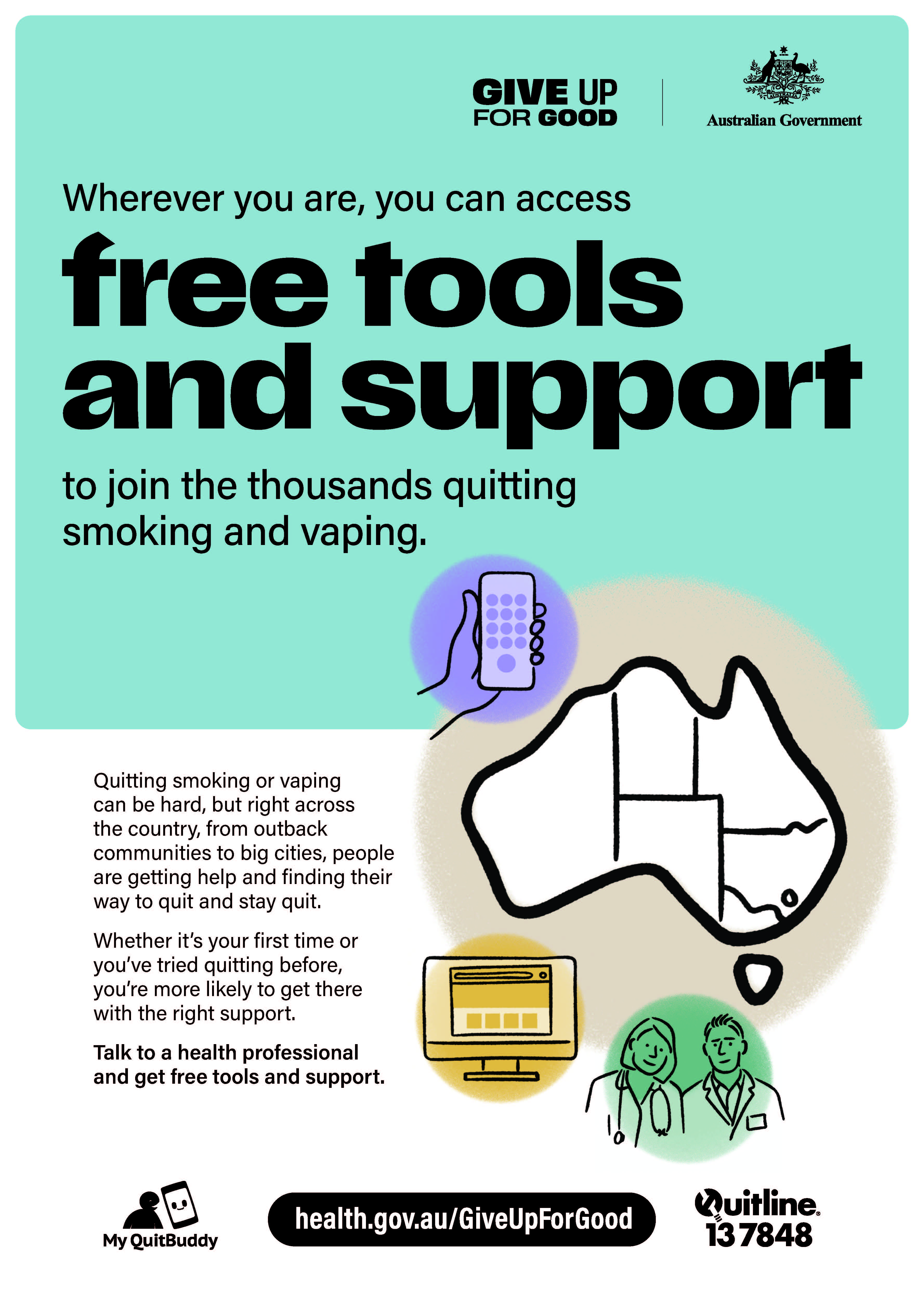
Free tools and support
Wherever you are, you can access free tools and support to join the thousands quitting smoking and vaping. -
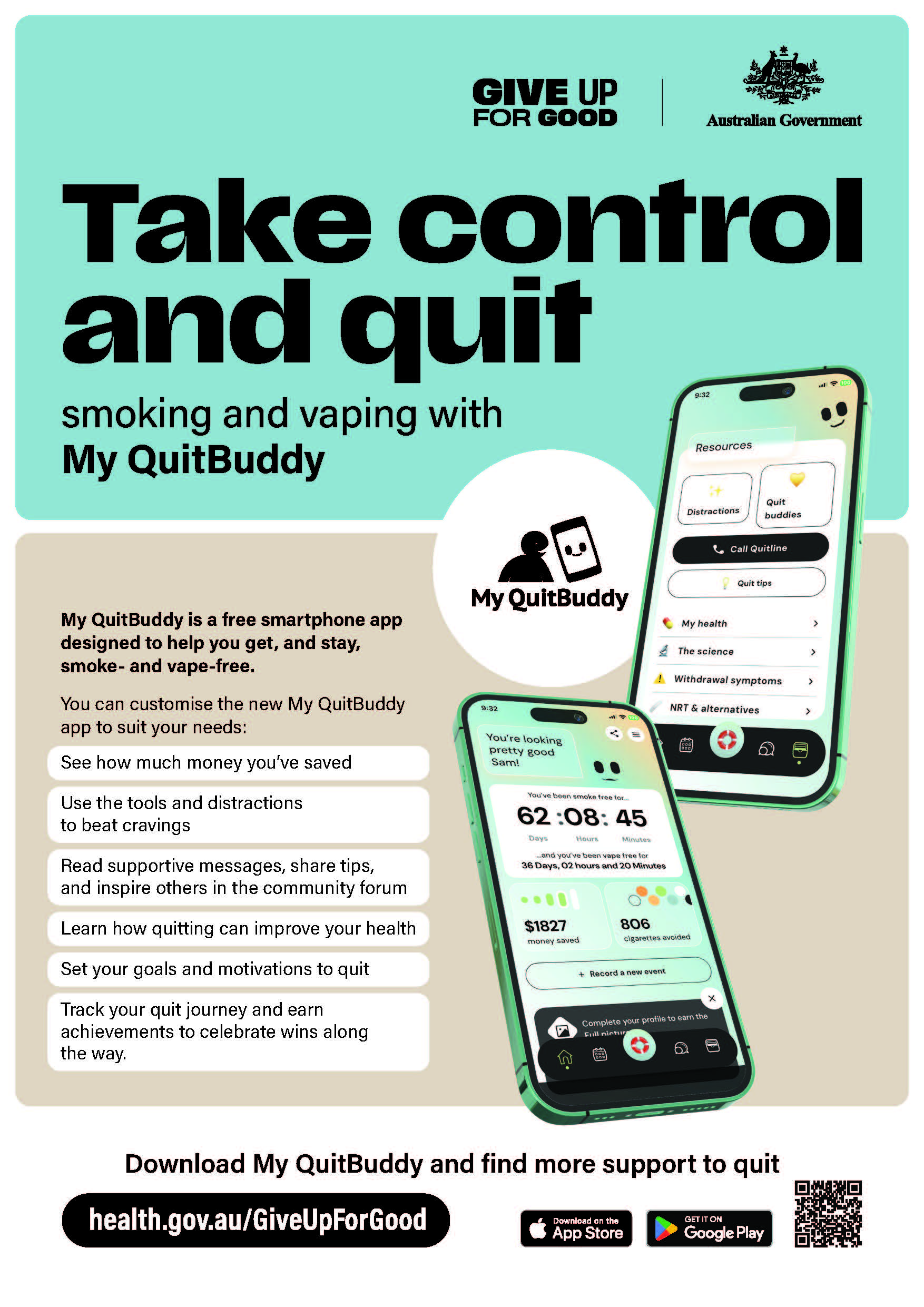
Take control and quit
Take control and quit smoking and vaping with My QuitBuddy app. -
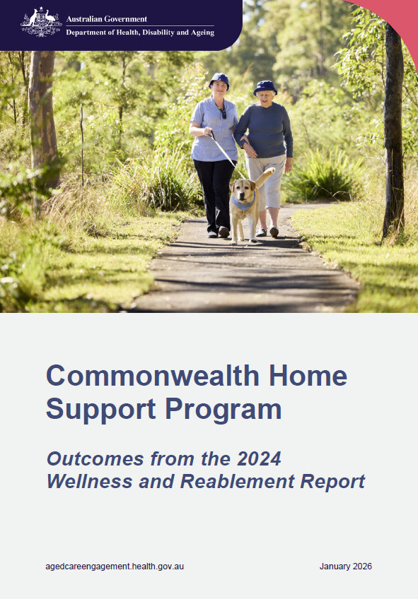
Commonwealth Home Support Program – Outcomes from the 2024 Wellness and Reablement Report
Read the findings of the Commonwealth Home Support Program 2024 Wellness and Reablement Report, about Commonwealth Home Support Program providers’ progress towards embedding wellness and reablement approaches. -
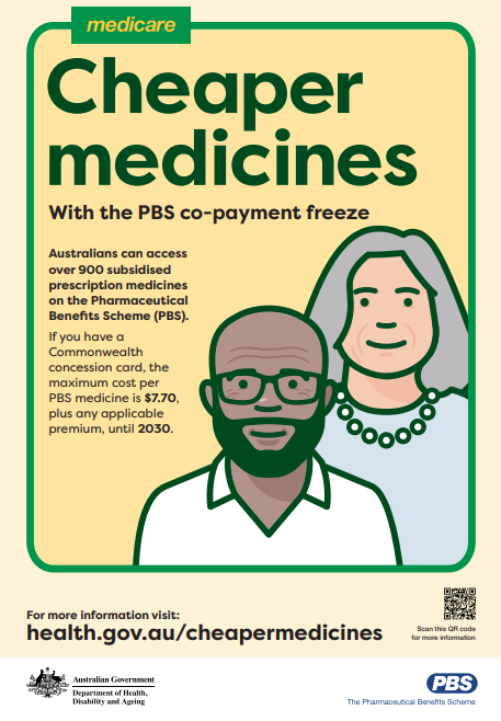
PBS co‑payment freeze : Cheaper medicines for concession card holders – A3 Poster
This poster highlights that concession card holders will pay no more than $7.70 per PBS medicine until 2030. It promotes access to over 900 subsidised medicines through the PBS. -
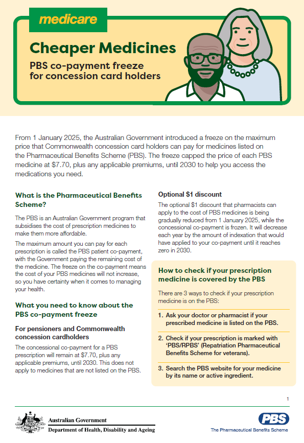
PBS co‑payment freeze: What it means for concession card holders – Fact sheet
This fact sheet explains the PBS concessional co‑payment freeze, keeping medicine costs capped at $7.70 until 2030. It outlines how the freeze works, ways to save on medicines, and where to find more information. -
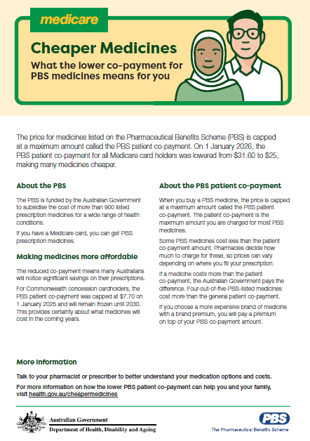
PBS price reduction: What the lower co‑payment means for you – Fact sheet
This fact sheet explains the reduction of the PBS patient co‑payment to $25 for Medicare card holders and the continued $7.70 cap for concession card holders. It outlines how the PBS works and how the changes make medicines more affordable. -

Cheaper Medicines: FAQs about the lower PBS co‑payment
This FAQ explains how the reduced PBS co‑payment helps Australians save on medicines, what the changes mean for general and concession card holders, and how costs, Safety Net thresholds, and brand premiums may affect what you pay. -

PBS price reduction: Lower prescription costs for Medicare and concession card holders – A3 Poster
This poster highlights PBS medicine costs dropping to $25 for Medicare card holders from 1 January 2026, with concession card holders continuing to pay $7.70. It promotes savings on prescriptions through the PBS. -
Certification statement – PBS Awareness Campaign (Phase 3: Co-payment Reduction)
This certification statement, signed by A/g Secretary Professor Anthony Lawler on 5 January 2025, certifies that PBS Awareness Campaign (Phase 3: Co-payment Reduction) complies with relevant guidelines and policies. -
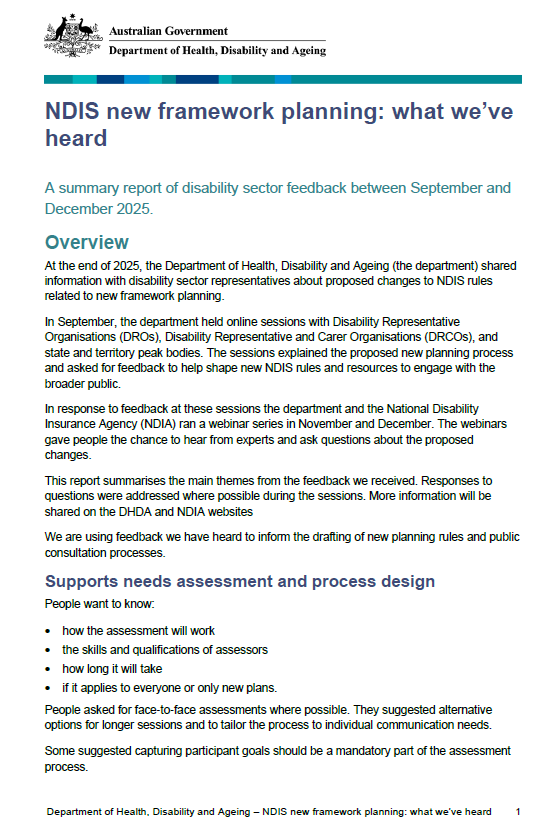
NDIS new framework planning: what we heard summary report
The report summarises disability sector feedback on proposed NDIS new framework planning, highlighting support for clearer, fairer planning and concerns about support needs assessments, assessor skills, tools, transparency, participant preparation, and inclusion of diverse groups. -
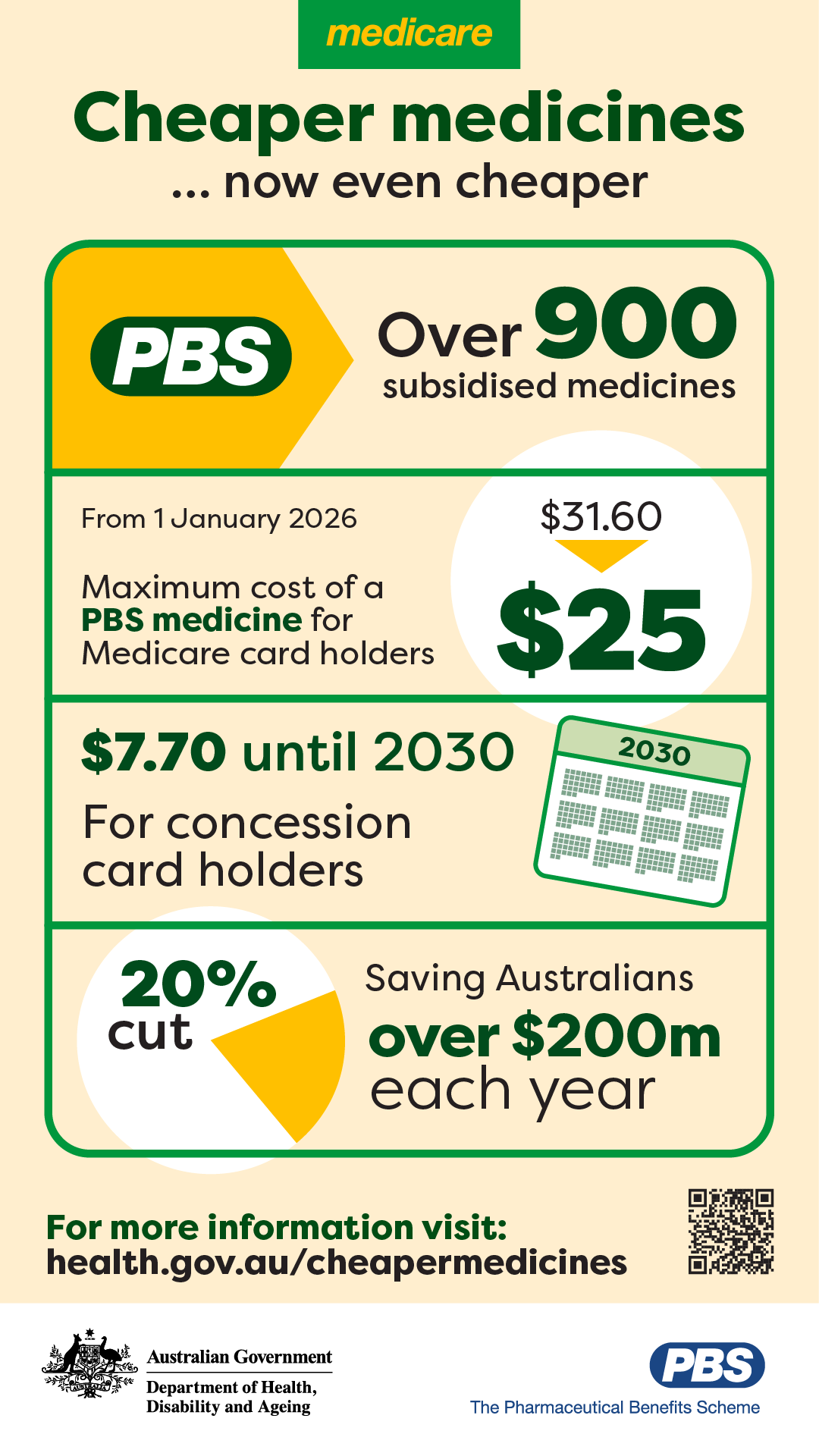
Cheaper Medicines: Key facts about lower PBS medicine costs infographic
This infographic highlights changes to PBS medicine costs, including a $25 cap for Medicare card holders and co-payment freeze for concession card holders until 2030, applying to more than 900 subsidised medicines. -

Cheaper Medicines: PBS price changes for Medicare and concession card holders – Postcard
This postcard highlights PBS patient costs dropping to a maximum of $25 for Medicare card holders from 1 January 2026, while concession card holders continue to pay $7.70 until 2030. -

Public Register – Data matching activities
This public register records data matching undertaken for Medicare compliance purposes. Part VIIIA of the National Health Act 1953 requires the Chief Executive Medicare to maintain this register.