Filter results
You can narrow down the results using the filters
Audience
Topics
Our work
Diseases
405 results
-
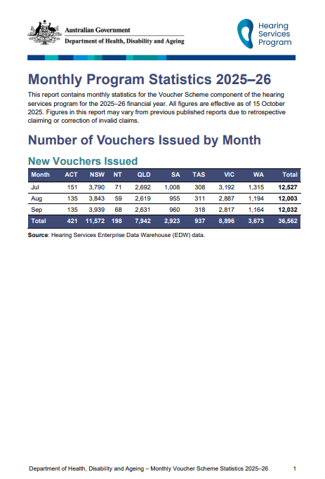
Hearing Services Program statistics – Year to date 2025–26 to 30 September 2025
This report contains monthly statistics for the Voucher Scheme component of the Hearing Services Program for the 2024–25 financial year through to 30 June 2025. -
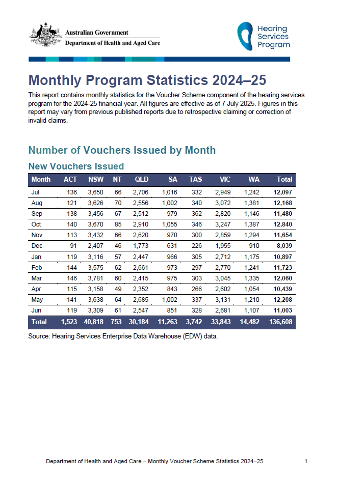
Hearing Services Program statistics – Year to date 2024–25 to 30 June 2025
This report contains monthly statistics for the Voucher Scheme component of the Hearing Services Program for the 2024–25 financial year through to 30 June 2025. -

Hearing Services Program statistics – Year to date 2025–26 to 31 December 2025
This report contains monthly statistics for the Voucher Scheme component of the Hearing Services Program for the 2025–26 financial year through to 31 December 2025. -
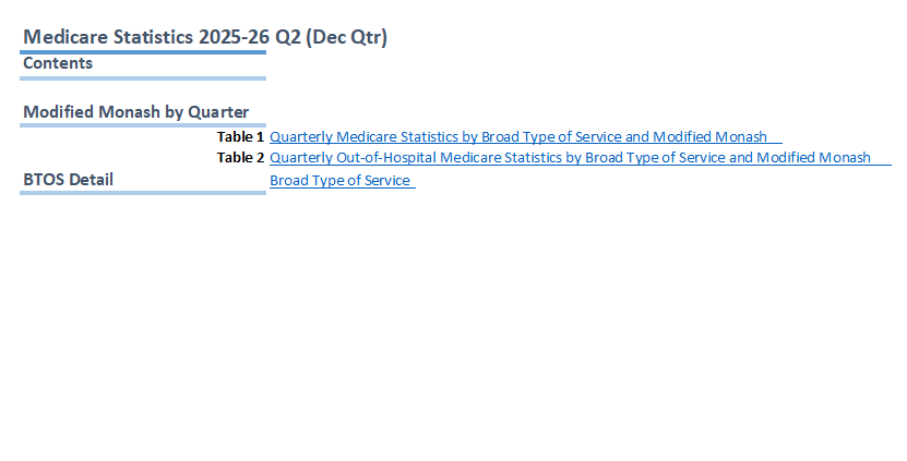
Medicare quarterly statistics – Modified Monash Model locations (December quarter 2025-26)
This document contains statistics about the use of Medicare for Modified Monash Model locations, from September quarter 2009–10 to December quarter 2025–26. -
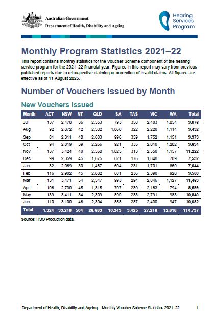
Hearing Services Program statistics – Year to date 2021–22 to 30 June 2022
This report contains monthly statistics for the Voucher Scheme component of the Hearing Services Program for the 2021–22 financial year through to 30 June 2022. -

Hearing Services Program statistics – Year to date 2022–23 to 30 June 2023
This report contains monthly statistics for the Voucher Scheme component of the Hearing Services Program for the 2022–23 financial year through to 30 June 2023. -

Medicare quarterly statistics – Bulk Billing by Primary Health Network (December quarter 2025–26)
This document contains bulk billing statistics for Primary Health Networks, from September quarter 2009–10 to December quarter 2025–26. -

Medicare quarterly statistics – Primary Care Service Type Summary (December quarter 2025–26)
This document contains GP Non-Referred Attendance statistics by the SEIFA Index for Relative Disadvantage, from September quarter 2009–10 to December quarter 2025–26. -
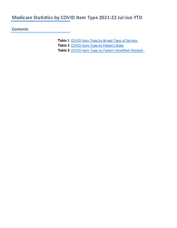
Medicare annual statistics – Medicare Benefits Schedule (MBS) COVID-19 items (2021–22)
This document contains annual statistics about the use of MBS COVID-19 items for 2021–22. -
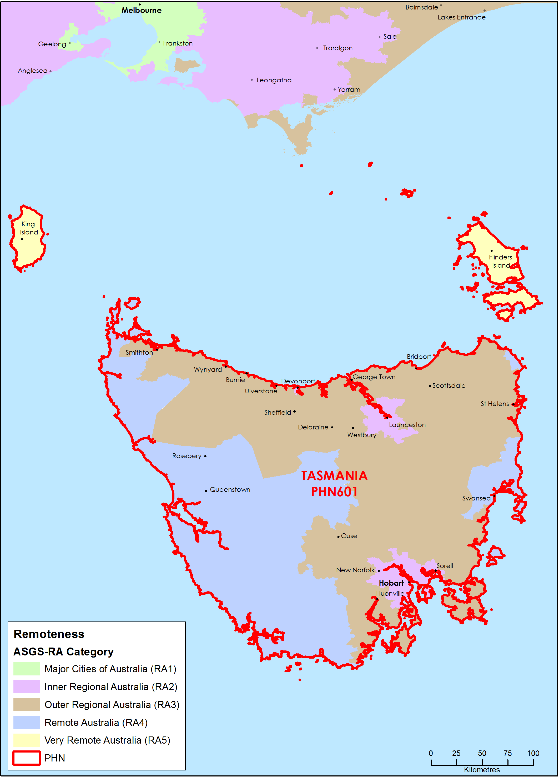
Tasmania Primary Health Network (PHN) map – Australian Statistical Geography Standard (ASGS) remoteness area
This map shows the Australian Statistical Geography Standard remoteness area classifications within the Tasmania Primary Health Network. -

Medicare quarterly statistics – Socio-Economic Indexes for Areas (SEIFA) Summary (December quarter 2025–26)
This document contains GP Non-Referred Attendance statistics by the SEIFA Index for Relative Disadvantage, from September quarter 2009–10 to December quarter 2025–26. -
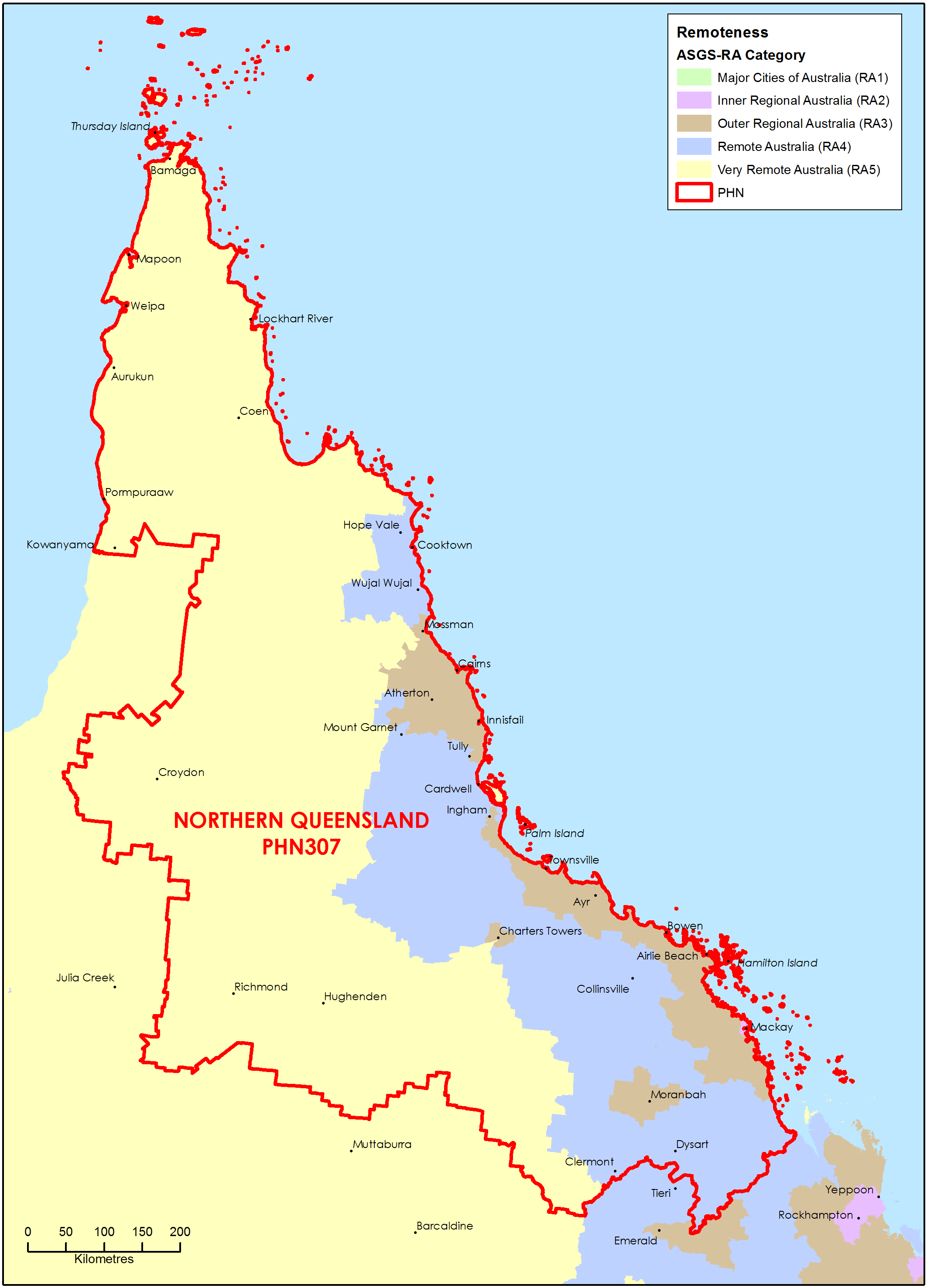
Northern Queensland Primary Health Network (PHN) map – Australian Statistical Geography Standard (ASGS) remoteness area
This map shows the Australian Statistical Geography Standard remoteness area classifications within the Northern Queensland Primary Health Network. -
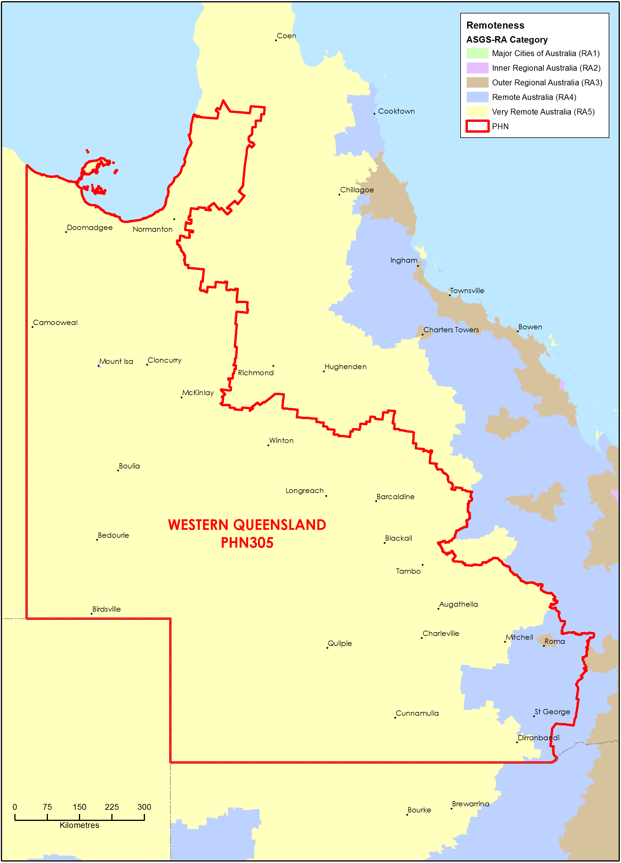
Western Queensland Primary Health Network (PHN) map – Australian Statistical Geography Standard (ASGS) remoteness area
This map shows the Australian Statistical Geography Standard remoteness area classifications within the Western Queensland Primary Health Network. -
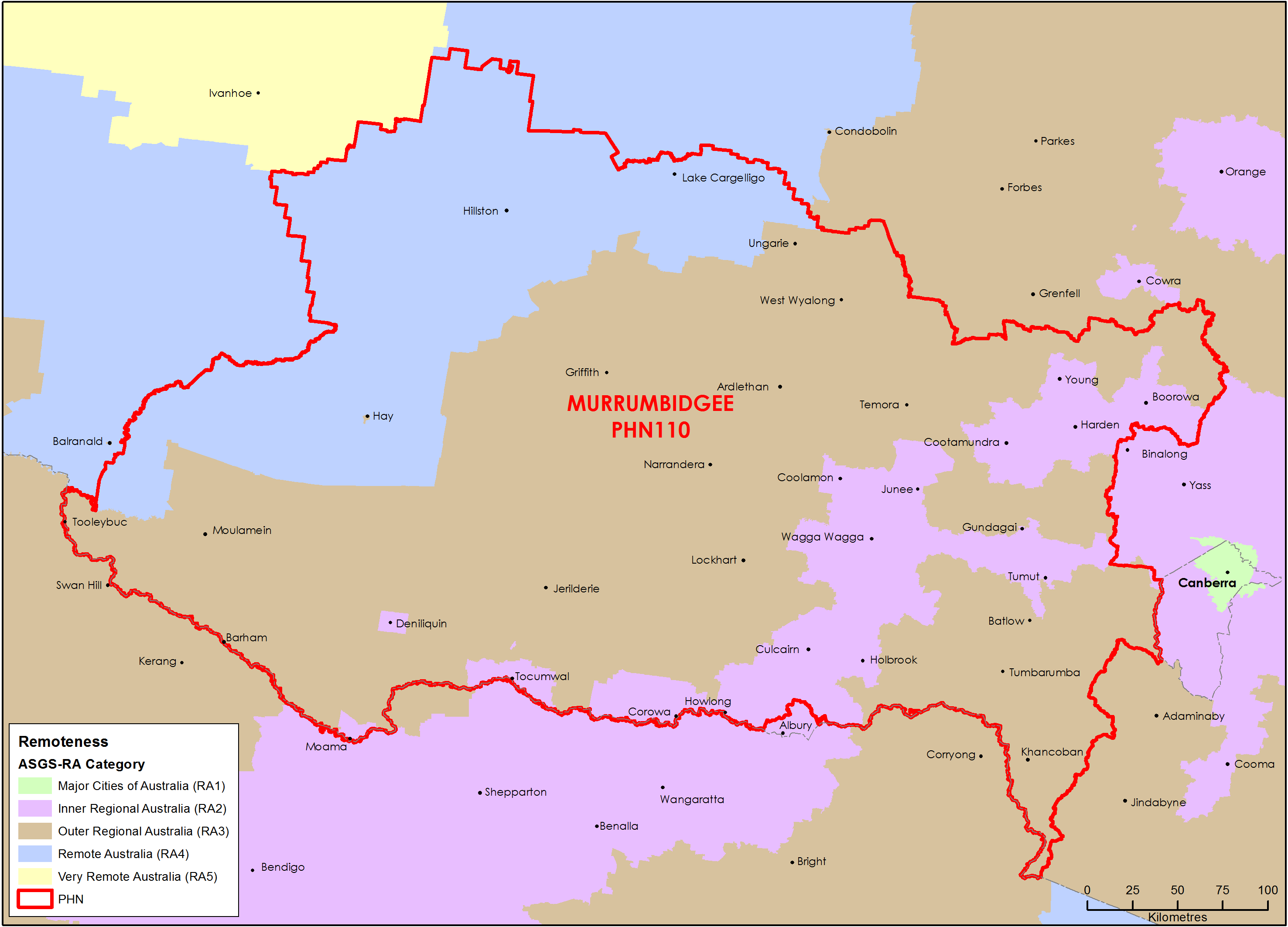
Murrumbidgee (NSW) Primary Health Network (PHN) map – Australian Statistical Geography Standard (ASGS) remoteness area
This map shows the Australian Statistical Geography Standard remoteness area classifications within the Murrumbidgee (NSW) Primary Health Network. -
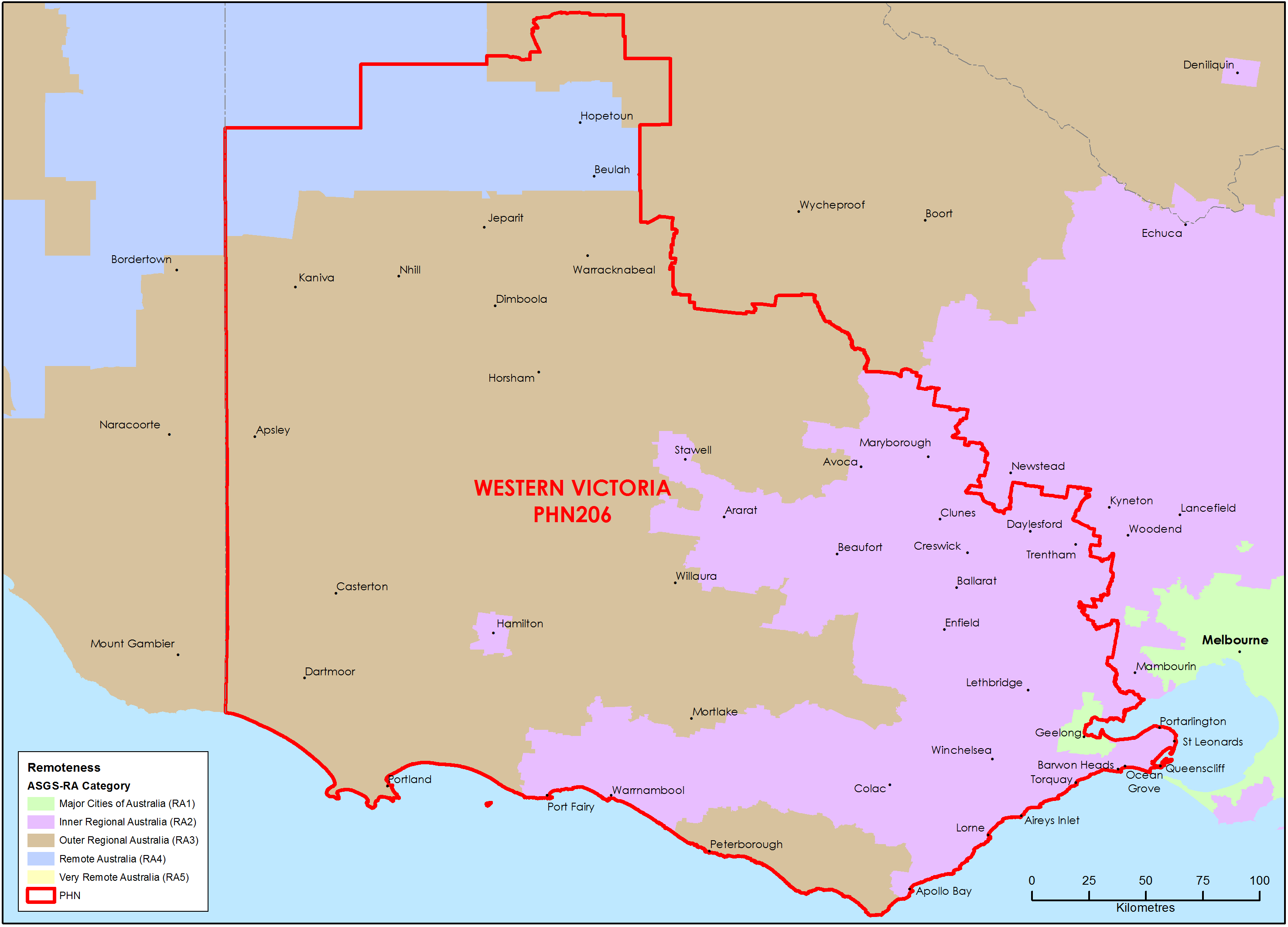
Western Victoria Primary Health Network (PHN) map – Australian Statistical Geography Standard (ASGS) remoteness area
This map shows the Australian Statistical Geography Standard remoteness area classifications within the Western Victoria Primary Health Network. -
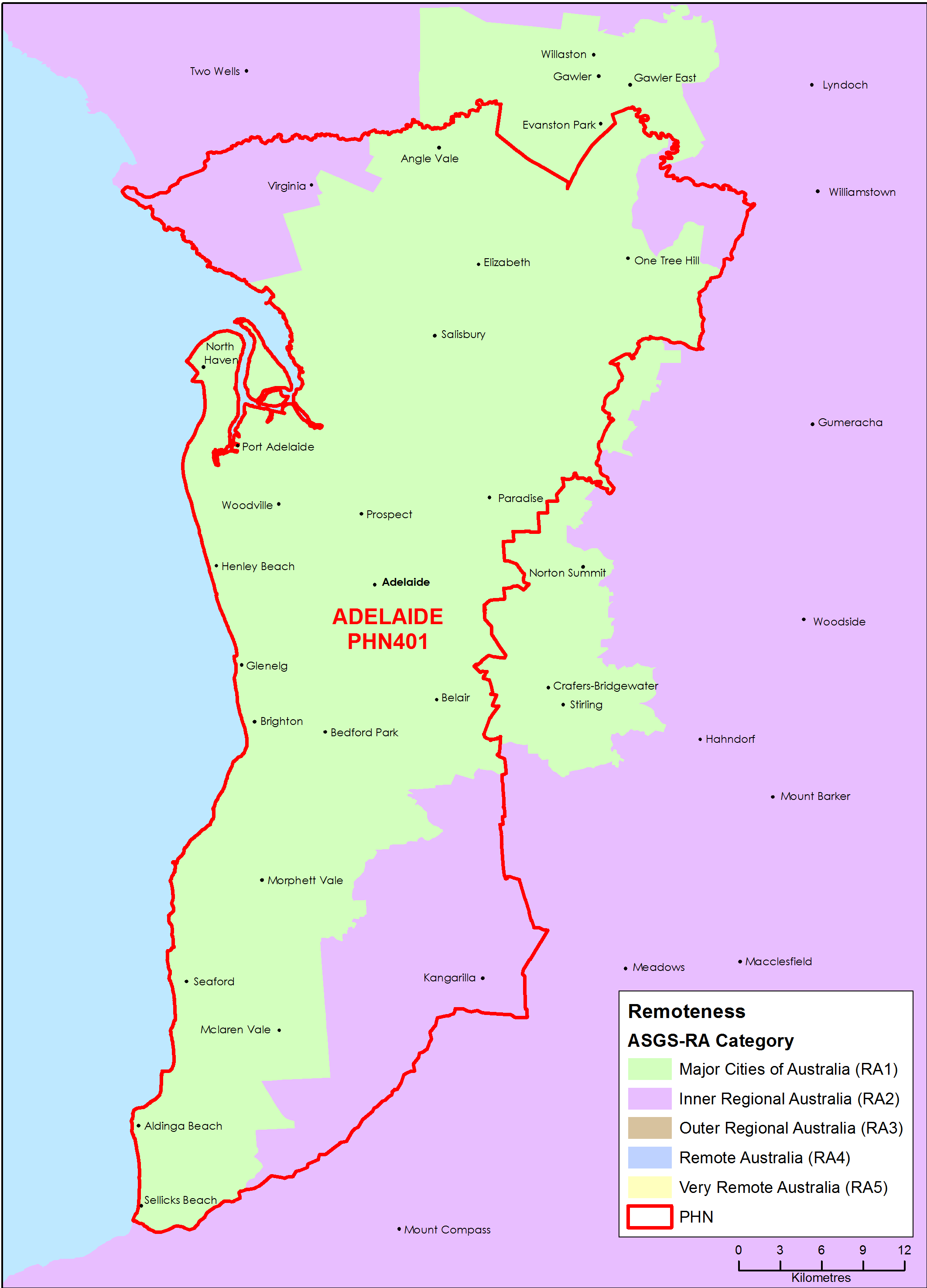
Adelaide (SA) Primary Health Network (PHN) map – Australian Statistical Geography Standard (ASGS) remoteness area
This map shows the Australian Statistical Geography Standard remoteness area classifications within the Adelaide (SA) Primary Health Network. -
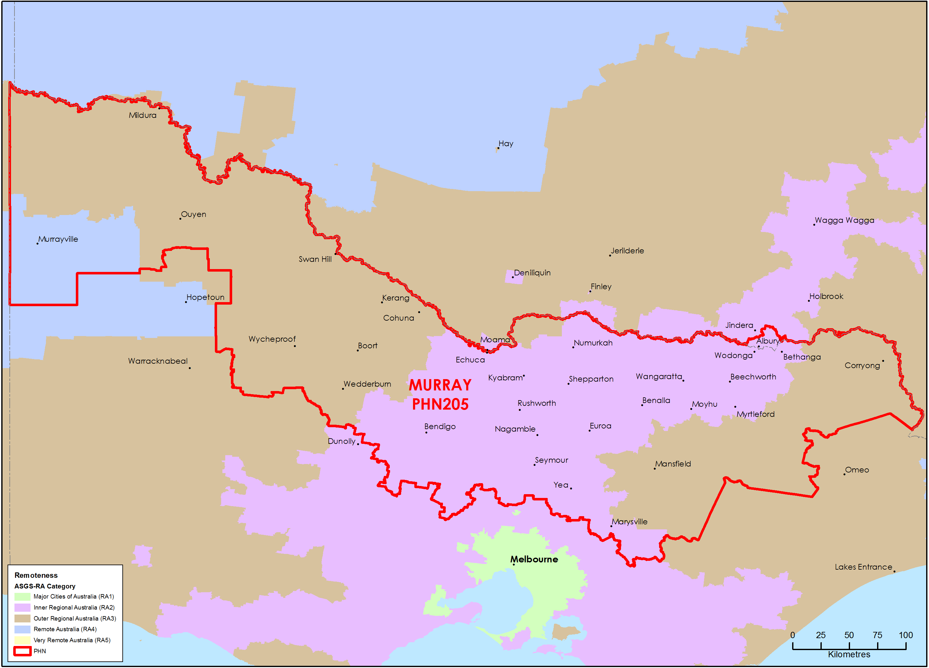
Murray (Vic) Primary Health Network (PHN) map – Australian Statistical Geography Standard (ASGS) remoteness area
This map shows the Australian Statistical Geography Standard remoteness area classifications within the Murray (Vic) Primary Health Network. -
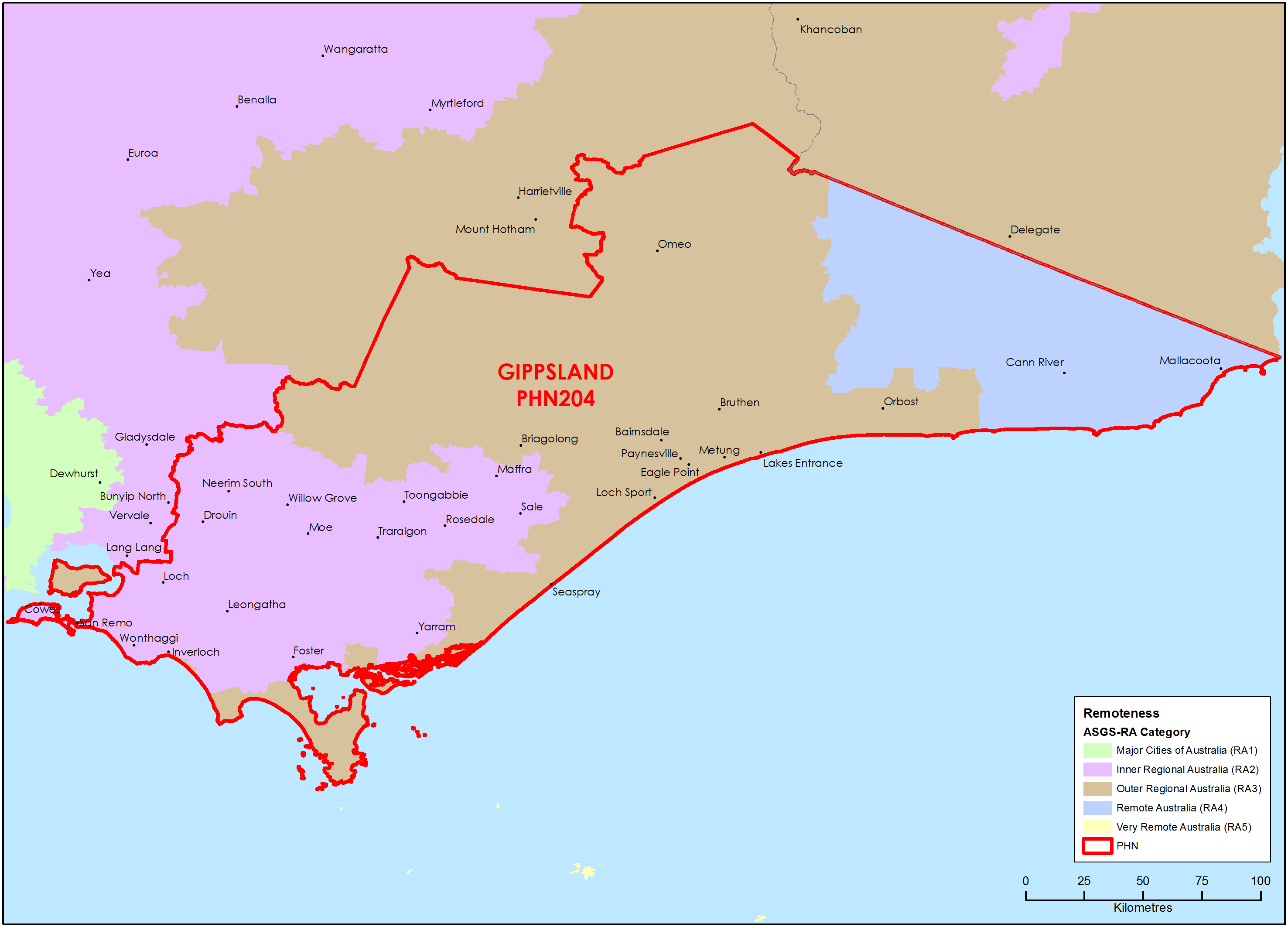
Gippsland (Vic) Primary Health Network (PHN) map – Australian Statistical Geography Standard (ASGS) remoteness area
This map shows the Australian Statistical Geography Standard remoteness area classifications within the Gippsland (Vic) Primary Health Network. -
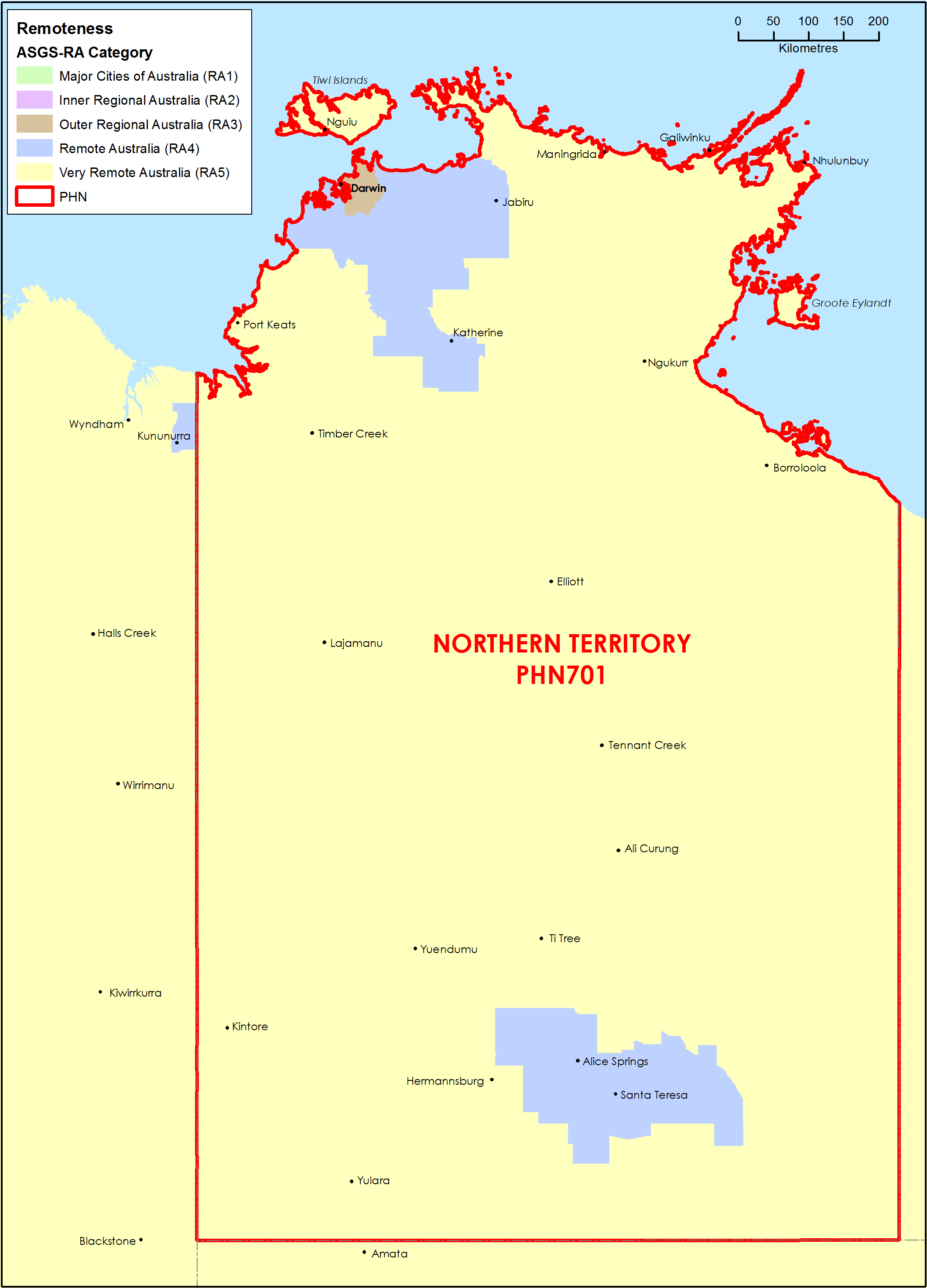
Northern Territory (NT) Primary Health Network (PHN) map – Australian Statistical Geography Standard (ASGS) remoteness area
This map shows the Australian Statistical Geography Standard remoteness area classifications within the Northern Territory Primary Health Network. -
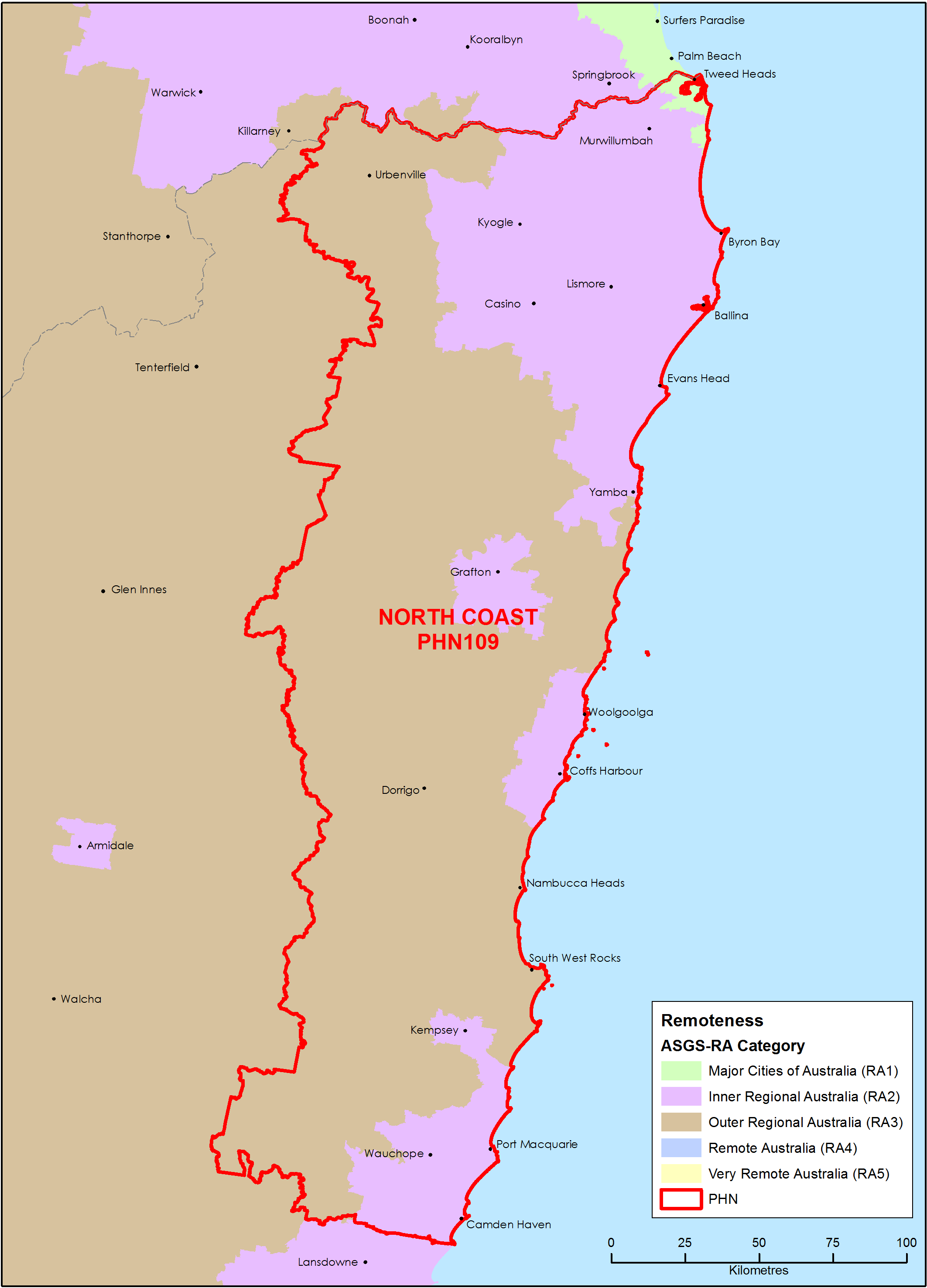
North Coast (NSW) Primary Health Network (PHN) map – Australian Statistical Geography Standard (ASGS) remoteness area
This map shows the Australian Statistical Geography Standard remoteness area classifications within the North Coast (NSW) Primary Health Network. -
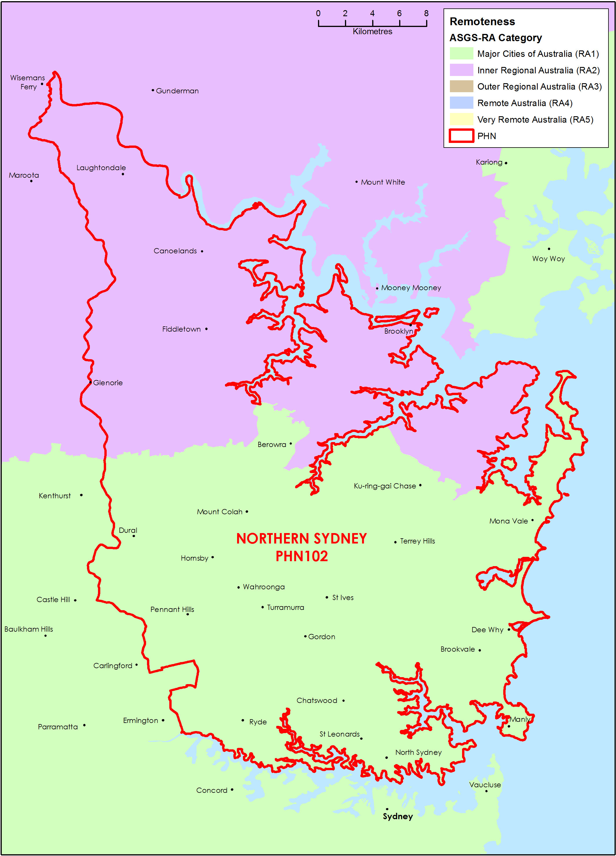
Northern Sydney (NSW) Primary Health Network (PHN) map – Australian Statistical Geography Standard (ASGS) remoteness area
This map shows the Australian Statistical Geography Standard remoteness area classifications within the Northern Sydney (NSW) Primary Health Network. -
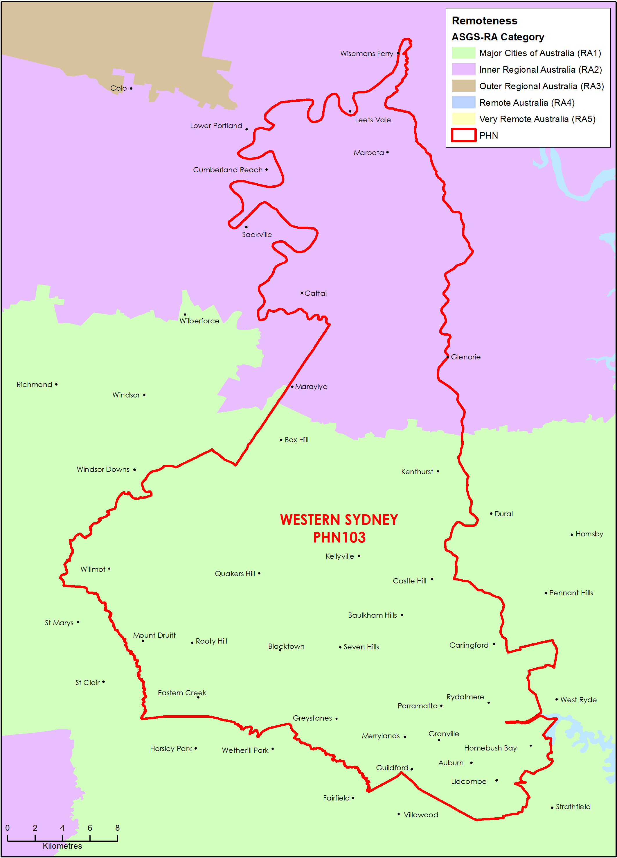
Western Sydney (NSW) Primary Health Network (PHN) map – Australian Statistical Geography Standard (ASGS) remoteness area
This map shows the Australian Statistical Geography Standard remoteness area classifications within the Western Sydney (NSW) Primary Health Network. -
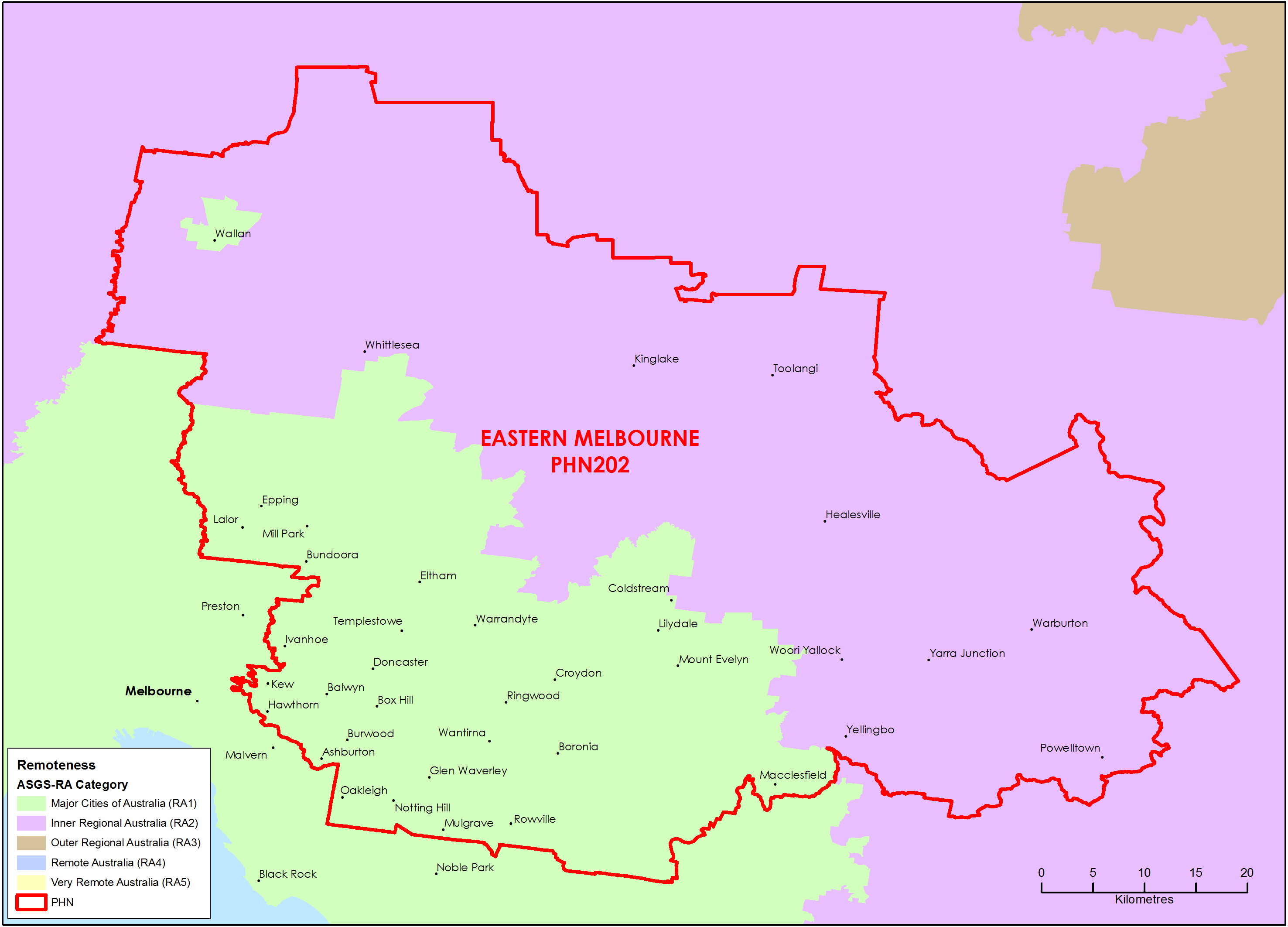
Eastern Melbourne (Vic) Primary Health Network (PHN) map – Australian Statistical Geography Standard (ASGS) remoteness area
This map shows the Australian Statistical Geography Standard remoteness area classifications within the Eastern Melbourne (Vic) Primary Health Network. -
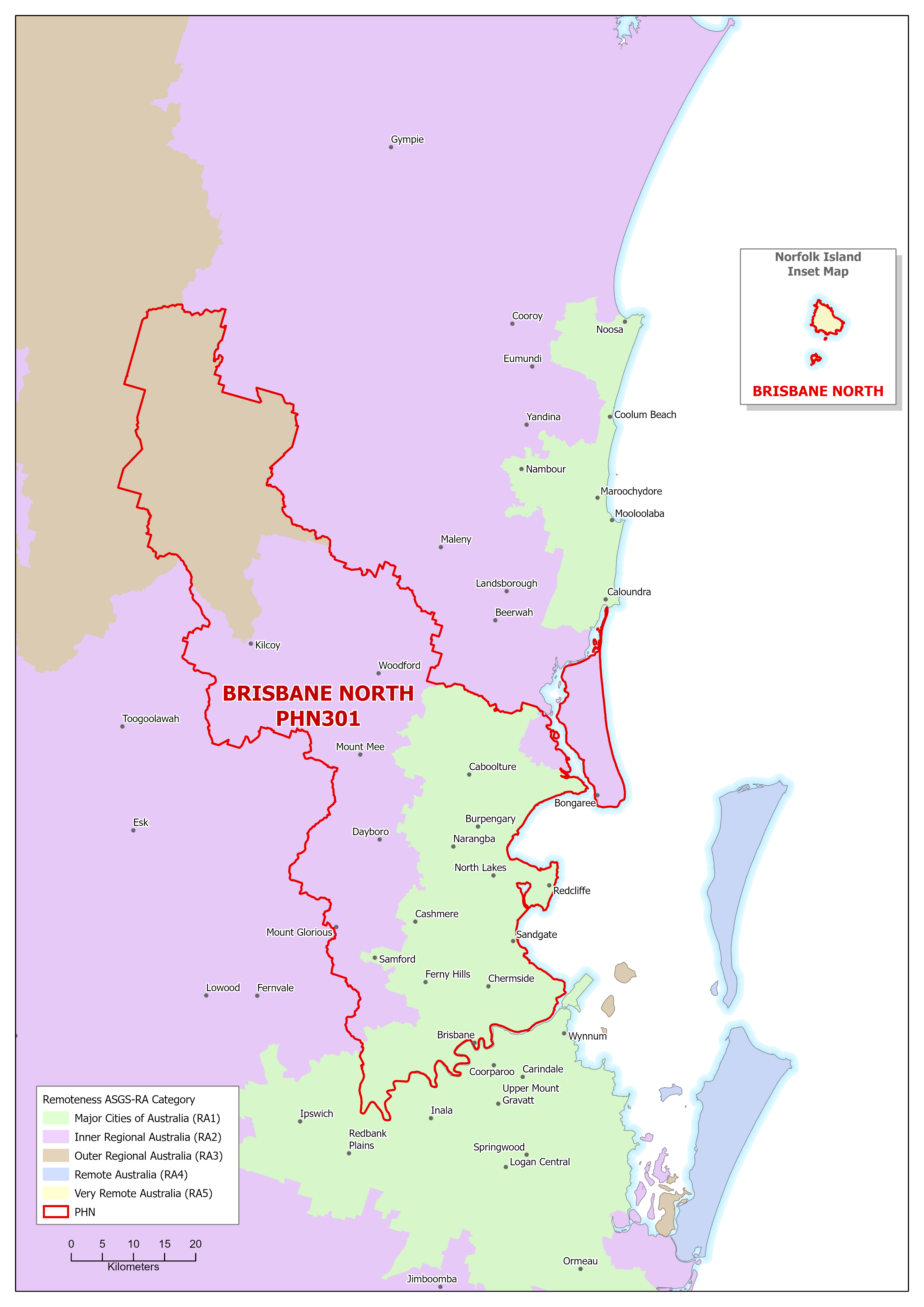
Brisbane North (Qld) Primary Health Network (PHN) map – Australian Statistical Geography Standard (ASGS) remoteness area
This map shows the Australian Statistical Geography Standard remoteness area classifications within the Brisbane North (Qld) Primary Health Network. -
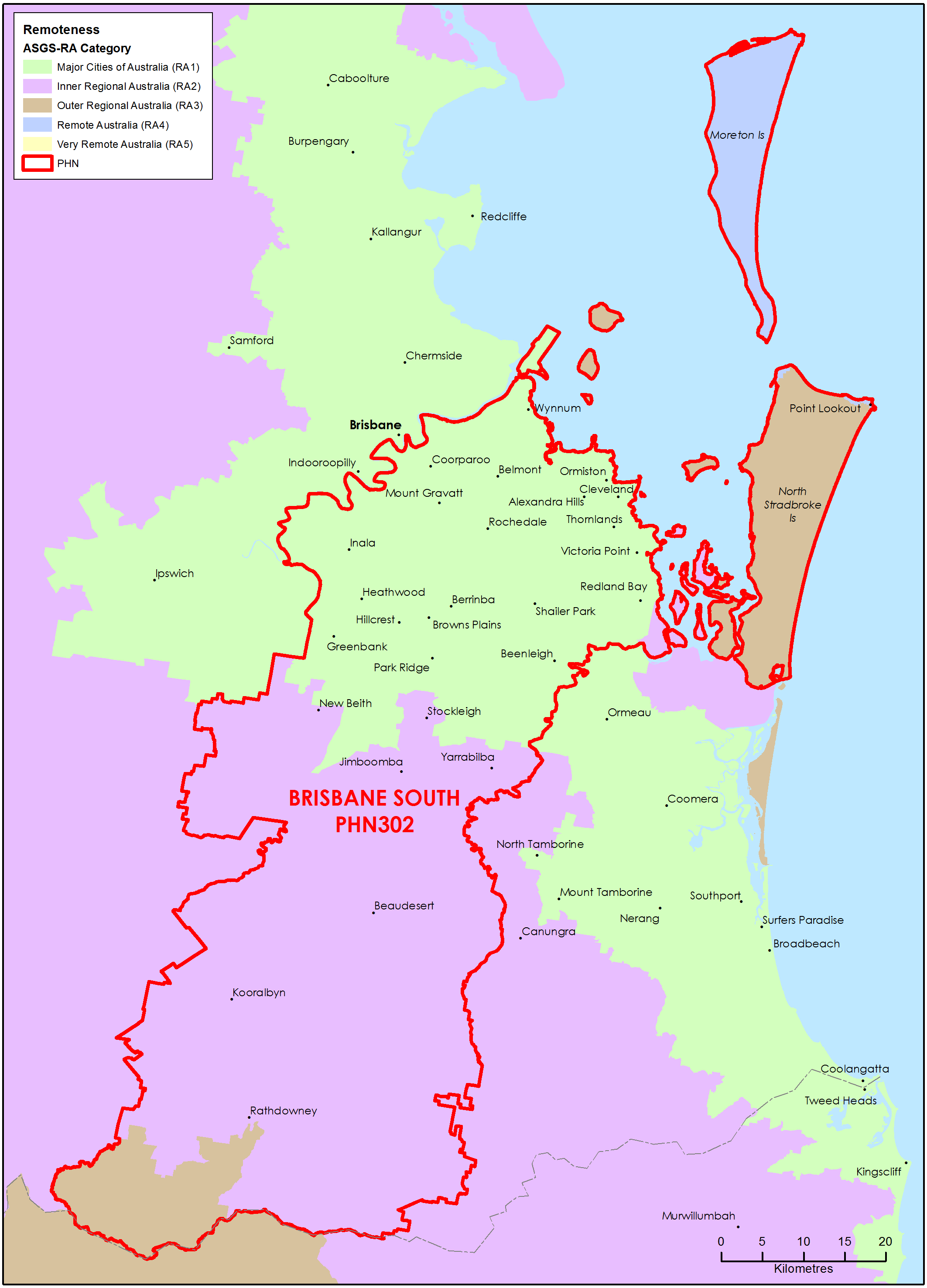
Brisbane South (Qld) Primary Health Network (PHN) map – Australian Statistical Geography Standard (ASGS) remoteness area
This map shows the Australian Statistical Geography Standard remoteness area classifications within the Brisbane South (Qld) Primary Health Network.