Filter results
You can narrow down the results using the filters
Audience
Topics
Our work
Diseases
11692 results
-
Integrating practice pharmacists into Aboriginal Community Controlled Health Services – Final report
This report presents the results of the IPAC project that compared usual care with having pharmacists provide medication management services in Aboriginal Community Controlled Health Services. -

Coronavirus (COVID-19) at a glance – 27 June 2020
This infographic provides a quick view of the coronavirus (COVID-19) situation in Australia on 27 June 2020. -

Coronavirus (COVID-19) at a glance – 26 June 2020
This infographic provides a quick view of the coronavirus (COVID-19) situation in Australia on 26 June 2020. -

Coronavirus (COVID-19) at a glance – 25 June 2020
This infographic provides a quick view of the coronavirus (COVID-19) situation in Australia on 25 June 2020. -

Coronavirus (COVID-19) at a glance – 24 June 2020
This infographic provides a quick view of the coronavirus (COVID-19) situation in Australia on 24 June 2020. -
Effectiveness of the aged care quality assessment and accreditation framework
Australian Government response to the Senate Community Affairs Committee report for the inquiry into the effectiveness of the aged care quality assessment and accreditation framework. -
Review of Assistive Technology Programs in Australia Final Report
This final report examines the current Assistive Technology (AT) arrangements in Australia. -
Review of Assistive Technology Programs in Australia Supplementary Technical Report
This technical report examines the current Assistive Technology (AT) arrangements in Australia. -
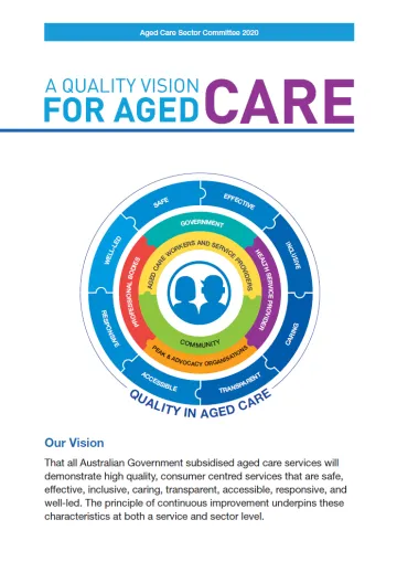
A quality vision for aged care
These resources outline the Aged Care Sector Committee's vision for quality aged care. They include an illustrated poster, a radial diagram poster, an infographic and an overview of the vision and how it supports quality in aged care. -

Coronavirus (COVID-19) at a glance – 23 June 2020
This infographic provides a quick view of the coronavirus (COVID-19) situation in Australia on 23 June 2020. -

Coronavirus (COVID-19) at a glance – 22 June 2020
This infographic provides a quick view of the coronavirus (COVID-19) situation in Australia on 22 June 2020. -

Coronavirus (COVID-19) at a glance – 21 June 2020
This infographic provides a quick view of the coronavirus (COVID-19) situation in Australia on 21 June 2020. -
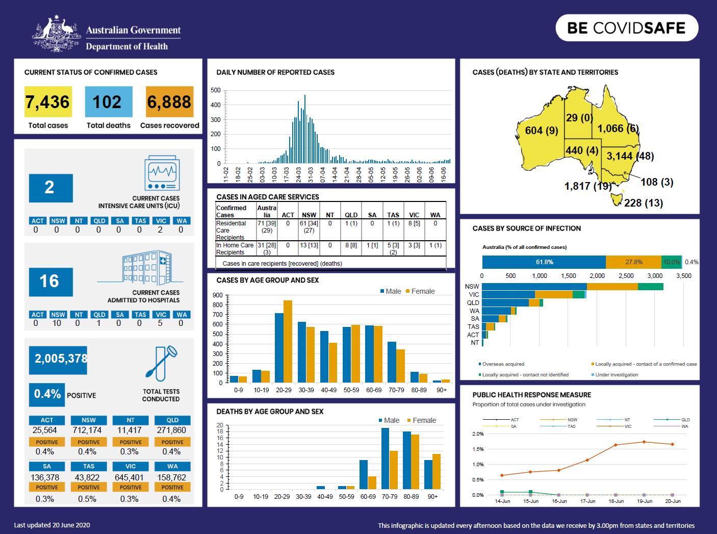
Coronavirus (COVID-19) at a glance – 20 June 2020
This infographic provides a quick view of the coronavirus (COVID-19) situation in Australia on 20 June 2020. -

Coronavirus (COVID-19) at a glance – 19 June 2020
This infographic provides a quick view of the coronavirus (COVID-19) situation in Australia on 19 June 2020. -

Return to School for Students with Disability COVID-19 Risk Management Plan
This plan can help prepare for the return to school. The document is an optional resource for parents and carers. It can aid discussions with a student’s school and doctor on strategies to reduce risks in the school environment. -

Coronavirus (COVID-19) at a glance – 18 June 2020
This infographic provides a quick view of the coronavirus (COVID-19) situation in Australia on 18 June 2020. -
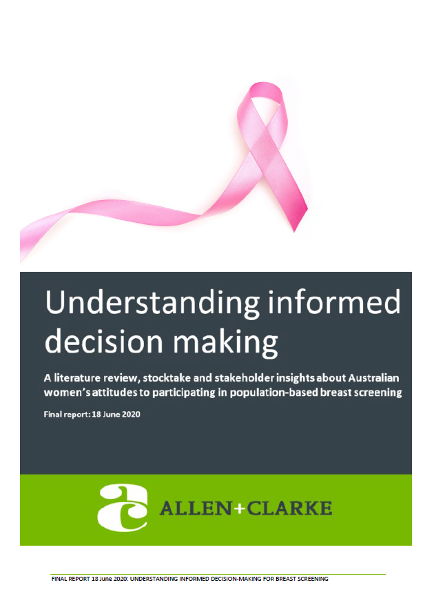
BreastScreen Australia – Understanding informed decision making – a literature review
This report describes Australian women’s attitudes to participating in the BreastScreen Australia Program (BSA), a population-based screening program. It is based on a literature review, resources stocktake and insights from stakeholder interviews. -
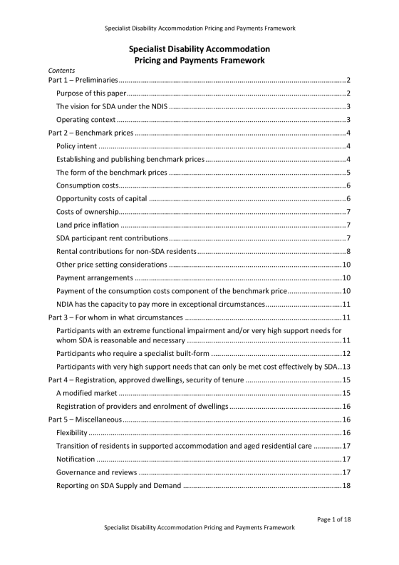
Specialist Disability Accommodation Pricing and Payments Framework
Specialist Disability Accommodation Pricing and Payments Framework -
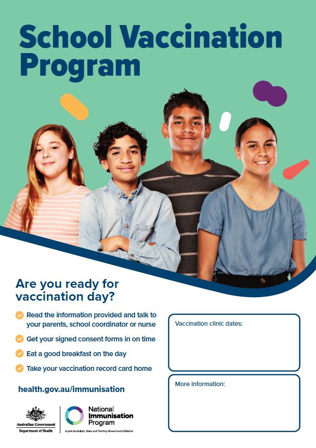
School vaccination program – poster
This poster promotes general school-based vaccination programs for adolescents, for use in school settings. -

Coronavirus (COVID-19) at a glance – 17 June 2020
This infographic provides a quick view of the coronavirus (COVID-19) situation in Australia on 17 June 2020. -
Prostheses List Cost Recovery Implementation Statement – 1 July 2020 to 30 June 2021
This statement describes how we recover the costs of administering the Prostheses List. -

Coronavirus (COVID-19) at a glance – 16 June 2020
This infographic provides a quick view of the coronavirus (COVID-19) situation in Australia on 16 June 2020. -
IPAG communique – 16 June 2020
A statement on the proceedings of the 13th IPAG meeting held on 16 June 2020. -
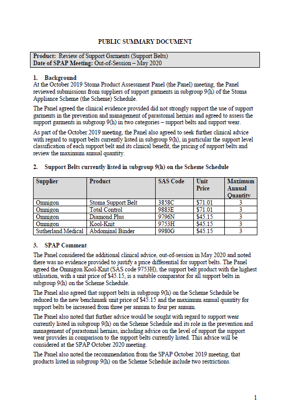
Stoma Product Assessment Panel public summary documents – May 2020 – review of support garments
This public summary document outlines a Stoma Product Assessment Panel decision, following a review of support garments in subgroup 9(h) of the Stoma Appliance Scheme Schedule. -

COVID-19 and the particular risks for people with disability – Roundtable – Minutes and actions arising 16 June 2020
This communique outlines the issues and key actions following the third Roundtable meeting on 16 June 2020. The Chair invited discussion of lived experience during the COVID-19 pandemic.