
Filter results
You can narrow down the results using the filters
Audience
Topics
Our work
Diseases
11609 results
-

Thriving Kids Advisory Group communique – September 2025
This communique is published following each meeting of the Thriving Kids Advisory Group. It summarises the meeting discussions and outcomes. -
 57:31
Changes in financial reporting from 1 November 2025 – Video
This is a recording of the Changes in financial reporting from 1 November 2025 webinar held on 23 September 2025. -
Support at Home – Frequently asked questions for older people
This document answers some frequently asked questions from older people, families and carers about the Support at Home program following the webinar on 14 August 2025. -
24/7 registered nurses in aged care homes
This fact sheet helps older people, their families and carers understand the 24/7 registered nurse requirement for approved residential aged care. -

Australian Capital Territory (ACT) Primary Health Network (PHN) map – Modified Monash Model (MMM) remoteness area
This map shows the Modified Monash Model remoteness area classifications of the Australian Capital Territory Primary Health Network. -

Australian Capital Territory (ACT) Primary Health Network (PHN) map – socioeconomic disadvantage
This map shows the most socioeconomically disadvantaged areas within the Australian Capital Territory Primary Health Network. -

Australian Capital Territory (ACT) Primary Health Network (PHN) map – topographic
This map shows the geographical area of the Australian Capital Territory Primary Health Network. -
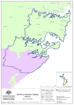
Central and Eastern Sydney (NSW) Primary Health Network (PHN) map – Modified Monash Model (MMM) remoteness area
This map shows the Modified Monash Model remoteness area classifications of the Central and Eastern Sydney (NSW) Primary Health Network. -

Central and Eastern Sydney (NSW) Primary Health Network (PHN) map – socioeconomic disadvantage
This map shows the most socioeconomically disadvantaged areas within the Central and Eastern Sydney (NSW) Primary Health Network. -

Central and Eastern Sydney (NSW) Primary Health Network (PHN) map – topographic
This map shows the geographical area of the Central and Eastern Sydney (NSW) Primary Health Network. -
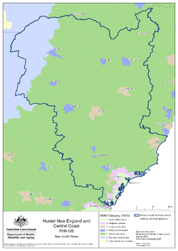
Hunter, New England and Central Coast (NSW) Primary Health Network (PHN) map – Modified Monash Model (MMM) remoteness area
This map shows the Modified Monash Model remoteness area classifications of the Hunter, New England and Central Coast (NSW) Primary Health Network. -

Hunter, New England and Central Coast (NSW) Primary Health Network (PHN) map – socioeconomic disadvantage
This map shows the most socioeconomically disadvantaged areas within the Hunter, New England and Central Coast (NSW) Primary Health Network. -

Hunter, New England and Central Coast (NSW) Primary Health Network (PHN) map – topographic
This map shows the geographical area of the Hunter, New England and Central Coast (NSW) Primary Health Network. -
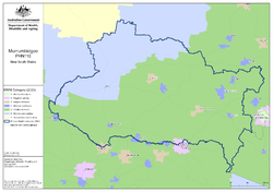
Murrumbidgee (NSW) Primary Health Network (PHN) map – Modified Monash Model (MMM) remoteness area
This map shows the Modified Monash Model remoteness area classifications of the Murrumbidgee (NSW) Primary Health Network. -

Murrumbidgee (NSW) Primary Health Network (PHN) map – socioeconomic disadvantage
This map shows the most socioeconomically disadvantaged areas within the Murrumbidgee (NSW) Primary Health Network. -

Murrumbidgee (NSW) Primary Health Network (PHN) map – topographic
This map shows the geographical area of the Murrumbidgee (NSW) Primary Health Network. -
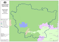
Nepean Blue Mountains (NSW) Primary Health Network (PHN) map – Modified Monash Model (MMM) remoteness area
This map shows the Modified Monash Model remoteness area classifications of the Nepean Blue Mountains (NSW) Primary Health Network. -

Nepean Blue Mountains (NSW) Primary Health Network (PHN) map – socioeconomic disadvantage
This map shows the most socioeconomically disadvantaged areas within the Nepean Blue Mountains (NSW) Primary Health Network. -

Nepean Blue Mountains (NSW) Primary Health Network (PHN) map – topographic
This map shows the geographical area of the Nepean Blue Mountains (NSW) Primary Health Network. -

Northern Territory (NT) Primary Health Network (PHN) map – Modified Monash Model (MMM) remoteness area
This map shows the Modified Monash Model remoteness area classifications of the Northern Territory Primary Health Network. -

Northern Territory (NT) Primary Health Network (PHN) map – socioeconomic disadvantage
This map shows the most socioeconomically disadvantaged areas within the Northern Territory Primary Health Network. -
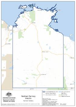
Northern Territory (NT) Primary Health Network (PHN) map – topographic
This map shows the geographical area of the Northern Territory Primary Health Network. -
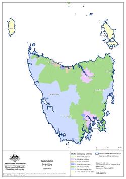
Tasmania Primary Health Network (PHN) map – Modified Monash Model (MMM) remoteness area
This map shows the Modified Monash Model remoteness area classifications of the Tasmania Primary Health Network. -

Tasmania Primary Health Network (PHN) map – socioeconomic disadvantage
This map shows the most socioeconomically disadvantaged areas within the Tasmania Primary Health Network. -

Tasmania Primary Health Network (PHN) map – topographic
This map shows the geographical area of the Tasmania Primary Health Network.