Filter results
You can narrow down the results using the filters
Audience
Topics
Our work
Diseases
11776 results
-
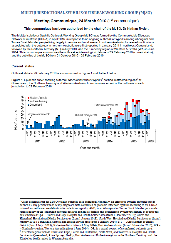
Multijurisdictional Syphilis Outbreak (MJSO) Surveillance Report – consolidated reports March 2016 to February 2018
The surveillance reports summarise the status of an ongoing outbreak of infectious syphilis among Aboriginal and Torres Strait Islander people in remote and rural areas of northern Australia. This report consolidates the monthly surveillance reports from March 2016 to February 2018. -
Review of the Transition Care Programme – Final Report
This review showed that the program plays an effective and important role where Australia’s health and aged care systems meet. It has supported the early discharge of older people from hospital and can help delay their entry into residential care. -
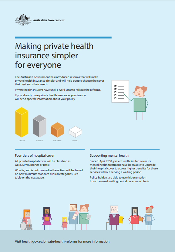
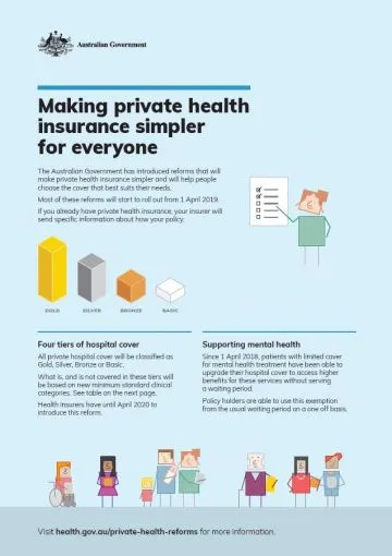
Making private health insurance simpler for everyone – fact sheet
This fact sheet describes the Government’s reforms to private health insurance. -
Australian Government Response to the Joint Standing Committee – Provision of Assistive Technology under the NDIS
The Joint Standing Committee on the National Disability Insurance Scheme (the Committee) released a report into the provision of Assistive Technology (AT) under the National Disability Insurance Scheme (NDIS) in December 2018. -
National Strategic Action Plan for Inflammatory Bowel Disease
The National Strategic Action Plan for Inflammatory Bowel Disease (IBD) provides a path to better care, better quality of life and reduced burden of IBD for the Australian community. -
National Strategic Action Plan for Arthritis
The National Strategic Action Plan for Arthritis aims to guide national efforts to address the burden of arthritis. -
Review of implementation of the National Disability Strategy 2010–2020
As part of the development of Australia’s Disability Strategy 2021–2031, the Department of Social Services engaged the Social Policy Research Centre of the University of New South Wales to undertake an independent, targeted review of implementation of the National Disability Strategy 2010–2020. -
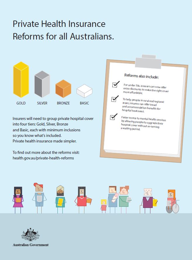
Private health insurance reforms campaign poster
This poster outlines the Government’s reforms to private health insurance. -
Annual report 2018 – National Rural Health Commissioner
This annual report covers the commissioner’s activities from 1 January 2018 to 31 December 2018. -
Roadmap for Hearing Health
The Roadmap for Hearing Health was developed independently by the Hearing Health Sector Committee. It sets out suggested actions to support short, medium and long-term improvements in hearing health for all people in Australia. -
Reform and system transformation – a 5-year horizon for Primary Health Networks
This document provides a plan to support Primary Health Networks as they take part in mental health reform over the next 5 years. -
Strengthening Protections for Older Australians
This report — Strengthening Protections for Older Australians: Models and Options for a Serious Incident Response Scheme for Commonwealth-funded Aged Care Service Providers — was prepared by KPMG. It details options for a serious incident response scheme (SIRS). -
Australian National Breastfeeding Strategy – Report on stakeholder consultations, October 2018
This report presents the key themes from online public consultation on the draft Australian National Breastfeeding Strategy, from 22 May to 18 June 2018. -
The National Palliative Care Strategy 2018
This is most recent version of the National Palliative Care Strategy. -
Healthy Food Partnership – Industry Best Practice Guide Working Group work plan
This document guides the work of the Healthy Food Partnership’s Industry Best Practice Working Group, as they develop a guide for industry on setting and promoting appropriate serving sizes. -
Summary outcomes of Collaborative HTLV-1 Forum, Alice Springs, August 2018
This summary reflects the discussions of participants at the Collaborative Human T-Lymphotropic Virus Type 1 forum held in Alice Springs on 28 and 29 August 2018. -
National Aged Care Advocacy Framework
This framework sets out the objectives, principles, activities and target groups of the National Aged Care Advocacy Program (NACAP). It outlines ways to make sure program services are consistent, accessible, flexible, innovative and high quality. -
Cardiac Technical Support Services Industry Working Group Terms of Reference
This document sets out the roles, function, membership and operating guidelines of the Cardiac Technical Support Services Industry Working Group. -
Private health insurance reforms web tile
You can use this web tile on your own website to link to information about the Government’s private health insurance reforms. -
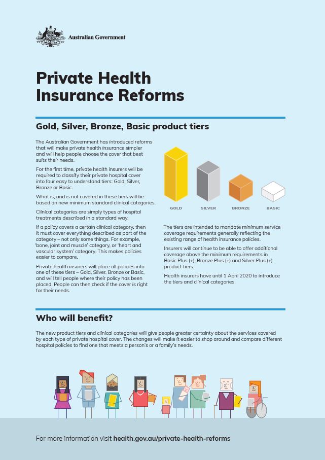
Private health insurance reforms – Gold, Silver, Bronze, Basic product tiers – campaign fact sheet
This campaign fact sheet describes the Gold, Silver, Bronze and Basic private hospital insurance tiers, and what they mean to you. -
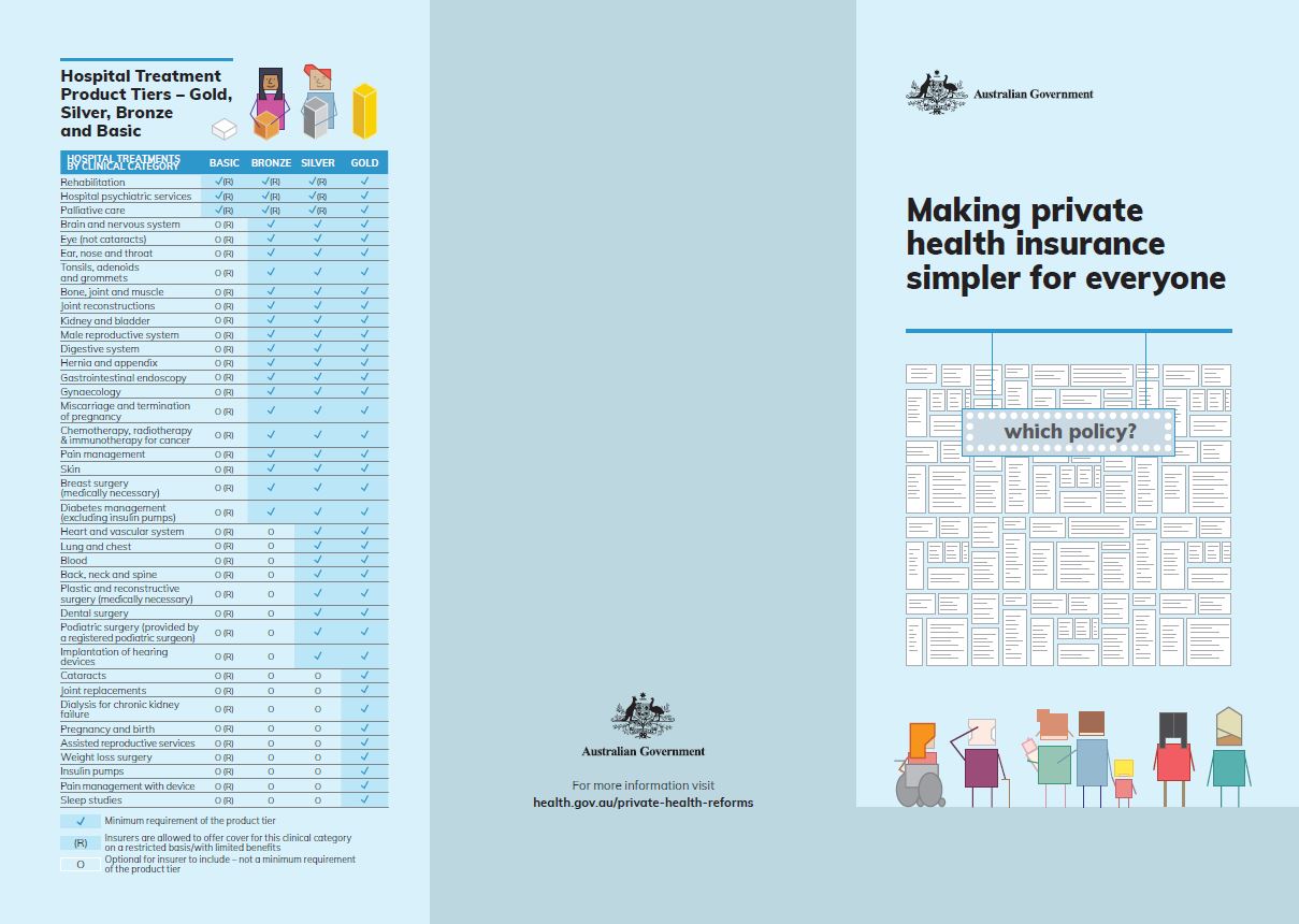
Making private health insurance simpler for everyone – brochure
This brochure describes the Government’s reforms to private health insurance. -
Private health insurance reforms – campaign materials
These campaign materials outline the Government’s reforms to private health insurance.
Several resources are available in English and 5 other languages, including Simplified Chinese, Traditional Chinese, Arabic, Vietnamese and Korean. -
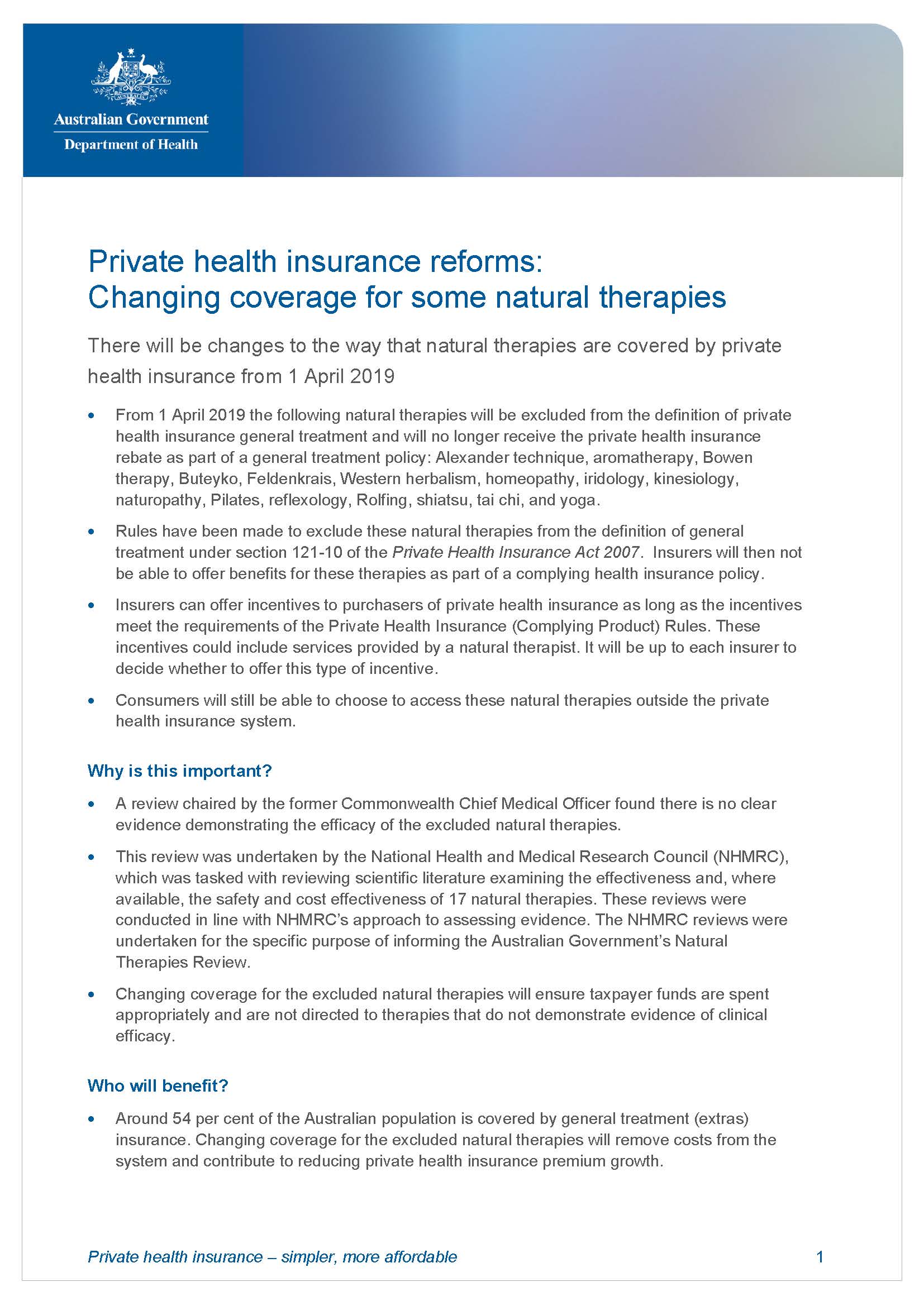
Private health insurance reforms – changing coverage for some natural therapies
This fact sheet is for the general public. It explains the changes to the way that natural therapies are covered by private health insurance. -
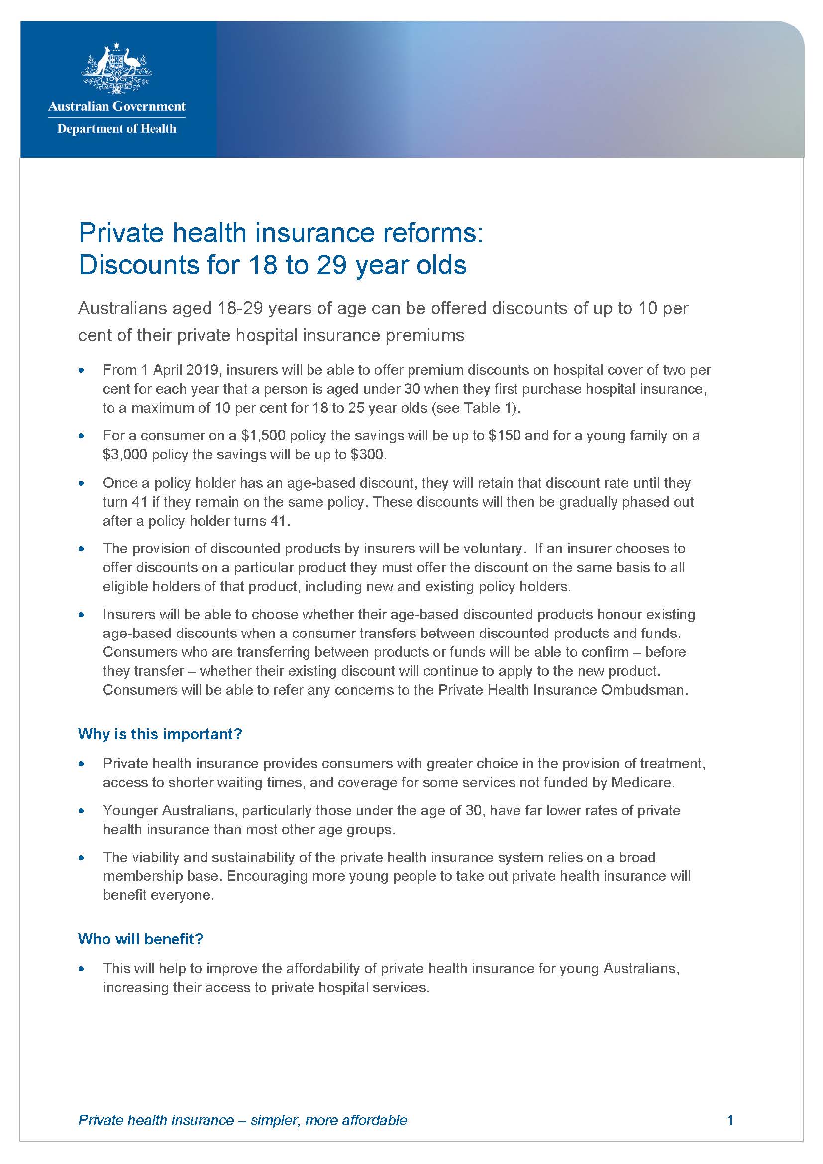
Private health insurance reforms – discount for 18 to 29 year olds
This fact sheet is for the general public. It explains how Australians aged between 18 and 29 years of age can be offered discounts of up to 10% of their private hospital insurance premiums. -
Private health insurance reforms – travel and accommodation benefits for regional and rural consumers
This fact sheet is for the general public. It explains private health insurance improvements to benefits for travel and accommodation for people who have to travel long distances for hospital treatment.