Filter results
You can narrow down the results using the filters
Audience
Topics
Our work
Diseases
11321 results
-
Providers with Younger People in Residential Aged Care: NDIS
This fact sheet is for residential aged care providers delivering care to younger people who may be eligible for the National Disability Insurance Scheme (NDIS). -
Providers with Younger People in Residential Aged Care: NDIS Eligibility Meetings
This fact sheet is for residential aged care providers delivering care to younger people who may be eligible for the National Disability Insurance Scheme (NDIS). It explains how you can help the younger person prepare for their NDIS eligibility meeting. -
Younger People in Residential Aged Care: NDIS
This fact sheet is for people under the age of 65 who are currently in residential care and may be eligible for the National Disability Insurance Scheme (NDIS). -
Younger People in Residential Aged Care: NDIS Eligibility Meetings
This fact sheet is for people under the age of 65 who are currently in residential care and may be eligible for the National Disability Insurance Scheme (NDIS). It explains how you can prepare for your NDIS eligibility meeting. -
Medical complaints process in Australia
Australian Government response to the Senate Community Affairs References Committee report: Medical complaints process in Australia -
Establishment of a national registration system for Australian paramedics to improve and ensure patient and community safety
Australian Government response to the Legal and Constitutional Affairs References Committee report: Establishment of a national registration system for Australian paramedics to improve and ensure patient and community safety -
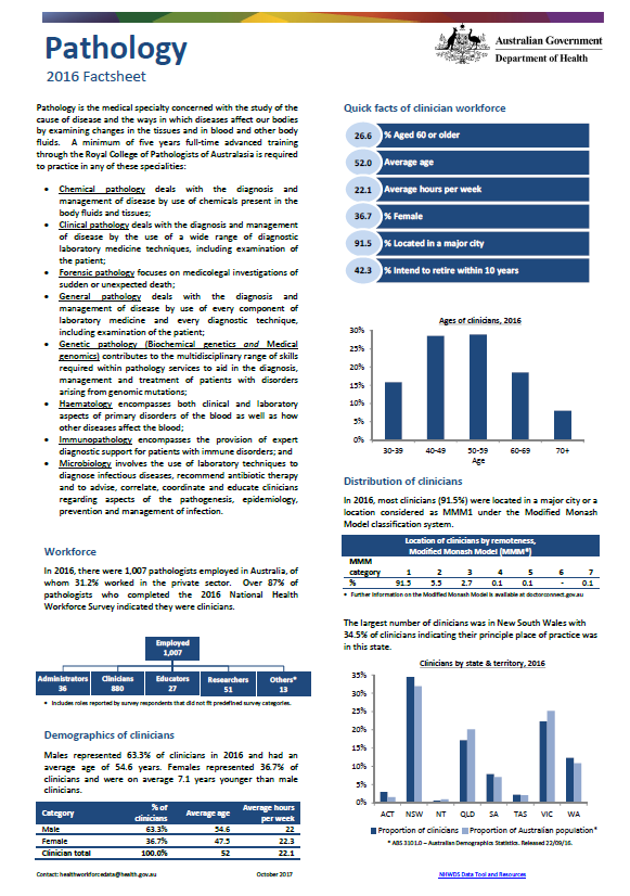
Pathology workforce – MWRAC fact sheet
This Medical Workforce Reform Advisory Committee (MWRAC) fact sheet provides information on the demographics and distribution of the pathology workforce. -
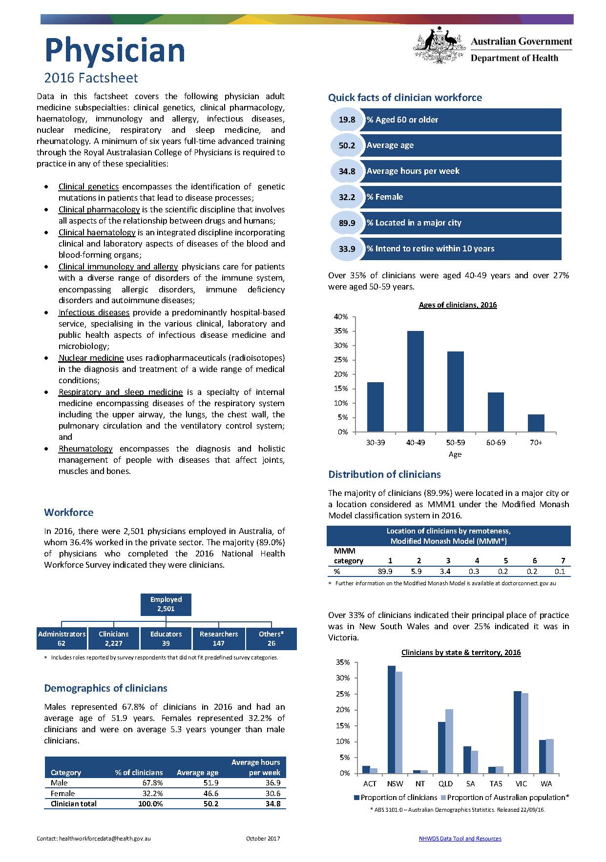
Physician workforce – MWRAC fact sheet
This Medical Workforce Reform Advisory Committee (MWRAC) fact sheet provides information on the demographics and distribution of the physician workforce. -
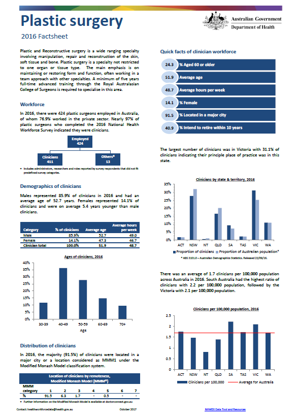
Plastic and reconstructive surgery workforce – MWRAC fact sheet
This Medical Workforce Reform Advisory Committee (MWRAC) fact sheet provides information on the demographics and distribution of the plastic and reconstructive surgery workforce. -
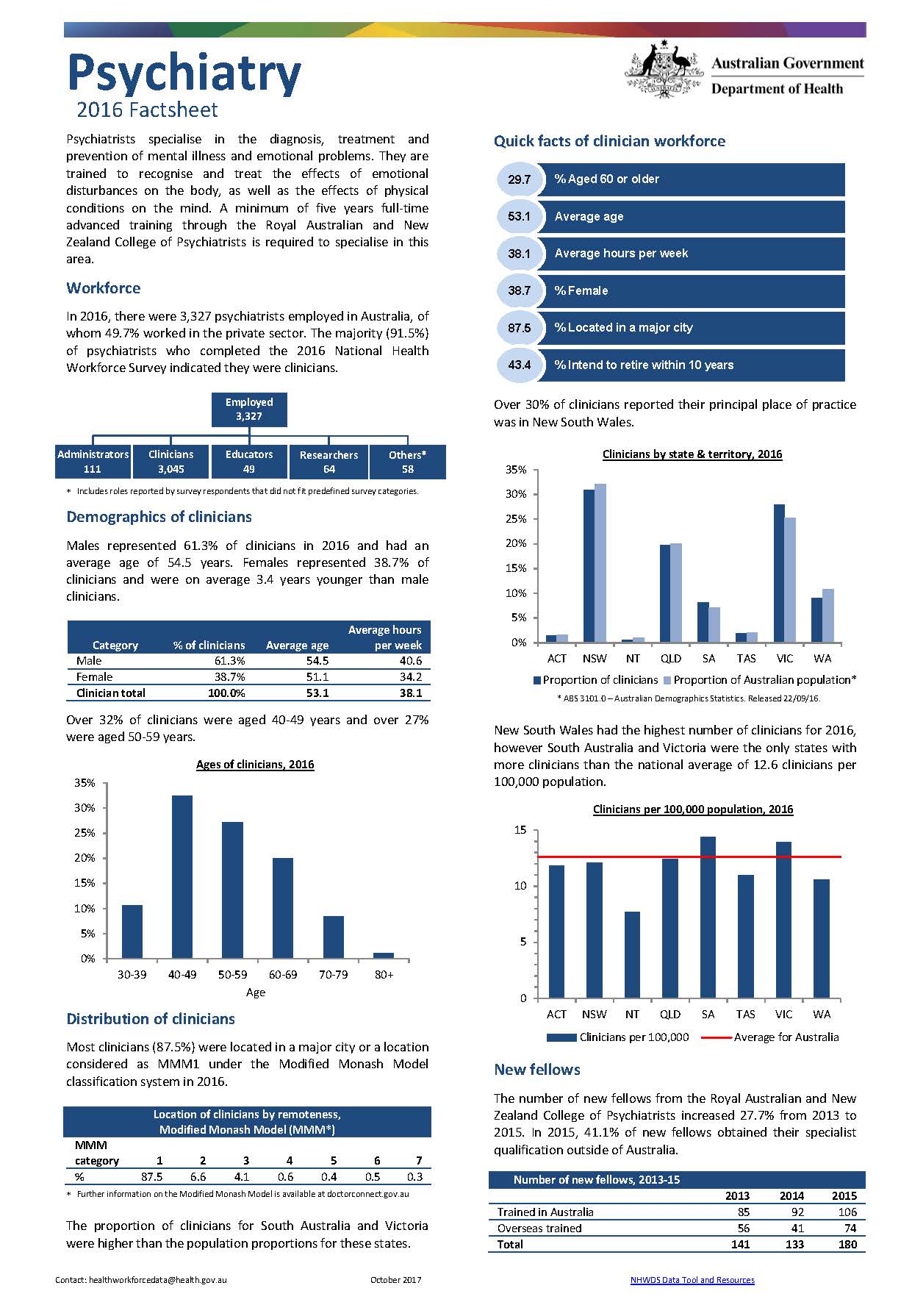
Psychiatry workforce – MWRAC fact sheet
This Medical Workforce Reform Advisory Committee (MWRAC) fact sheet provides information on the demographics and distribution of the psychiatry workforce. -
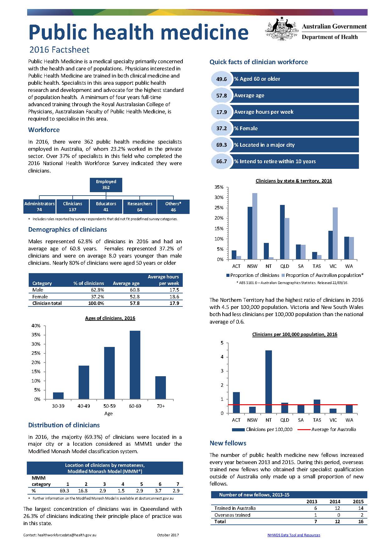
Public health medicine workforce – MWRAC fact sheet
This Medical Workforce Reform Advisory Committee (MWRAC) fact sheet provides information on the demographics and distribution of the public health medicine workforce. -
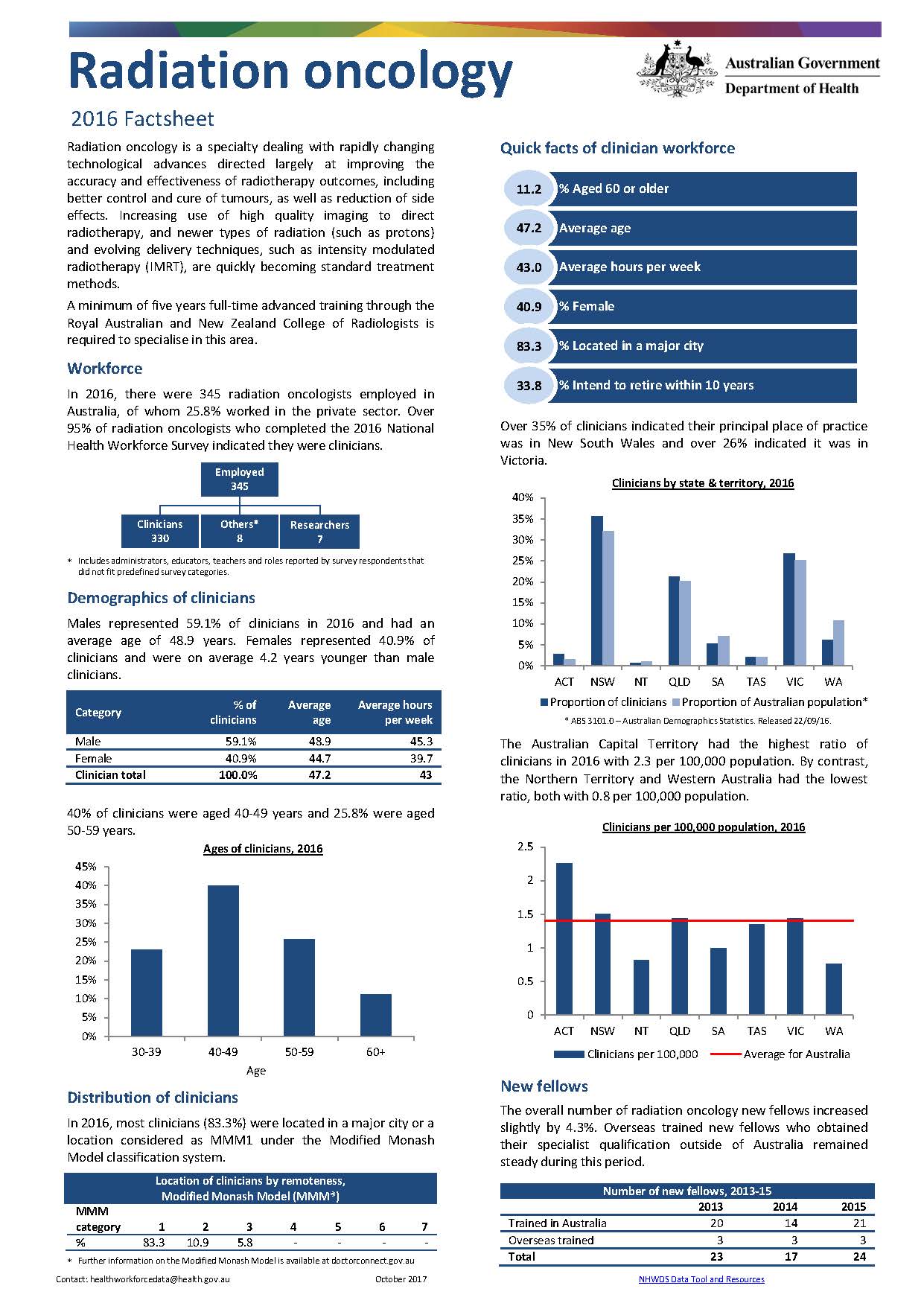
Radiation oncology workforce – MWRAC fact sheet
This Medical Workforce Reform Advisory Committee (MWRAC) fact sheet provides information on the demographics and distribution of the radiation oncology workforce. -
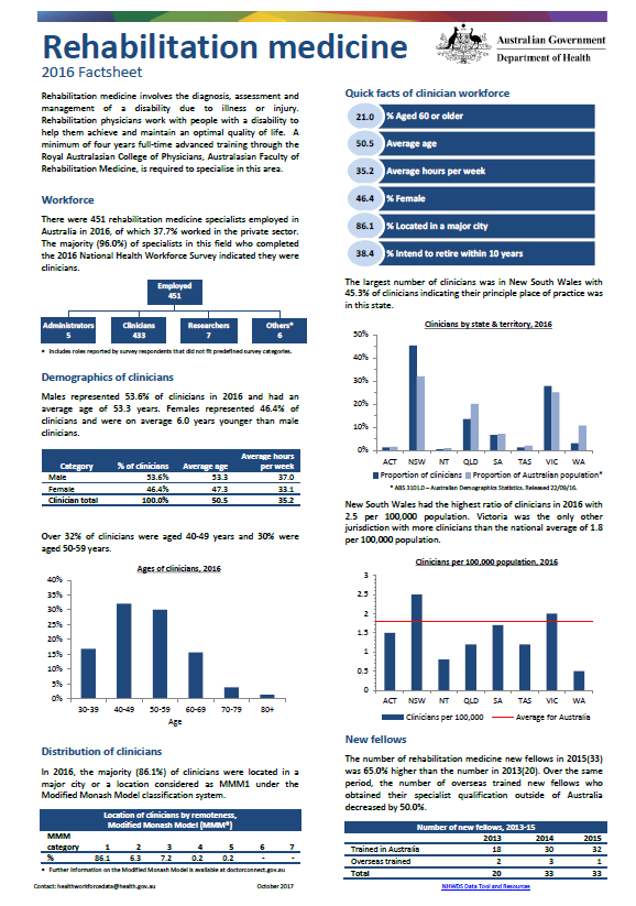
Rehabilitation medicine workforce – MWRAC fact sheet
This Medical Workforce Reform Advisory Committee (MWRAC) fact sheet provides information on the demographics and distribution of the rehabilitation medicine workforce. -
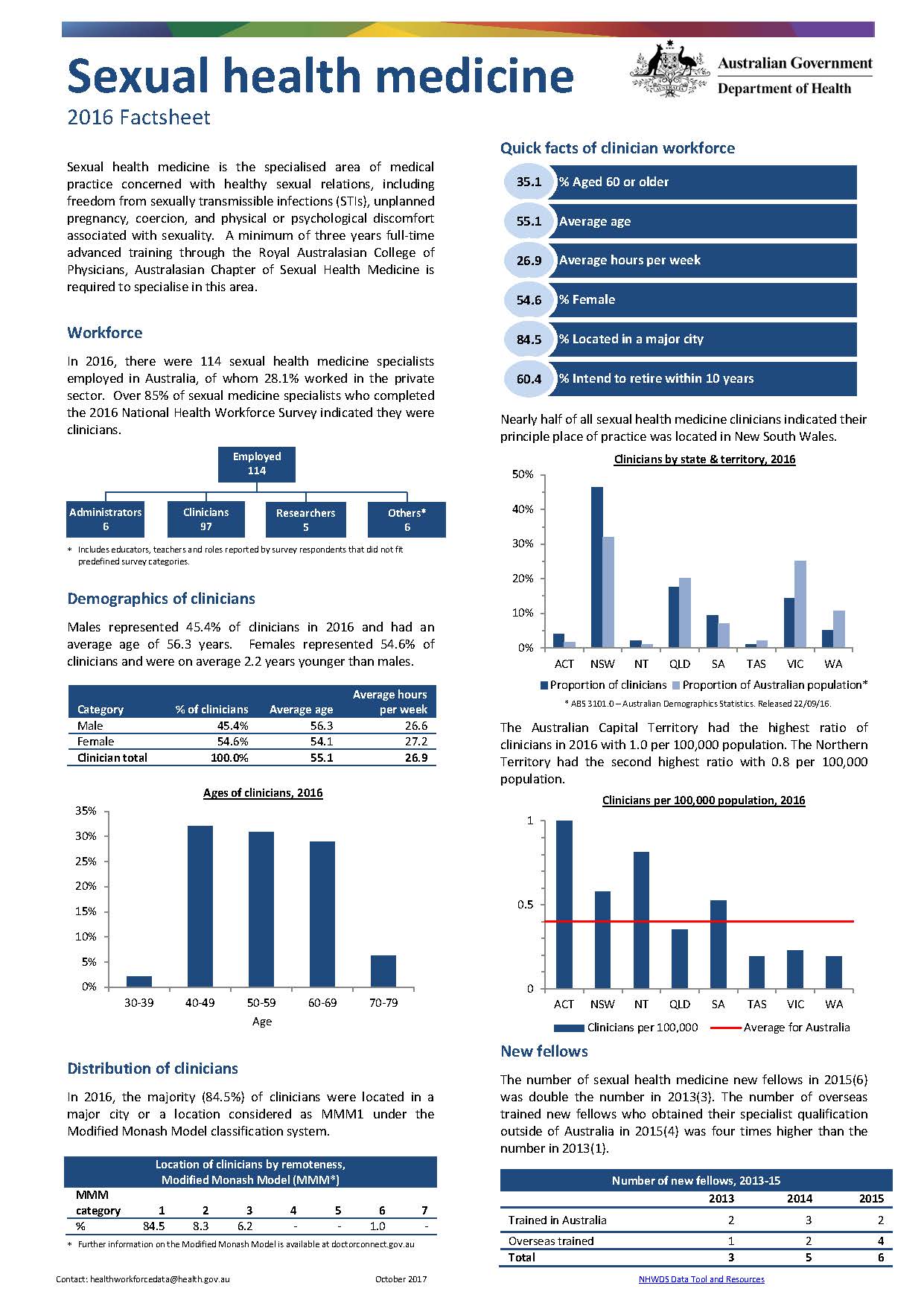
Sexual health medicine workforce – MWRAC fact sheet
This Medical Workforce Reform Advisory Committee (MWRAC) fact sheet provides information on the demographics and distribution of the sexual health medicine workforce. -
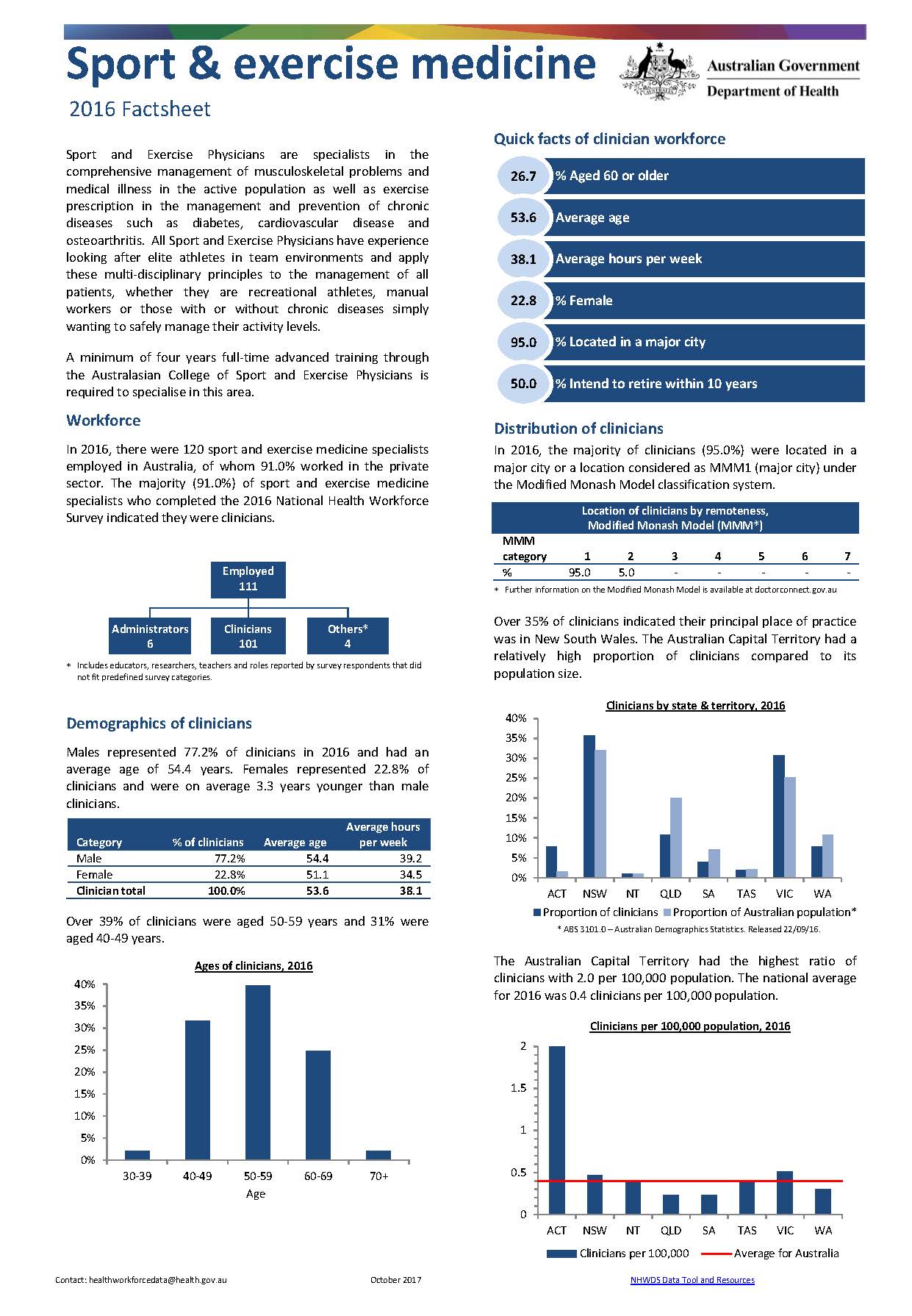
Sport and exercise medicine workforce – MWRAC fact sheet
This Medical Workforce Reform Advisory Committee (MWRAC) fact sheet provides information on the demographics and distribution of the sport and exercise medicine workforce. -
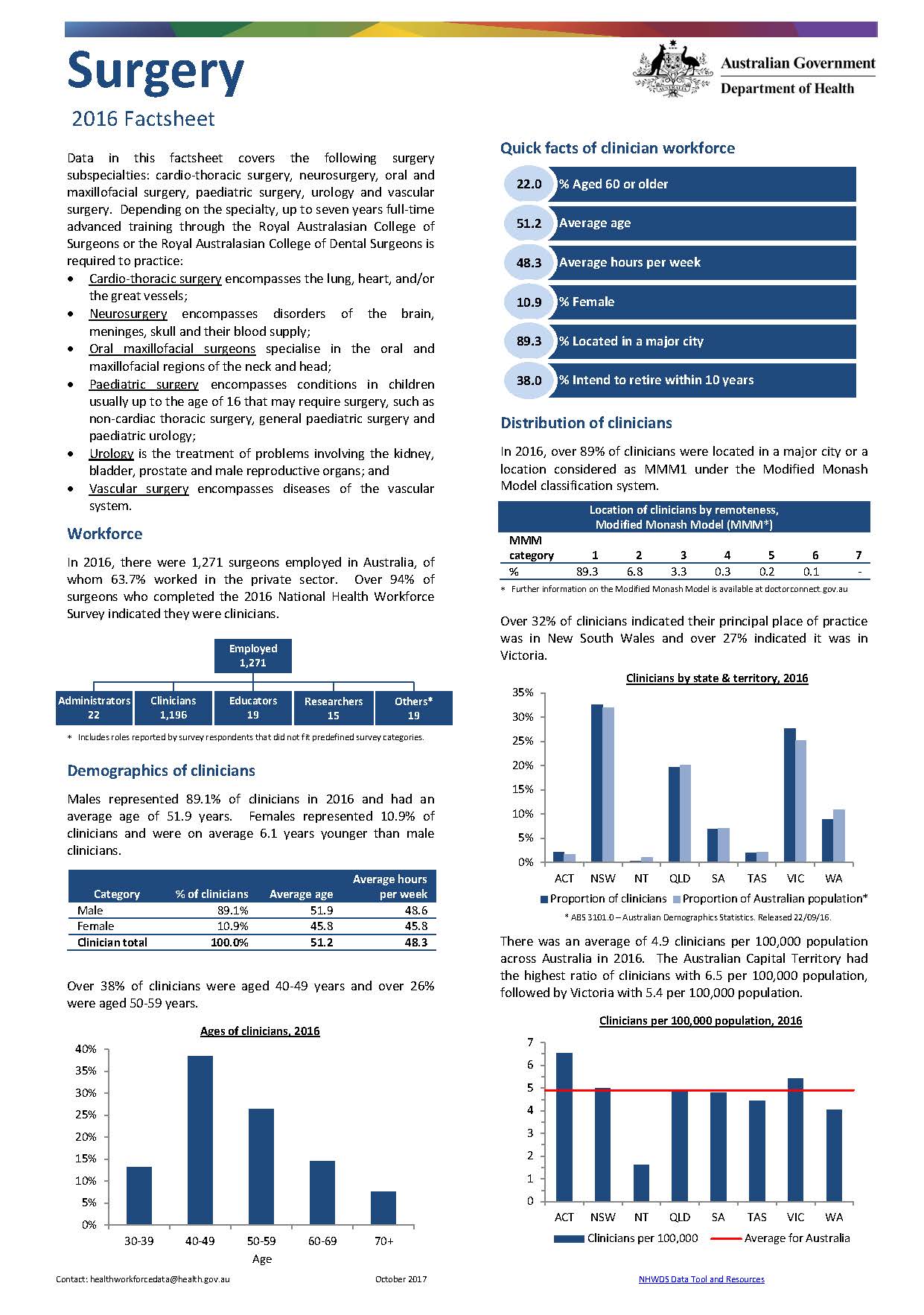
Surgery workforce – MWRAC fact sheet
This Medical Workforce Reform Advisory Committee (MWRAC) fact sheet provides information on the demographics and distribution of the surgery workforce. -
Prevocational doctor fact sheet methodology paper
This document outlines the method we used to develop the Medical Workforce Reform Advisory Committee (MWRAC) workforce fact sheets. -
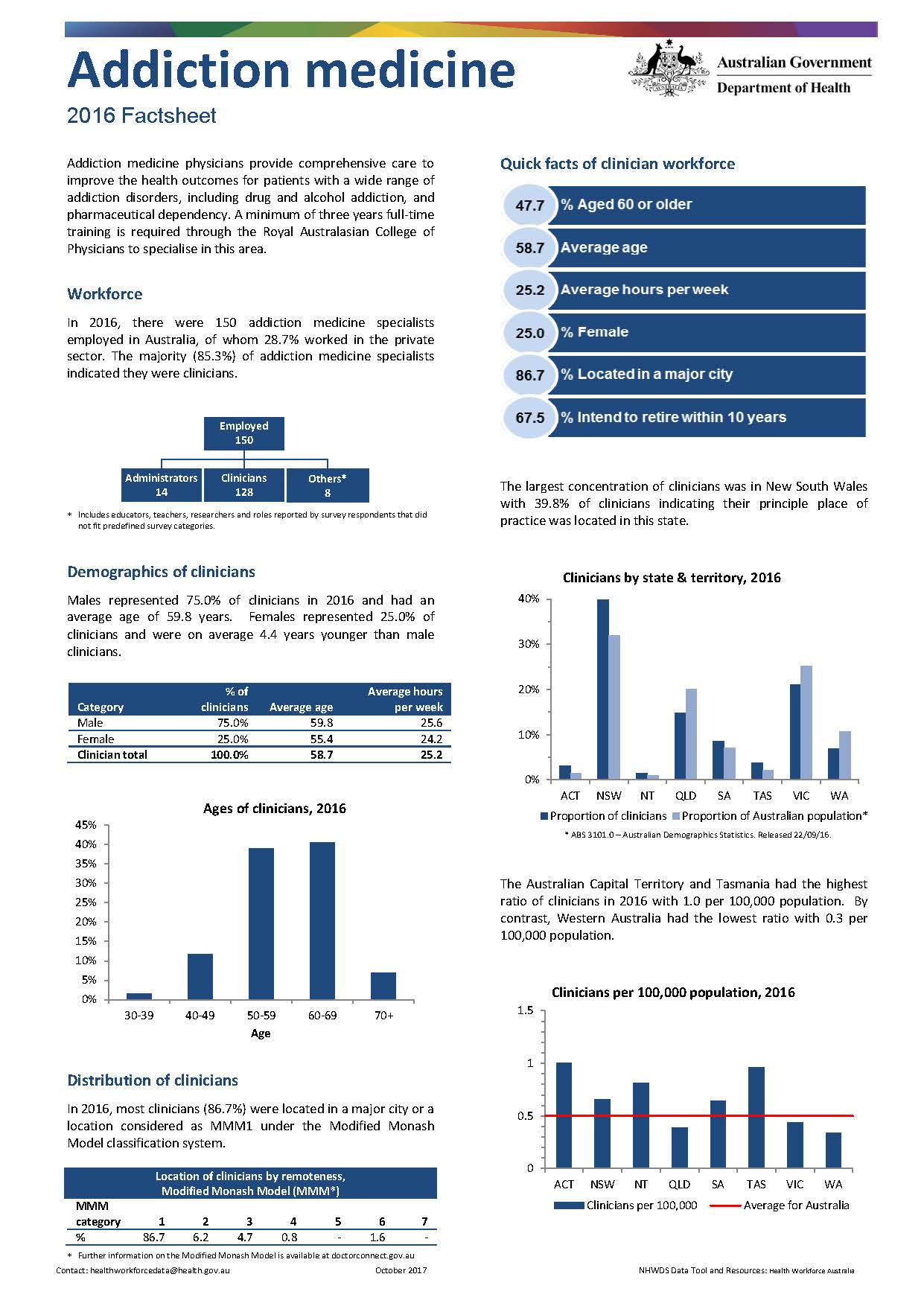
Addiction medicine workforce – MWRAC fact sheet
This Medical Workforce Reform Advisory Committee (MWRAC) fact sheet provides information on the demographics and distribution of the addiction medicine workforce. -
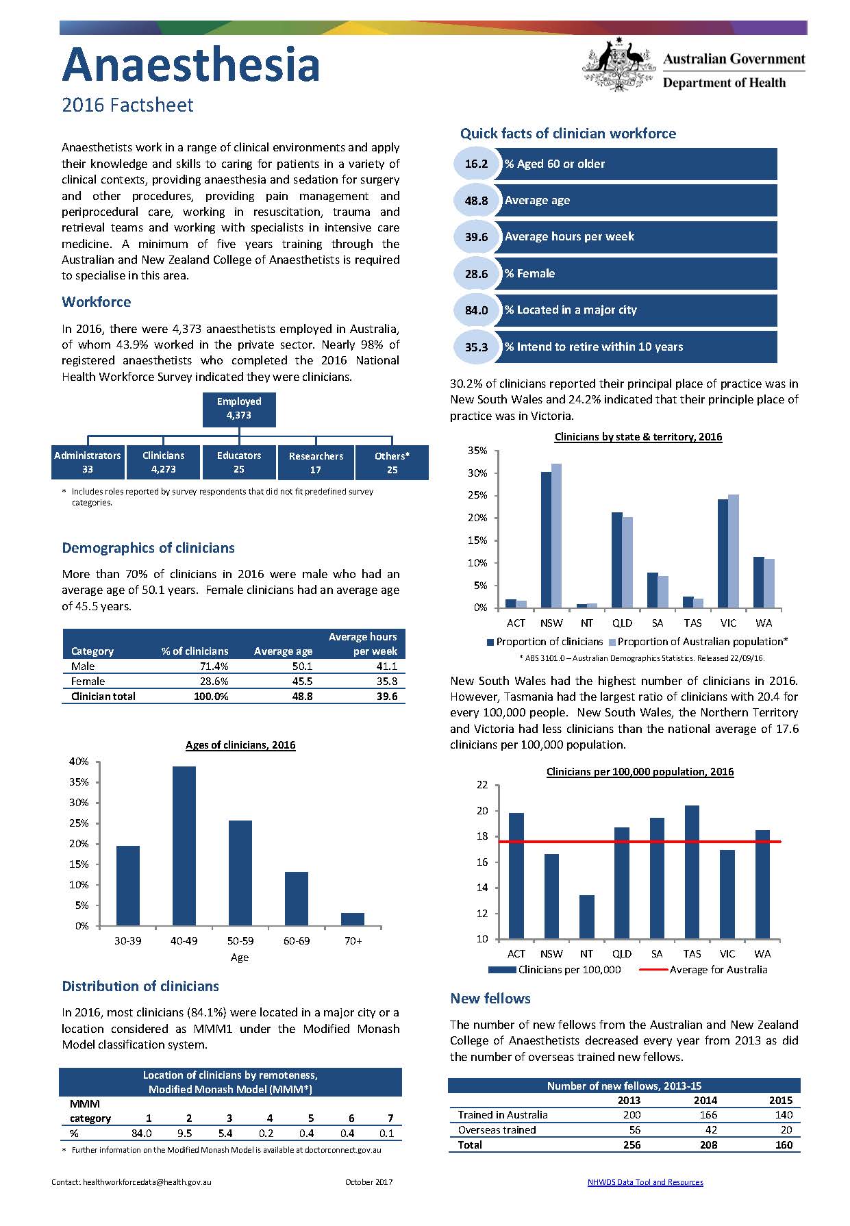
Anaesthesia workforce – MWRAC fact sheet
This Medical Workforce Reform Advisory Committee (MWRAC) fact sheet provides information on the demographics and distribution of the anaesthesia workforce. -
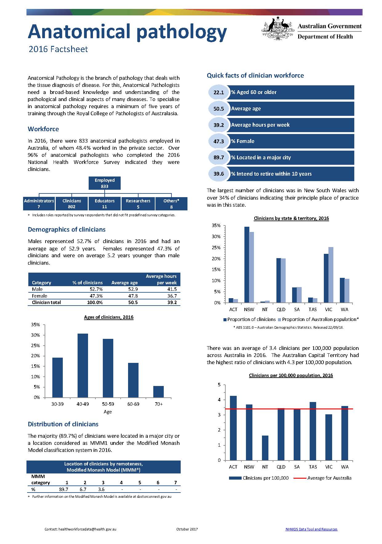
Anatomical pathology workforce – MWRAC fact sheet
This Medical Workforce Reform Advisory Committee (MWRAC) fact sheet provides information on the demographics and distribution of the anatomical pathology workforce. -
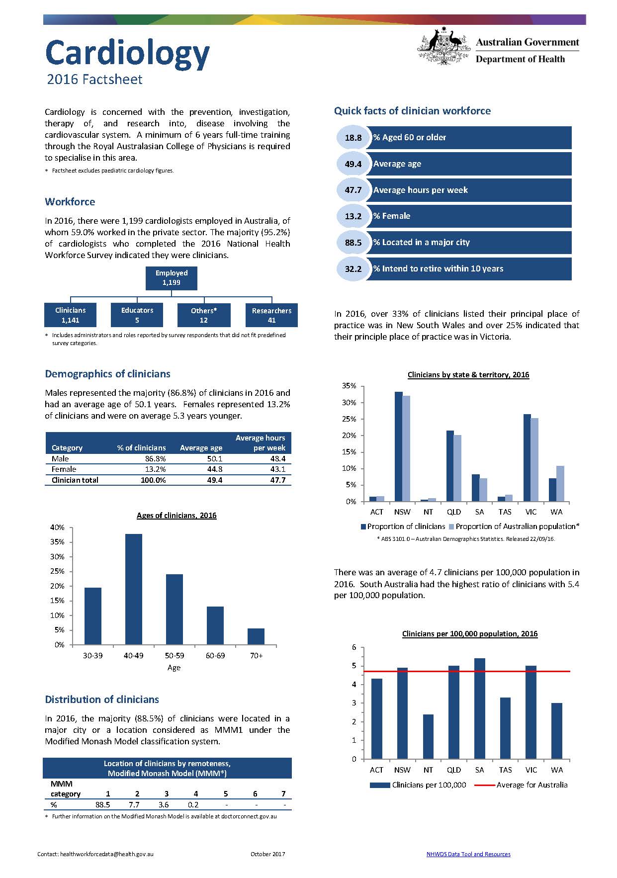
Cardiology workforce – MWRAC fact sheet
This Medical Workforce Reform Advisory Committee (MWRAC) fact sheet provides information on the demographics and distribution of the cardiology workforce. -
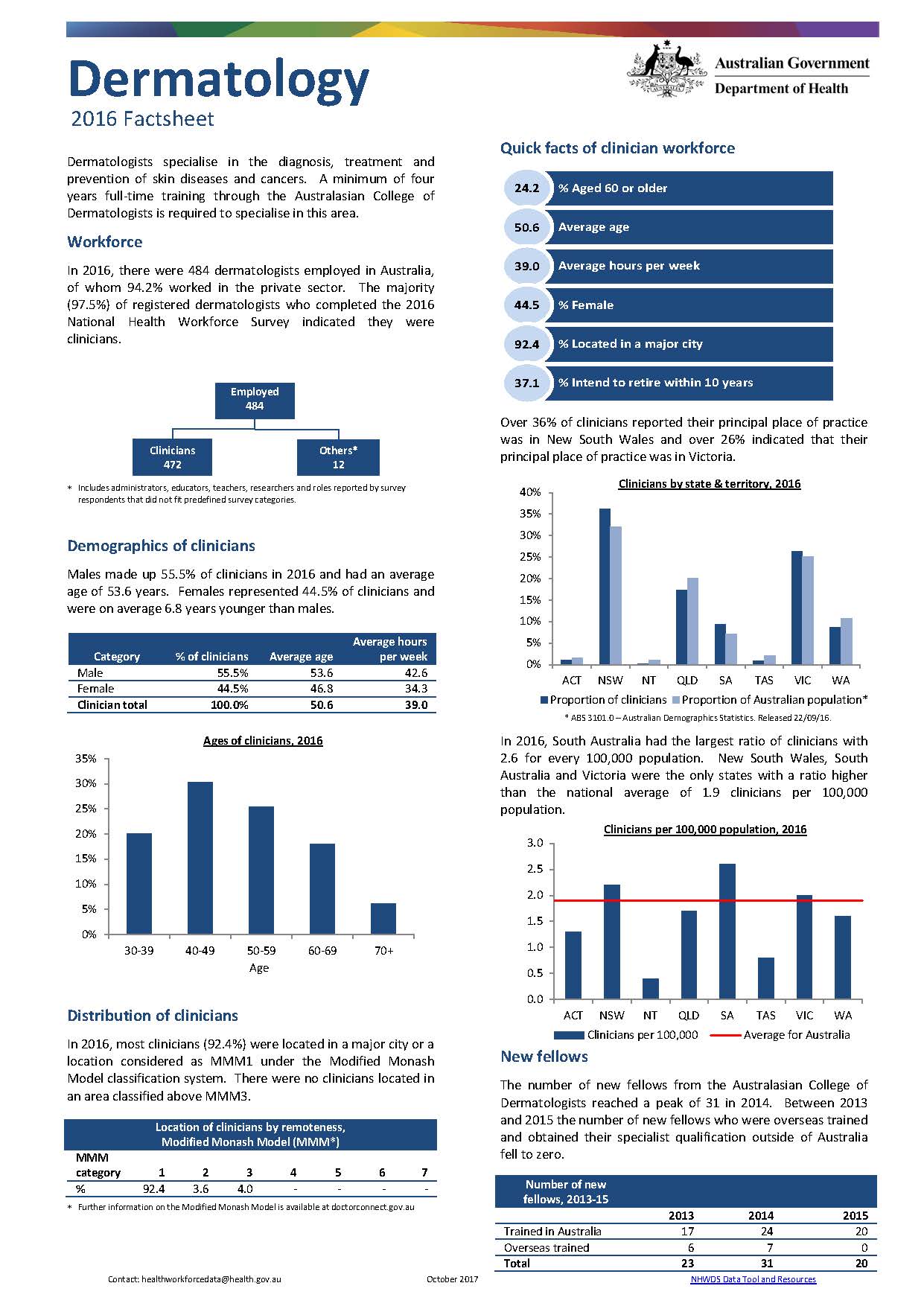
Dermatology workforce – MWRAC fact sheet
This Medical Workforce Reform Advisory Committee (MWRAC) fact sheet provides information on the demographics and distribution of the dermatology workforce. -
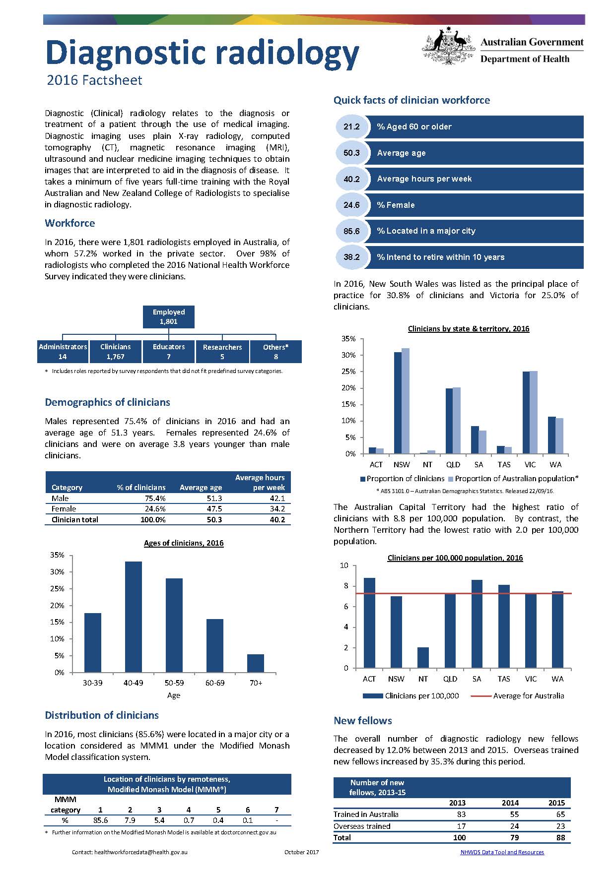
Diagnostic radiology workforce – MWRAC fact sheet
This Medical Workforce Reform Advisory Committee (MWRAC) fact sheet provides information on the demographics and distribution of the diagnostic radiology workforce. -
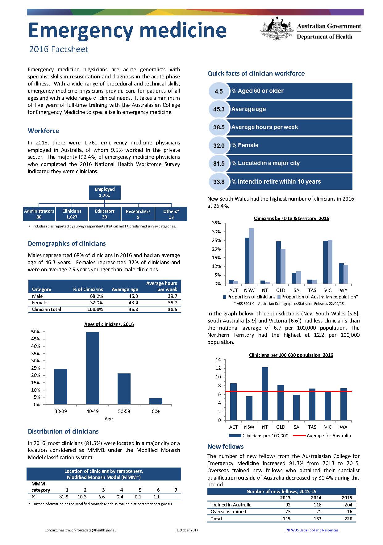
Emergency medicine workforce – MWRAC fact sheet
This Medical Workforce Reform Advisory Committee (MWRAC) fact sheet provides information on the demographics and distribution of the emergency medicine workforce. -
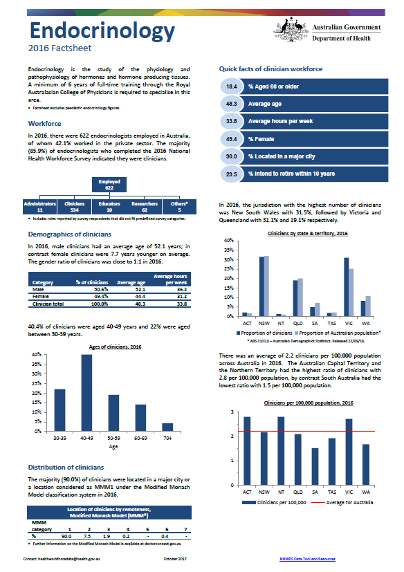
Endocrinology workforce – MWRAC fact sheet
This Medical Workforce Reform Advisory Committee (MWRAC) fact sheet provides information on the demographics and distribution of the endocrinology workforce.