Filter results
You can narrow down the results using the filters
Audience
Topics
Our work
Diseases
11564 results
-
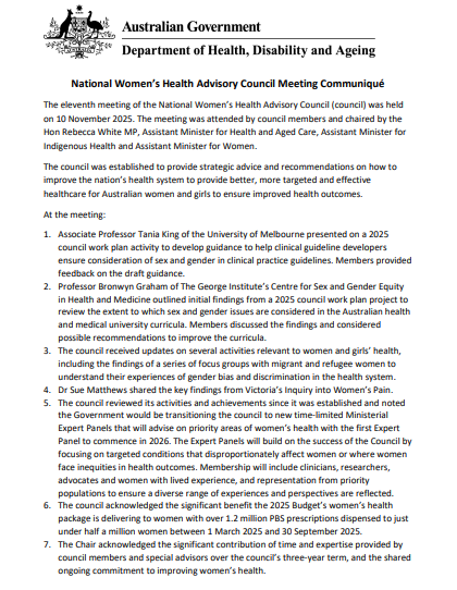
National Women's Health Advisory Council communique – 10 November 2025
This communiqué from the 11th meeting of the National Women's Health Advisory Council on 10 November 2025. -

How to acknowledge all items as incorrectly claimed using the Online Compliance Platform (OCP)
This OCP user guide demonstrates how to tell us that your claims are all compliant using the Online Compliance Platform (OCP). -

How to voluntarily acknowledge additional services using the Online Compliance Platform (OCP)
This OCP user guide demonstrates how to voluntarily acknowledge additional services using the Online Compliance Platform (OCP). -
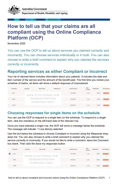
How to tell us that your claims are all compliant using the Online Compliance Platform (OCP)
This OCP user guide demonstrates how to tell us about compliant and incorrect claims using the Online Compliance Platform (OCP). -
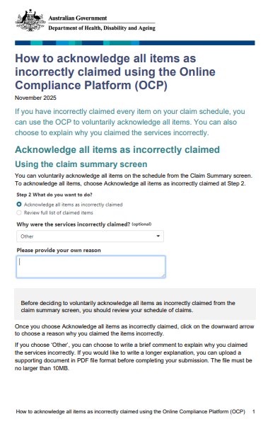
How to acknowledge all items as incorrectly claimed using the Online Compliance Platform (OCP)
This OCP user guide demonstrates how to acknowledge all items as incorrectly claimed using the Online Compliance Platform (OCP). -
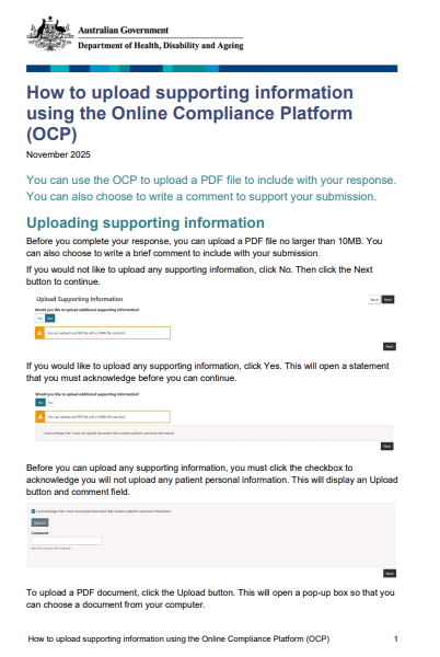
How to upload supporting information using the Online Compliance Platform (OCP)
This OCP user guide demonstrates how to upload supporting information using the Online Compliance Platform (OCP). -
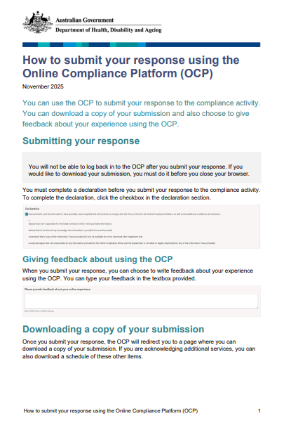
How to submit your response using the Online Compliance Platform (OCP)
This OCP user guide demonstrates how to submit your response using the Online Compliance Platform (OCP) -
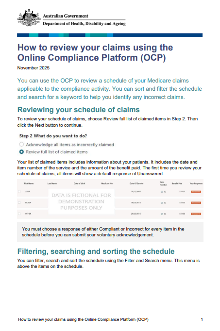
How to review your claims using the Online Compliance Platform (OCP)
This OCP user guide demonstrates how to review your claims using the Online Compliance Platform (OCP). -

Online Compliance Platform – Introduction to using the OCP
An introduction to using the Online Compliance Platform. -
 3:21
3:21Mabel’s story – Protect your children from pneumococcal
Children can become seriously ill from pneumococcal and in some cases, it can be fatal. This was the case for 6-month-old Mabel. In this video, her mother Carly shares Mabel’s story, to warn other parents about the serious risks of pneumococcal in young children and the importance of vaccination. -
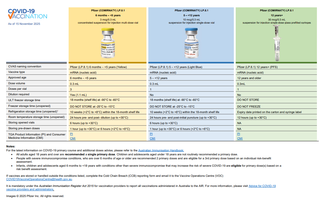
COVID-19 vaccines in Australia – A3 poster
This poster provides key differences between each COVID-19 vaccine approved for use in the National COVID-19 Vaccine Program. -
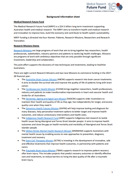
MRFF Research Missions program evaluation – Background information
Information on the Medical Research Future Fund (MRFF) and our evaluation of MRFF Research Missions. -
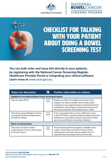
National Bowel Cancer Screening Program – Checklist for talking with your patients
This checklist includes all the key items health professionals should cover when talking to patients about bowel screening. These activities do not all need to be carried out by one health professional or all at the same time. -
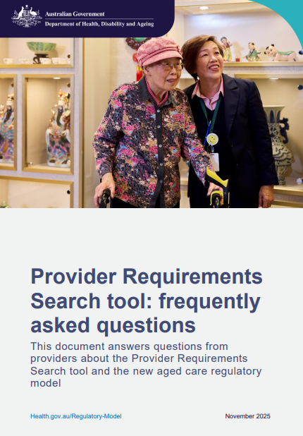
Provider Requirements Search tool webinar frequently asked questions
This document answers questions from providers about the Provider Requirements Search tool and the new aged care regulatory model. -
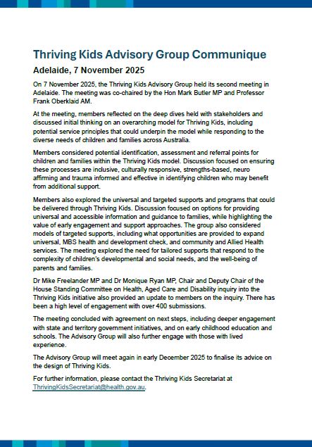
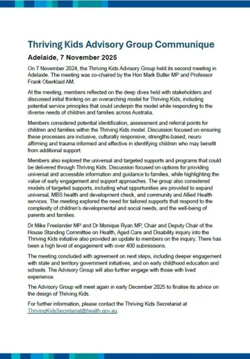
Thriving Kids Advisory Group Communique – November 2025
This communique is published following each meeting of the Thriving Kids Advisory Group. It summarises the meeting discussions and outcomes. -
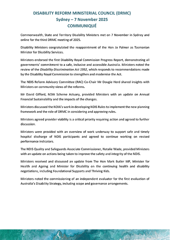
DRMC communique – 7 November 2025
The Commonwealth, state and territory Disability Ministers met on 7 November 2025. This document provides a record of the meeting. -
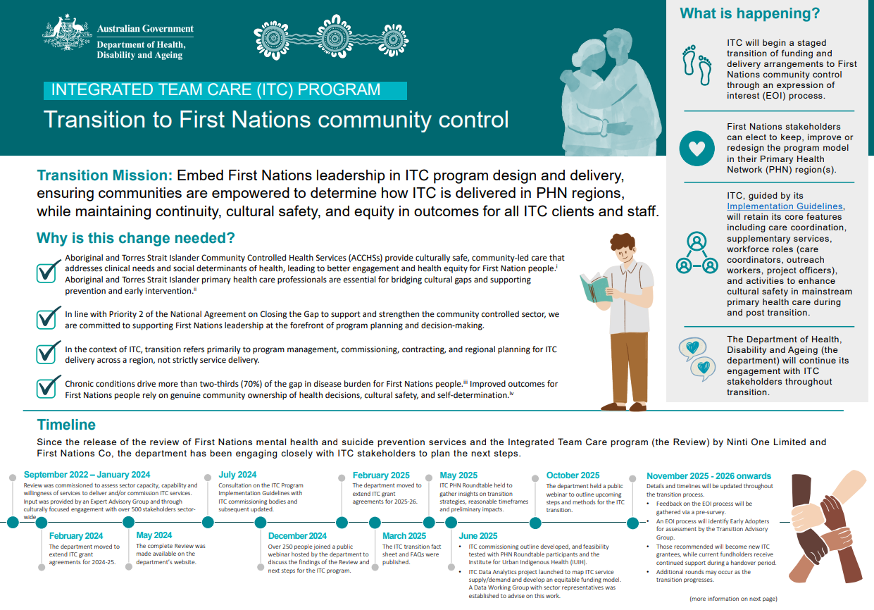
Integrated Team Care (ITC) – Transition to First Nations community control
This fact sheet provides an overview of the strategy for transitioning the Integrated Team Care (ITC) program to First Nations community control, progress to date, and upcoming milestones. -
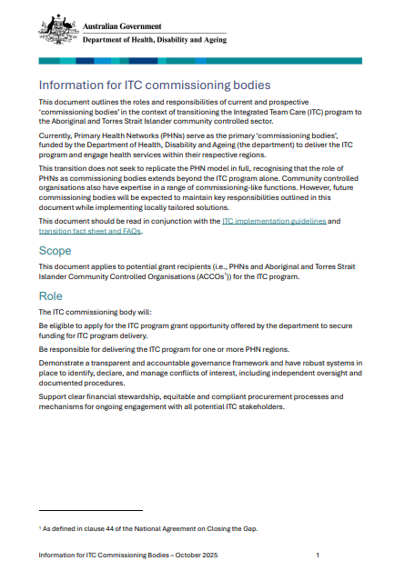
Information for ITC commissioning bodies
This fact sheet outlines the roles and responsibilities of current and prospective ‘commissioning bodies’ in the context of transitioning the Integrated Team Care (ITC) program to the Aboriginal and Torres Strait Islander community controlled sector. -
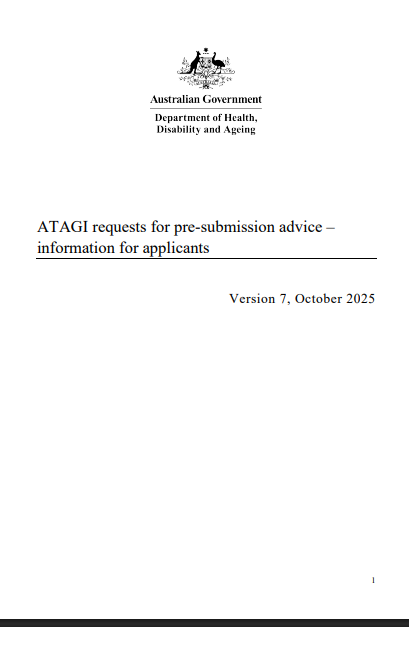
ATAGI pre-submission advice for industry sponsors wishing to make a PBAC submission
Cost recovery arrangements commenced on 1 July 2020 for Australian Technical Advisory Group on Immunisation (ATAGI) evaluation that supports Pharmaceutical Benefits Advisory Committee (PBAC) consideration of vaccines for the National Immunisation Program (NIP). -
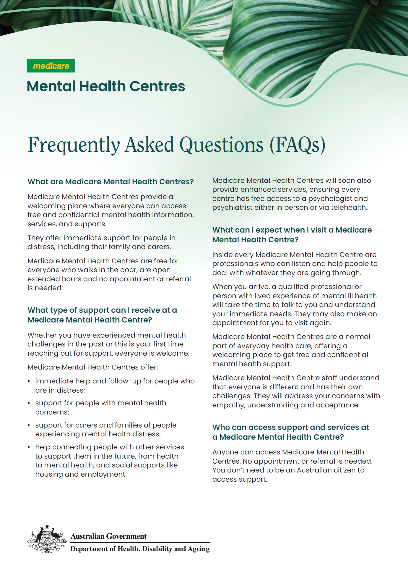
Medicare Mental Health Centres – Frequently asked questions
Frequently asked questions about Medicare Mental Health Centres and the recent rebrand for consumers and service providers. -
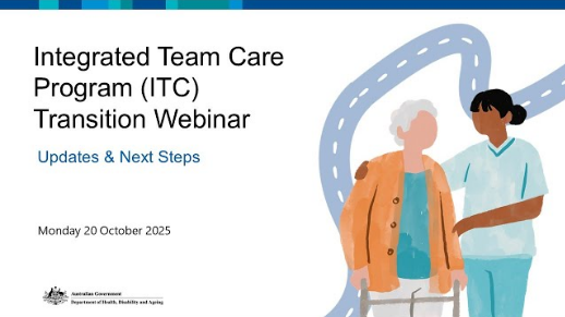
Integrated Team Care (ITC) Program Transition Webinar – Updates and Next steps – Webinar Presentation
The Department of Health, Disability and Ageing hosted the ITC Transition Webinar: Updates and Next Steps on 20 October 2025. These are the presentation from the webinar.
-
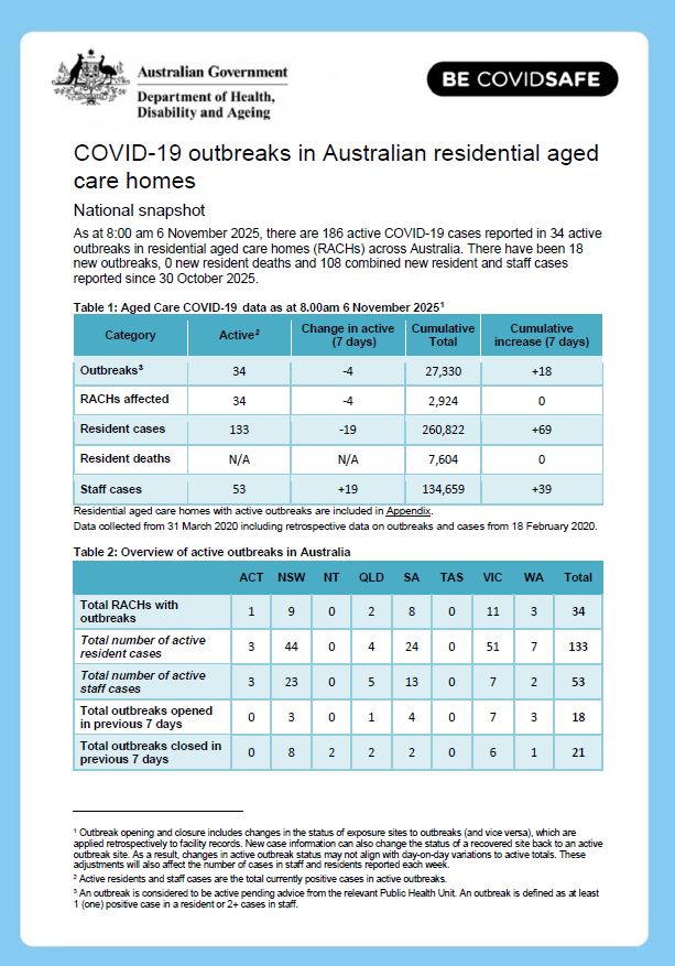
COVID-19 outbreaks in Australian residential aged care homes – 7 November 2025
This weekly report provides a snapshot of data on the impact of COVID-19 in residential aged care facilities nationally in 2025. It includes data on the number of services impacted and number of staff and resident cases, as well as workforce, vaccine rollout, testing and PPE provided to services. -
Thriving Kids Advisory Group – Communiques
Communiques from the Thriving Kids Advisory Group. -
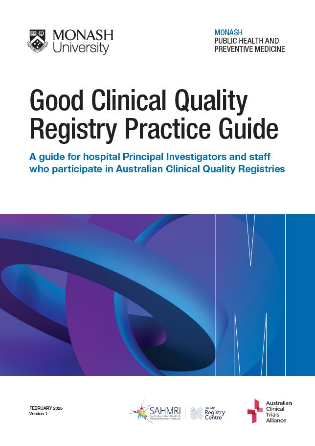
Good Clinical Quality Registry Practice Guide
The guide provides best practice training for hospital staff and clinicians as they begin participating in national Clinical Quality Registries. -
 51:52
51:52Webinar 12: Aged Care Reforms – Impacts on the Multi-Purpose Service (MPS) program and providers – webinar recording
The twelfth webinar in the series provides updates on the MPSP reforms, policy manual, and the Thin Markets review work underway.