Filter results
You can narrow down the results using the filters
Audience
Topics
Our work
Diseases
11321 results
-
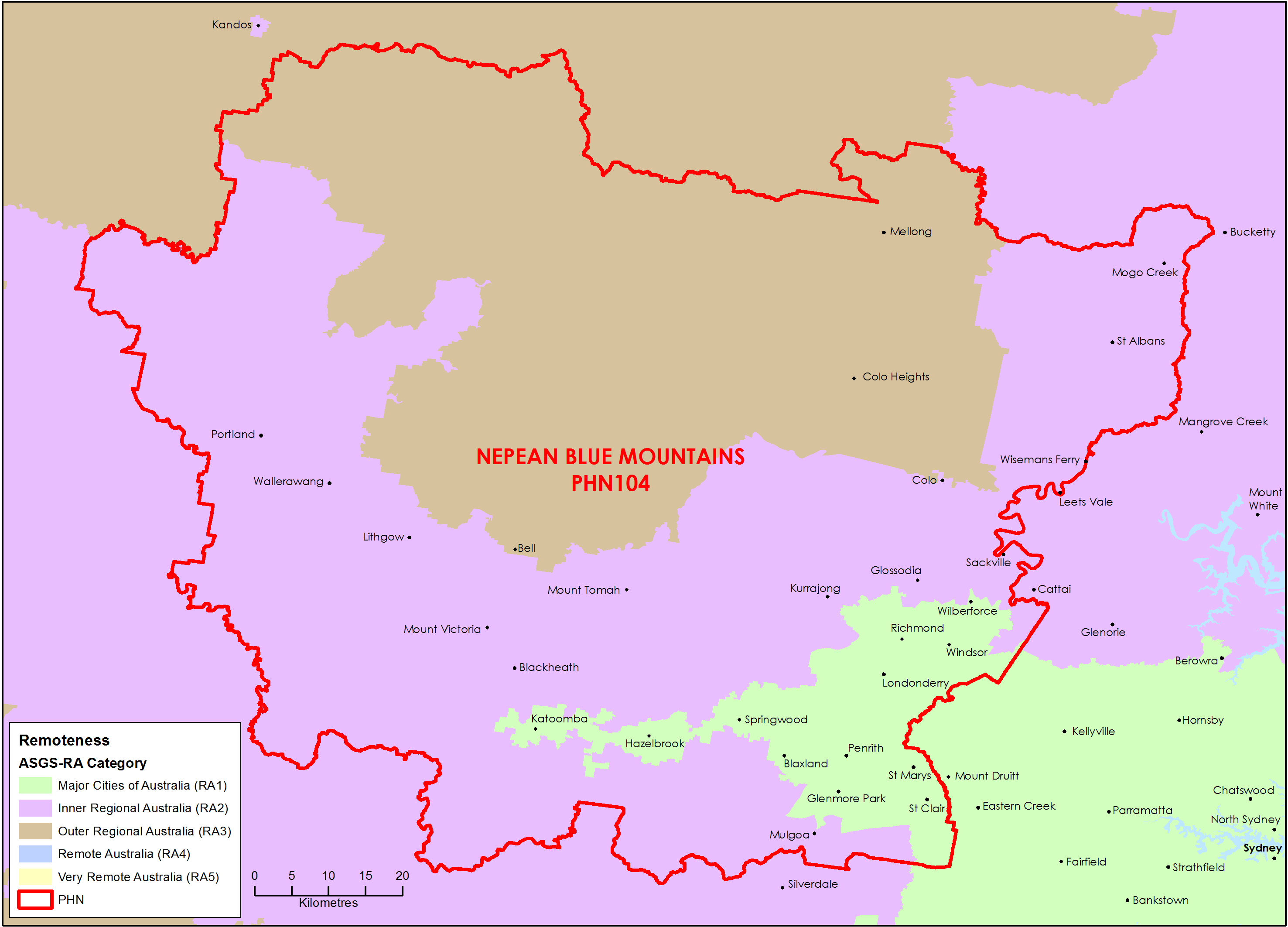
Nepean Blue Mountains (NSW) Primary Health Network (PHN) map – Australian Statistical Geography Standard (ASGS) remoteness area
This map shows the Australian Statistical Geography Standard remoteness area classifications within the Nepean Blue Mountains (NSW) Primary Health Network. -
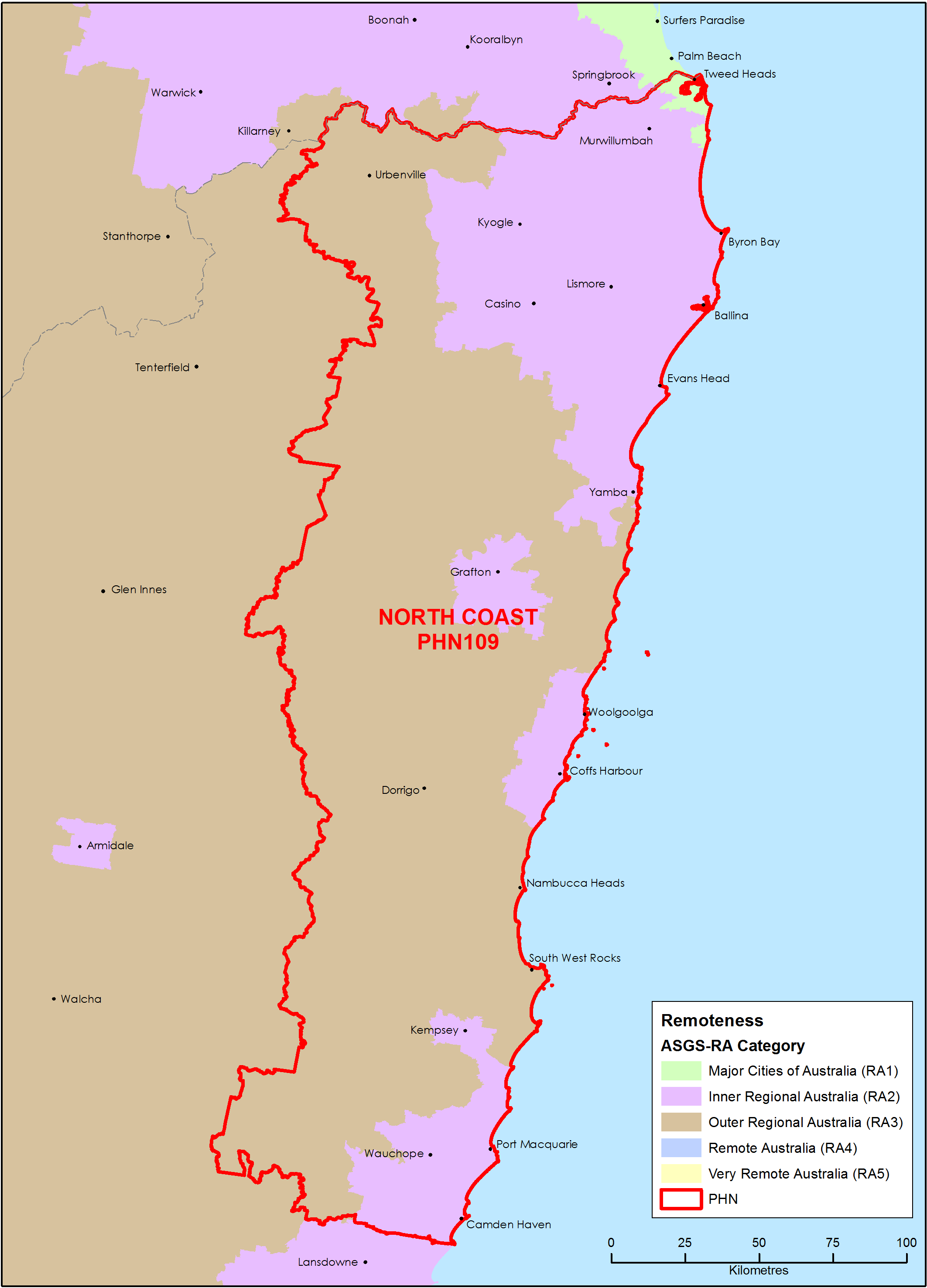
North Coast (NSW) Primary Health Network (PHN) map – Australian Statistical Geography Standard (ASGS) remoteness area
This map shows the Australian Statistical Geography Standard remoteness area classifications within the North Coast (NSW) Primary Health Network. -
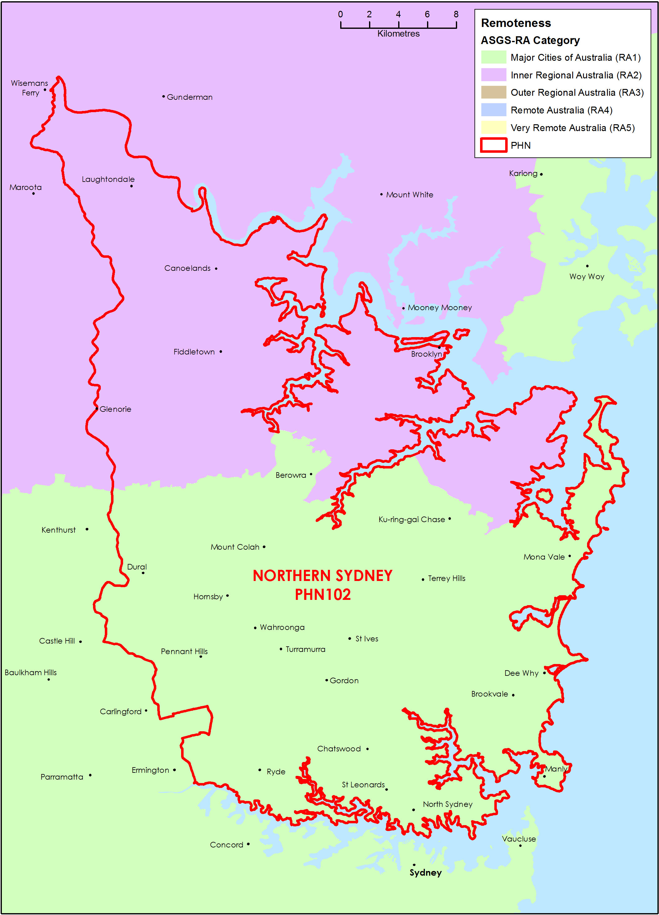
Northern Sydney (NSW) Primary Health Network (PHN) map – Australian Statistical Geography Standard (ASGS) remoteness area
This map shows the Australian Statistical Geography Standard remoteness area classifications within the Northern Sydney (NSW) Primary Health Network. -
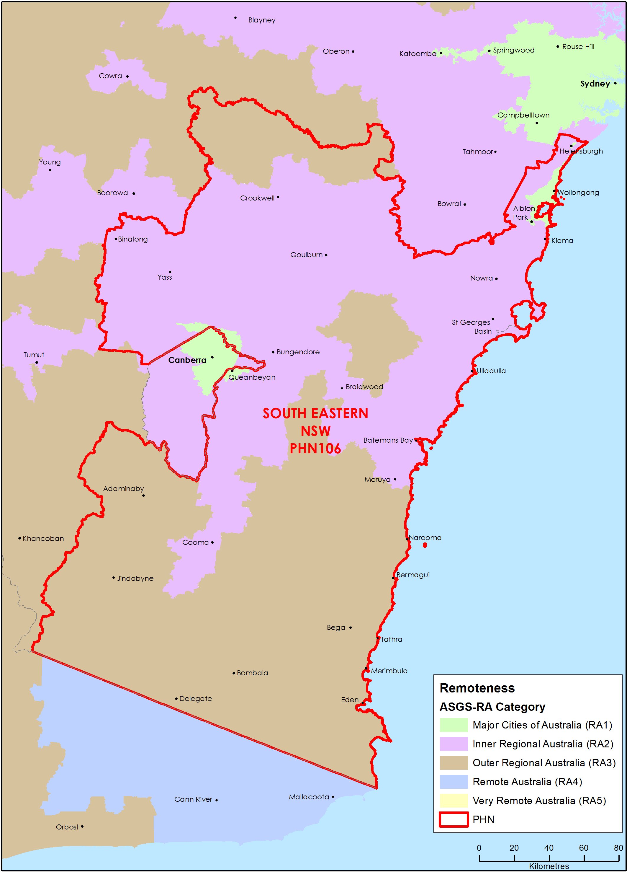
South Eastern New South Wales Primary Health Network (PHN) map – Australian Statistical Geography Standard (ASGS) remoteness area
This map shows the Australian Statistical Geography Standard remoteness area classifications within the South Eastern New South Wales Primary Health Network. -
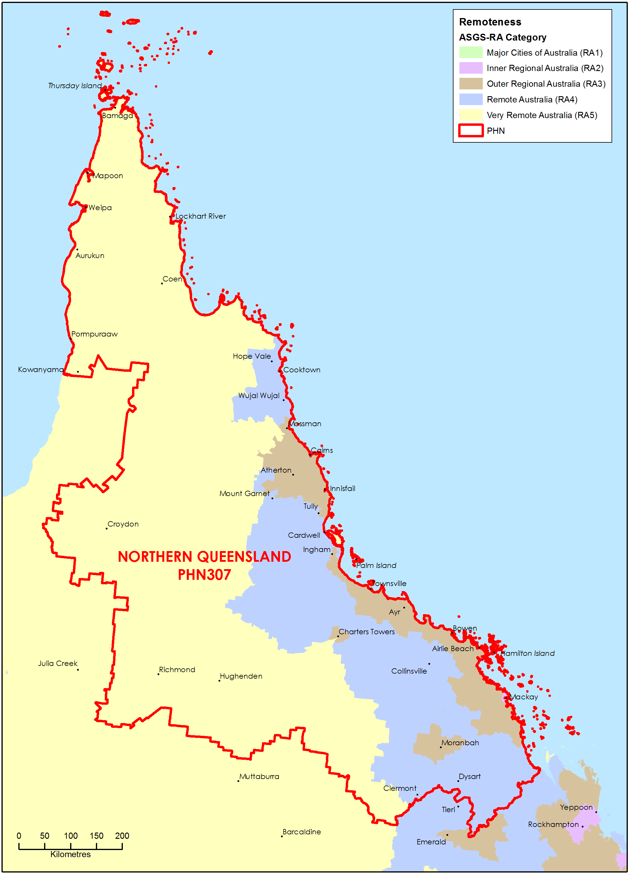
Northern Queensland Primary Health Network (PHN) map – Australian Statistical Geography Standard (ASGS) remoteness area
This map shows the Australian Statistical Geography Standard remoteness area classifications within the Northern Queensland Primary Health Network. -
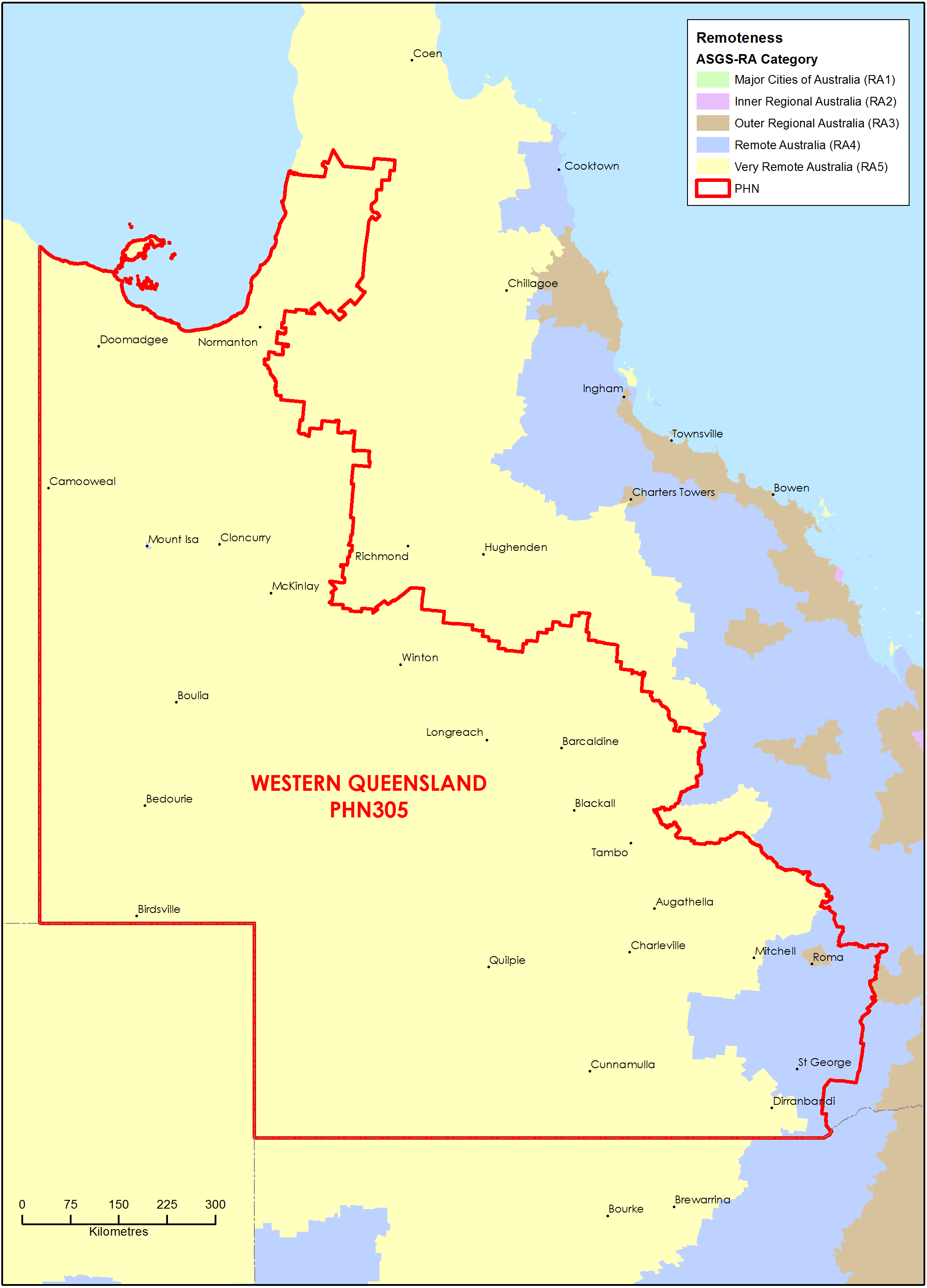
Western Queensland Primary Health Network (PHN) map – Australian Statistical Geography Standard (ASGS) remoteness area
This map shows the Australian Statistical Geography Standard remoteness area classifications within the Western Queensland Primary Health Network. -
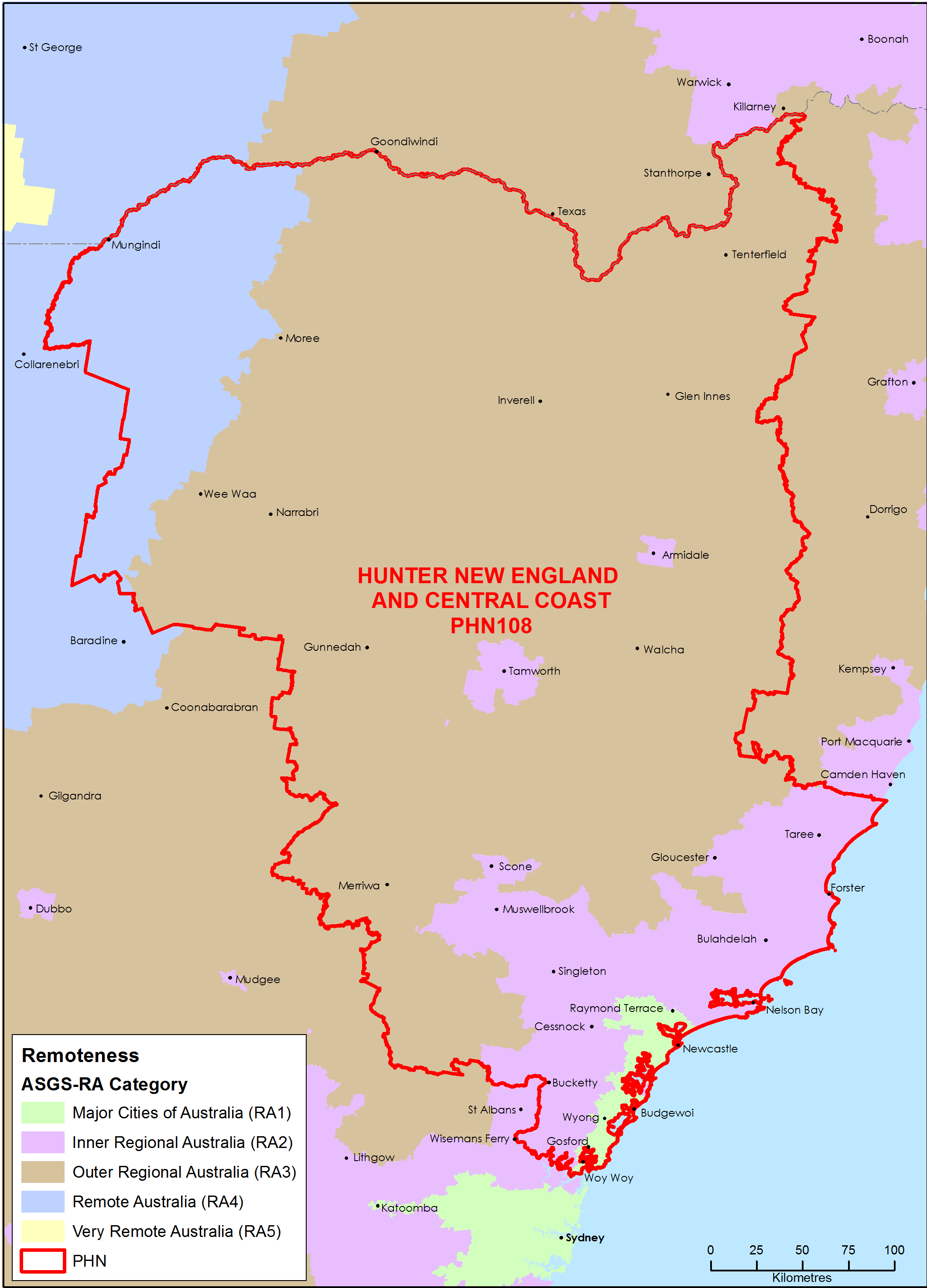
Hunter, New England and Central Coast (NSW) Primary Health Network (PHN) map – Australian Statistical Geography Standard (ASGS) remoteness area
This map shows the Australian Statistical Geography Standard remoteness area classifications within the Hunter, New England and Central Coast (NSW) Primary Health Network. -
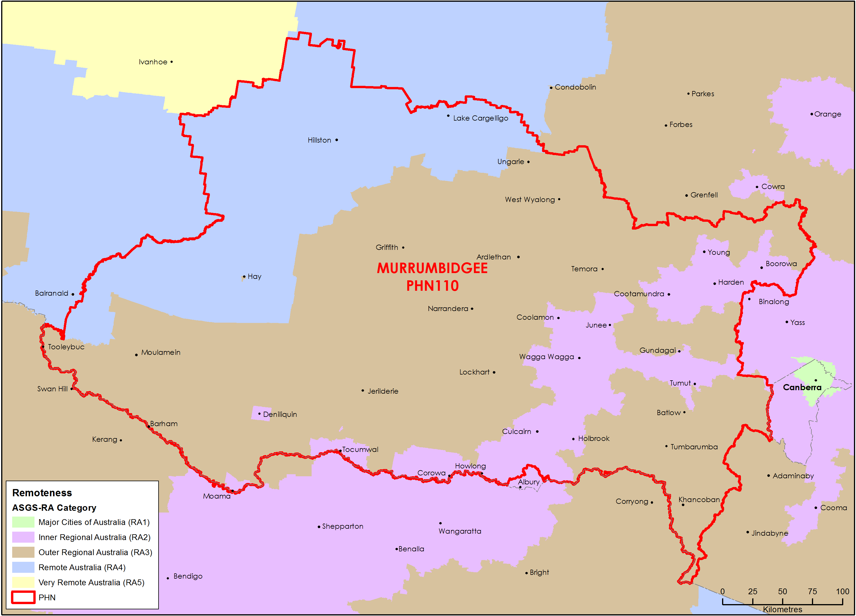
Murrumbidgee (NSW) Primary Health Network (PHN) map – Australian Statistical Geography Standard (ASGS) remoteness area
This map shows the Australian Statistical Geography Standard remoteness area classifications within the Murrumbidgee (NSW) Primary Health Network. -
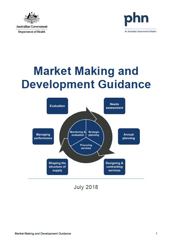
Primary Health Networks (PHNs) market making and development guidance and toolkit
This guidance and toolkit help Primary Health Networks (PHNs) understand, influence, support, develop and work collaboratively with their service provider markets. -
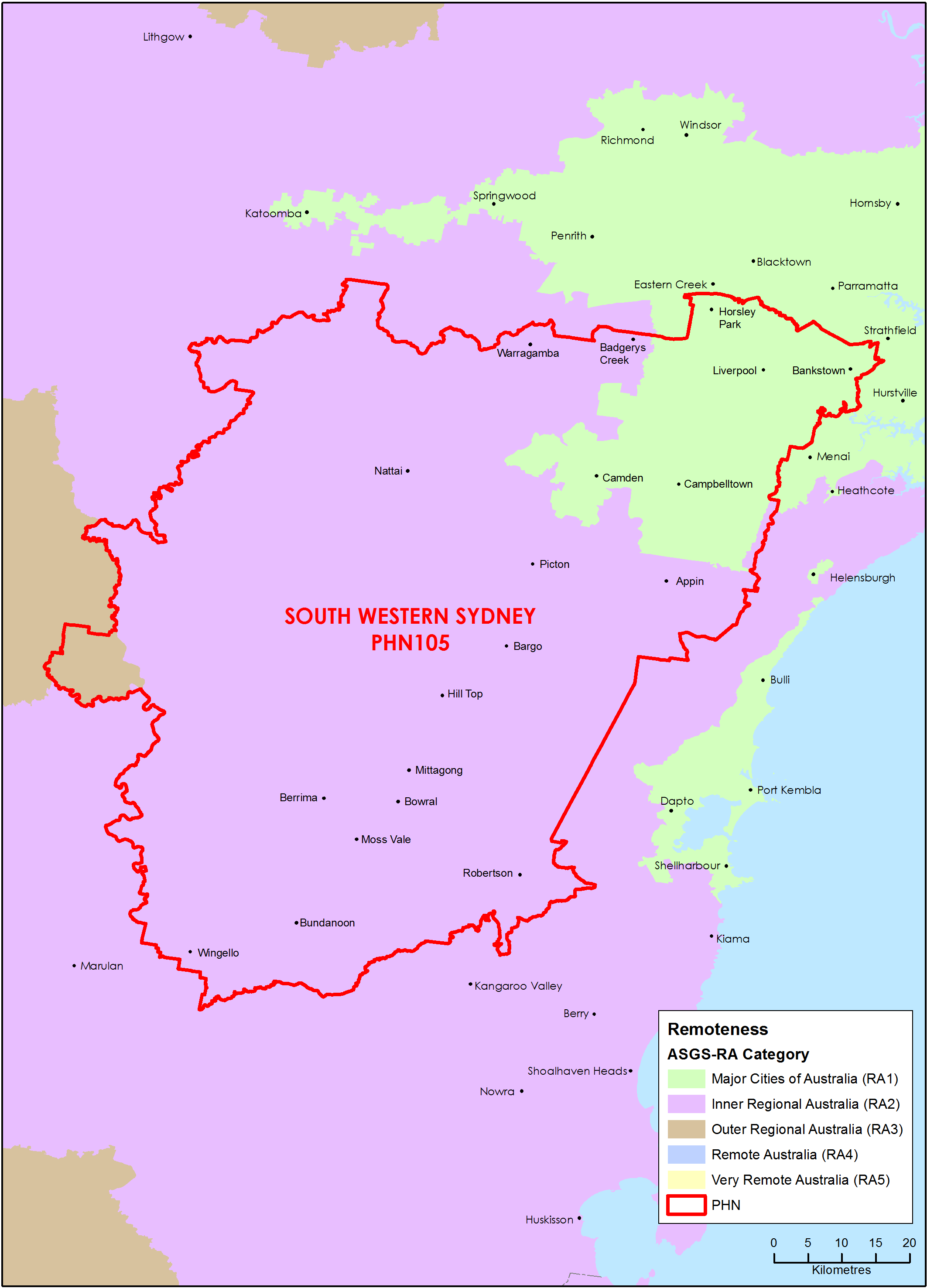
South Western Sydney (NSW) Primary Health Network (PHN) map – Australian Statistical Geography Standard (ASGS) remoteness area
This map shows the Australian Statistical Geography Standard remoteness area classifications within the South Western Sydney (NSW) Primary Health Network. -
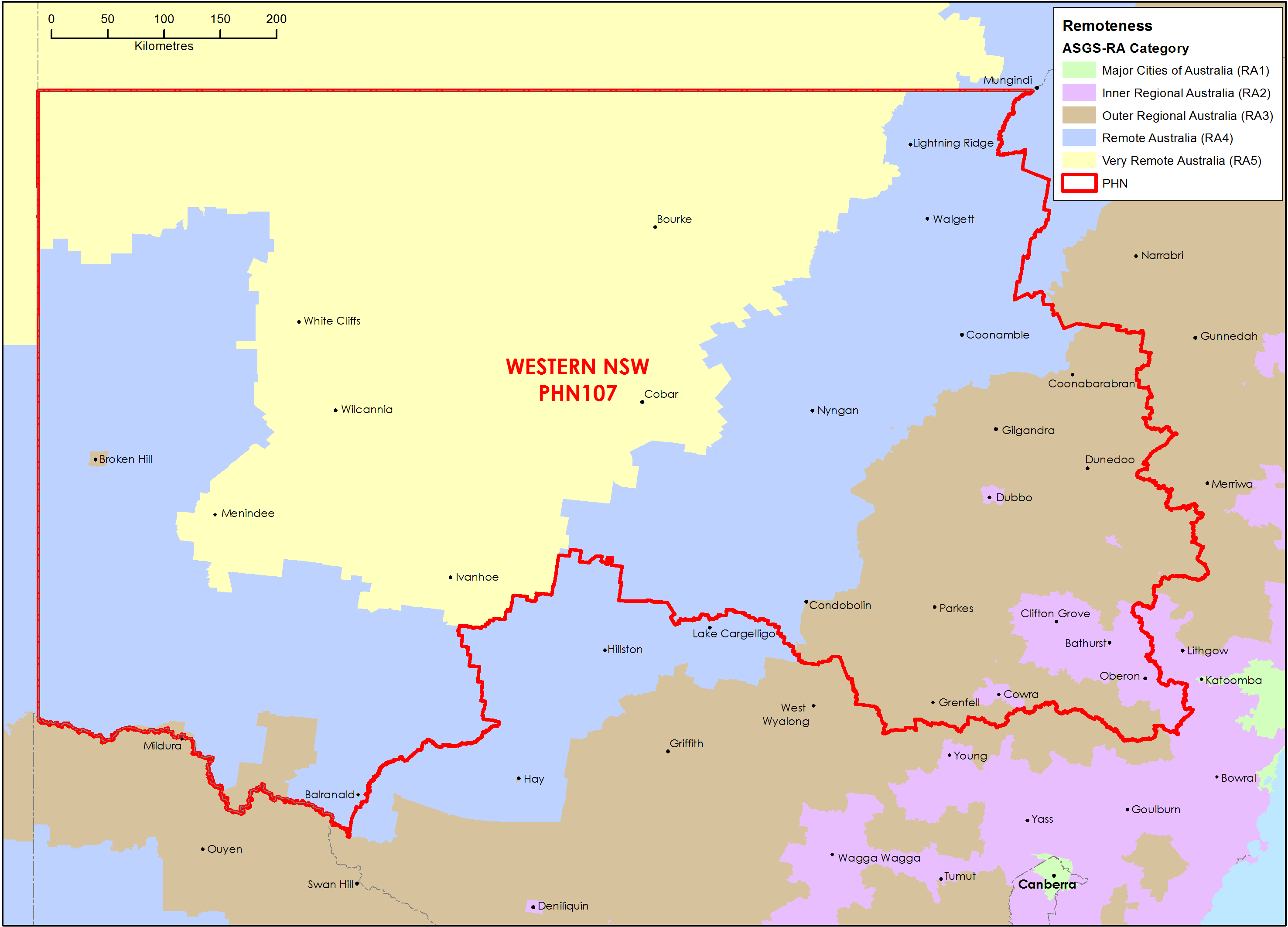
Western New South Wales Primary Health Network (PHN) map – Australian Statistical Geography Standard (ASGS) remoteness area
This map shows the Australian Statistical Geography Standard remoteness area classifications within the Western New South Wales Primary Health Network. -
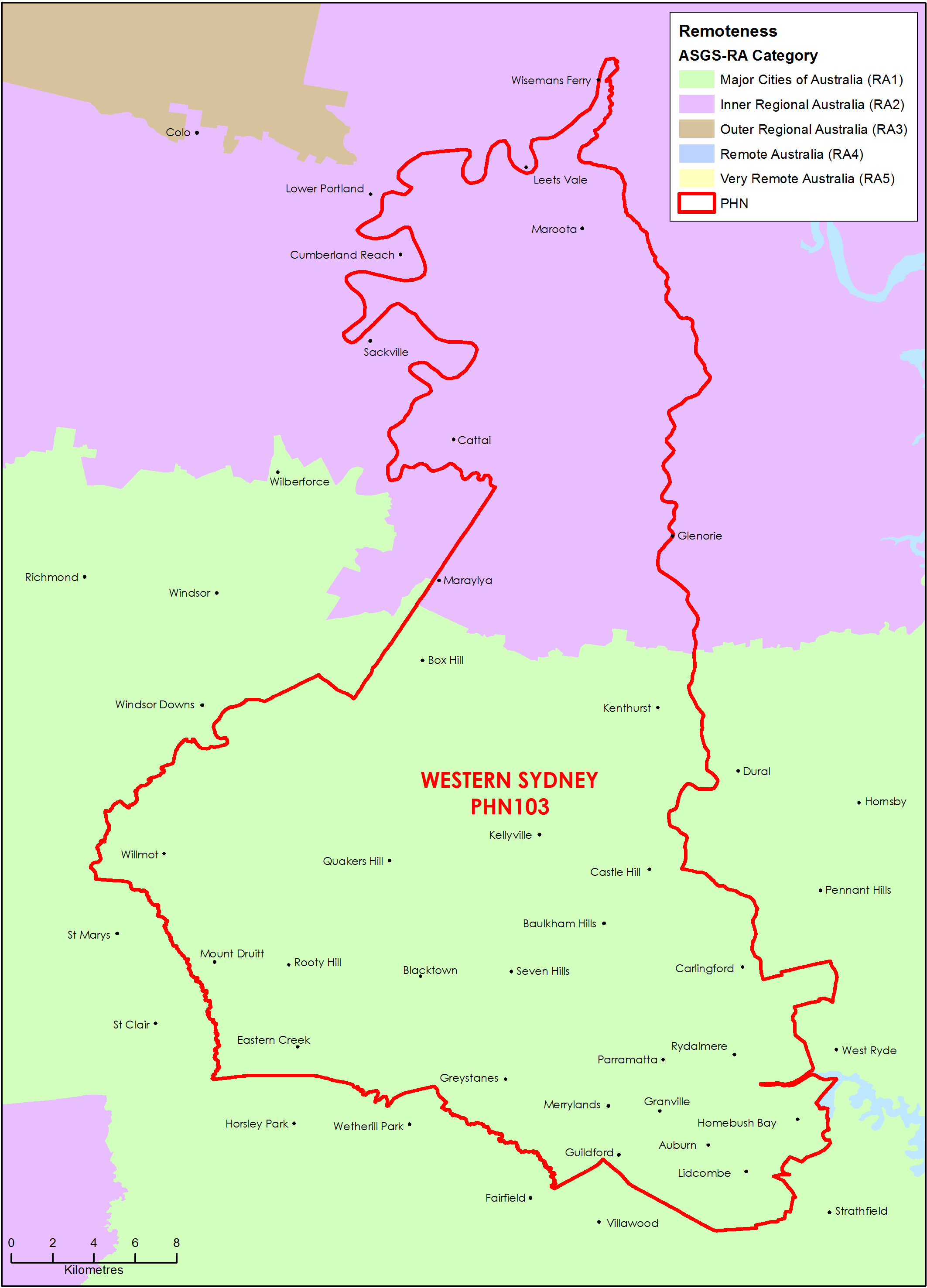
Western Sydney (NSW) Primary Health Network (PHN) map – Australian Statistical Geography Standard (ASGS) remoteness area
This map shows the Australian Statistical Geography Standard remoteness area classifications within the Western Sydney (NSW) Primary Health Network. -
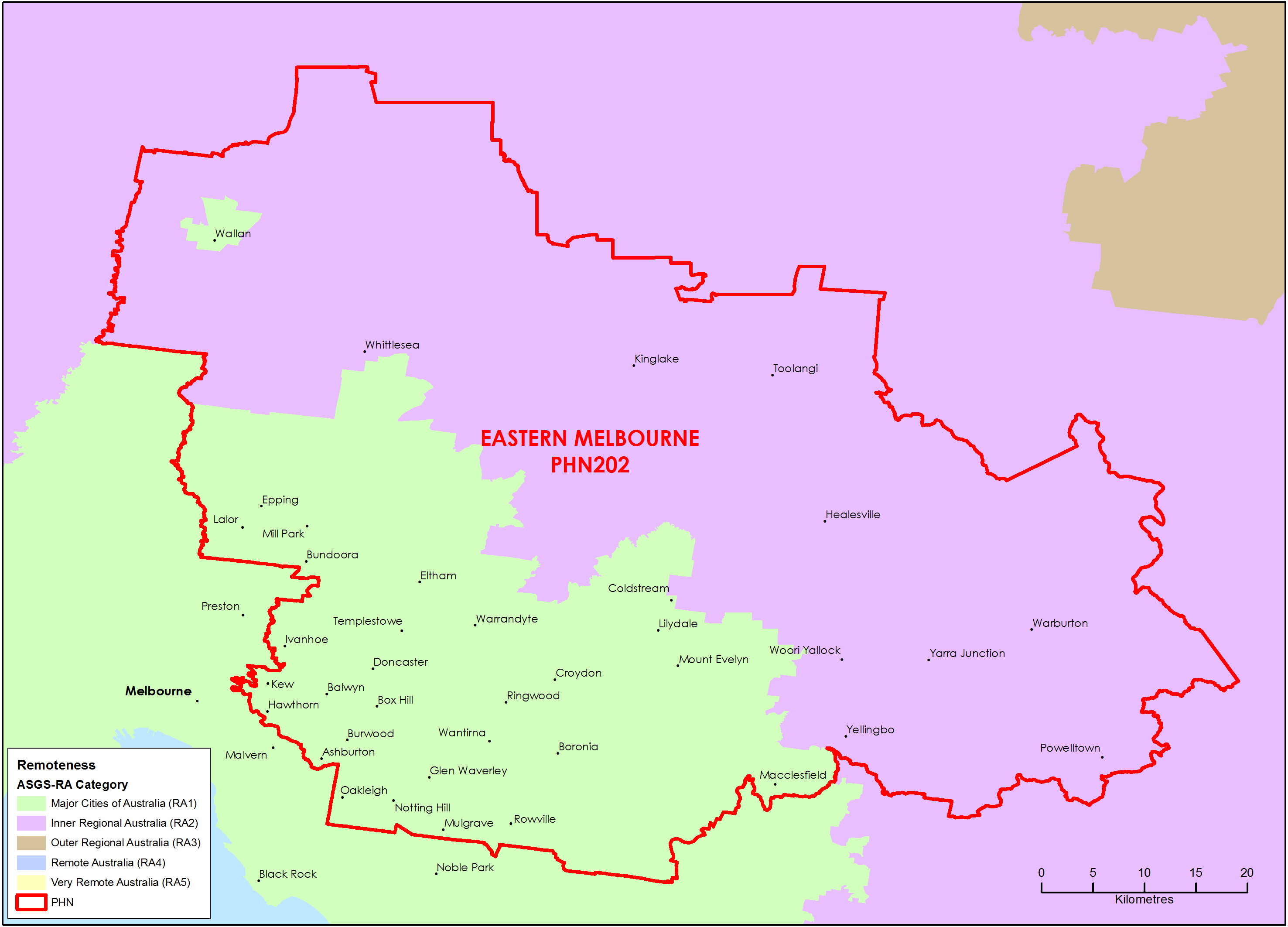
Eastern Melbourne (Vic) Primary Health Network (PHN) map – Australian Statistical Geography Standard (ASGS) remoteness area
This map shows the Australian Statistical Geography Standard remoteness area classifications within the Eastern Melbourne (Vic) Primary Health Network. -
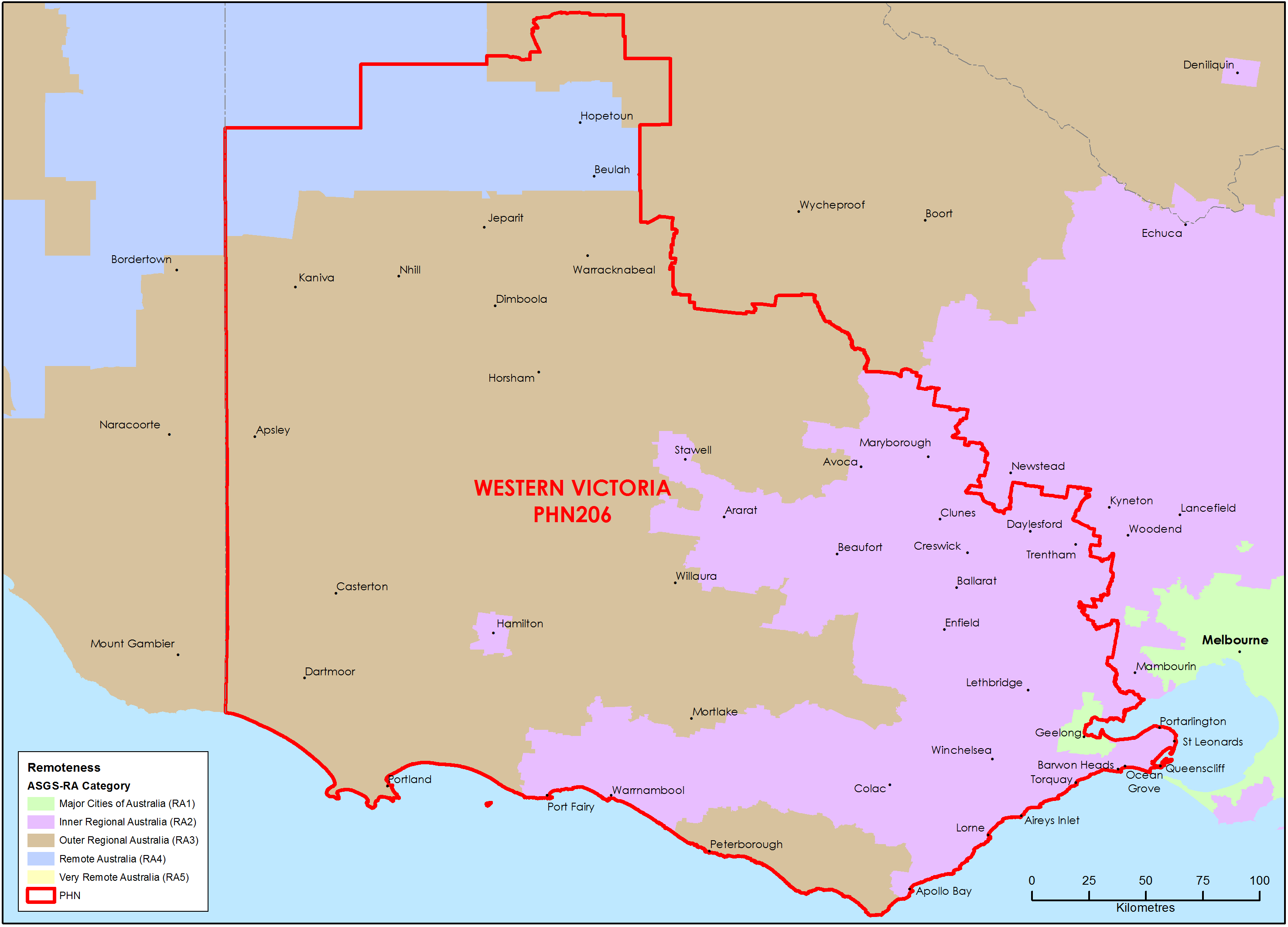
Western Victoria Primary Health Network (PHN) map – Australian Statistical Geography Standard (ASGS) remoteness area
This map shows the Australian Statistical Geography Standard remoteness area classifications within the Western Victoria Primary Health Network. -
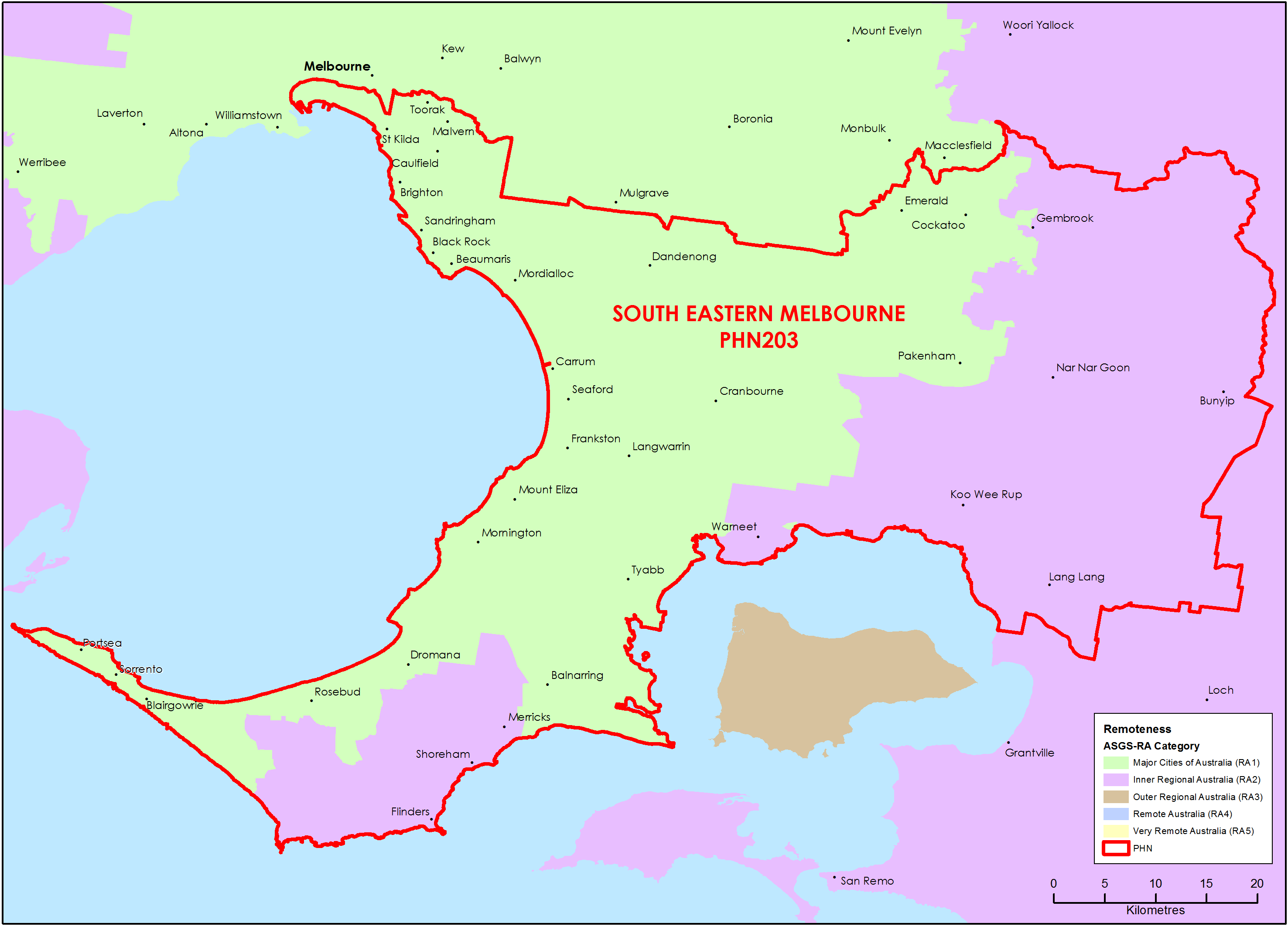
South Eastern Melbourne (Vic) Primary Health Network (PHN) map – Australian Statistical Geography Standard (ASGS) remoteness area
This map shows the Australian Statistical Geography Standard remoteness area classifications within the South Eastern Melbourne (Vic) Primary Health Network. -
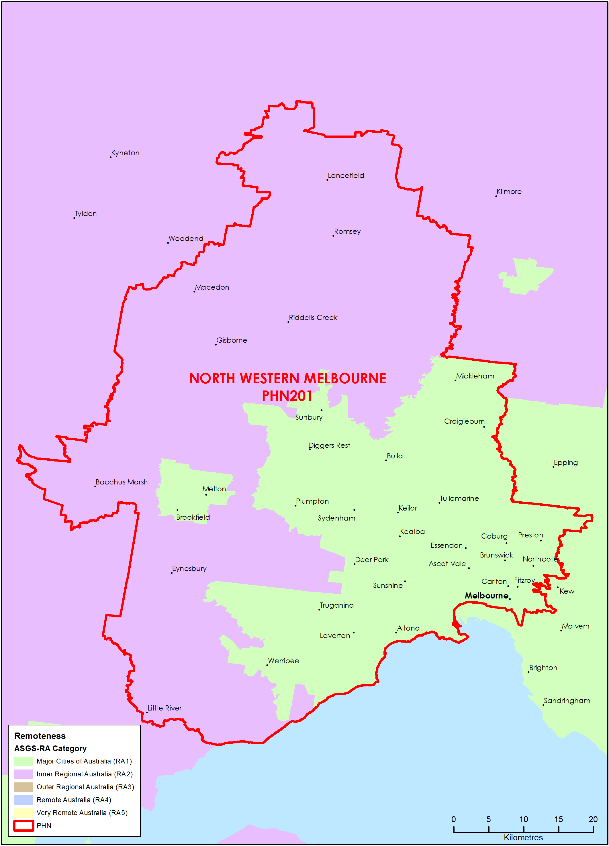
North Western Melbourne (Vic) Primary Health Network (PHN) map – Australian Statistical Geography Standard (ASGS) remoteness area
This map shows the Australian Statistical Geography Standard remoteness area classifications within the North Western Melbourne (Vic) Primary Health Network. -
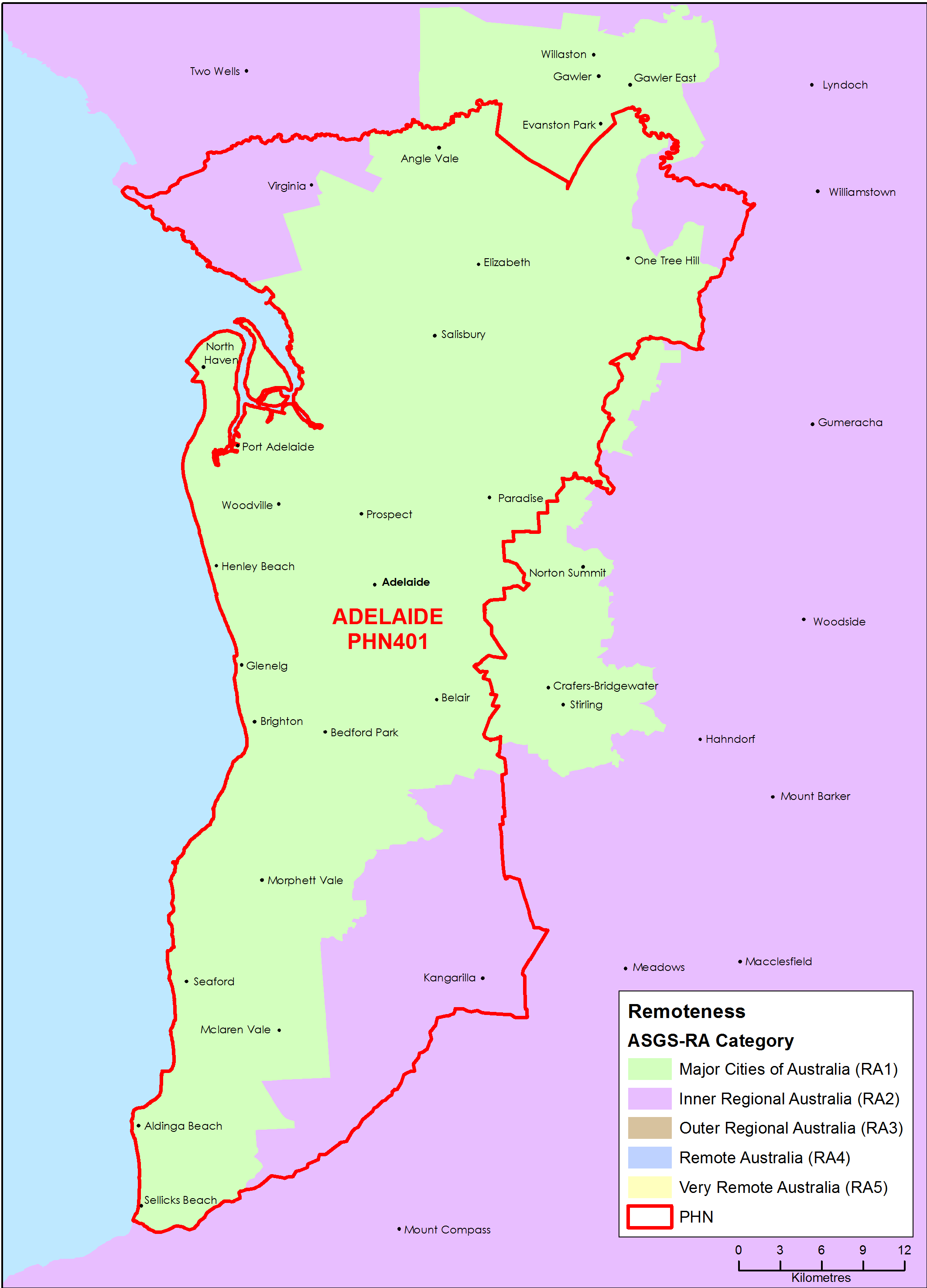
Adelaide (SA) Primary Health Network (PHN) map – Australian Statistical Geography Standard (ASGS) remoteness area
This map shows the Australian Statistical Geography Standard remoteness area classifications within the Adelaide (SA) Primary Health Network. -
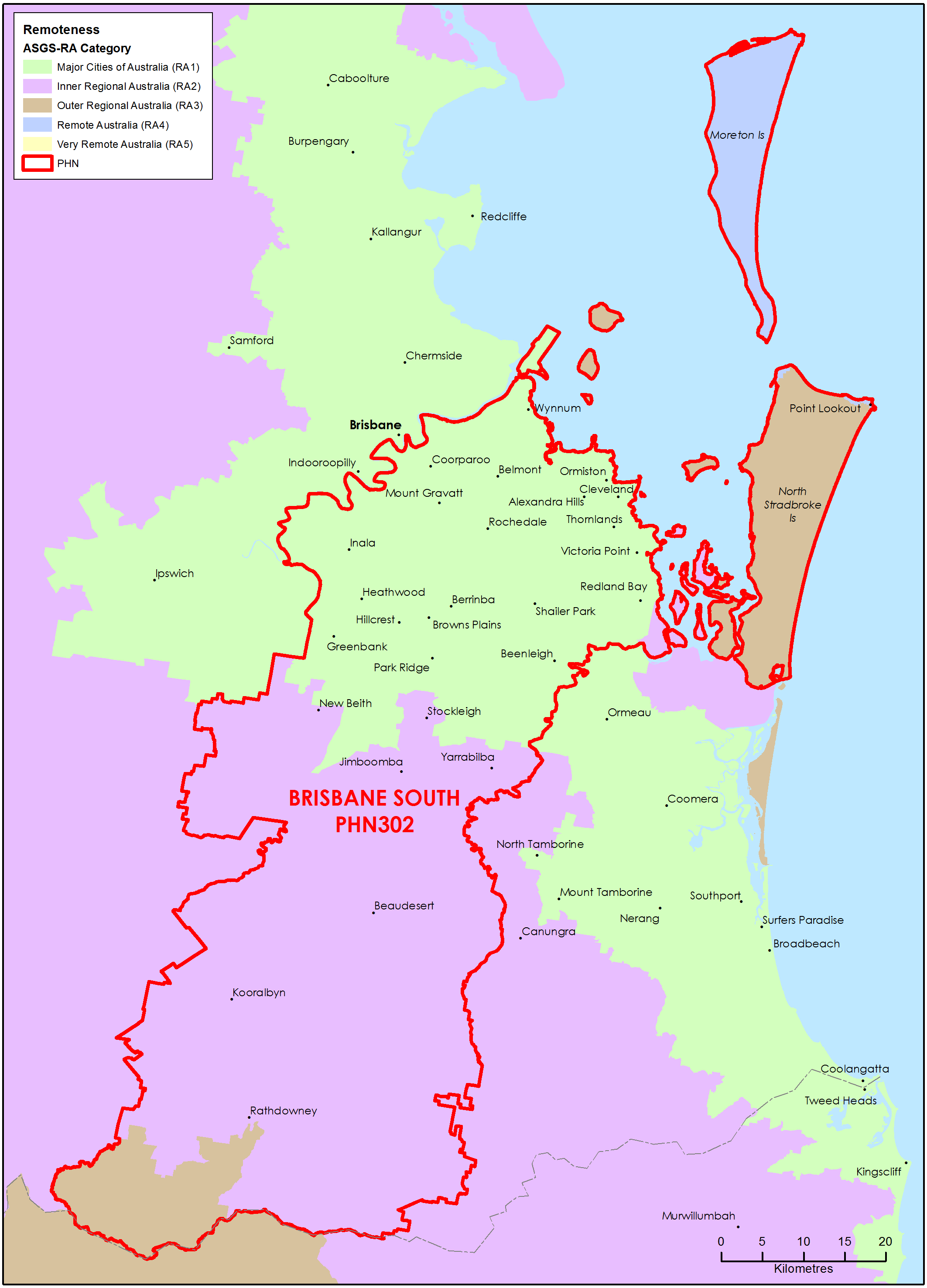
Brisbane South (Qld) Primary Health Network (PHN) map – Australian Statistical Geography Standard (ASGS) remoteness area
This map shows the Australian Statistical Geography Standard remoteness area classifications within the Brisbane South (Qld) Primary Health Network. -
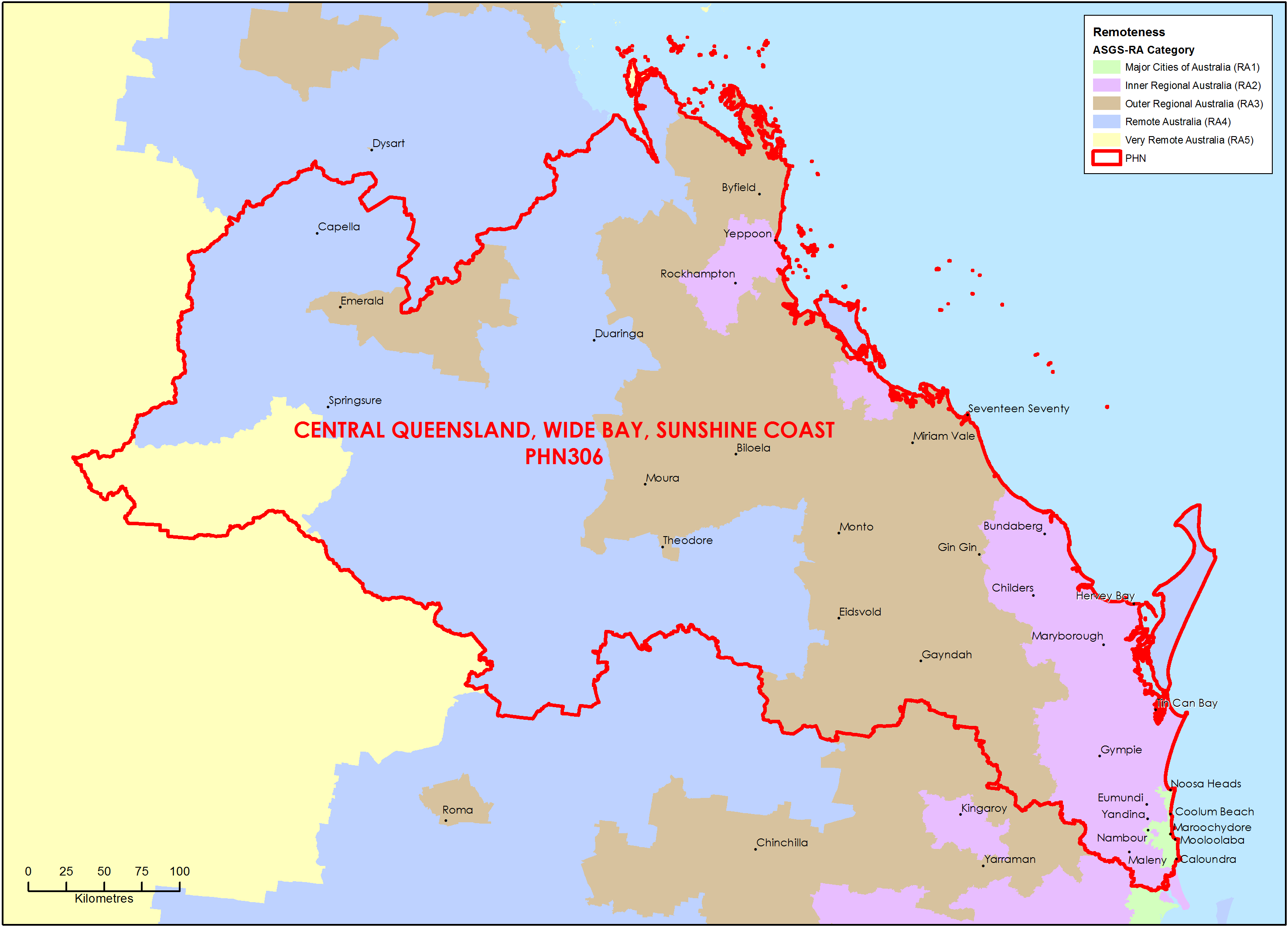
Central Queensland, Wide Bay, Sunshine Coast Primary Health Network (PHN) map – Australian Statistical Geography Standard (ASGS) remoteness area
This map shows the Australian Statistical Geography Standard remoteness area classifications within the Central Queensland, Wide Bay, Sunshine Coast Primary Health Network. -
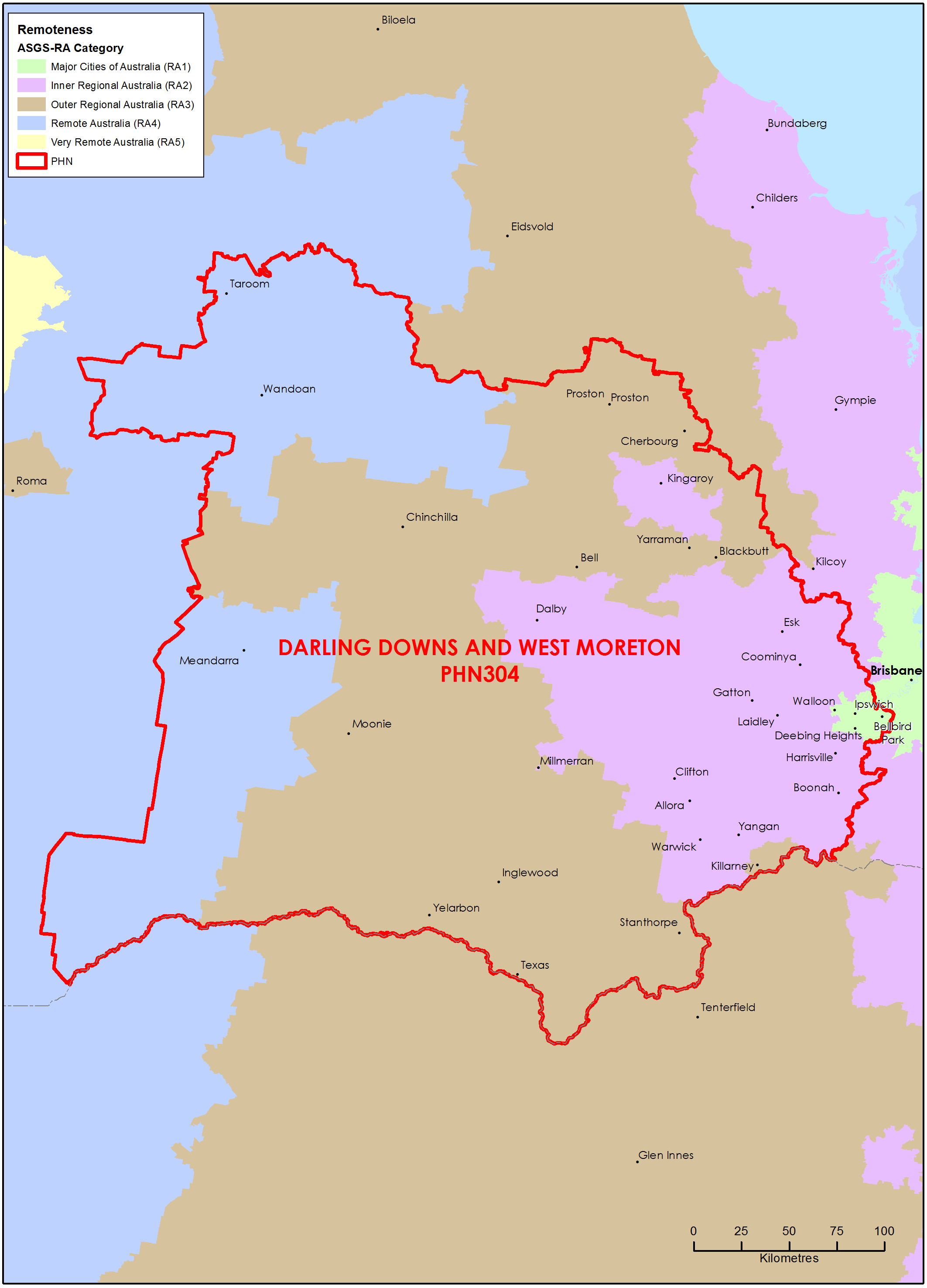
Darling Downs and West Moreton (Qld) Primary Health Network (PHN) map – Australian Statistical Geography Standard (ASGS) remoteness area
This map shows the Australian Statistical Geography Standard remoteness area classifications within the Darling Downs and West Moreton (Qld) Primary Health Network. -
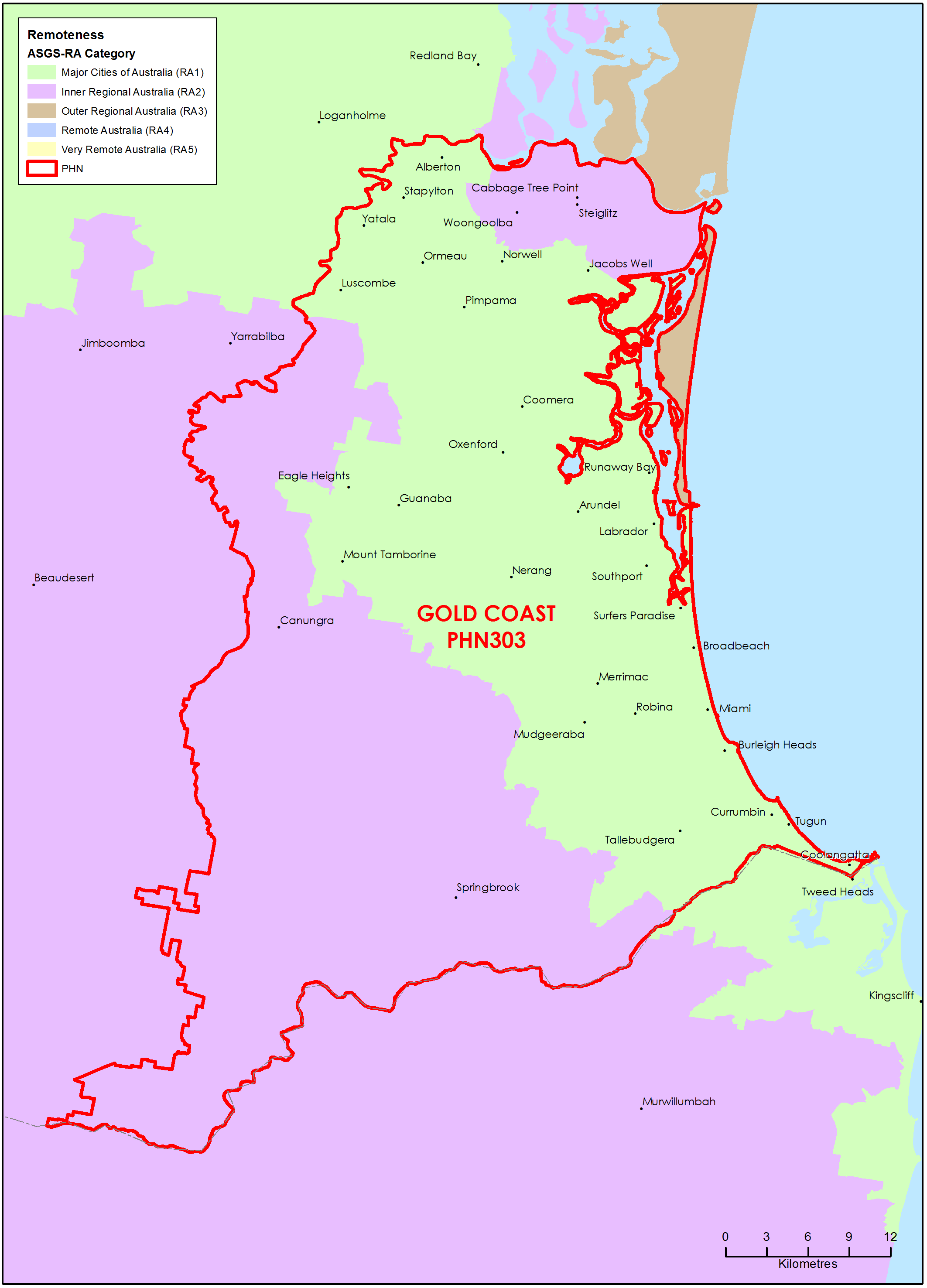
Gold Coast (Qld) Primary Health Network (PHN) map – Australian Statistical Geography Standard (ASGS) remoteness area
This map shows the Australian Statistical Geography Standard remoteness area classifications within the Gold Coast (Qld) Primary Health Network. -
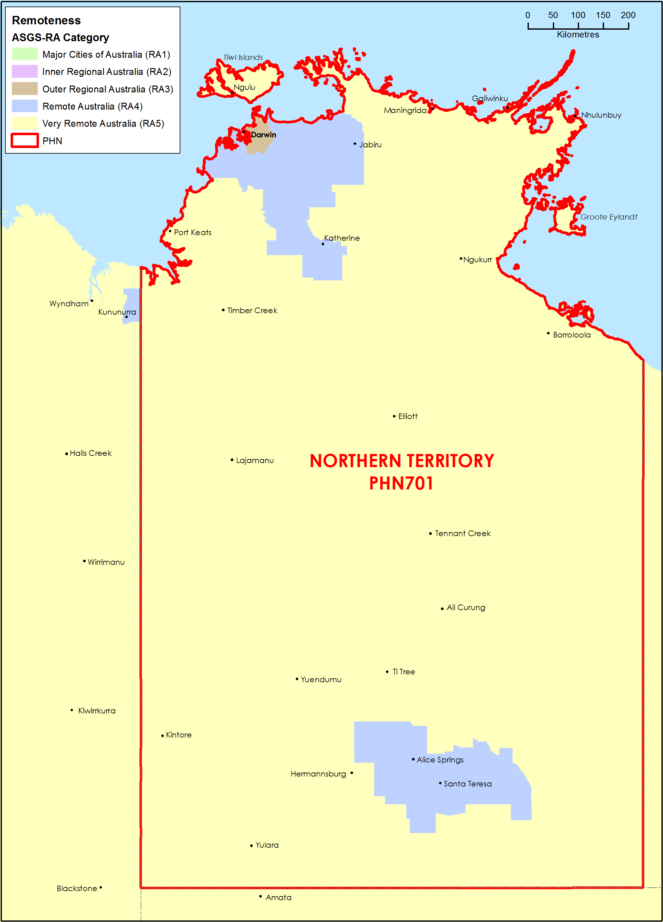
Northern Territory (NT) Primary Health Network (PHN) map – Australian Statistical Geography Standard (ASGS) remoteness area
This map shows the Australian Statistical Geography Standard remoteness area classifications within the Northern Territory Primary Health Network. -
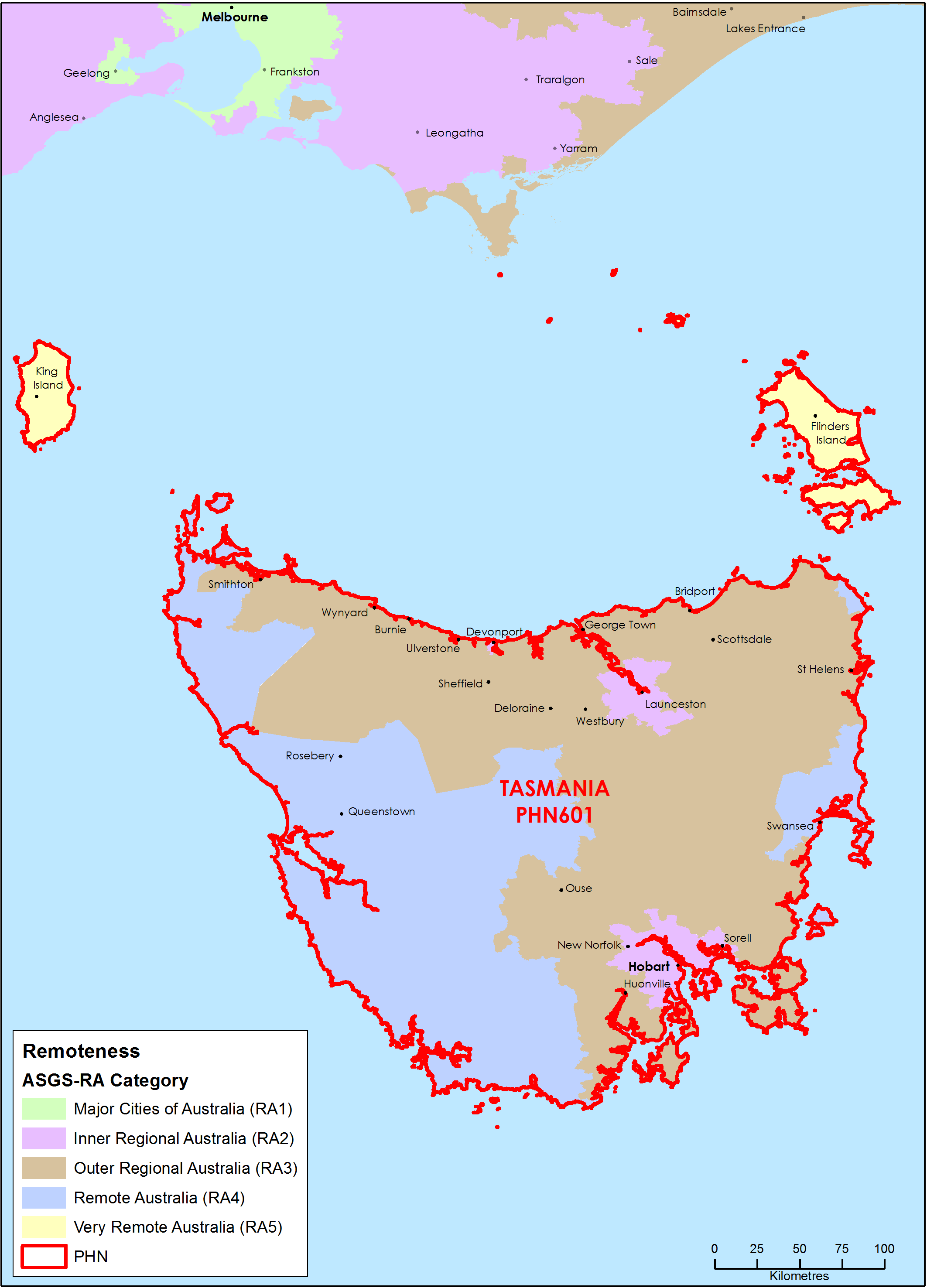
Tasmania Primary Health Network (PHN) map – Australian Statistical Geography Standard (ASGS) remoteness area
This map shows the Australian Statistical Geography Standard remoteness area classifications within the Tasmania Primary Health Network. -
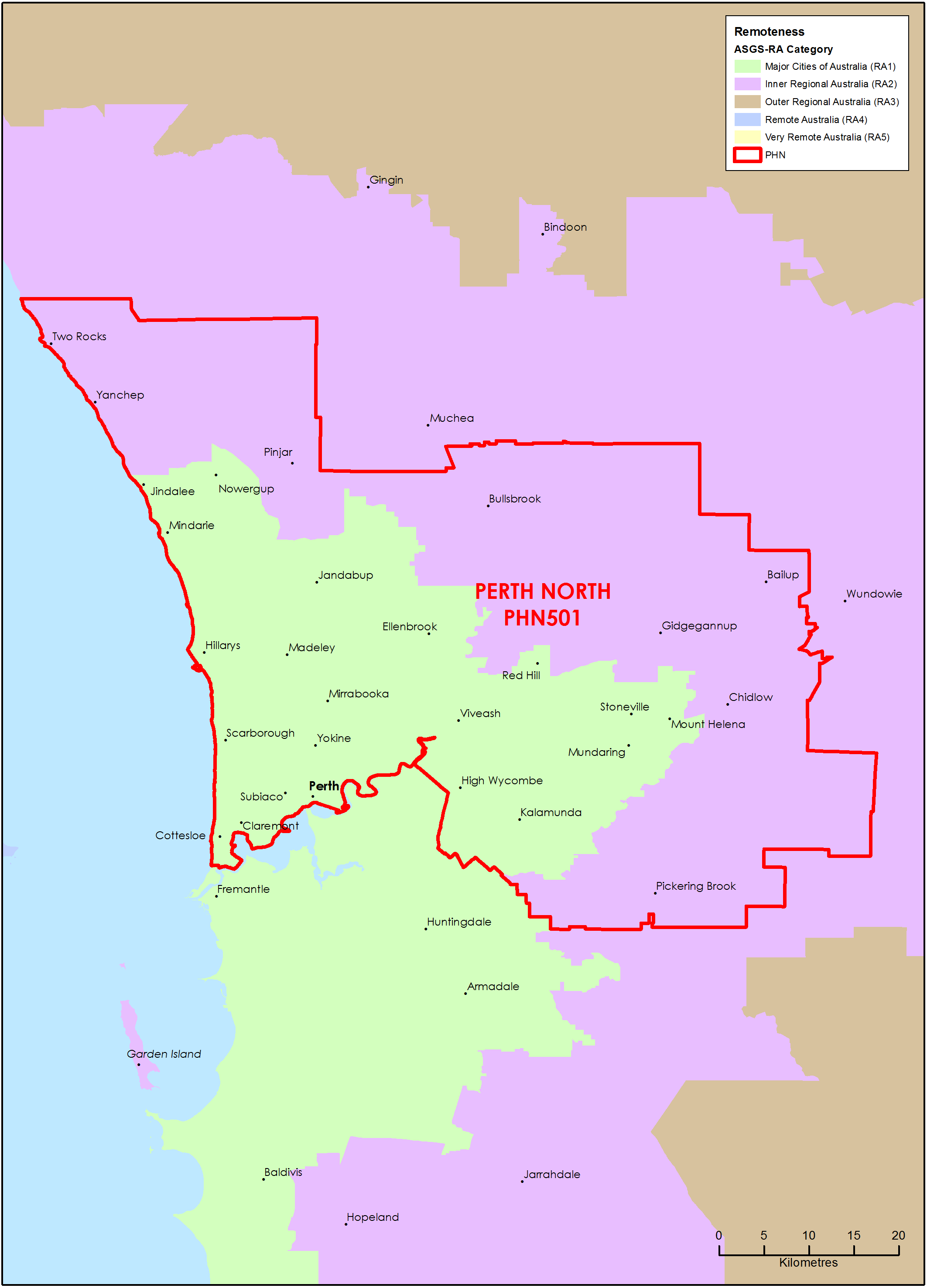
Perth North (WA) Primary Health Network (PHN) map – Australian Statistical Geography Standard (ASGS) remoteness area
This map shows the Australian Statistical Geography Standard remoteness area classifications within the Perth North (WA) Primary Health Network. -
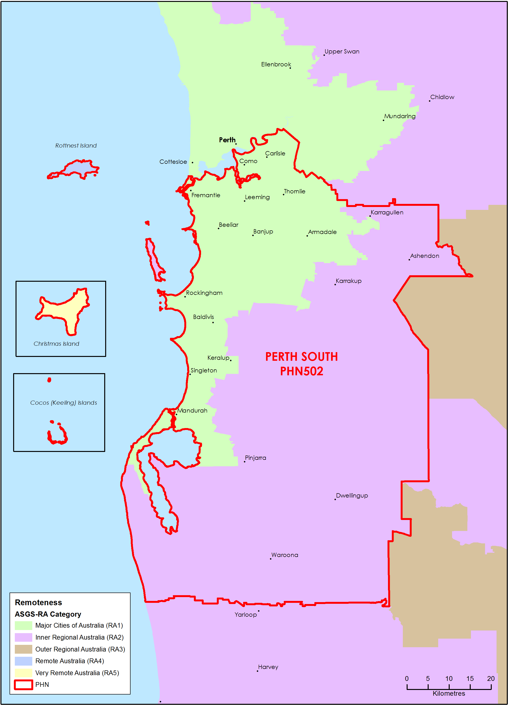
Perth South (WA) Primary Health Network (PHN) map – Australian Statistical Geography Standard (ASGS) remoteness area
This map shows the Australian Statistical Geography Standard remoteness area classifications within the Perth South (WA) Primary Health Network.