
Filter results
You can narrow down the results using the filters
Audience
Publication type
Topics
Our work
Diseases
9438 results
-

Improving access to aged care assessments FAQs September 2025
We’re transferring some referrals for aged care assessment to assessment organisations with capacity to take on additional assessments at this time. Find our more in our frequently asked questions. -

Bilateral Regional Health Forum – Joint communique – 25 September 2025
The Bilateral Regional Health Forum met on 3 October 2023 to discuss joint interests in rural and regional mental health and suicide prevention, aged care, innovative workforce models, and virtual care in NSW. -

Aged Care Transition Taskforce – Summary of twelfth meeting – 24 September 2025
A summary of the Aged Care Transition Taskforce meeting held on 24 September 2025. -

Life Saving Drugs Program (LSDP) Expert Panel meeting agenda – 31 October 2025
Life Saving Drugs Program (LSDP) Expert Panel (the panel) agenda for the 22nd meeting on 31 October 2025. -

Australian Capital Territory (ACT) Primary Health Network (PHN) map – Modified Monash Model (MMM) remoteness area
This map shows the Modified Monash Model remoteness area classifications of the Australian Capital Territory Primary Health Network. -

Australian Capital Territory (ACT) Primary Health Network (PHN) map – socioeconomic disadvantage
This map shows the most socioeconomically disadvantaged areas within the Australian Capital Territory Primary Health Network. -

Australian Capital Territory (ACT) Primary Health Network (PHN) map – topographic
This map shows the geographical area of the Australian Capital Territory Primary Health Network. -
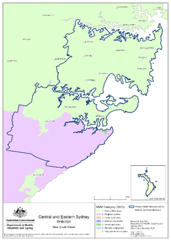
Central and Eastern Sydney (NSW) Primary Health Network (PHN) map – Modified Monash Model (MMM) remoteness area
This map shows the Modified Monash Model remoteness area classifications of the Central and Eastern Sydney (NSW) Primary Health Network. -

Central and Eastern Sydney (NSW) Primary Health Network (PHN) map – socioeconomic disadvantage
This map shows the most socioeconomically disadvantaged areas within the Central and Eastern Sydney (NSW) Primary Health Network. -

Central and Eastern Sydney (NSW) Primary Health Network (PHN) map – topographic
This map shows the geographical area of the Central and Eastern Sydney (NSW) Primary Health Network. -
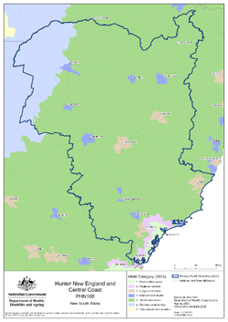
Hunter, New England and Central Coast (NSW) Primary Health Network (PHN) map – Modified Monash Model (MMM) remoteness area
This map shows the Modified Monash Model remoteness area classifications of the Hunter, New England and Central Coast (NSW) Primary Health Network. -

Hunter, New England and Central Coast (NSW) Primary Health Network (PHN) map – socioeconomic disadvantage
This map shows the most socioeconomically disadvantaged areas within the Hunter, New England and Central Coast (NSW) Primary Health Network. -

Hunter, New England and Central Coast (NSW) Primary Health Network (PHN) map – topographic
This map shows the geographical area of the Hunter, New England and Central Coast (NSW) Primary Health Network. -
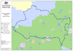
Murrumbidgee (NSW) Primary Health Network (PHN) map – Modified Monash Model (MMM) remoteness area
This map shows the Modified Monash Model remoteness area classifications of the Murrumbidgee (NSW) Primary Health Network. -

Murrumbidgee (NSW) Primary Health Network (PHN) map – socioeconomic disadvantage
This map shows the most socioeconomically disadvantaged areas within the Murrumbidgee (NSW) Primary Health Network. -

Murrumbidgee (NSW) Primary Health Network (PHN) map – topographic
This map shows the geographical area of the Murrumbidgee (NSW) Primary Health Network. -
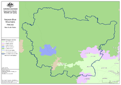
Nepean Blue Mountains (NSW) Primary Health Network (PHN) map – Modified Monash Model (MMM) remoteness area
This map shows the Modified Monash Model remoteness area classifications of the Nepean Blue Mountains (NSW) Primary Health Network. -

Nepean Blue Mountains (NSW) Primary Health Network (PHN) map – socioeconomic disadvantage
This map shows the most socioeconomically disadvantaged areas within the Nepean Blue Mountains (NSW) Primary Health Network. -

Nepean Blue Mountains (NSW) Primary Health Network (PHN) map – topographic
This map shows the geographical area of the Nepean Blue Mountains (NSW) Primary Health Network. -

Northern Territory (NT) Primary Health Network (PHN) map – Modified Monash Model (MMM) remoteness area
This map shows the Modified Monash Model remoteness area classifications of the Northern Territory Primary Health Network. -

Northern Territory (NT) Primary Health Network (PHN) map – socioeconomic disadvantage
This map shows the most socioeconomically disadvantaged areas within the Northern Territory Primary Health Network. -
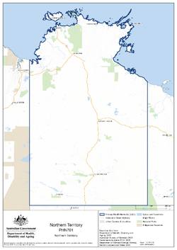
Northern Territory (NT) Primary Health Network (PHN) map – topographic
This map shows the geographical area of the Northern Territory Primary Health Network. -
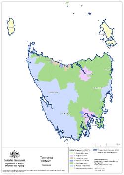
Tasmania Primary Health Network (PHN) map – Modified Monash Model (MMM) remoteness area
This map shows the Modified Monash Model remoteness area classifications of the Tasmania Primary Health Network. -

Tasmania Primary Health Network (PHN) map – socioeconomic disadvantage
This map shows the most socioeconomically disadvantaged areas within the Tasmania Primary Health Network. -

Tasmania Primary Health Network (PHN) map – topographic
This map shows the geographical area of the Tasmania Primary Health Network.