Filter results
You can narrow down the results using the filters
Audience
Publication type
Topics
Our work
Diseases
9570 results
-
National Immunisation Research — Qualitative (2016) and quantitative (2017) research reports
Research reports on qualitative and quantitative research conducted on attitudes and behaviours regarding childhood and adult immunisation. -
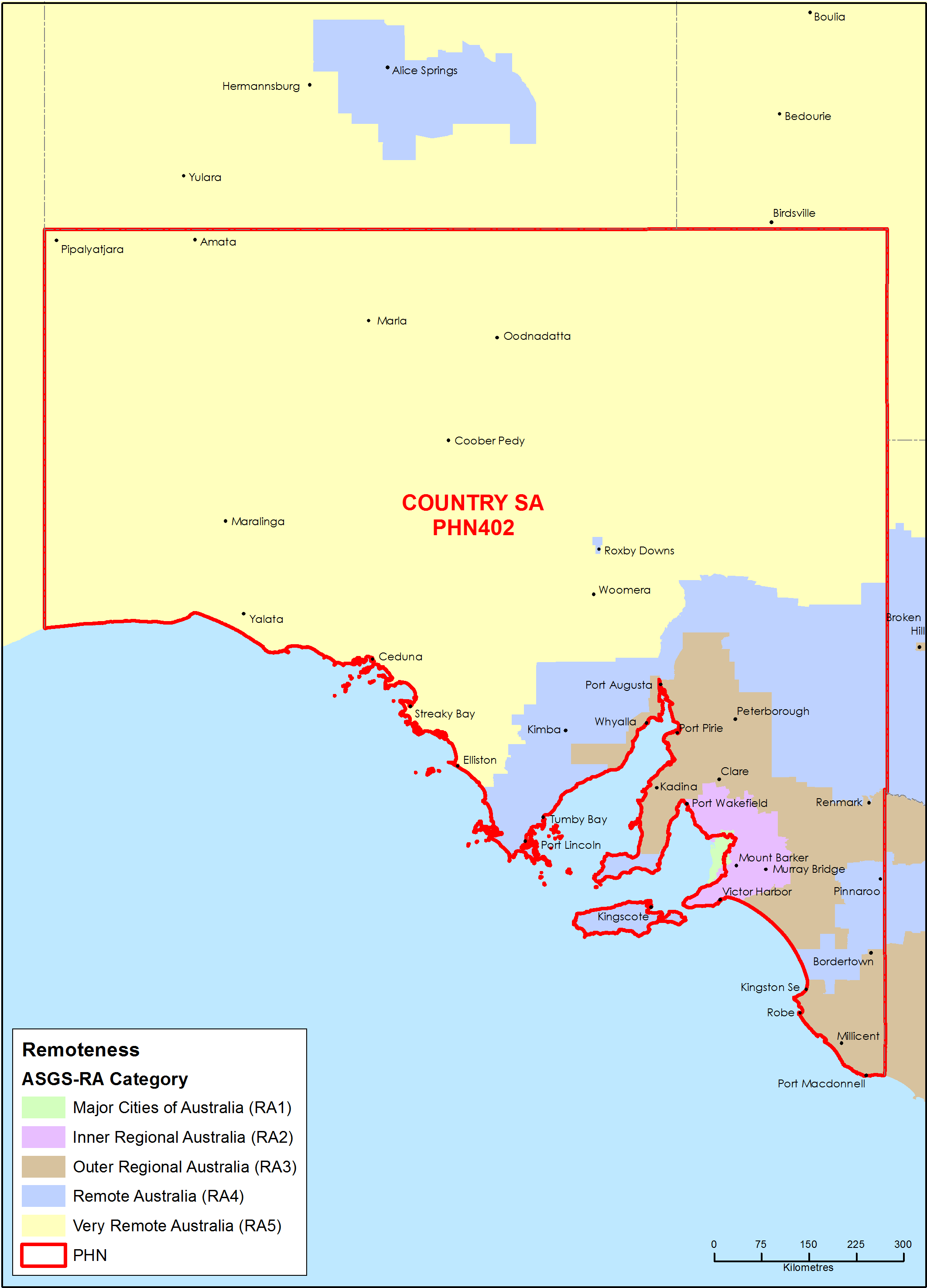
Country South Australia Primary Health Network (PHN) map – Australian Statistical Geography Standard (ASGS) remoteness area
This map shows the Australian Statistical Geography Standard remoteness area classifications within the Country South Australia Primary Health Network. -
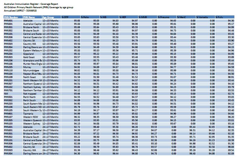
2018 PHN childhood immunisation coverage data
These spreadsheets provide 2018 childhood immunisation coverage data by Primary Health Network (PHN), for all children and Aboriginal and Torres Strait Islander children. -
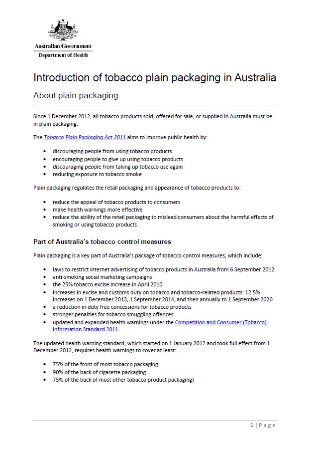
Introduction of tobacco plain packaging in Australia
Find out how plain packaging of tobacco products was introduced in Australia in 2012. -
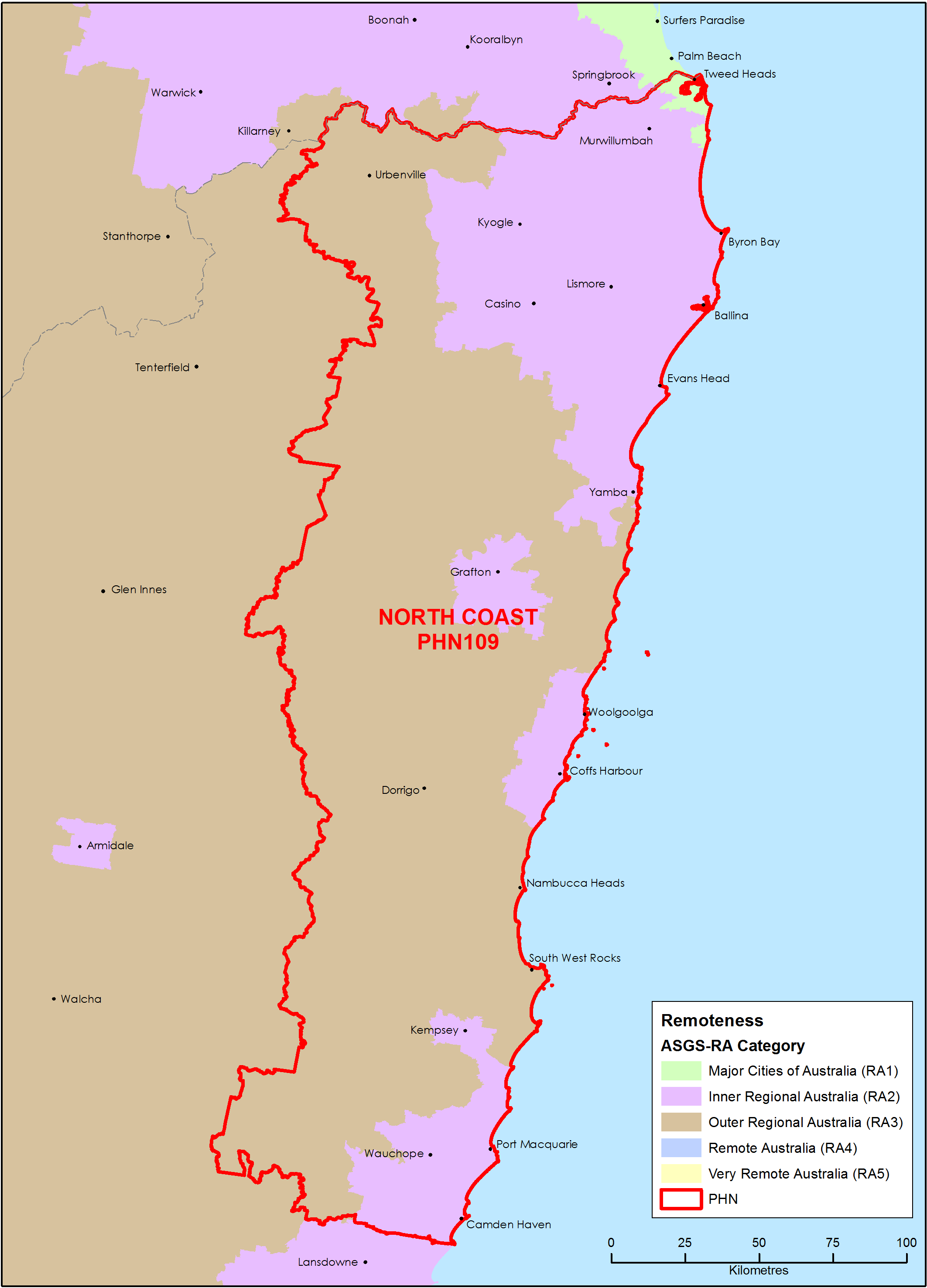
North Coast (NSW) Primary Health Network (PHN) map – Australian Statistical Geography Standard (ASGS) remoteness area
This map shows the Australian Statistical Geography Standard remoteness area classifications within the North Coast (NSW) Primary Health Network. -
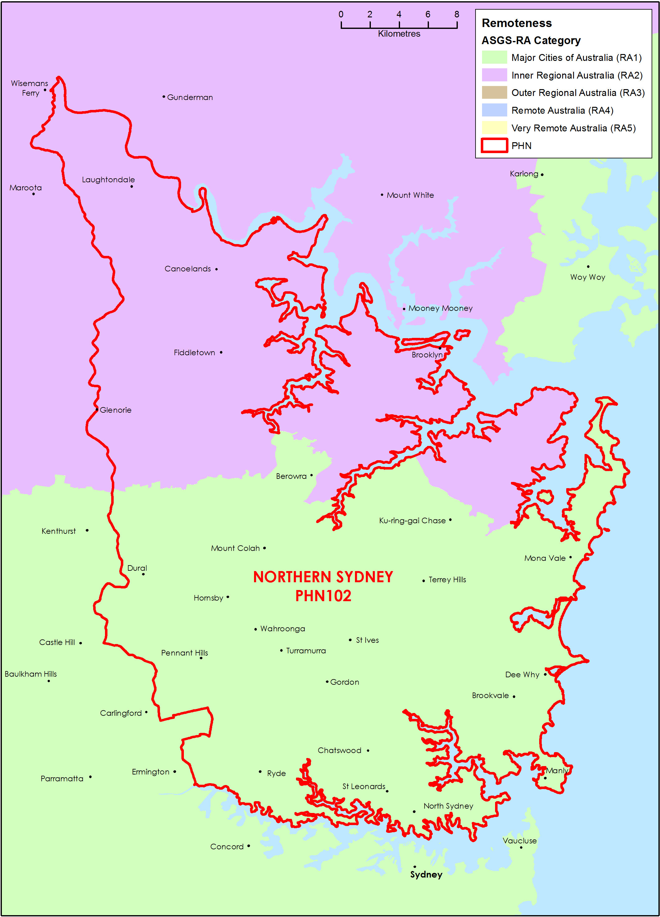
Northern Sydney (NSW) Primary Health Network (PHN) map – Australian Statistical Geography Standard (ASGS) remoteness area
This map shows the Australian Statistical Geography Standard remoteness area classifications within the Northern Sydney (NSW) Primary Health Network. -
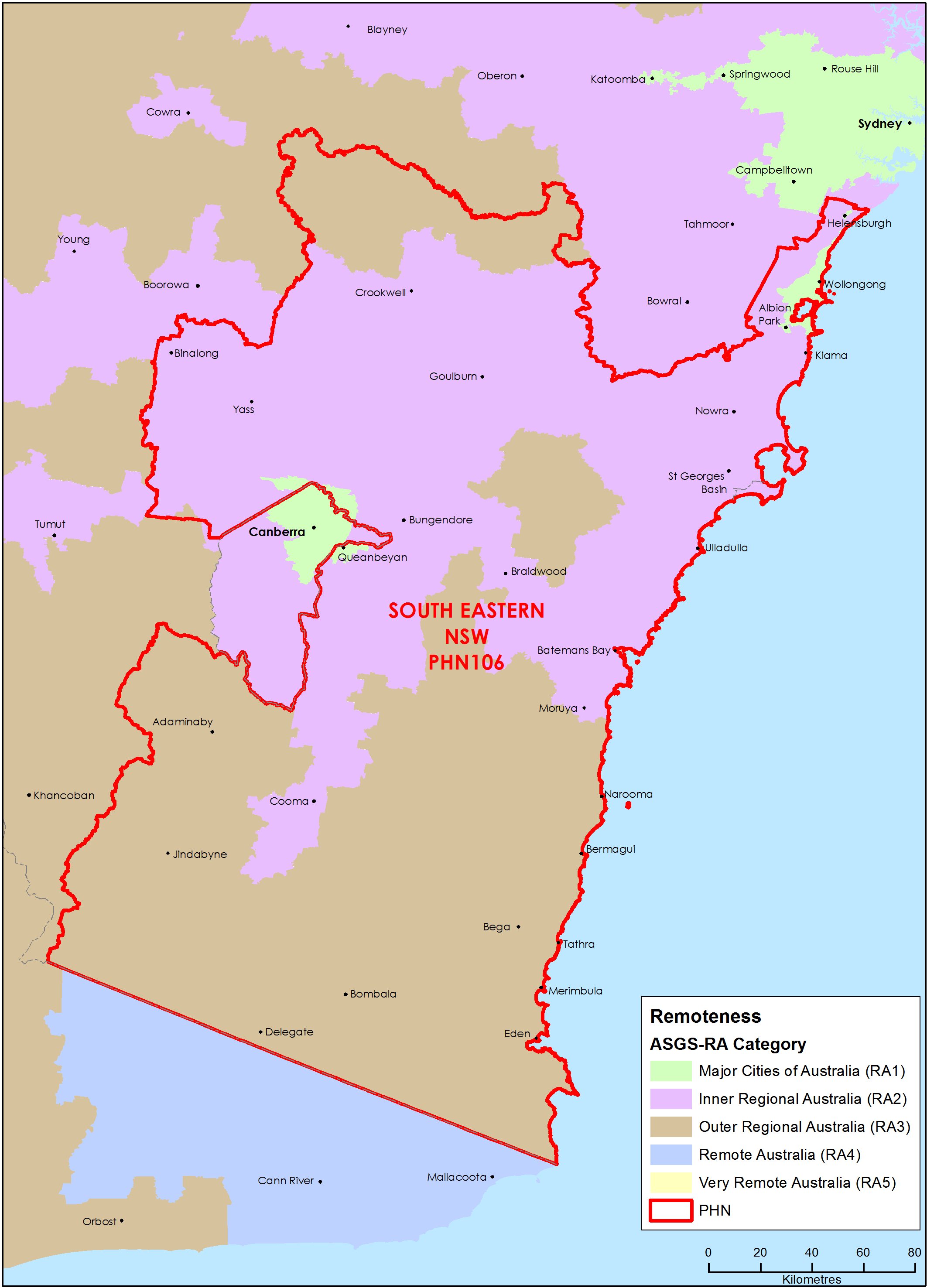
South Eastern New South Wales Primary Health Network (PHN) map – Australian Statistical Geography Standard (ASGS) remoteness area
This map shows the Australian Statistical Geography Standard remoteness area classifications within the South Eastern New South Wales Primary Health Network. -
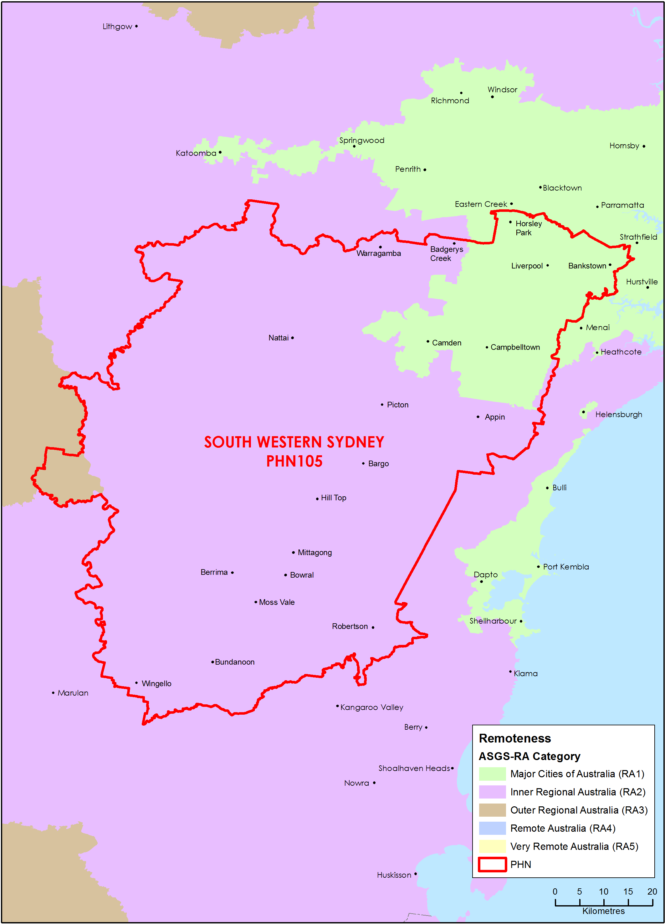
South Western Sydney (NSW) Primary Health Network (PHN) map – Australian Statistical Geography Standard (ASGS) remoteness area
This map shows the Australian Statistical Geography Standard remoteness area classifications within the South Western Sydney (NSW) Primary Health Network. -
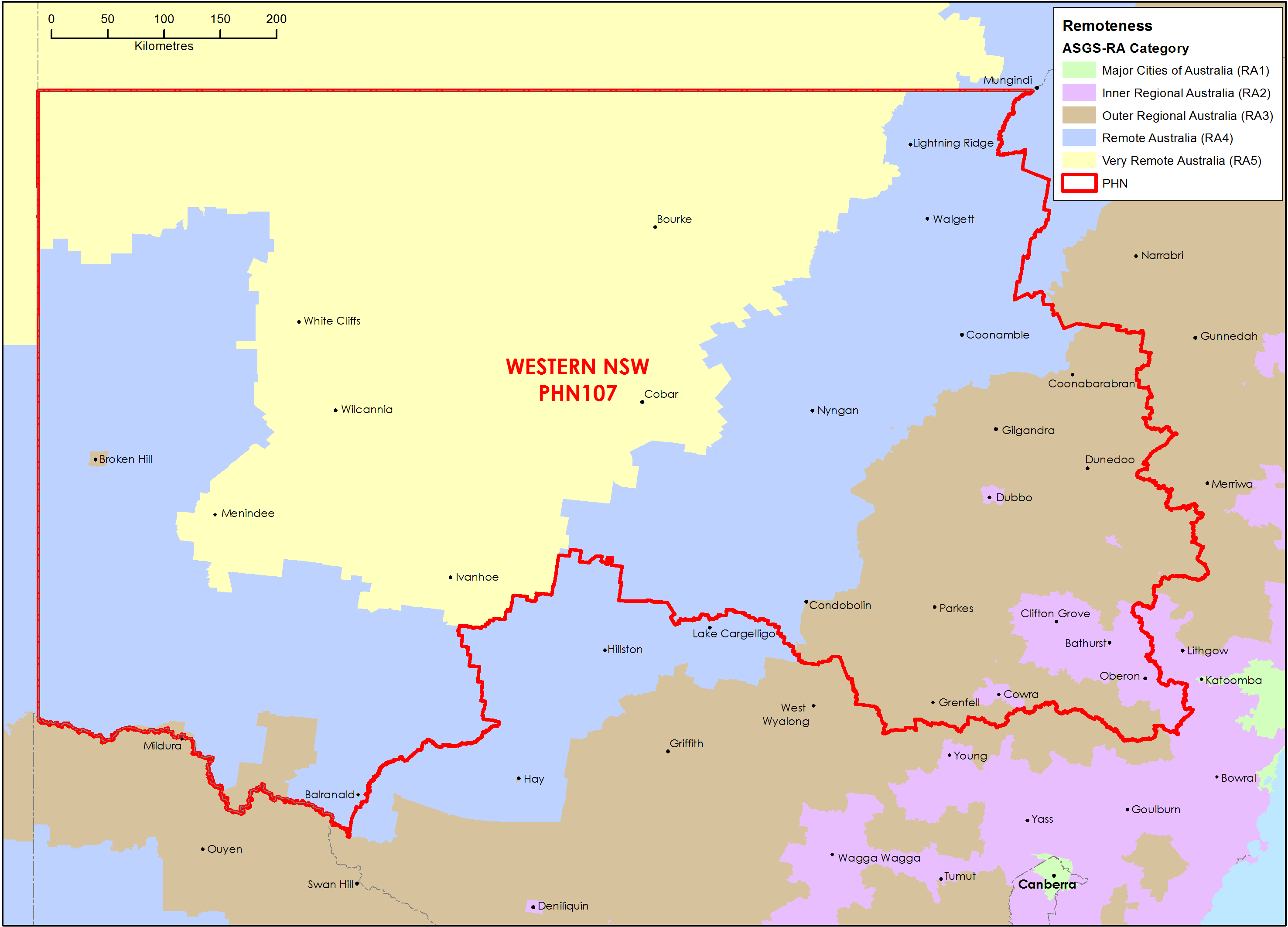
Western New South Wales Primary Health Network (PHN) map – Australian Statistical Geography Standard (ASGS) remoteness area
This map shows the Australian Statistical Geography Standard remoteness area classifications within the Western New South Wales Primary Health Network. -
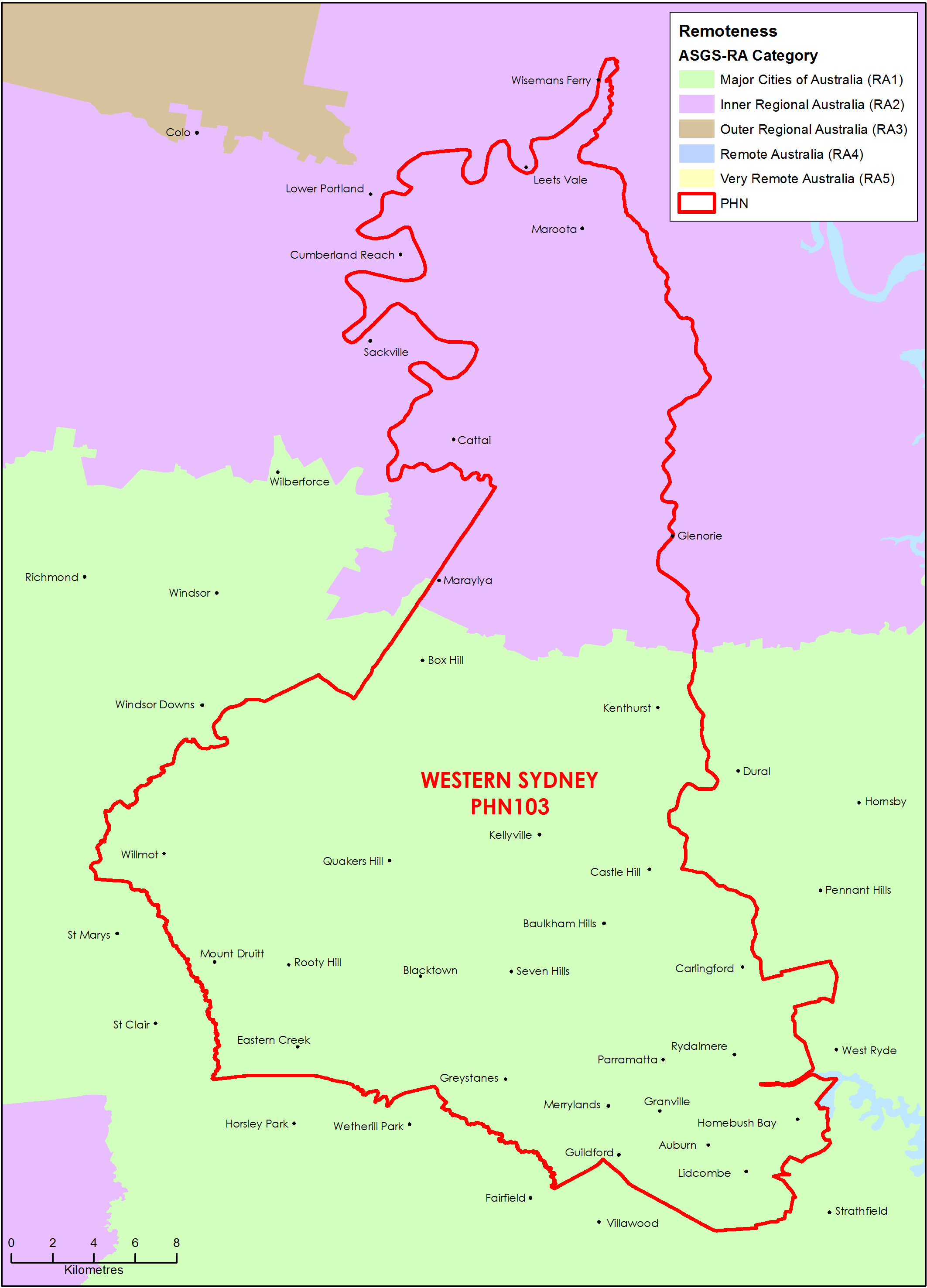
Western Sydney (NSW) Primary Health Network (PHN) map – Australian Statistical Geography Standard (ASGS) remoteness area
This map shows the Australian Statistical Geography Standard remoteness area classifications within the Western Sydney (NSW) Primary Health Network. -
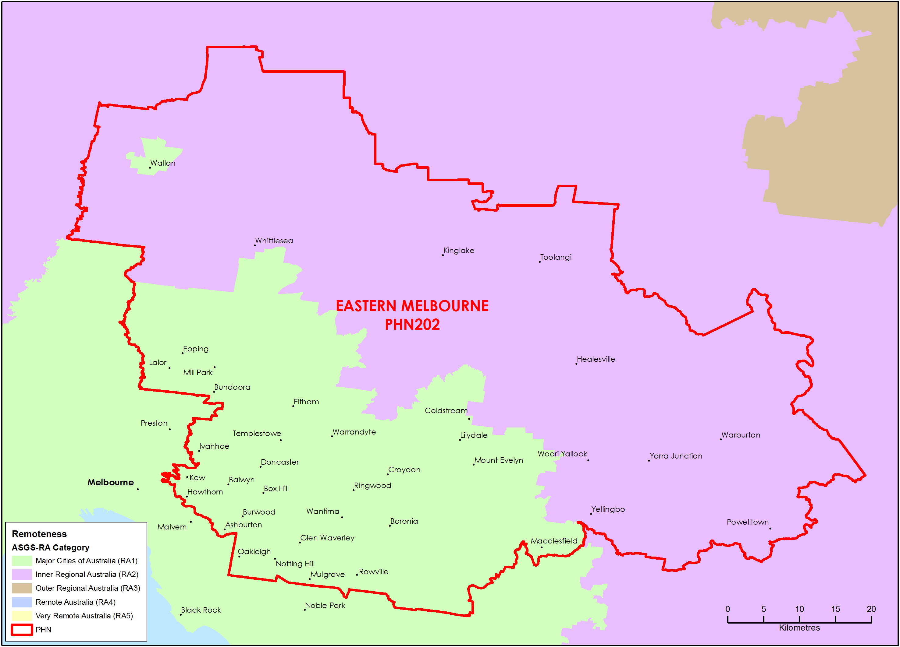
Eastern Melbourne (Vic) Primary Health Network (PHN) map – Australian Statistical Geography Standard (ASGS) remoteness area
This map shows the Australian Statistical Geography Standard remoteness area classifications within the Eastern Melbourne (Vic) Primary Health Network. -
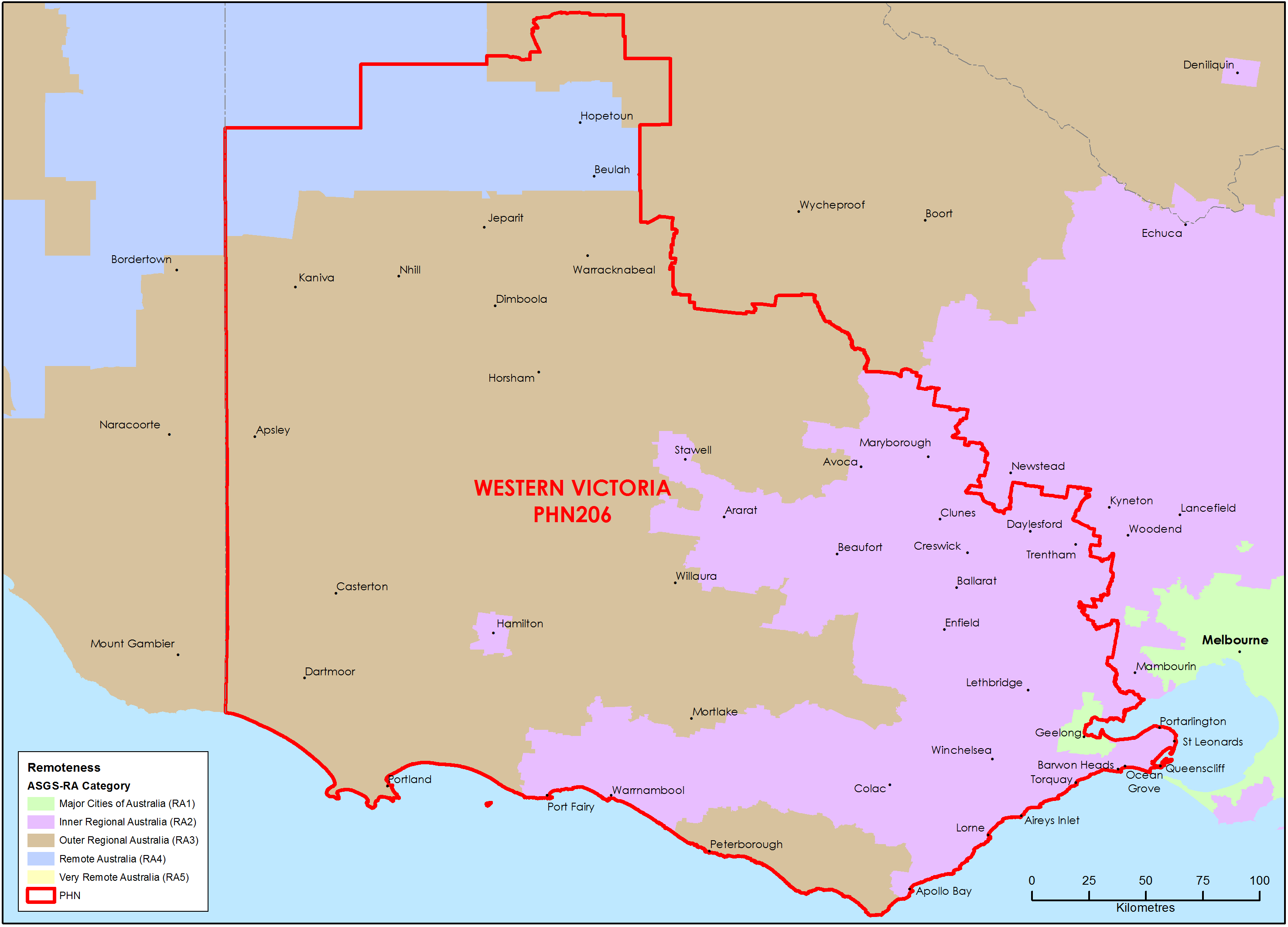
Western Victoria Primary Health Network (PHN) map – Australian Statistical Geography Standard (ASGS) remoteness area
This map shows the Australian Statistical Geography Standard remoteness area classifications within the Western Victoria Primary Health Network. -
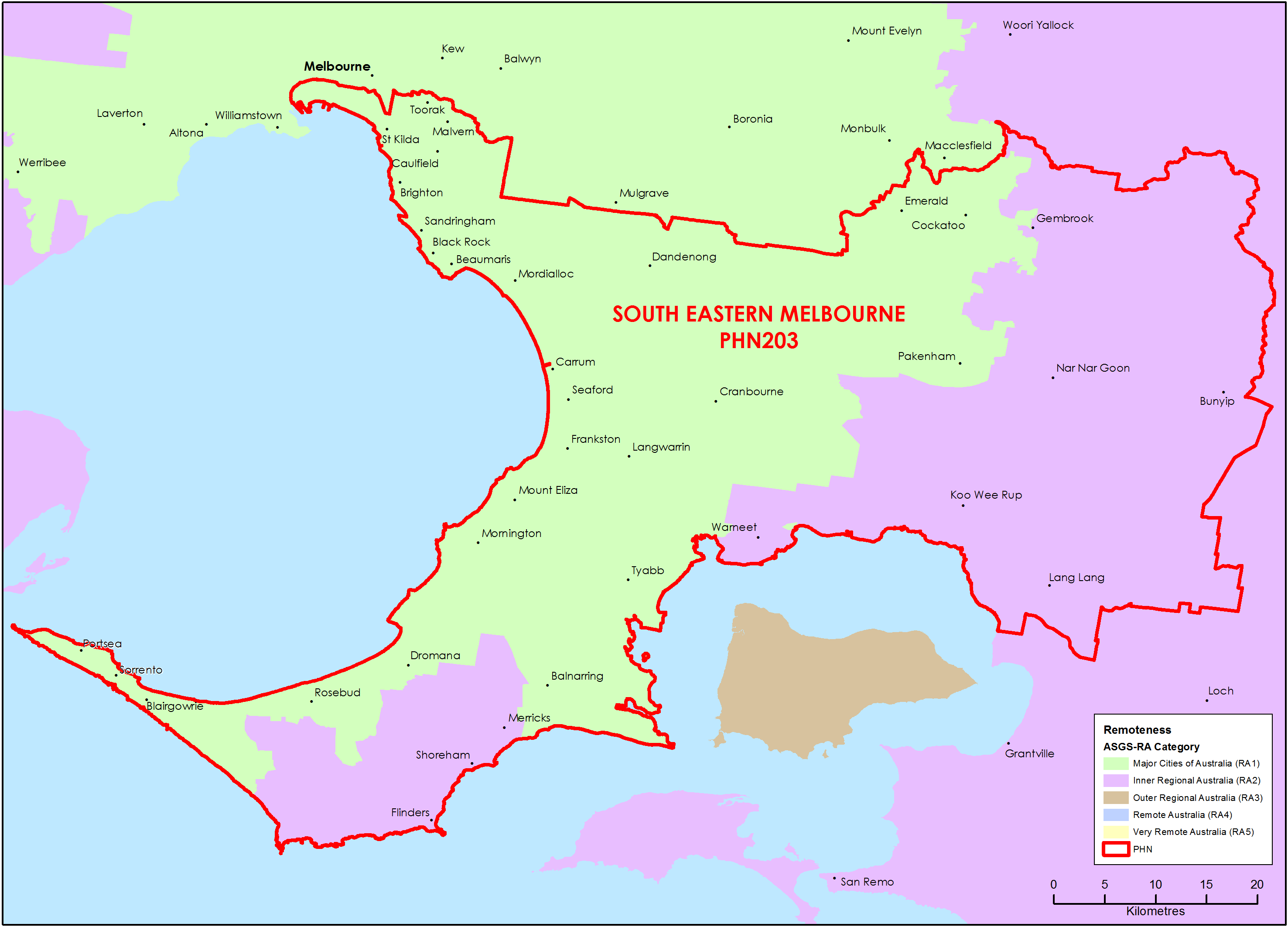
South Eastern Melbourne (Vic) Primary Health Network (PHN) map – Australian Statistical Geography Standard (ASGS) remoteness area
This map shows the Australian Statistical Geography Standard remoteness area classifications within the South Eastern Melbourne (Vic) Primary Health Network. -
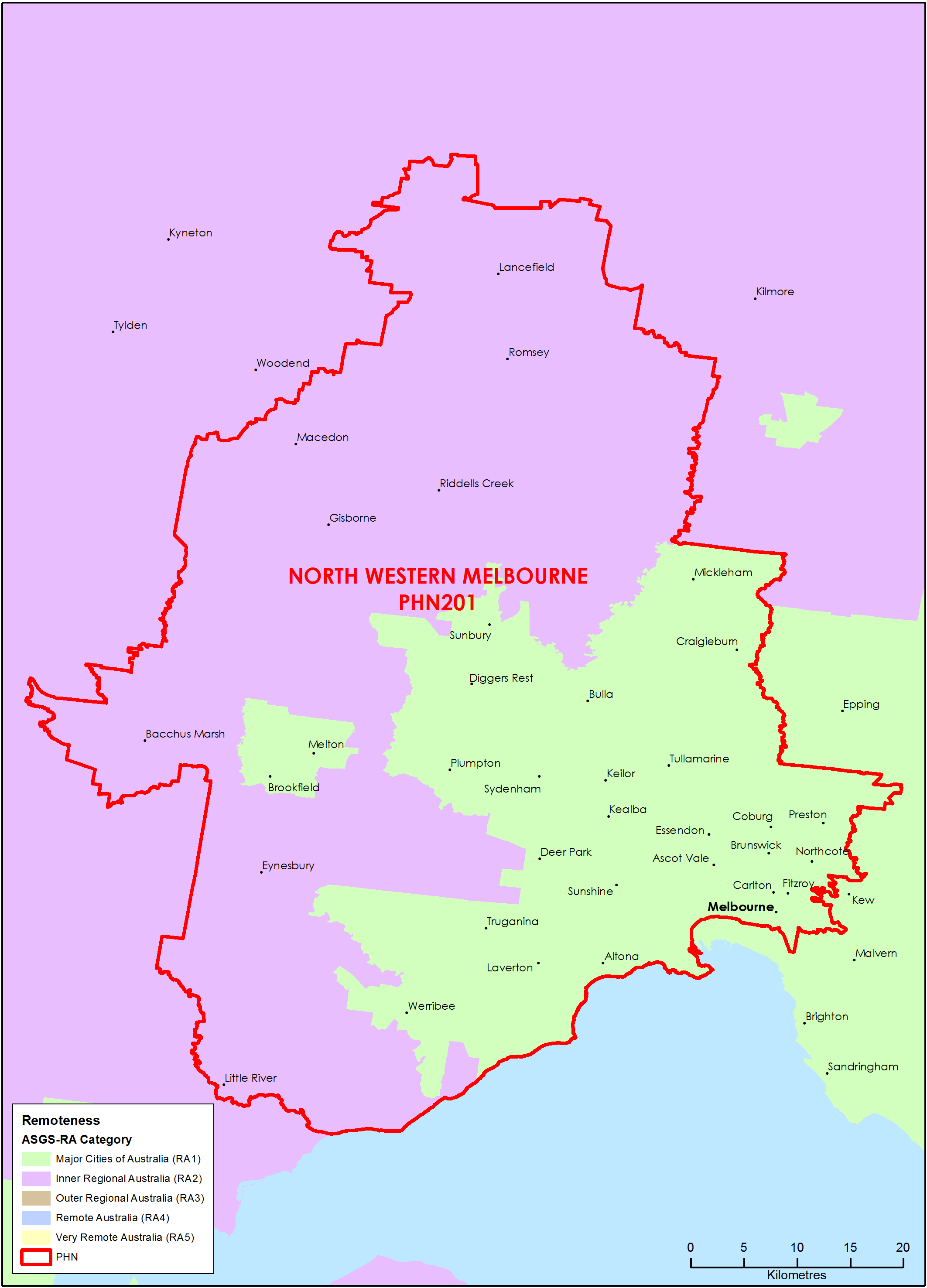
North Western Melbourne (Vic) Primary Health Network (PHN) map – Australian Statistical Geography Standard (ASGS) remoteness area
This map shows the Australian Statistical Geography Standard remoteness area classifications within the North Western Melbourne (Vic) Primary Health Network. -
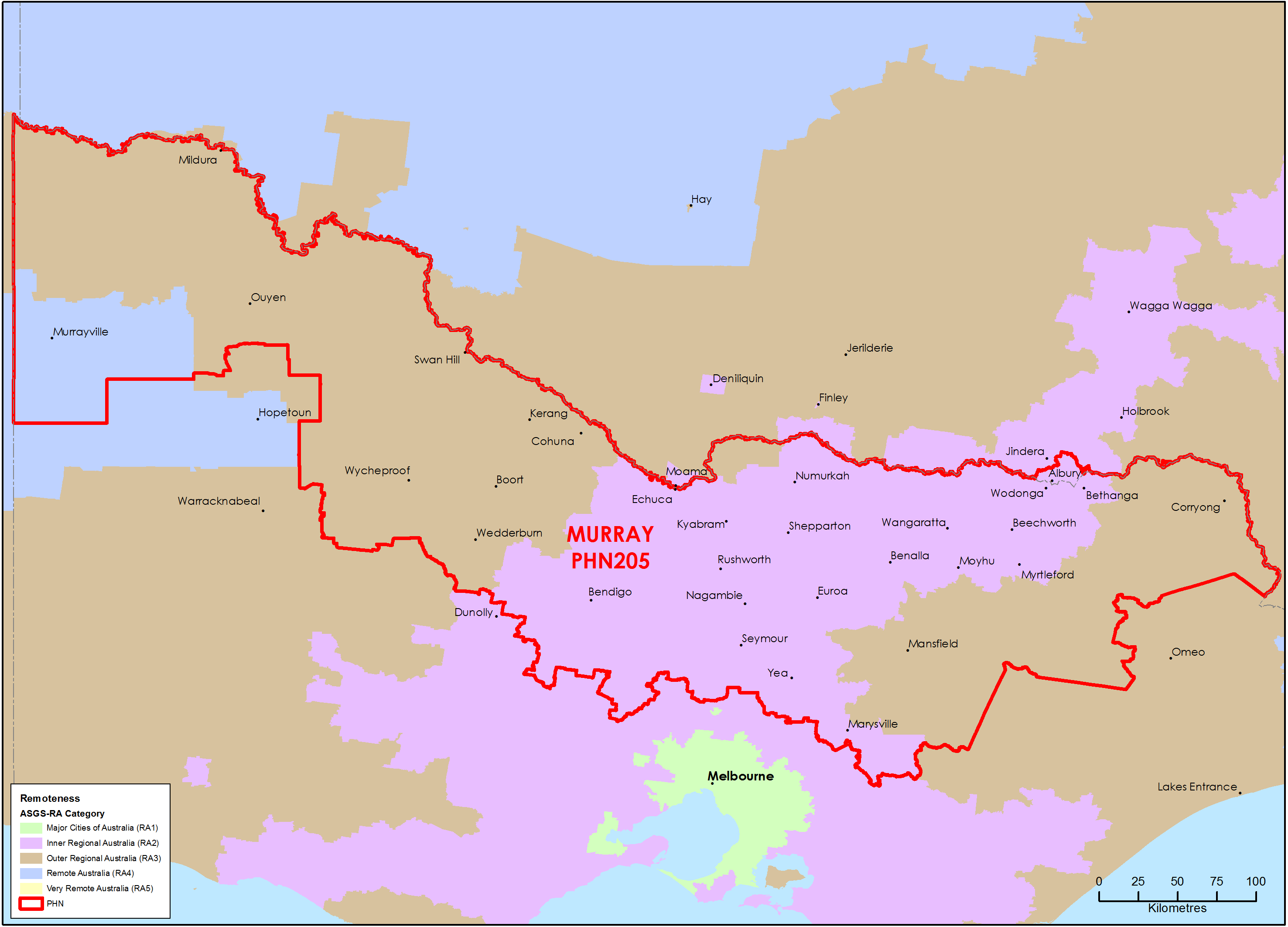
Murray (Vic) Primary Health Network (PHN) map – Australian Statistical Geography Standard (ASGS) remoteness area
This map shows the Australian Statistical Geography Standard remoteness area classifications within the Murray (Vic) Primary Health Network. -
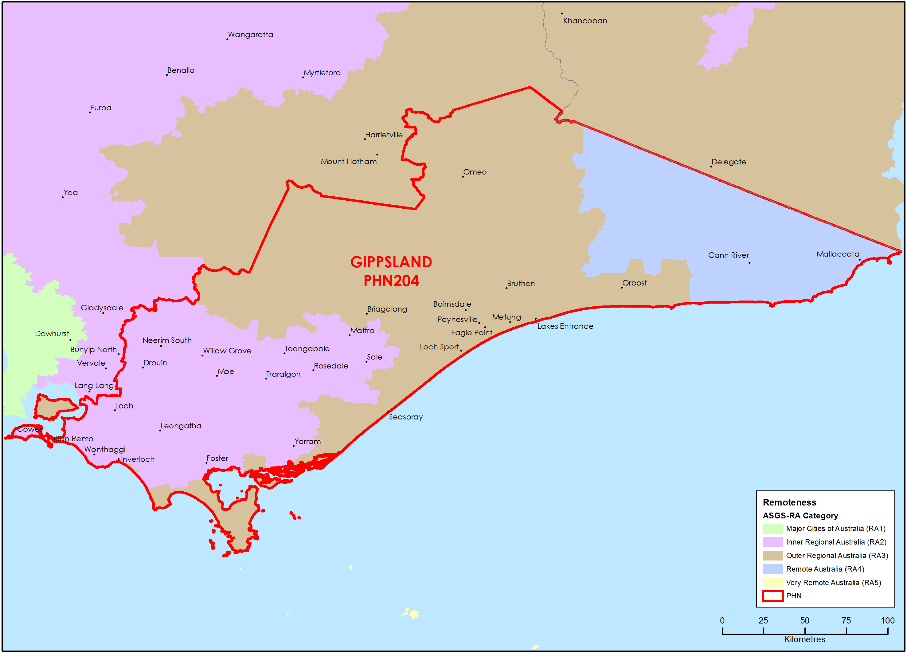
Gippsland (Vic) Primary Health Network (PHN) map – Australian Statistical Geography Standard (ASGS) remoteness area
This map shows the Australian Statistical Geography Standard remoteness area classifications within the Gippsland (Vic) Primary Health Network. -
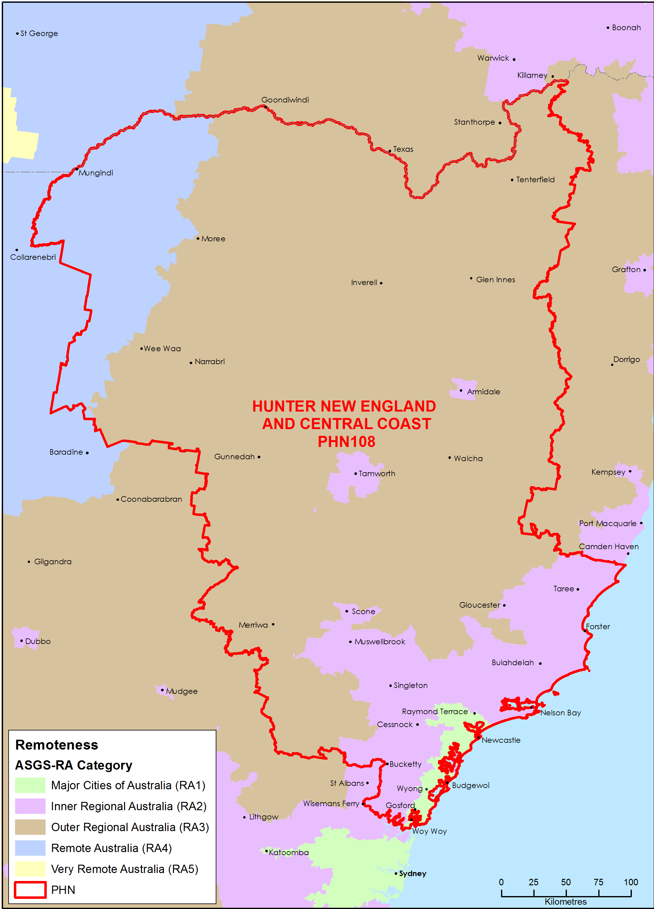
Hunter, New England and Central Coast (NSW) Primary Health Network (PHN) map – Australian Statistical Geography Standard (ASGS) remoteness area
This map shows the Australian Statistical Geography Standard remoteness area classifications within the Hunter, New England and Central Coast (NSW) Primary Health Network. -
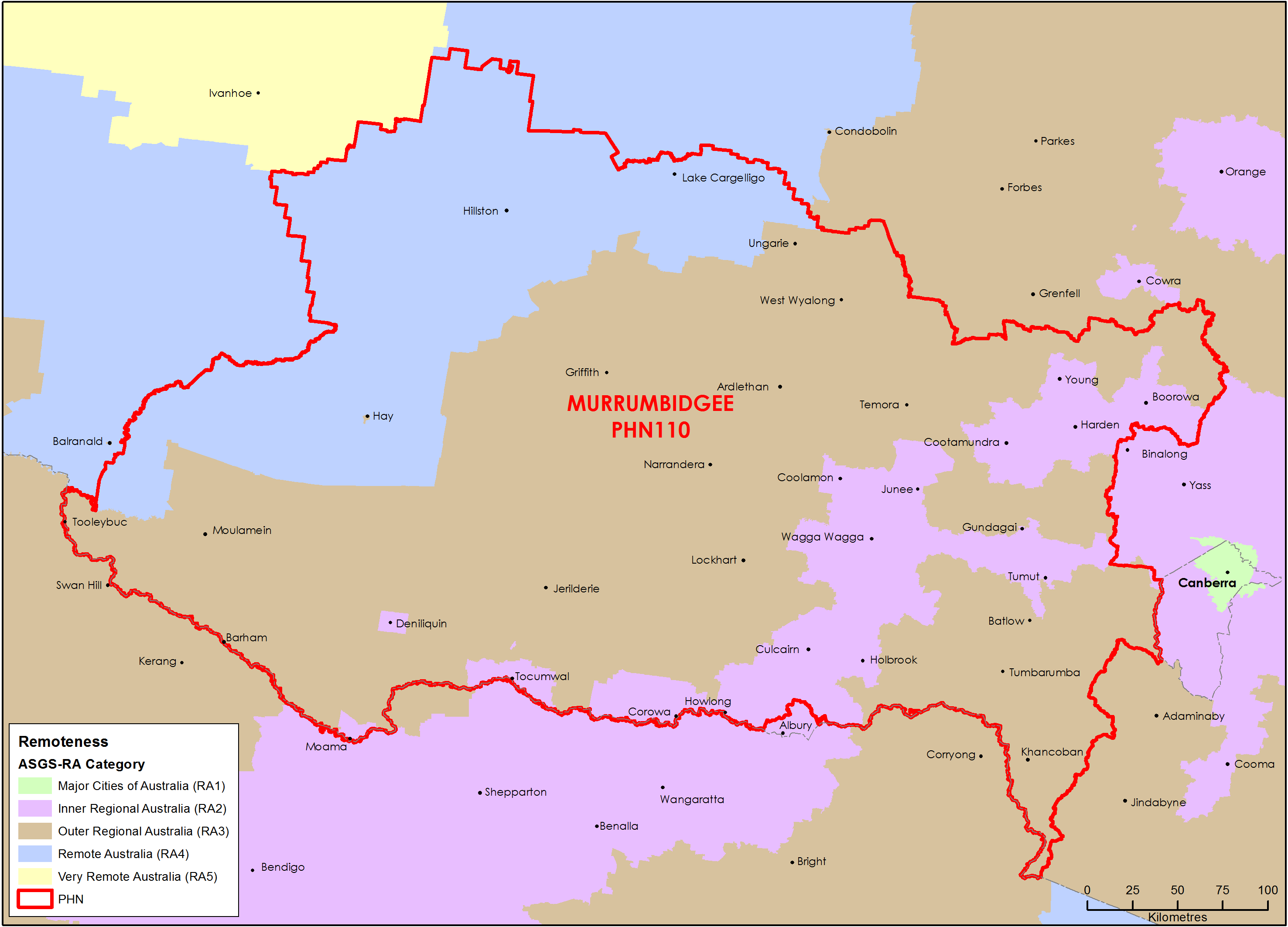
Murrumbidgee (NSW) Primary Health Network (PHN) map – Australian Statistical Geography Standard (ASGS) remoteness area
This map shows the Australian Statistical Geography Standard remoteness area classifications within the Murrumbidgee (NSW) Primary Health Network. -
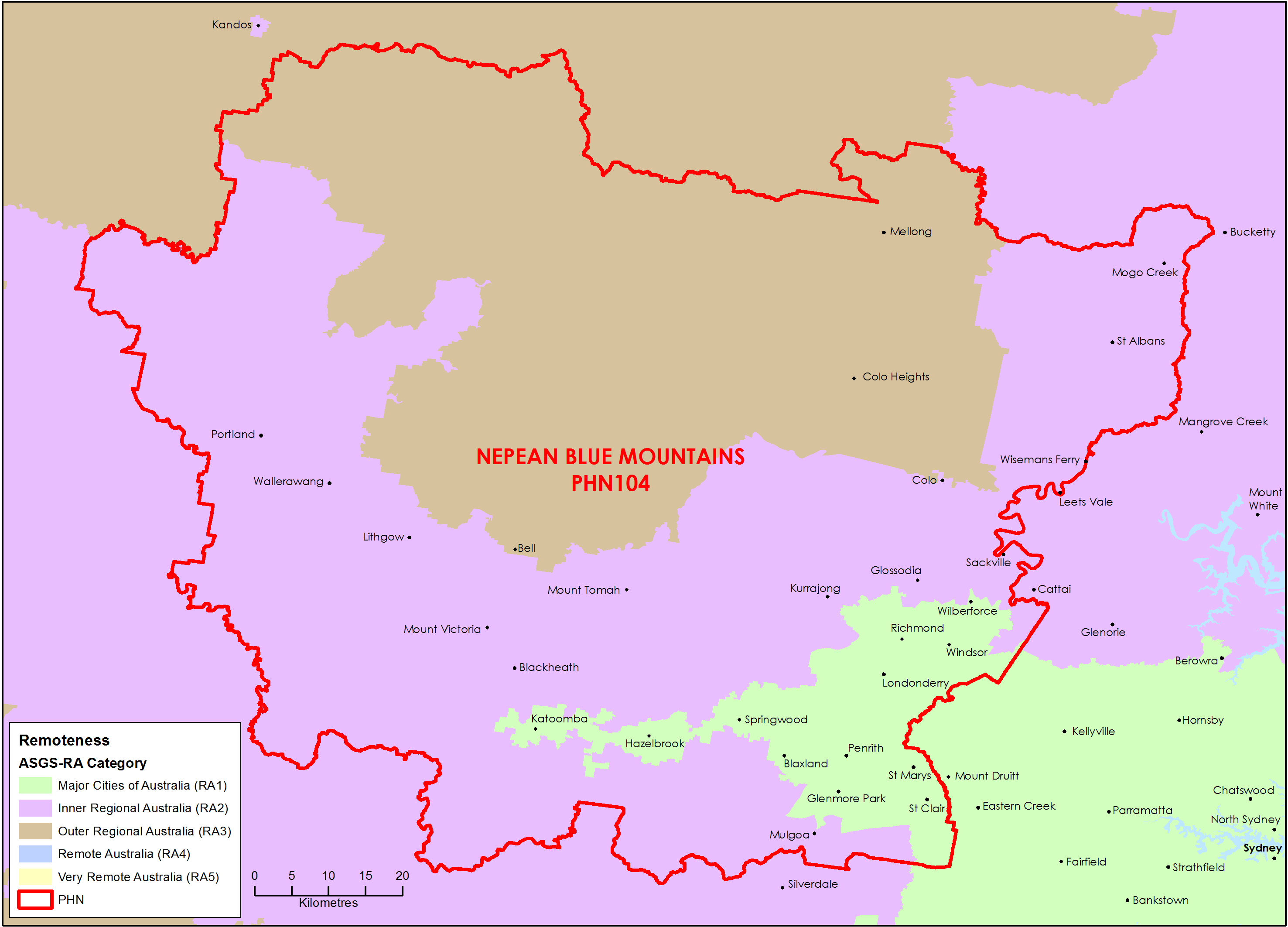
Nepean Blue Mountains (NSW) Primary Health Network (PHN) map – Australian Statistical Geography Standard (ASGS) remoteness area
This map shows the Australian Statistical Geography Standard remoteness area classifications within the Nepean Blue Mountains (NSW) Primary Health Network. -
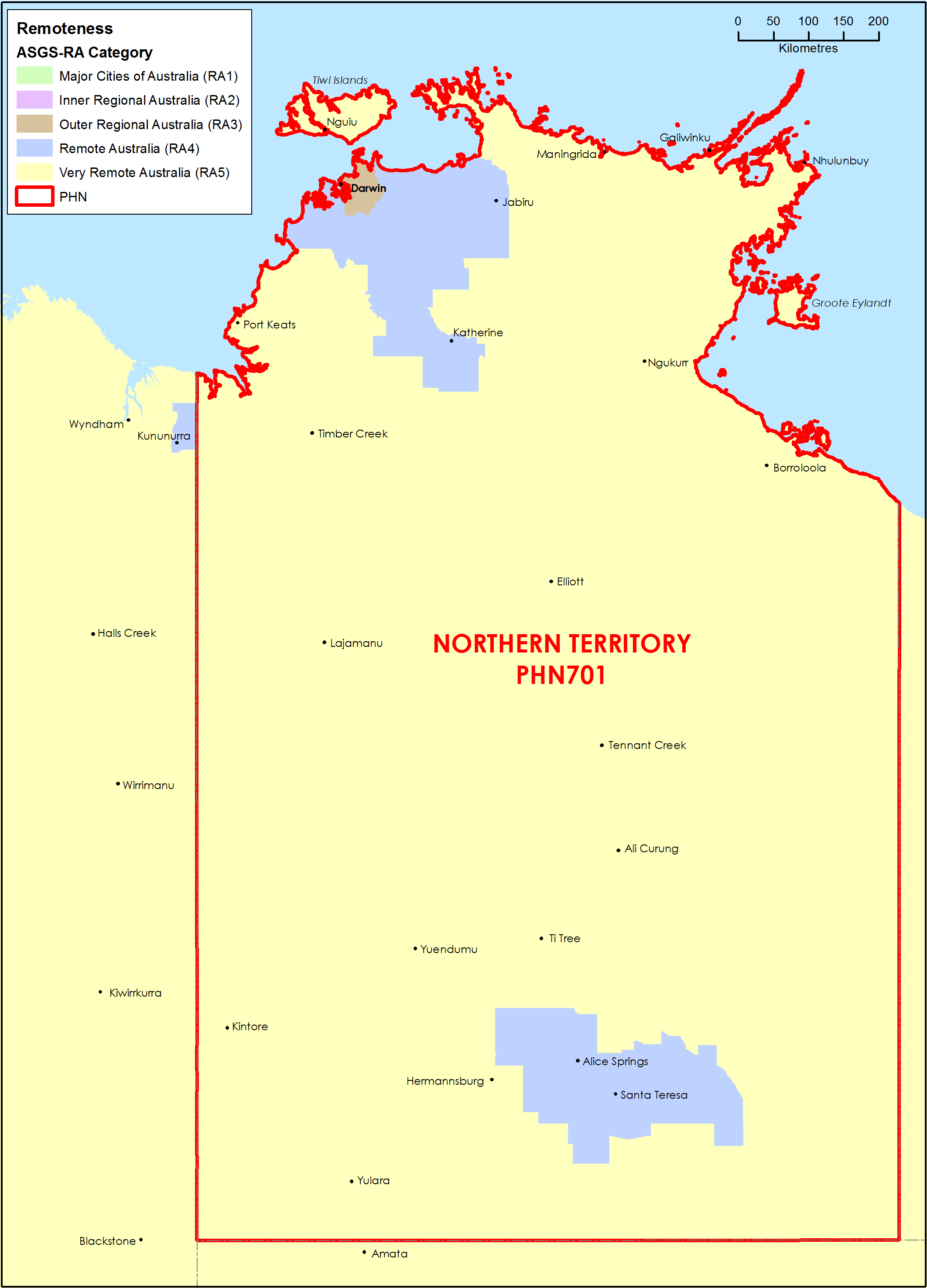
Northern Territory (NT) Primary Health Network (PHN) map – Australian Statistical Geography Standard (ASGS) remoteness area
This map shows the Australian Statistical Geography Standard remoteness area classifications within the Northern Territory Primary Health Network. -
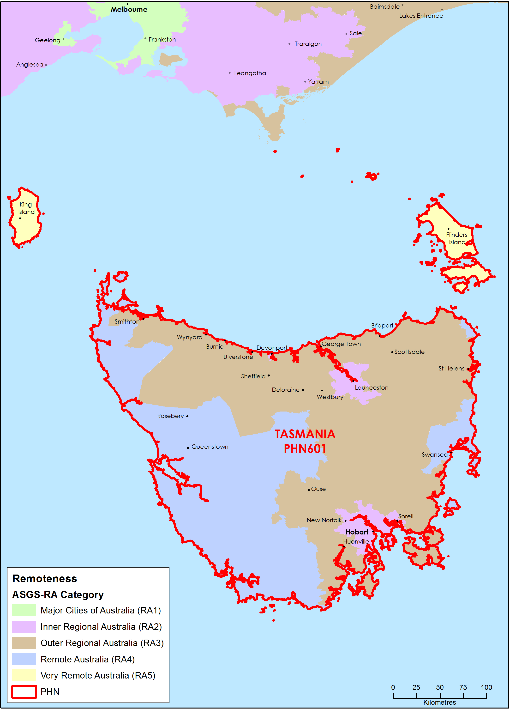
Tasmania Primary Health Network (PHN) map – Australian Statistical Geography Standard (ASGS) remoteness area
This map shows the Australian Statistical Geography Standard remoteness area classifications within the Tasmania Primary Health Network. -
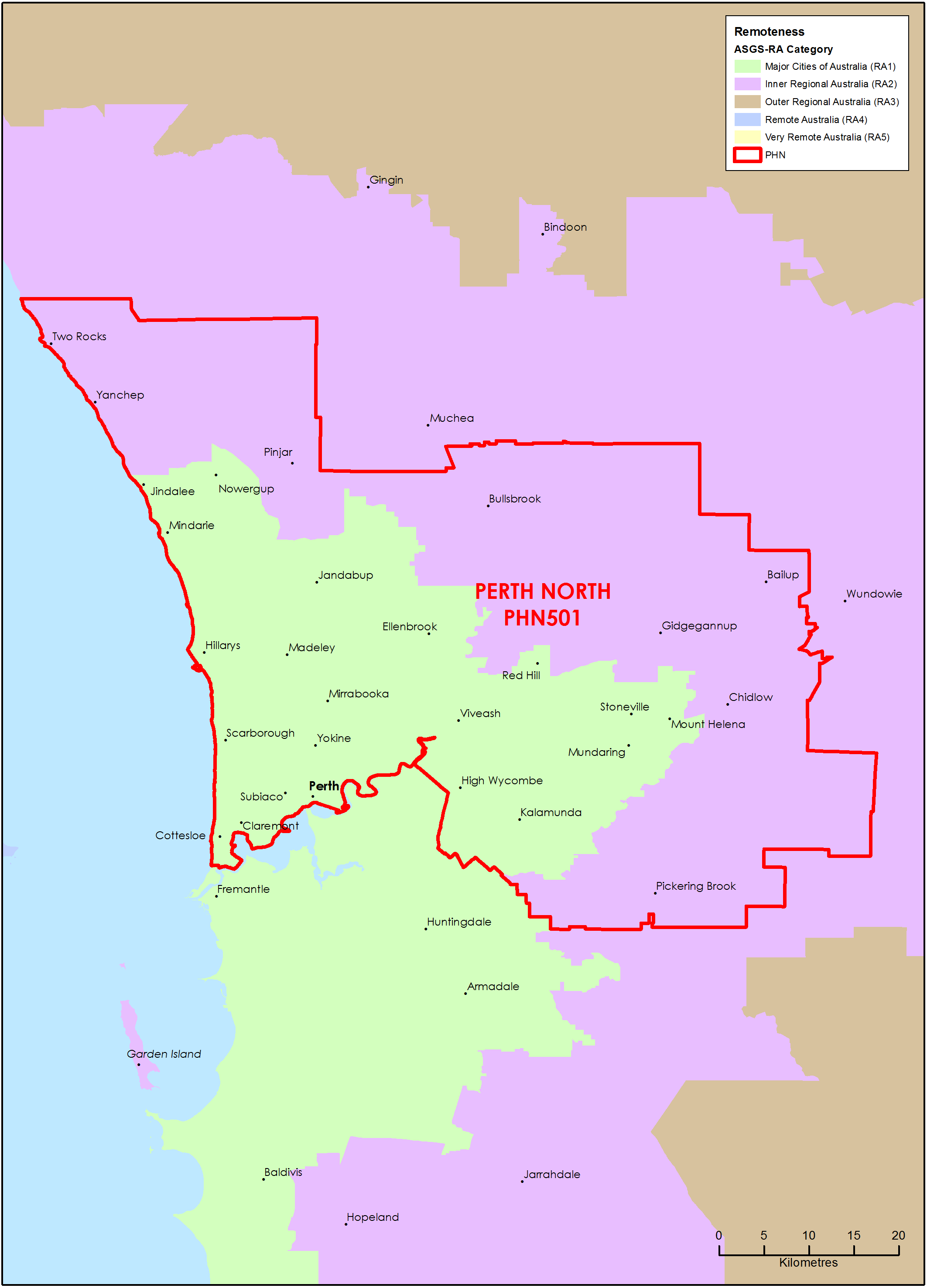
Perth North (WA) Primary Health Network (PHN) map – Australian Statistical Geography Standard (ASGS) remoteness area
This map shows the Australian Statistical Geography Standard remoteness area classifications within the Perth North (WA) Primary Health Network. -
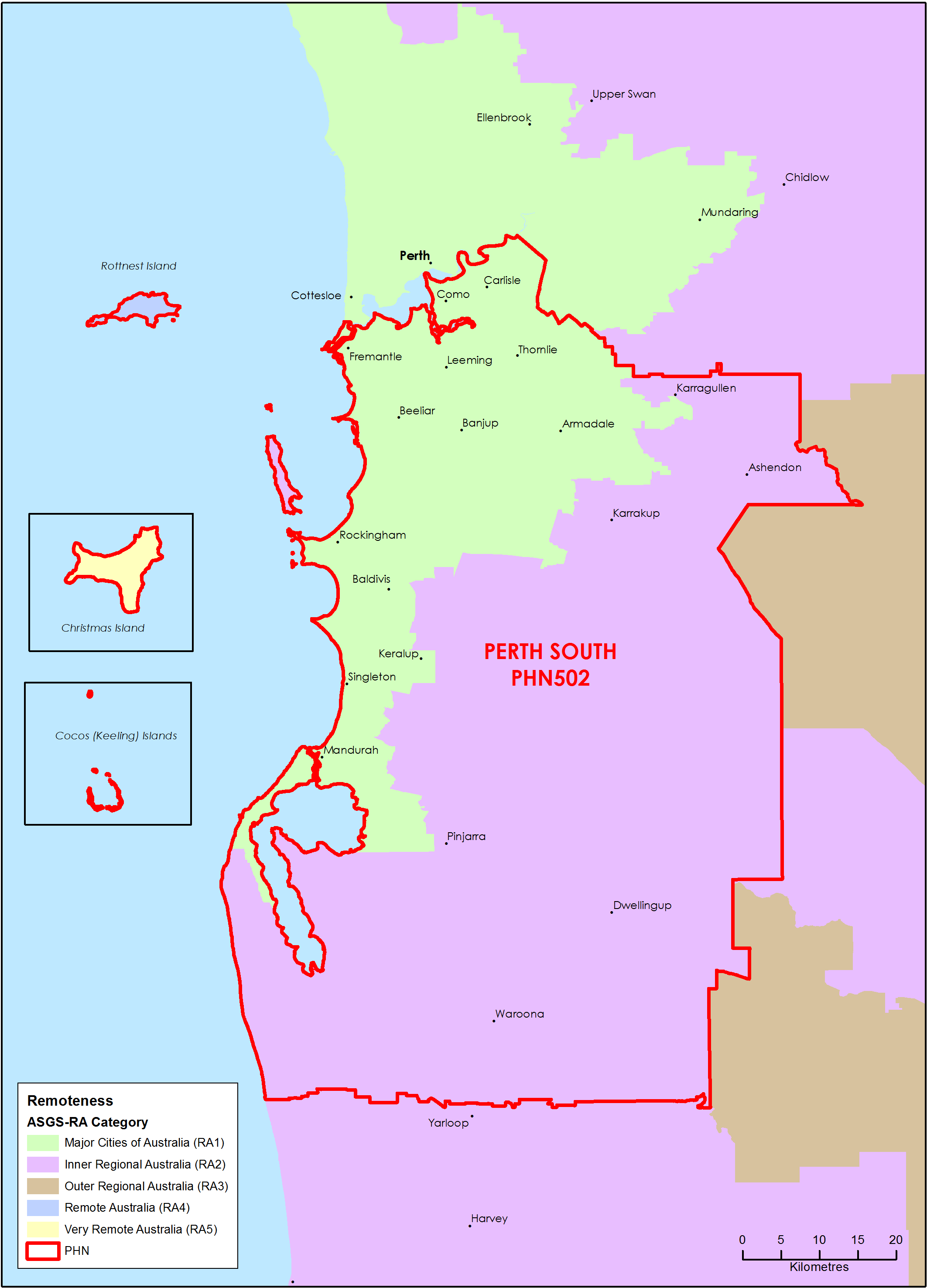
Perth South (WA) Primary Health Network (PHN) map – Australian Statistical Geography Standard (ASGS) remoteness area
This map shows the Australian Statistical Geography Standard remoteness area classifications within the Perth South (WA) Primary Health Network. -
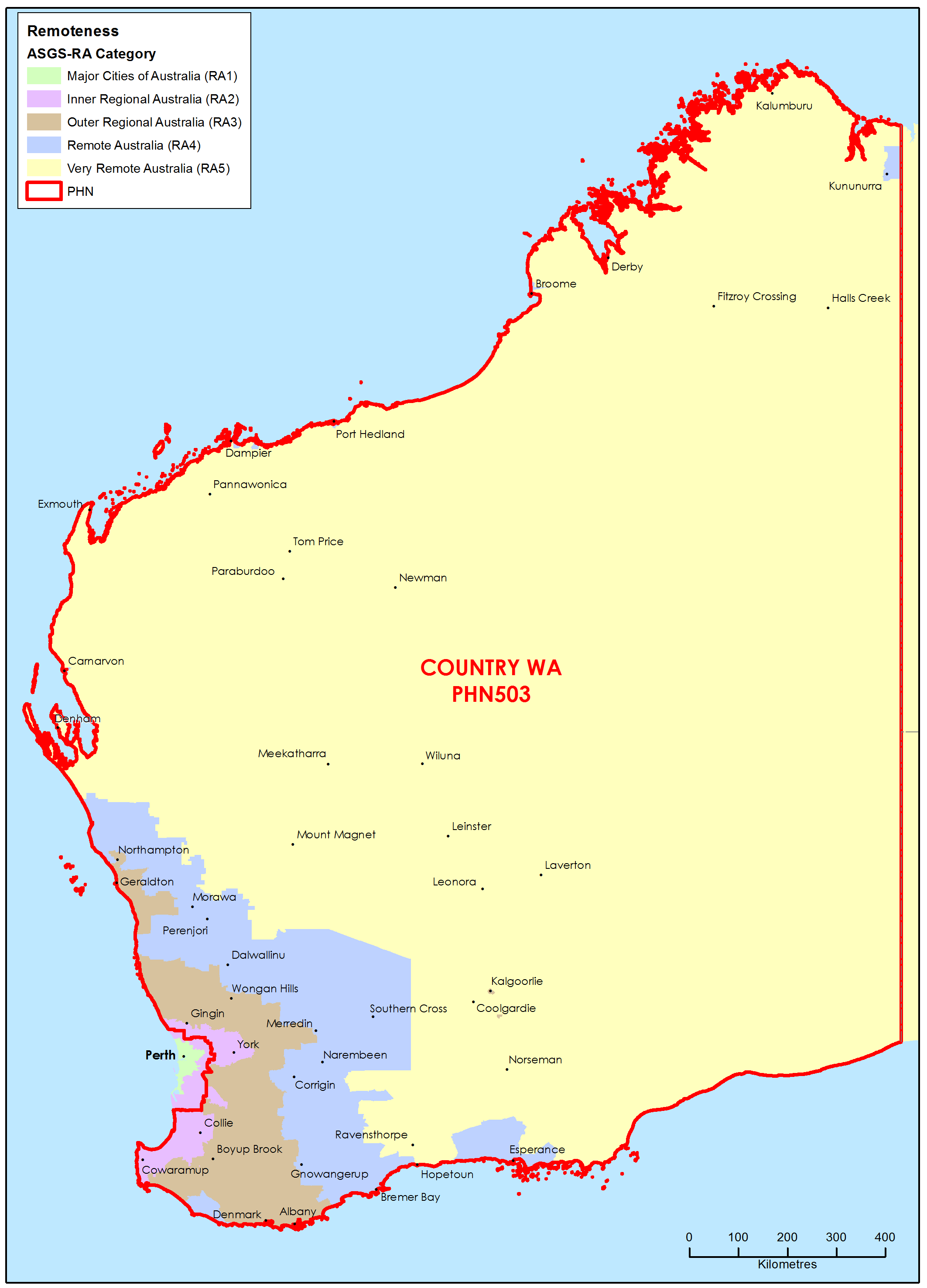
Country Western Australia Primary Health Network (PHN) map – Australian Statistical Geography Standard (ASGS) remoteness area
This map shows the Australian Statistical Geography Standard remoteness area classifications within the Country Western Australia Primary Health Network. -
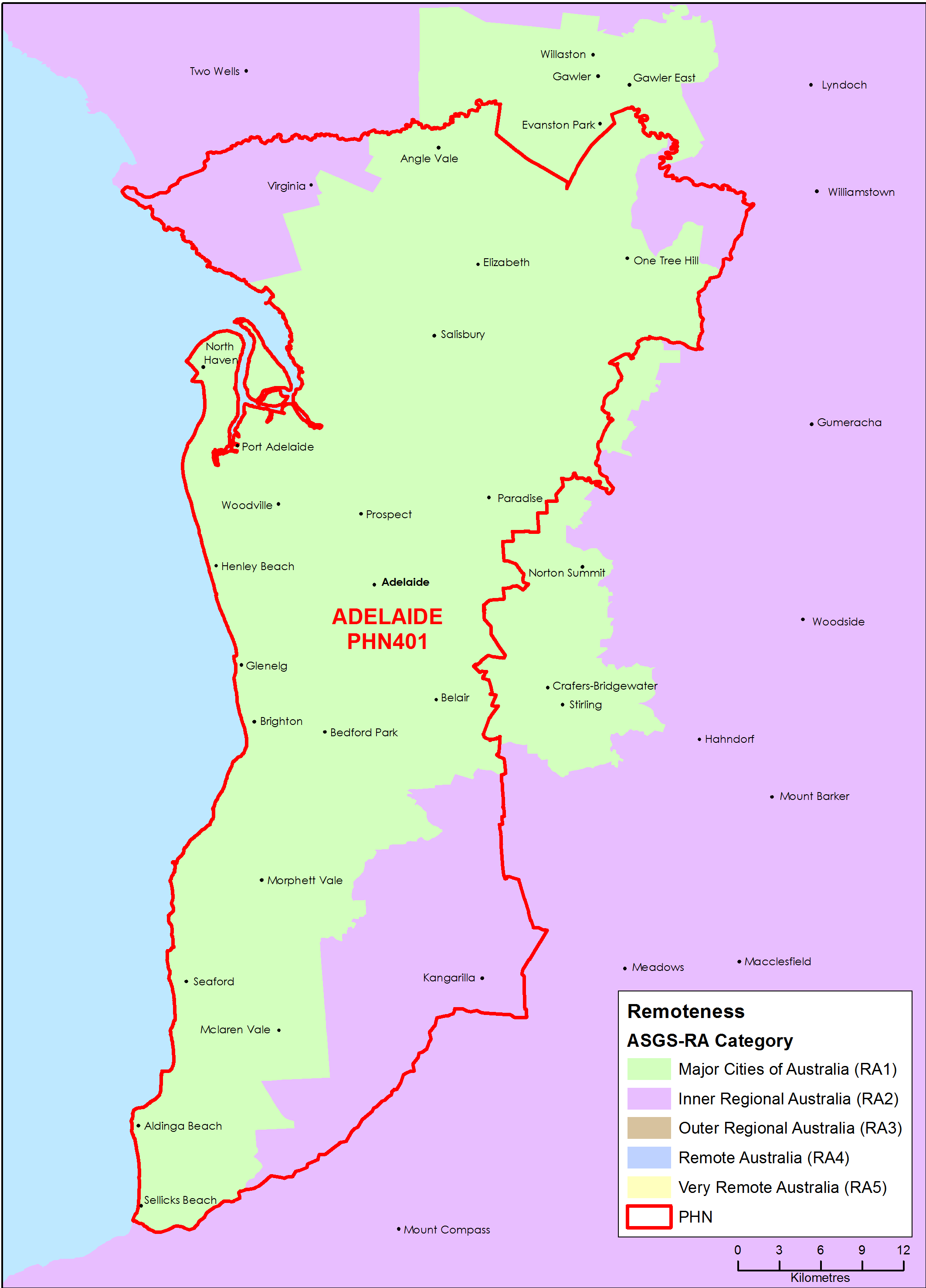
Adelaide (SA) Primary Health Network (PHN) map – Australian Statistical Geography Standard (ASGS) remoteness area
This map shows the Australian Statistical Geography Standard remoteness area classifications within the Adelaide (SA) Primary Health Network.