Filter results
You can narrow down the results using the filters
Audience
Publication type
Topics
Our work
Diseases
9573 results
-

Coronavirus (COVID-19) at a glance – 11 June 2020
This infographic provides a quick view of the coronavirus (COVID-19) situation in Australia on 11 June 2020. -

Coronavirus (COVID-19) at a glance – 10 June 2020
This infographic provides a quick view of the coronavirus (COVID-19) situation in Australia on 10 June 2020. -
Post-market validation of the Beijing Genomics Institute (BGI) SARS-CoV-2 Real Time PCR platform
This report presents the results of post-market validation of the Beijing Genomics Institute SARS-CoV-2 Real time PCR test kit. -

Coronavirus (COVID-19) at a glance – 9 June 2020
This infographic provides a quick view of the coronavirus (COVID-19) situation in Australia on 9 June 2020. -
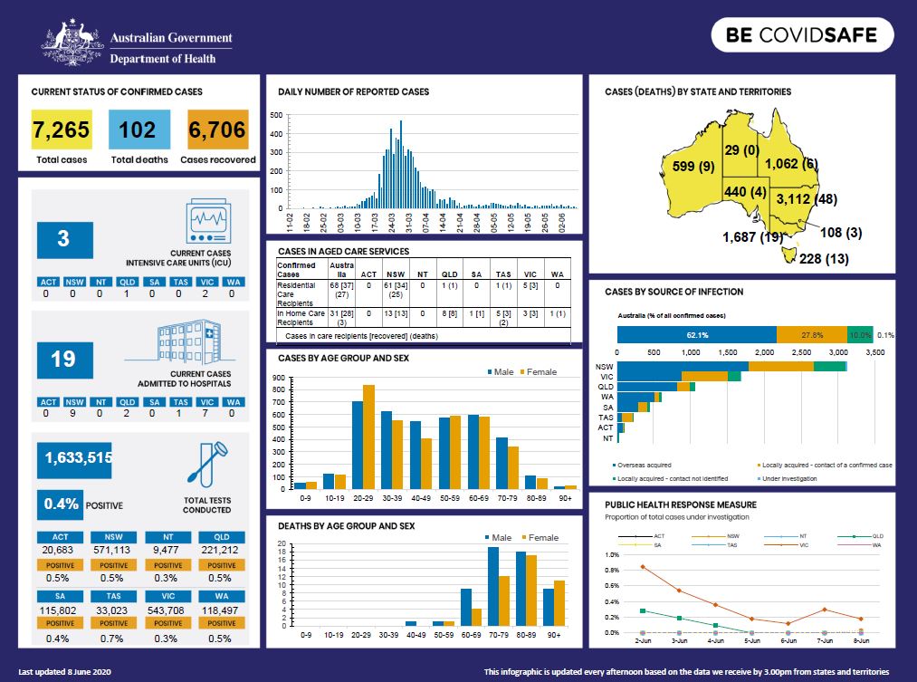
Coronavirus (COVID-19) at a glance – 8 June 2020
This infographic provides a quick view of the coronavirus (COVID-19) situation in Australia on 8 June 2020. -

Coronavirus (COVID-19) at a glance – 7 June 2020
This infographic provides a quick view of the coronavirus (COVID-19) situation in Australia on 7 June 2020. -

Coronavirus (COVID-19) at a glance – 6 June 2020
This infographic provides a quick view of the coronavirus (COVID-19) situation in Australia on 6 June 2020. -
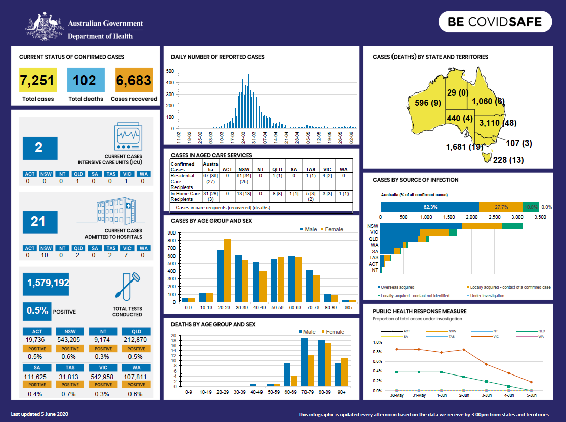
Coronavirus (COVID-19) at a glance – 5 June 2020
This infographic provides a quick view of the coronavirus (COVID-19) situation in Australia on 5 June 2020. -

Coronavirus (COVID-19) at a glance – 4 June 2020
This infographic provides a quick view of the coronavirus (COVID-19) situation in Australia on 4 June 2020. -
Eighth Report on the Funding and Financing of the Aged Care Industry – July 2020
This is the eighth annual report on funding and financing by the Aged Care Financing Authority (ACFA). It looks at the challenges facing the aged care sector in Australia and includes analysis of the data supplied by service providers in their 2018–19 financial reports. -
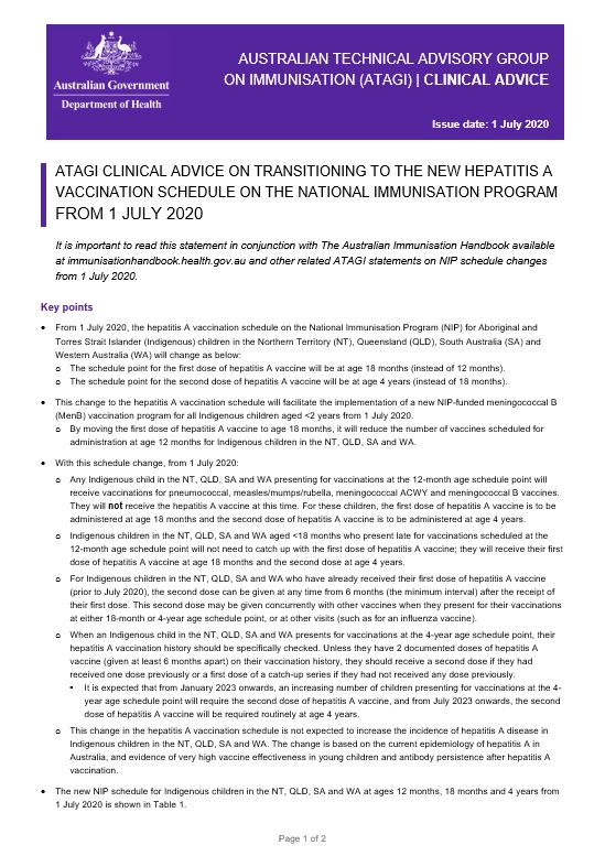
ATAGI clinical advice on hepatitis A vaccine
This resource provides advice for immunisation providers regarding the administration of hepatitis A vaccine. -
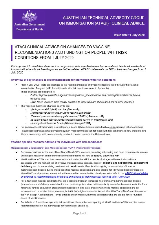
ATAGI clinical advice on vaccination recommendations for people with risk conditions from 1 July 2020
This resource provides clinical advice for immunisation providers on changes to vaccine recommendations and funding for people with risk conditions from 1 July 2020. -
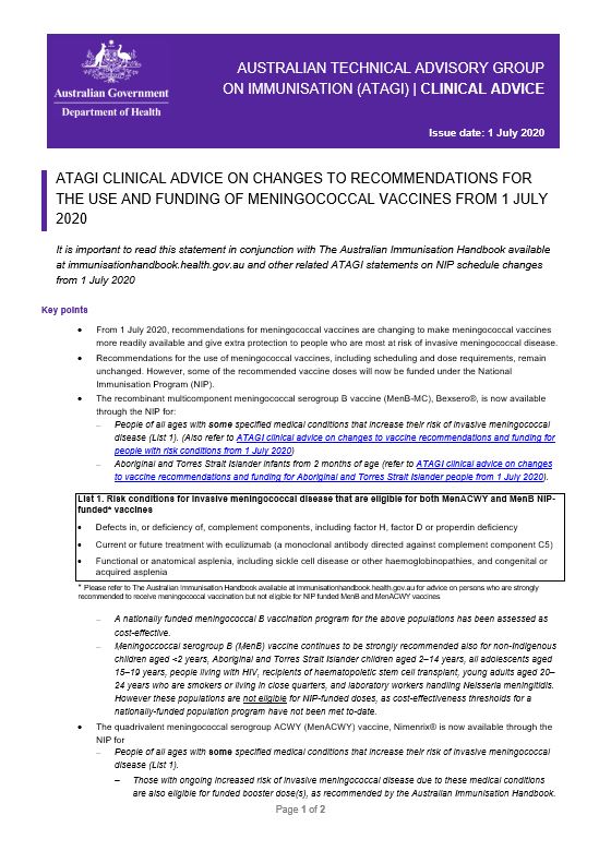
ATAGI clinical advice on changes to recommendations for meningococcal vaccines from 1 July 2020
This resource provides advice for immunisation providers on changes to recommendations for the use and funding of meningococcal vaccines from 1 July 2020. -
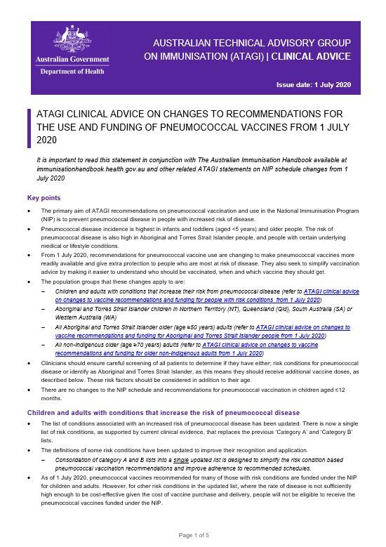
ATAGI clinical advice on changes to recommendations for pneumococcal vaccines from 1 July 2020
This resource provides advice for immunisation providers on changes to recommendations for the use and funding of pneumococcal vaccines from 1 July 2020. -
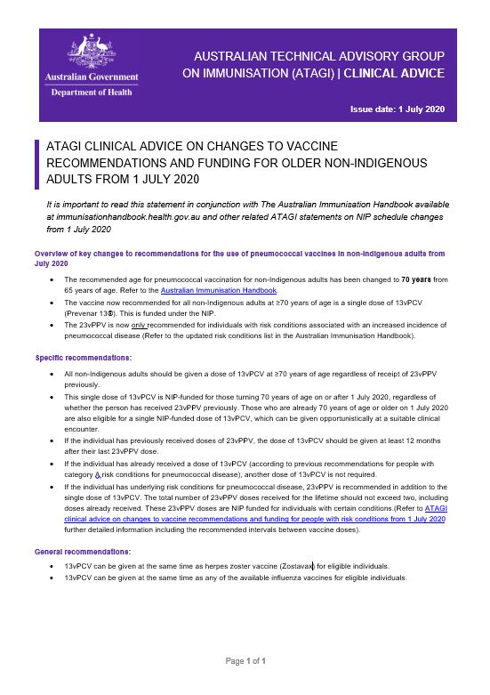
ATAGI clinical advice on vaccine recommendations for older non-Indigenous adults from 1 July 2020
This resource provides advice for immunisation providers on changes to vaccine recommendations and funding for older non-Indigenous adults from 1 July 2020. -
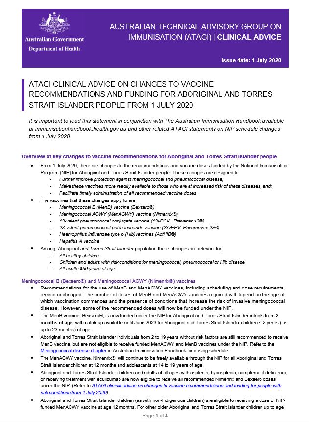
ATAGI clinical advice on vaccination recommendations for Aboriginal and Torres Strait Islander people from 1 July 2020
This resource provides clinical advice for immunisation providers on changes to vaccine recommendations and funding for Aboriginal and Torres Strait Islander people from 1 July 2020. -

PHLN Guidance: COVID-19 Swab Collection – Upper Respiratory Specimen
This Public Health Laboratory Network (PHLN) infographic shows how to collect an upper respiratory specimen to test for COVID-19. -
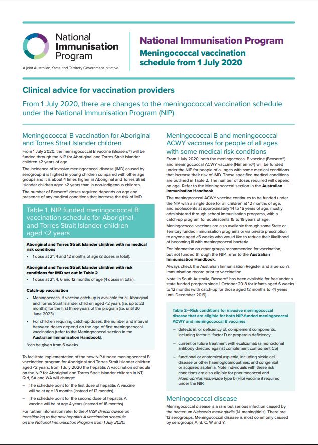
National Immunisation Program – Meningococcal vaccination schedule from 1 July 2020 – Clinical advice for vaccination providers
This fact sheet provides clinical advice for vaccination providers on changes to meningococcal vaccination on the National Immunisation Program schedule from 1 July 2020. -
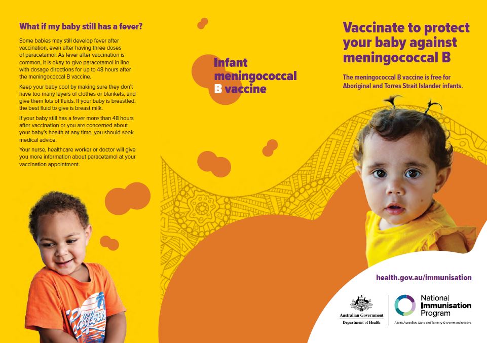
Vaccinate to protect your baby against meningococcal B – brochure for Aboriginal and Torres Strait Islander people
This brochure provides information for Aboriginal and Torres Strait Islander parents and carers about getting their child vaccinated against meningococcal B disease. -
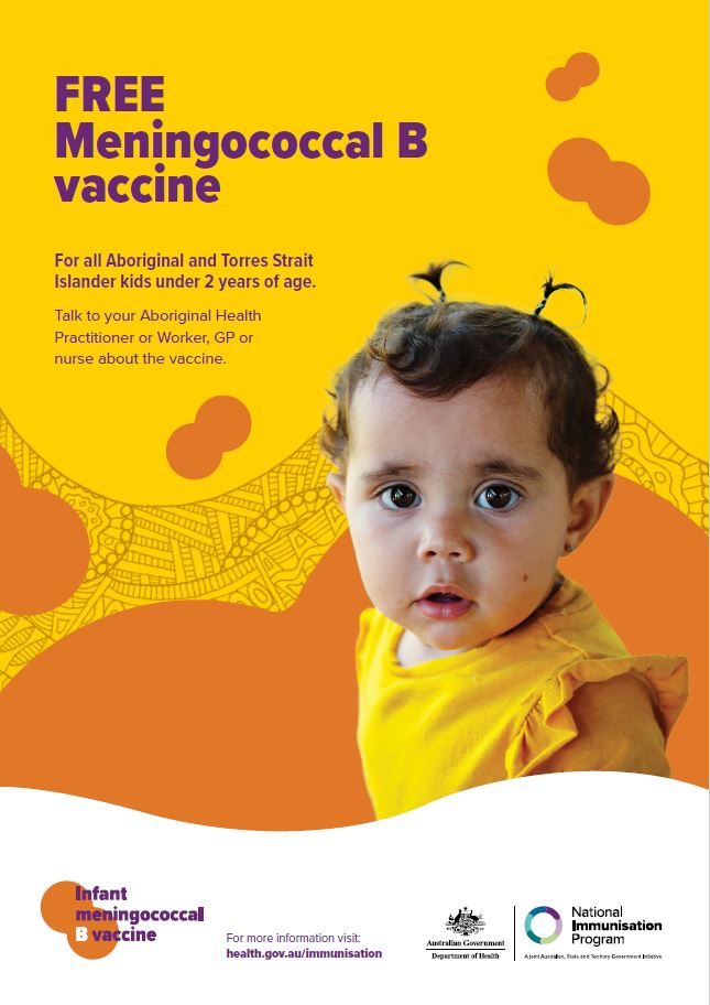
Free meningococcal B vaccine – poster for Aboriginal and Torres Strait Islander people
This poster provides information for Aboriginal and Torres Strait Islander people about the meningococcal B vaccine for infants, and can be used in health care and community settings. -
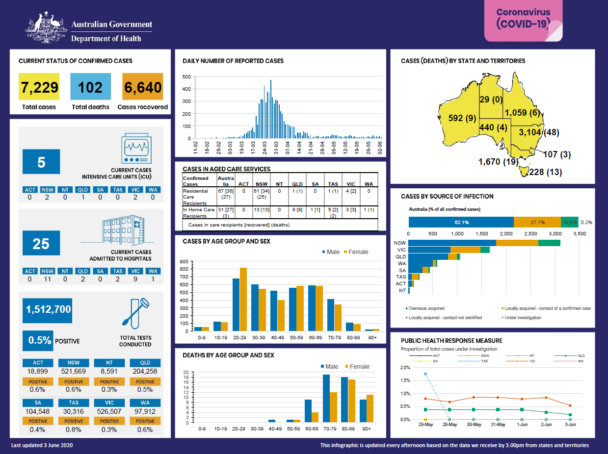
Coronavirus (COVID-19) at a glance – 3 June 2020
This infographic provides a quick view of the coronavirus (COVID-19) situation in Australia on 3 June 2020. -
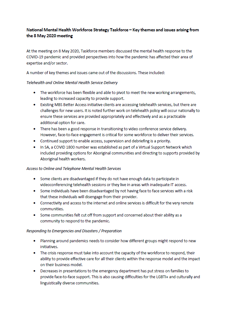
NMHWS taskforce meeting communique – 8 May 2020
This communique summarises the 3rd meeting of the National Mental Health Workforce Strategy taskforce (NMHWS) held 8 May 2020. -

Coronavirus (COVID-19) at a glance – 2 June 2020
This infographic provides a quick view of the coronavirus (COVID-19) situation in Australia on 2 June 2020. -
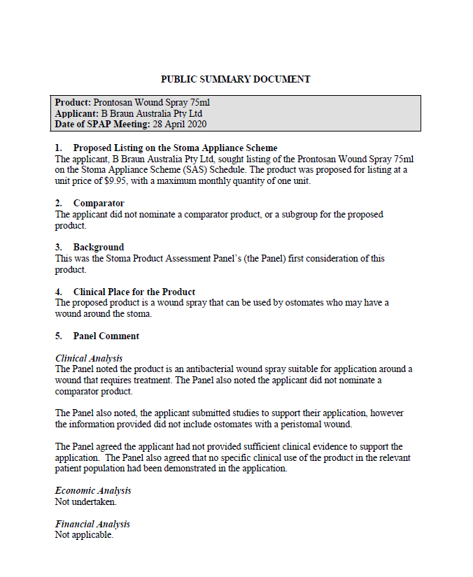
SPAP public summary documents – April 2020 – B Braun Prontosan wound spray 75ml
This public summary document outlines a Stoma Product Assessment Panel (SPAP) recommendation not to list B Braun Prontosan wound spray 75ml on the Stoma Appliance Scheme Schedule. -
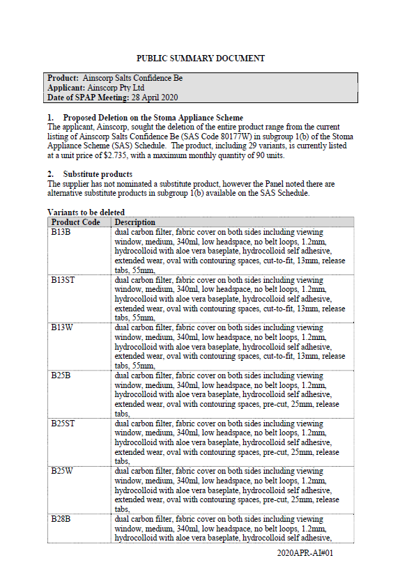
SPAP public summary documents – April 2020 – Ainscorp Salts Confidence Be one-piece closed pouch with flat baseplate
This public summary document outlines a Stoma Product Assessment Panel (SPAP) recommendation to delete the entire range of the Ainscorp Salts Confidence Be one-piece closed pouch with flat baseplate from subgroup 1(b) of the Stoma Appliance Scheme Schedule.