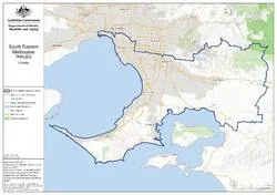
This topographic map shows:
- state and territory borders
- built up areas
- roads
- national parks
- lakes and rivers.
South Eastern Melbourne (Vic) PHN map – topographic
![South Eastern Melbourne (Vic) Primary Health Network (PHN) map – topographic [PNG - 6 MB]](/sites/default/files/2026-02/south-eastern-melbourne-vic-primary-health-network-phn-map-topographic.png)
About this resource
Publication date:
Publication type:
Infographic
Language:
English
Part of a collection: